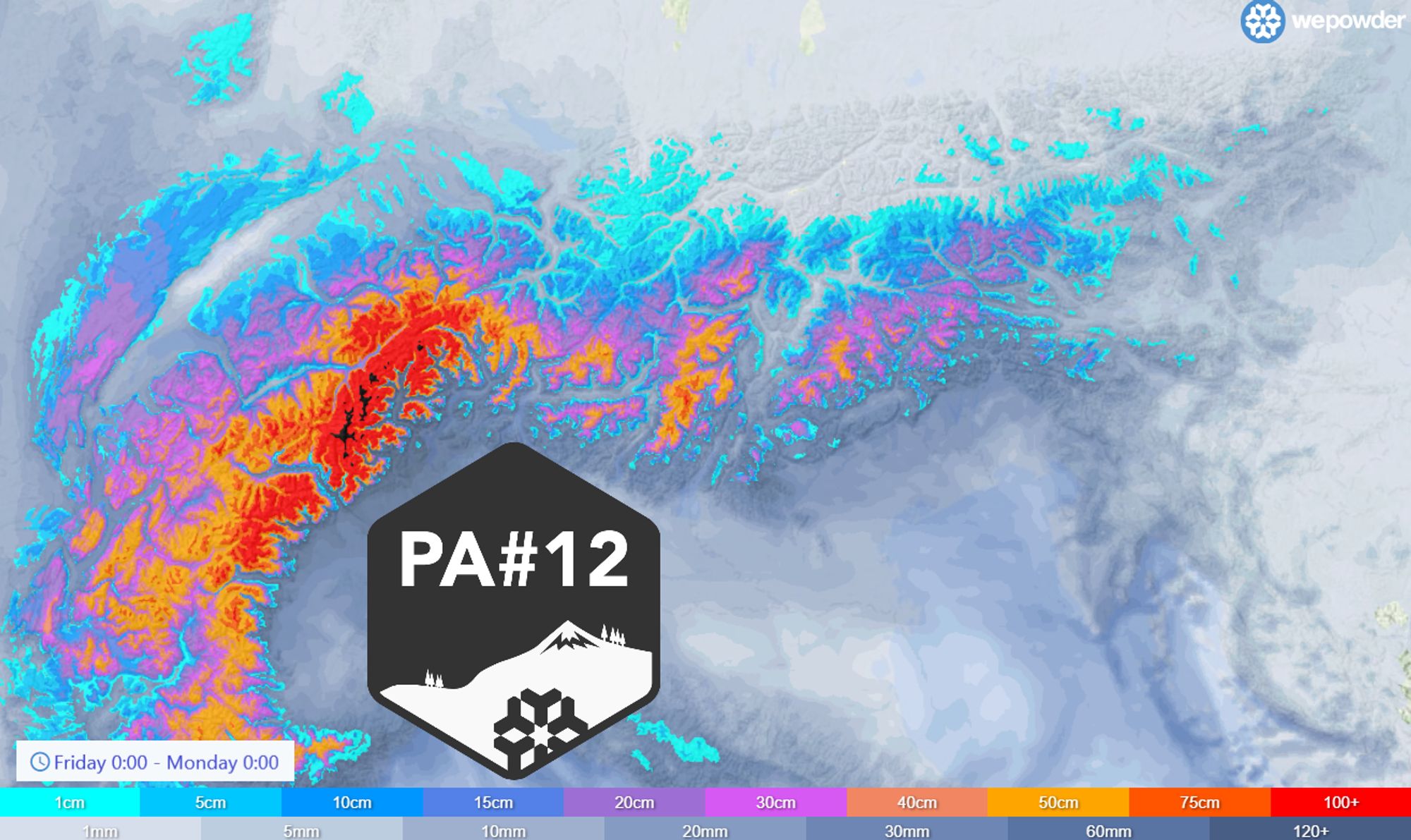
Also in March, our forecast map remains unabatedly colourful and once again it is the turn of the southern Alps. Piedmont and Ticino in particular could get the full loads of snow, as the Retour d’Est strikes again!
Also some snow in the Northwest Alps
More precipitation fell already in this part of the Southern Alps on Thursday, but the snowline was quite high, around 1,800 metres in most places, even a bit higher in the southernmost areas. This is immediately something to take into account in the choice during PA#12. In the coming days, another dump will follow, with also a lower snowline.
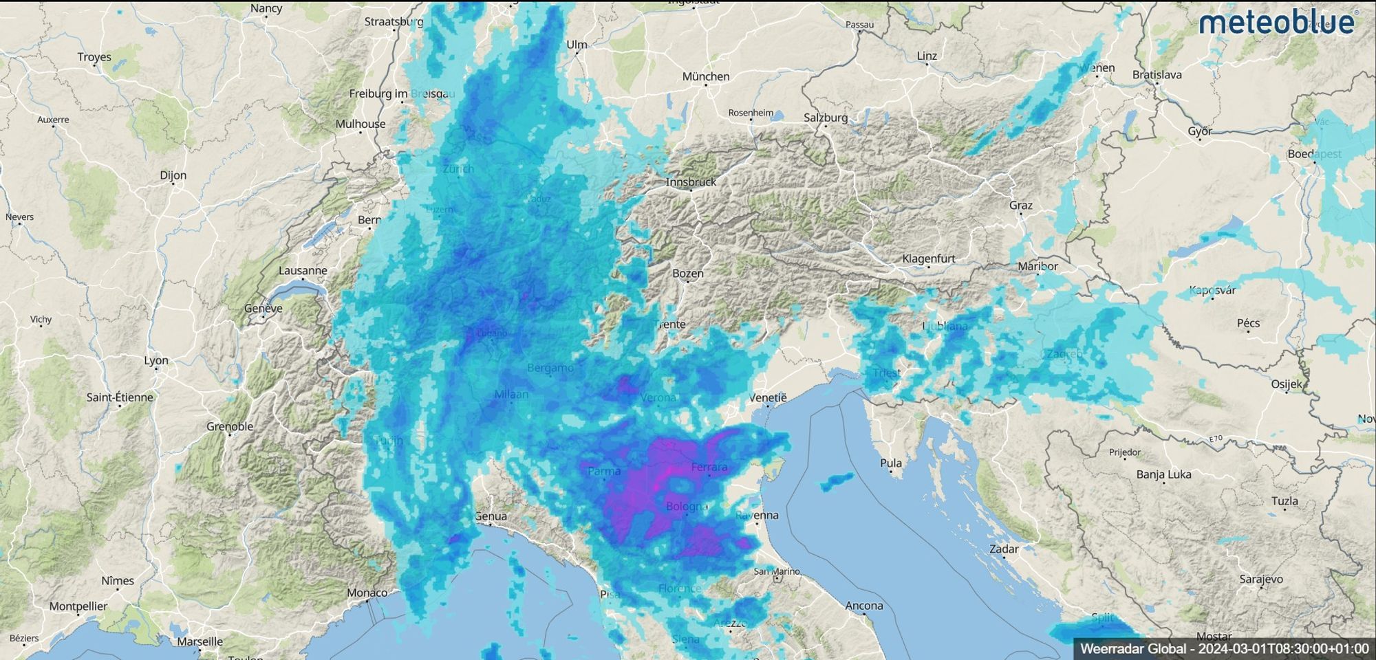
It’s already snowing at the moment. Not only in the southern Alps, but also in the north-western Alps with a small cold front. Above 2000 metres, 5 to 10 centimetres may fall, in central Switzerland locally also 20 centimetres. Also in Austria some snow will fall during the day with a snowline of around 1500 metres, but the larger amounts are again for the Southern Alps today, only in a limited area.
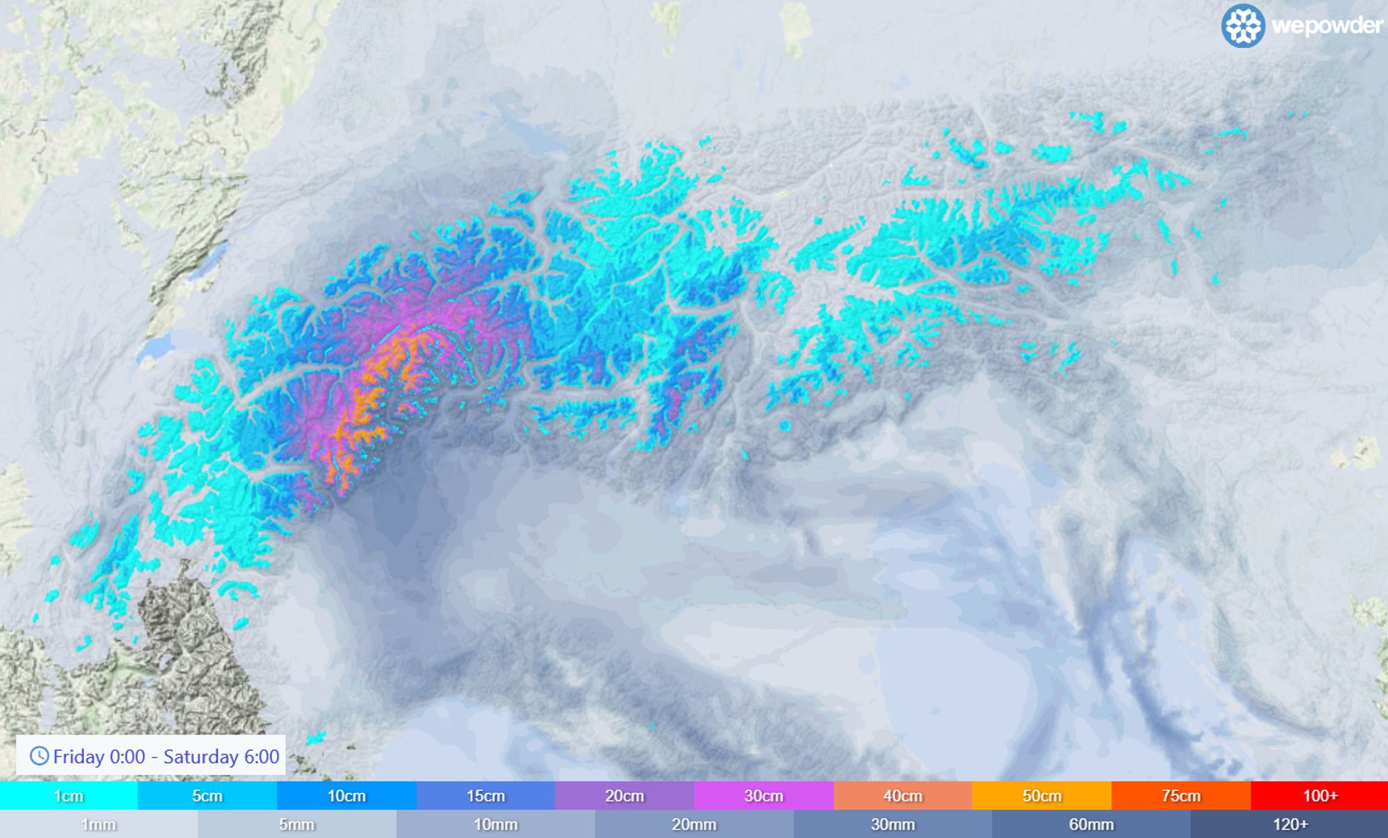
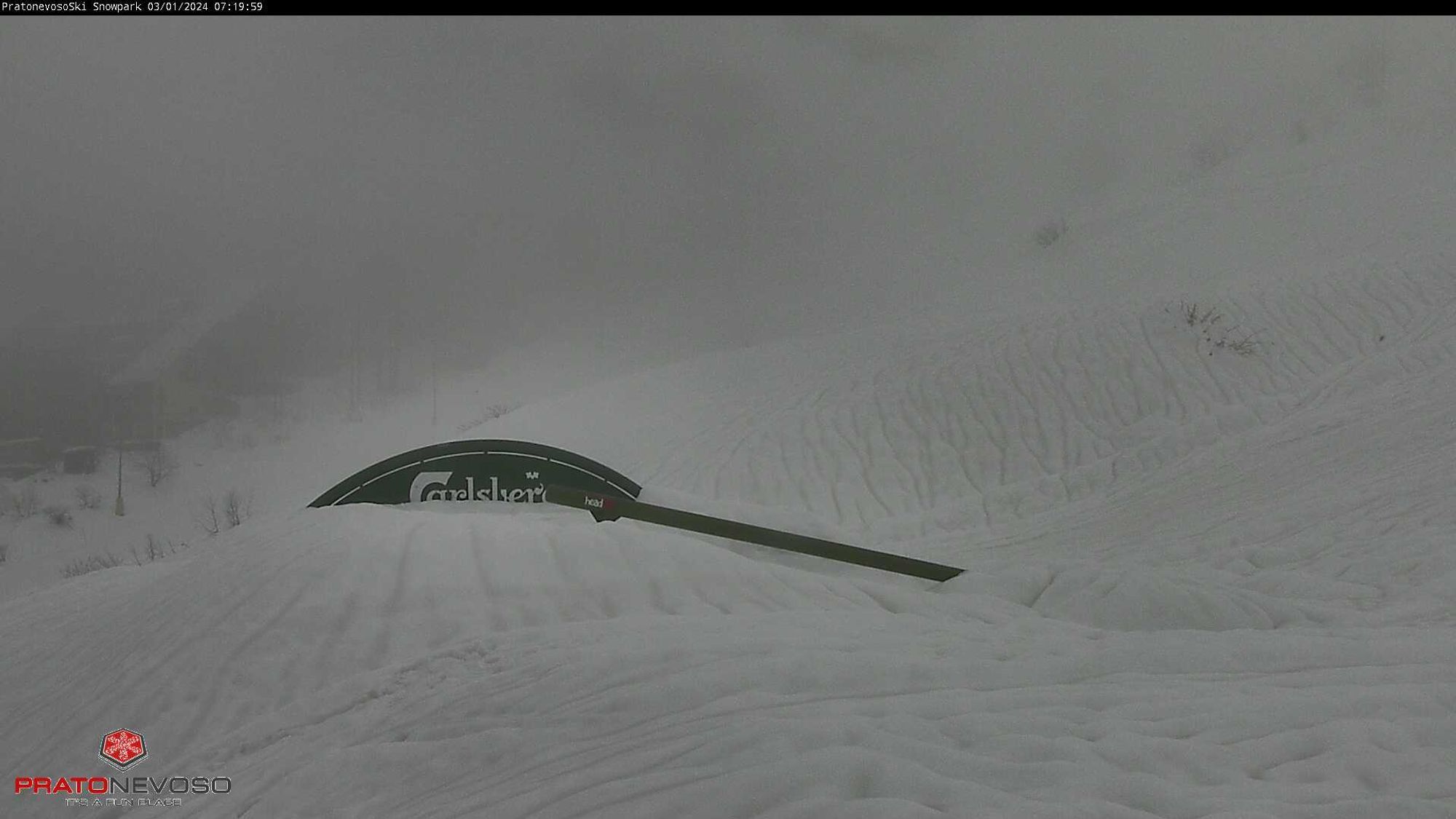
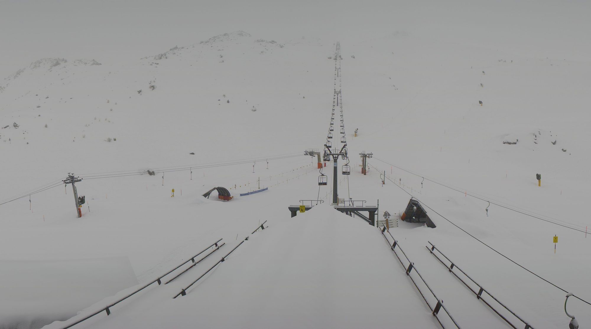
This can also be clearly seen on our forecast maps. The snowfall will mainly concentrate on the areas between Aosta and Ticino and southeastern Wallis (the border region with Italy). Some 30 to very locally 40 centimetres may again fall. The snowline will be around 1,200 - 1,400 metres. Close to the alpine edge also a bit higher, inner-alpine a bit lower. Some live images from those regions:
Retour d’Est over the weekend
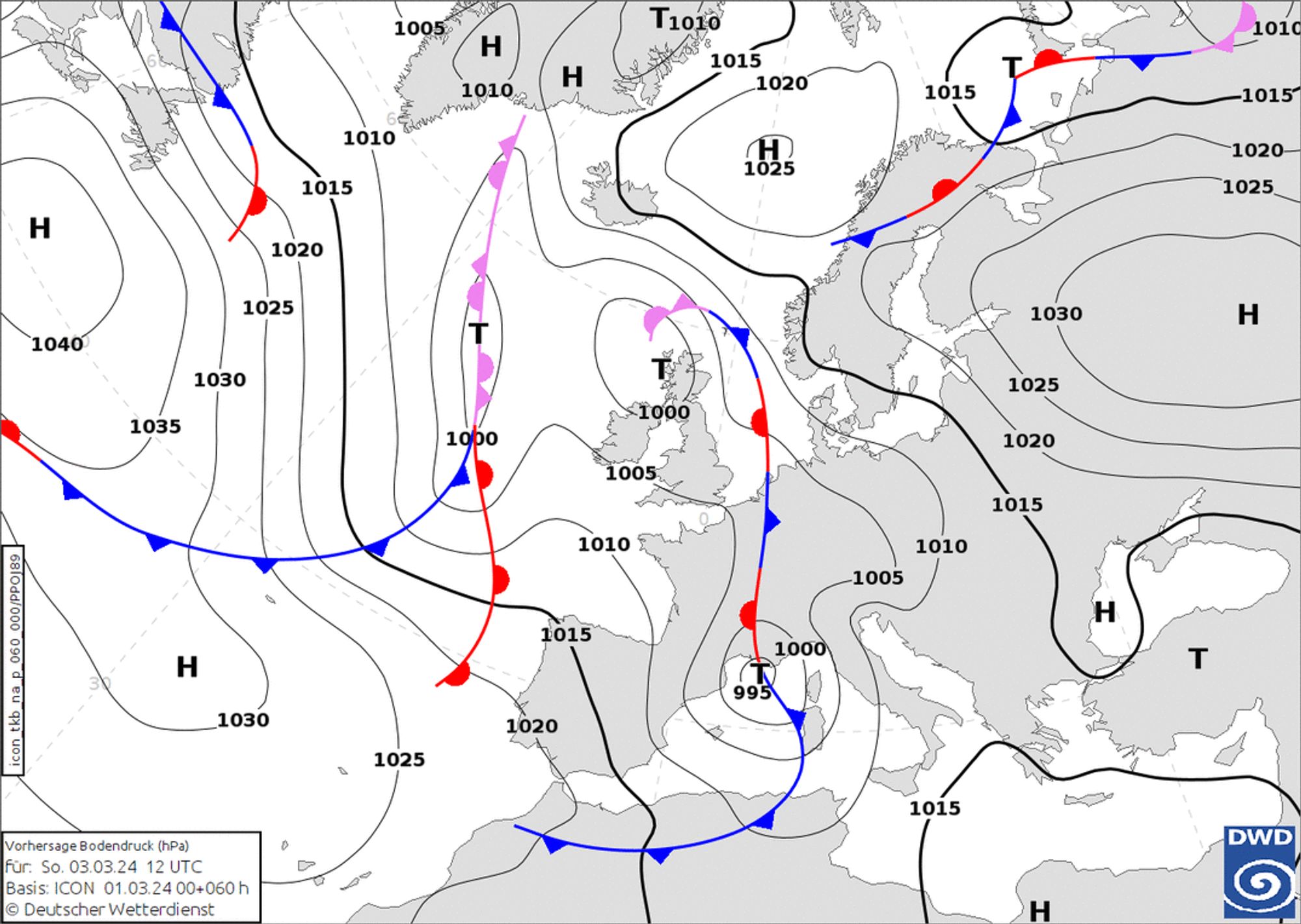
This is far from it, because over the weekend comes the real deal with massive snowfall in the south-western Alps! A low-pressure complex located to the west of the Alps will turn the upper level flow to the southwest. In the northern Alps, the southföhn will increase during Saturday. Until Sunday, this föhn flow persists.
For the southern Alps, however, this flow is good news, as a lot of moist air hits this part of the Alps, causing strong snowfall. On Saturday afternoon, it starts snowing from the southwest. The French southern Alps will get some precipitation, and snow will also start to fall rapidly again between Aosta and Ticino. The snow that falls today and tomorrow will merge almost seamlessly into the snow that follows.
A new Genoa Low develops, creating a proper retour d’Est on Sunday. This snowfall looks set to continue through Monday early morning and the amounts are really impressive. The short but fierce snowfall is typical for a retour d’Est! The core area lies in the arc from Prali (Alpi Cozie) all the way to western Ticino/Gotthard, via Aosta and the southern areas of Wallis. Here, above 1,500 - 1,800 metres, 70 to 100 centimetres could fall on a very large scale, with peaks up to perhaps 150 centimetres higher up. Some model calculations show even more precipitation. As typical with a retour d’Est, the largest amounts for the French Alps are mainly expected in the border regions with Italy (Queyras, Haute-Maurienne). As colder air moves in, precipitation may also move deeper into the French Alps during the night from Sunday to Monday.
Where to go?
The snowline seems to be coming down again. Saturday it will still start around 1,500 metres, but in the night to Sunday it will quickly drop to around 1,000 to 1,200 metres. With the solid snowfall, the snowline could drop even further to well below 1000 metres, especially in the narrower valleys.
With this expected snowline and white-out conditions higher up, you will have to rely mainly on the (higher) treeruns in the regions mentioned above. Higher up, winds could play a big role, especially on Sunday afternoon. Around the alpine main ridge, the south-föhn will blow hard to stormy all weekend. So pay close attention to the avalanche risk and especially check the avalanche reports before heading out. The amount of snow is not to be underestimated and with the increasing wind it can get tricky very quickly. On Monday, precipitation is likely to diminish quickly and the sun may come out during the day in the south-west Alps.
A quick look at the rest of the southern Alps: The Dolomites of course catch a lot less in this setting, although around the Adamello and the southern Dolomites there could still be around 20 to 30 centimetres of snow higher up. In the Alpi Marittime/Mercantour, over half a metre of snow could fall higher up on Sunday, but as mentioned, it was a bit warmer here during the last couple of days.
Réactions
finally!! :)
Awesome!! Any indication what this might mean for the Julian alps?
@MaxBalmford definitely not a hotspot there with this retour d’Est. Not more than 10-20cm over there.
@MaxBalmford definitely not a hotspot there with this retour d’Est. Not more than 10-20cm over there.
spoke to macugnaga tourist information , all lifts in Macugnaga will be closed tomorrow. They are going to try and open Passe morro on monday… update likely sunday at 1600 local time.
2 of us are going to gressoney la trinite for tomorrow afternoon … looking to lap one lift while it dumps.
updated will be sent… hopefuly over the shoulder pow.
Overpowder? :D
From Monte Rosa website: “On Sunday, March 3rd, the Monterosa Ski 3 Valli area will remain closed due to heavy precipitation affecting the entire area, leading to high avalanche risk (level 4 out of 5).
A similar situation is also present in the satellite ski areas of Antagnod, Brusson, Champorcher, Gressoney-Saint-Jean and Alpe di Mera.
In Val d’Ayas, the Champoluc-Crest gondola and the Frachey-Alpe Ciarcerio funicular are operational for pedestrians.”
Road to gressoney la trinite closed this afternoon after an avalanche hit the road stopping all traffic in and out. Pretty much everything around Monte Rosa was closed today …. And likely tomorrow after speaking to locals in gressoney and macugnaga. We have diverted to Prali to have a chance of skiing tomorrow.