The conditions are sunny and dry at the moment. For fresh snow, we need to look further ahead. It is not until the middle of next week that things really change and the Alps enter more changeable weather. There may be a lot of precipitation all around, but the Alps will be on the mild side of the air mass boundary. Thereby, it could also become considerably more turbulent with possibly föhn in the Northern Alps.
Some more sunny days first
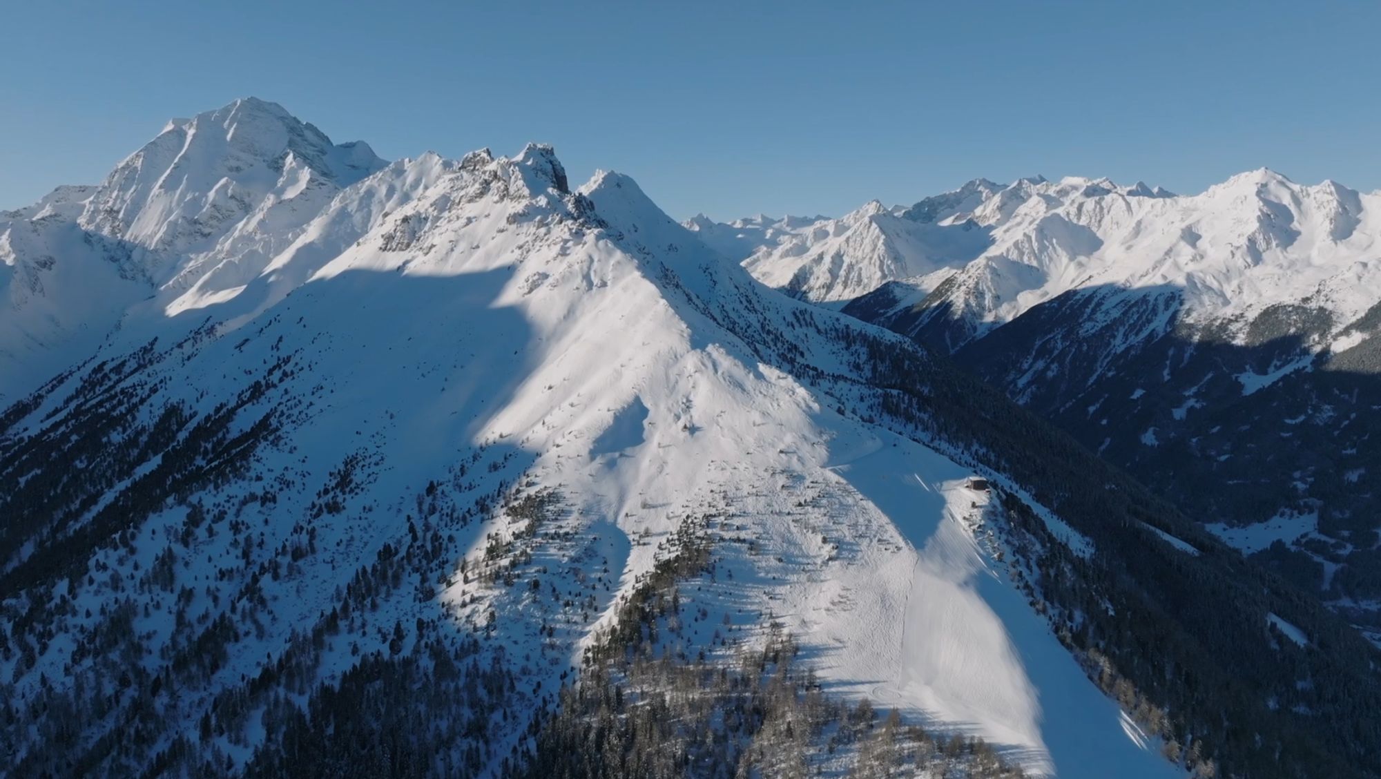
Before that happens, the Alps first have to deal with a few more sunny days. Only in the valleys will low-hanging clouds remain more persistent at times. Last days did see temporary snow in the Western Alps due to a front spur and a small cold bubble at higher altitudes over France. A very interesting weather setting, which meant that the amounts ended up being higher than expected beforehand. In many places, some 20 to 30 centimetres still fell and even all the way to Geneva, 15 centimetres fell.
In the coming days, it will remain dry. Winds will blow with increasing strength from the north. This brings the western Alps into a slightly milder air mass and the eastern Alps, on the contrary, into colder air on the edge of the cold outbreak towards the Black Sea.

- 0-2 bft
- 3-5 bft
- 6 bft
- 7 bft
- 8 bft
- 9 bft
- 10 bft
- 11 bft
- 12 bft
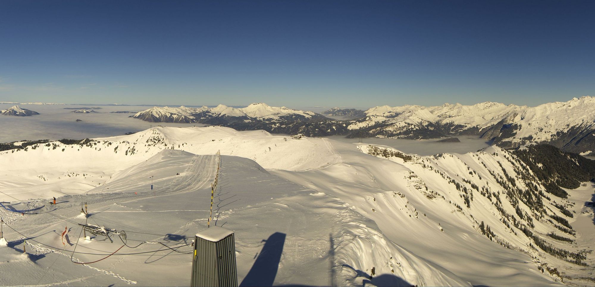
With some Nordföhn tendency, I expect, especially in the south-west Alps, that winds may increase in the coming days. Higher up here, winds will be moderate to quite strong. In our forecast, we also see more wind signals further east around the Alpine main ridge during the weekend. This is due to the new wave of cold air from the north/northwest, which initially looks like a nice Nordstau situation, but not this time…
Nordstau miss
It could have been a nice Nordstau, the weather setting from Sunday, but it soon became clear that the arctic slide over the North Sea will quickly be deflected towards the east, giving the Alps virtually no precipitation. However, the cold air will flow into the Northern Alps, making the Southern Alps most likely to experience Nordföhn.
Warmer, more changeable and turbulent
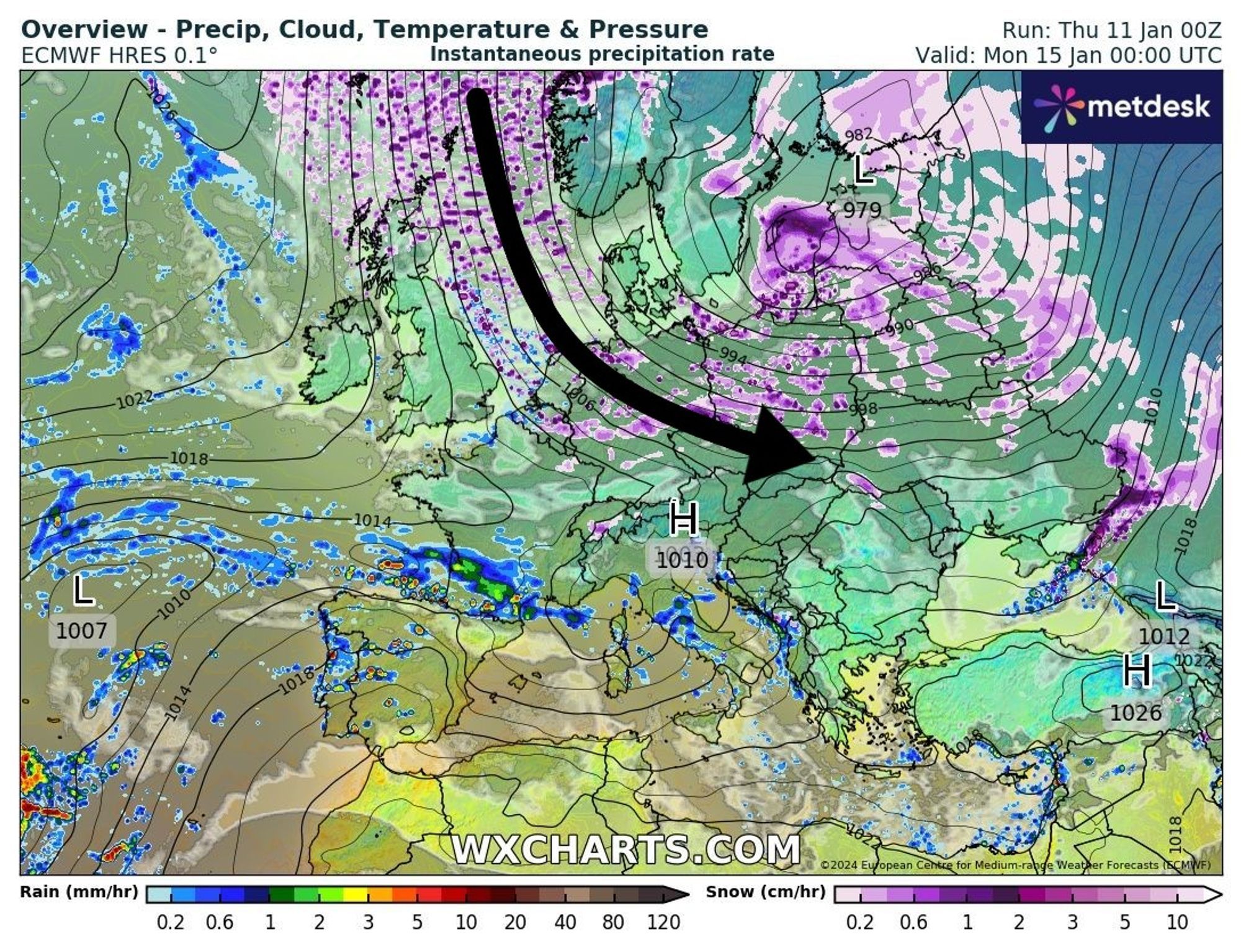
Tuesday will still be calm, but from Wednesday the battle of the air masses will begin. This is because a depression is approaching from the Atlantic and heading towards the European continent. The south and east sides of the depression bring very mild air to Europe, but it collides with the rather heavy cold air reservoir. This tough cold air will not be easily expelled, creating a very sharp air mass boundary. At that border, precipitation can be very heavy. To the north as snow and to the south mainly as rain.
Currently, this boundary is calculated quite far north of the Alps, preventing major precipitation, but in previous runs it was sometimes calculated further south. In that case, a lot of precipitation could fall in the Western Alps, but with the high risk that the snowline would also be very high. I will try to explain the situation using the images below:
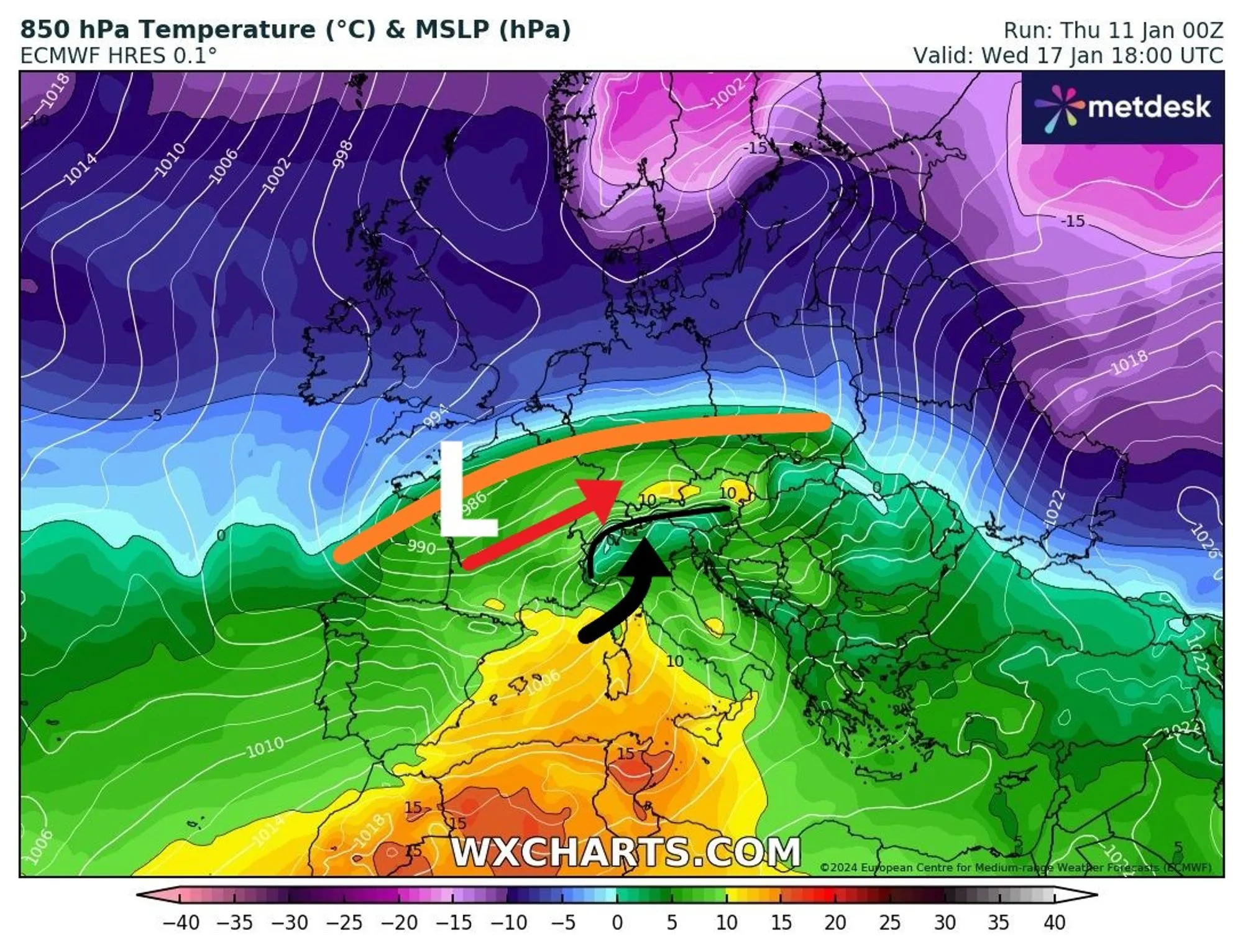
The low pressure area (with the L as its core) passes over the European continent, creating the air mass boundary (the orange line). Around this line is the area with the largest precipitation amounts. This air mass boundary is calculated quite a bit north of the Alps by the current ECMWF model run, leaving them in the mild south-west flow. With some stau and some precipitation on the south side (black arrow) and the entry of warm air on the northern side of the Alps. A fierce south föhn could develop on the northern side. In this model calculation, it could lead to very heavy wind gusts.
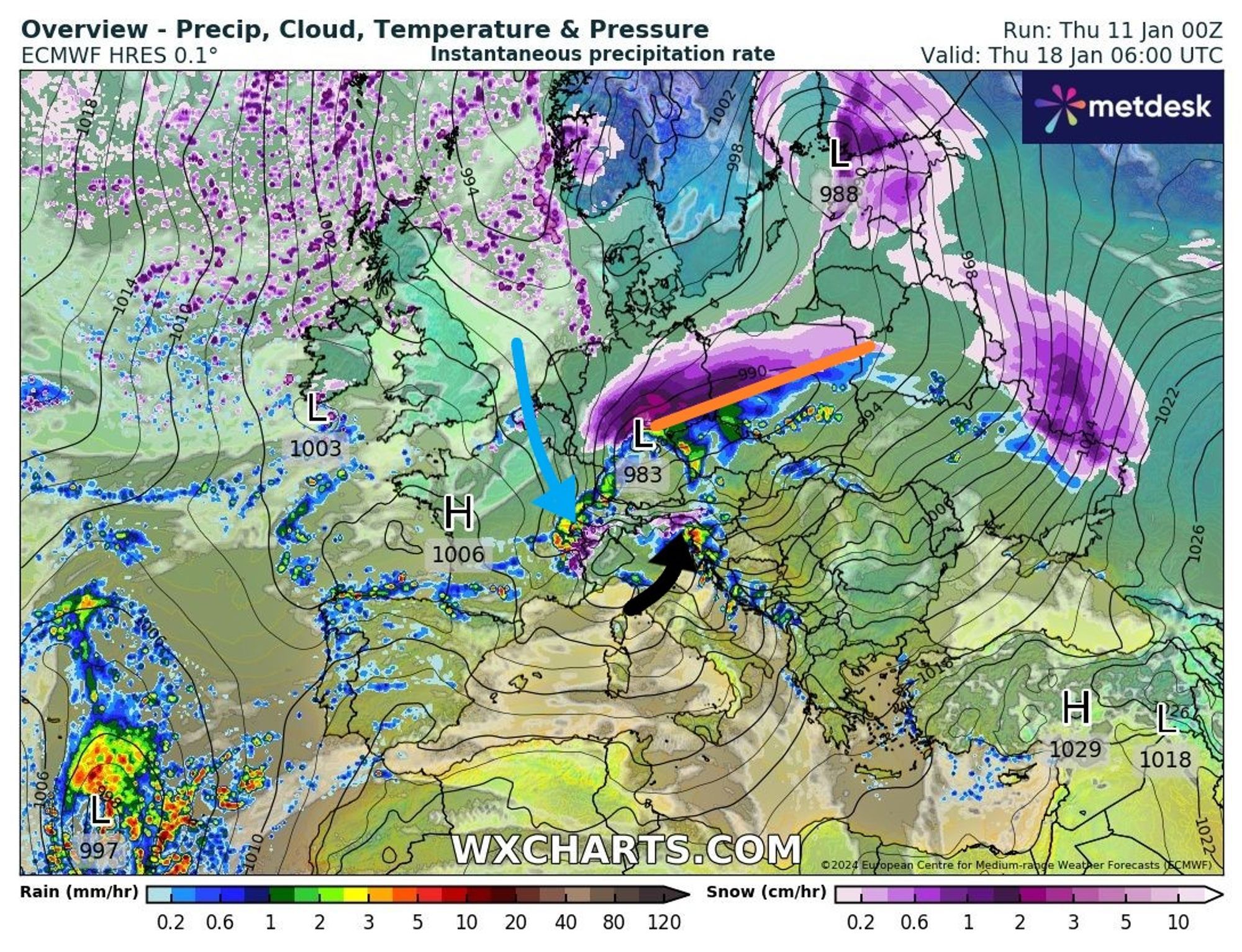
Then, as the low-pressure area moves further towards Poland/Czech Republic, the wind at the back of this depression turns to the northwest, allowing cold air to flow to the Alps again in combination with precipitation. In this calculation, you can also see the remnants of the stau in the southern Alps, diminishing from the west.
Note: this is still for 6-7 days ahead. I picked out this ECMWF operational run as an example, but what exactly will happen is still very uncertain and depends on several factors like:
- How unwieldy is the cold bubble over Europe/Northern Europe?
- How strong will the depression be?
- What exact course will the depression follow?
- etc.
These are all questions that the weather models are also wrestling with and will show different solutions to in the coming days. Only early next week will more and more become clear, although even then the details could still change. So for the Alps, we seem to remain on the mild side. Precipitation seems especially an issue in the Western and Southern Alps. For the Western Alps in particular, the snowline might be tricky. In the Northern Alps, föhn is possible and precipitation amounts are likely to remain limited.
Reaktionen
@Henri, When do we get the next update?
And thanks for PA7, which I got to enjoy!
@Henri PA8 out soon?
I’m working on an update at the moment. Will be online later this evening!