
- 1cm
- 5cm
- 10cm
- 15cm
- 20cm
- 30cm
- 40cm
- 50cm
- 75cm
- 100+
- 1mm
- 5mm
- 10mm
- 20mm
- 30mm
- 60mm
- 120+
After a short but fierce winter period, the weather will become more changeable and above all more turbulent in the coming week with occasional precipitation, but it will also become slightly milder at times, so we should keep an eye on the snowline!
Sunny with a high-pressure area
Currently, sunshine is still plentiful with a high-pressure area directly over the Alps. This will soon change, however, as the high-pressure influence weakens on Sunday. The core moves further eastwards and at the same time a very strong low pressure area on the Atlantic that listens to the name Storm Isha approaches.
A strong wind field develops over western Europe. The Alps will also notice the wind: Sunday at higher altitudes from the southwest slowly increasing, Monday turning to the west and further increasing in strength. Later in the week, it seems like it’s gonna be stormy.

Warm on Monday, then rapid cooling and snow
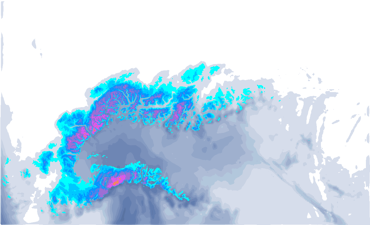
On Monday, with föhn influence, we see the freezing level briefly rise towards 3,000 metres on the northern side. However, a cold front follows from the northwest in the afternoon. The initial snowline is briefly high, but drops rapidly to eventually just below 1,500 metres in the evening hours in Switzerland and in Austria to around 1,000 metres. Some 15 to 25 centimetres will fall in the north-western stau areas, 5 to 15 centimetres in Austria behind the Arlberg, possibly a bit more in the stau areas in Salzburgerland. Winds increase significantly and are stormy in the high mountains.

Warmer on Tuesday
It won’t stay cold for long, as mild air follows from the west with a warm front. On Tuesday afternoon, this warm front is likely to cause some precipitation in Switzerland, at the alpine edge with a rising snowline rising to around 2,000 metres (inneralpine a bit lower). I don’t expect much precipitation, sticking to a few centimetres of snow higher up. In Austria too, the warm front may bring light precipitation on Tuesday evening. Here too, amounts will remain limited (although the ICON weather model, for example, shows significantly more). The largest amounts are expected for the northern edge, inneralpine areas often remain (as good as) dry in such cases. Westerly winds are especially strong at altitude.

Again a cold front
Wednesday then remains mild and also very turbulent. Higher up, the strong jet stream blow from west to east just north of the Alps. Lower in the atmosphere, the westerly wind is also strong and is going to play a big role in terms of lift-closings. It could get westföhny, resulting in extra warming locally in Austria. Temperatures in the valleys rise to well above 10 degrees, at 1500 metres temperatures of 5 to 8 degrees, in the south-west Alps rising to above 10 degrees. Again, it will be stormy higher up.
- 0-2 bft
- 3-5 bft
- 6 bft
- 7 bft
- 8 bft
- 9 bft
- 10 bft
- 11 bft
- 12 bft
Wednesday afternoon and evening some cooling follows from the northwest again with a cold front. Initially, the snowline will again be quite high at around 2,000 metres or even a bit higher. In the evening, the snowline does drop again with the entry of colder air to around 1500 metres, in the second half of the night even below that. I currently expect the most in the Northwest Alps between the Berner Oberland and Vorarlberg. Quantities are still uncertain, 5 to 20 cm, possibly locally 30 centimetres.
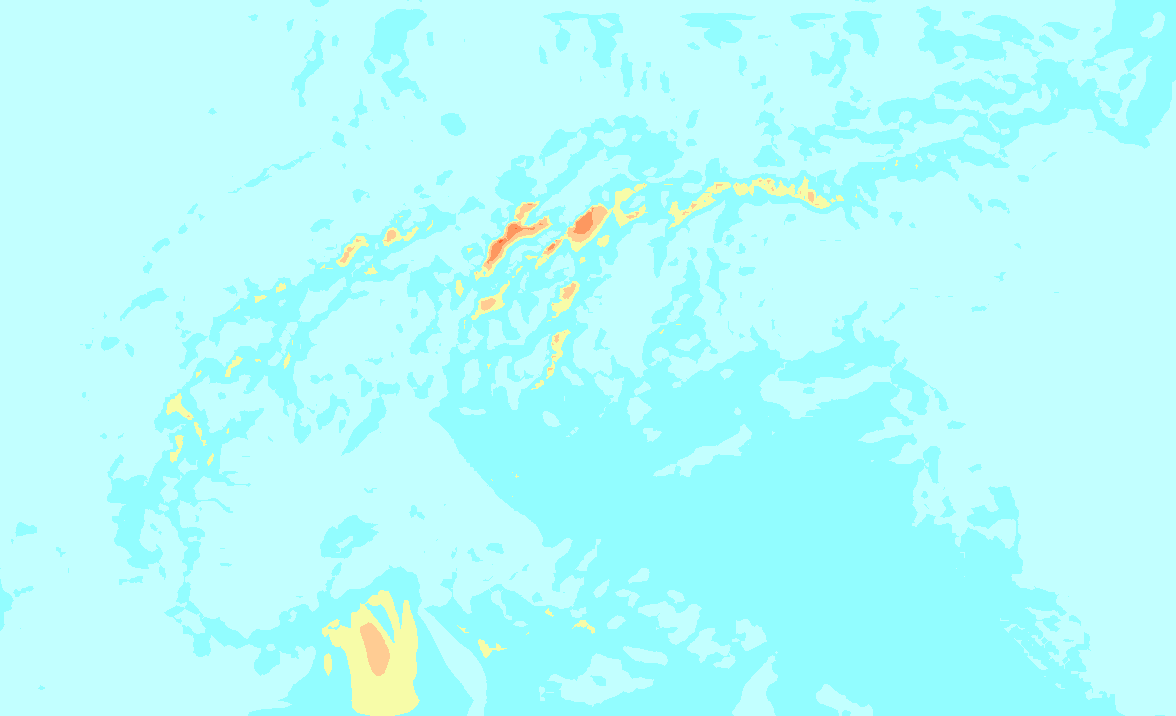
Stormy winds persist and will even intensify during the passage of the cold front. In the high mountains, there is a chance of a severe storm with wind gusts exceeding 150 kilometres per hour. The southern Alps will not be spared either, as the Nordföhn here will also make it more turbulent. On Thursday during the day, the strong winds decrease again from the west.

After that, calm returns a bit more. However, it does remain quite mild, as can be clearly seen in the ensemble for Geneva above.