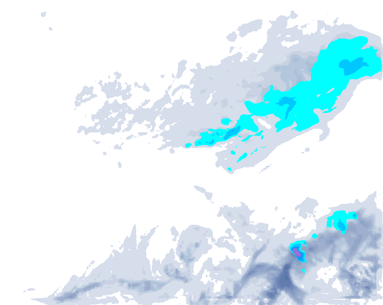
- 1cm
- 5cm
- 10cm
- 15cm
- 20cm
- 30cm
- 40cm
- 50cm
- 75cm
- 100+
- 1mm
- 5mm
- 10mm
- 20mm
- 30mm
- 60mm
- 120+
Due to limited internet on my train, I have to keep it short today. A glance at the snow map also shows that we need not expect anything in the form of fresh snow in the coming days. It will remain mostly dry and, above all, mild. Towards the end of next week however, a sharp weather change awaits us. Finally we’ll see some more snow, but not everywhere.
Warm and mostly dry
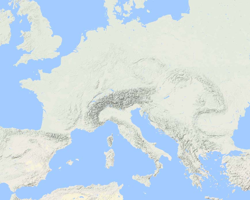
The Alps will remain dry until the middle of next week. Not completely, because the Austrian Alps are, although a high-pressure area is in control, with a west to north-west flow occasionally on the edge of this high. On Sunday, a front grazes this easternmost part of the Alps. It will mainly stick to some cloud cover: the further east, the more clouds are possible. In the easternmost areas, there will also be a splash of rain or a flake of snow, but it’s negligible.

With the westföhn possibly breaking through locally deeper into the valleys, it could become quite mild. Higher up, the wind remains quite strong, even stormy in the eastern parts of Austria. Here you have to keep in mind that higher lifts might be closed in the coming days. In the southern Alps too, with a setting Nordföhn, winds will be fairly strong. In Ticino, among others, it seems to be able to break through into the valleys, allowing temperatures of up to 20 degrees. Also in the Provence-Alpes-Côte d’Azur region, temperatures rise to values of 15 to 20 degrees this weekend.
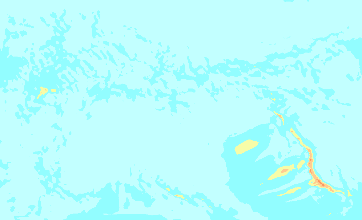

- 0-2 bft
- 3-5 bft
- 6 bft
- 7 bft
- 8 bft
- 9 bft
- 10 bft
- 11 bft
- 12 bft
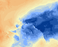
- -20°
- -15°
- -10°
- -5°
- 0°
- 5°
- 10°
- 15°
- 20°
The map above shows temperatures for the next few days at about 1500 metres altitude. In the Western Alps, temperatures at 1500 metres are around 10 degrees. On the northern side, especially in eastern Austria, it will remain a bit cooler with a few degrees above zero at this altitude. The sun will shine for many hours, but especially in the eastern Alps, high clouds will also pass over. At the same time, the high pressure area will also send some Saharan dust towards the Alps, although the concentrations and thus the impact will remain limited.
Increasingly changeable
Early next week will still be fairly calm and mild with an alternation of clouds and sunshine. We will continue to see this weather pattern until Wednesday. According to the current calculations, we will face a warm front from the west during the night from Wednesday to Thursday and during the day on Thursday. Especially the northern alpine rim could possibly get some precipitation from this, but not much yet.
After that, typical in a warm sector, we will (possibly) have to deal with a solid south föhn situation in the northern Alps. From the Atlantic, a strong low-pressure system is approaching and heading towards the UK.

Both the GFS and ECMWF show good signals for a südstau from Thursday night/Friday. On the northern side, a föhn storm rages at the same time, which could be substantial. So interesting developments, especially for the southern Alps! The French Alps could also benefit well in such a situation, although it depends heavily on the details, which will hopefully become clear soon in the coming days!
Reaktionen
Henri - is the Uk in line for snow next week then? Your Maps are showing 10-20 cm across the midlands!
rich_a_potter: These auto models are rarely trustworthy outside of the alps.
yes it does seem to vary wildly :) fingers crossed for some good snow in the Alps
March always delivers :)
New update on Tuesday evening!