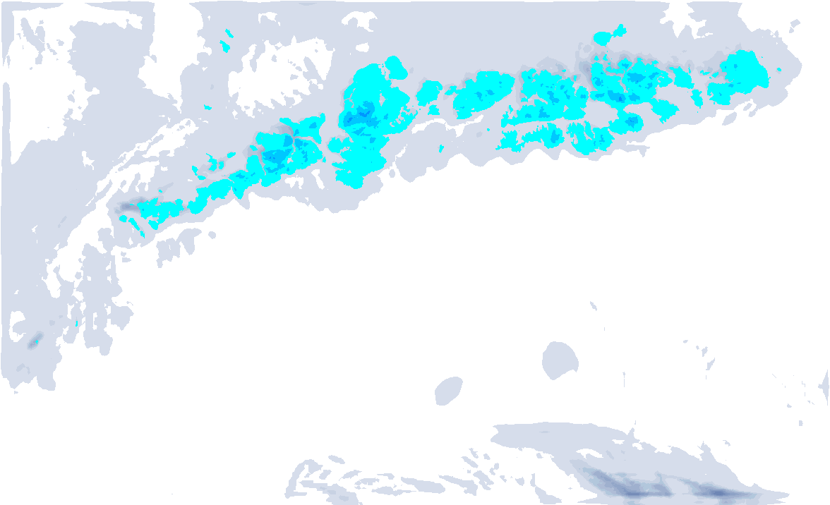
As a high-pressure system approaches from the west, the Alps will experience a brief period of dry and warmer weather. However, before it clears up everywhere, the northern side of the Alps will still see some leftover snow showers due to a northerly wind today.
Through the day, snowfall will gradually ease as pressure builds from the west. In the northern “stau” areas, around 5 to 20 centimeters of snow is expected, with the snowline reaching the valleys in most places. Further towards the alpine main crest, snow amounts quickly decrease due to the weak northerly flow.

Temporarily warmer
Especially at higher altitudes, temperatures will rise significantly in the coming days. This is due to a southwesterly flow higher up. At 1500 meters, temperatures will be around 8–10 degrees above the average for this time of year.
In the valleys, low level clouds will likely persist through the first half of the week. Higher up, it will generally be sunny, but on Tuesday and Wednesday, high clouds will move in from the southwest.
Ahead of another weather change, the pressure difference across the Alps will increase, and by Wednesday, a brief föhn episode will bring even higher temperatures to the northern side, reaching up to 10°C at 1500 meters. In the Southern Alps, it will remain cooler.

Atlantic Lows bring snowfall back
Atlantic lows will once again approach starting Thursday. The first precipitation will arrive in the Northwestern Alps during the day, with a relatively high snowline around 1800 meters. The warm air is still present and will only be replaced by much colder air with the second front. Above 2200 meters, up to 10 centimeters of snow is expected in the Northern French Alps and Wallis.
In the evening, the cold front will move in. The snowline will quickly drop below 1000 meters, reaching the valleys by Friday. In the Northwestern Alps, a total of 30–40 centimeters of snow is expected, although these larger accumulations will occur above 1800-2000 meters. The heaviest snowfall will be from the Northern French Alps to Central Switzerland. Further east (currently including Vorarlberg), the snow amounts will decrease.
The areas around the main Alpine ridge and the Southern Alps will experience Nordföhn wind with (very) heavy gusts at higher elevations. The Southern Alps are expected to stay almost completely dry due to this, although the forecast still shows some light snow in the blue areas.
By Friday, high pressure will build from the west, causing the snowfall to shift towards the Eastern Alps. With expected clearings from the west, it could be a very cold night ahead.

Changeable weather until Christmas
Saturday is a day to mark on your calendar because after fresh snow and a cold night, the sun will be shining brightly. However, new cloud cover seems to be approaching from the west in the afternoon, which is a sign of a warm front and slightly higher temperatures. On the northern edge of the Northwestern Alps, there may be some snow or rain on Saturday evening and into the night towards Sunday, but the details are still uncertain.
Just before Christmas, the wind will shift back to the northwest, bringing fresh snow with a dropping snowline. The precipitation signal just before Christmas for the Northwestern Alps is clearly visible in the ensemble forecast for Geneva, but the temperature spread also indicates that it is still uncertain what the exact snowline will do, especially during the Christmas days.
The classic Christmas thaw period we’ve seen in recent years doesn’t seem to be a concern based on these forecasts, but it might still be a bit too warm for snow in the valleys. The situation could shift slightly further east, allowing colder air from Eastern Europe to spill out, bringing the Alps into a west to northwest flow with slightly milder air. There’s no reason to panic for the Christmas week, but this is something to keep an eye on.

