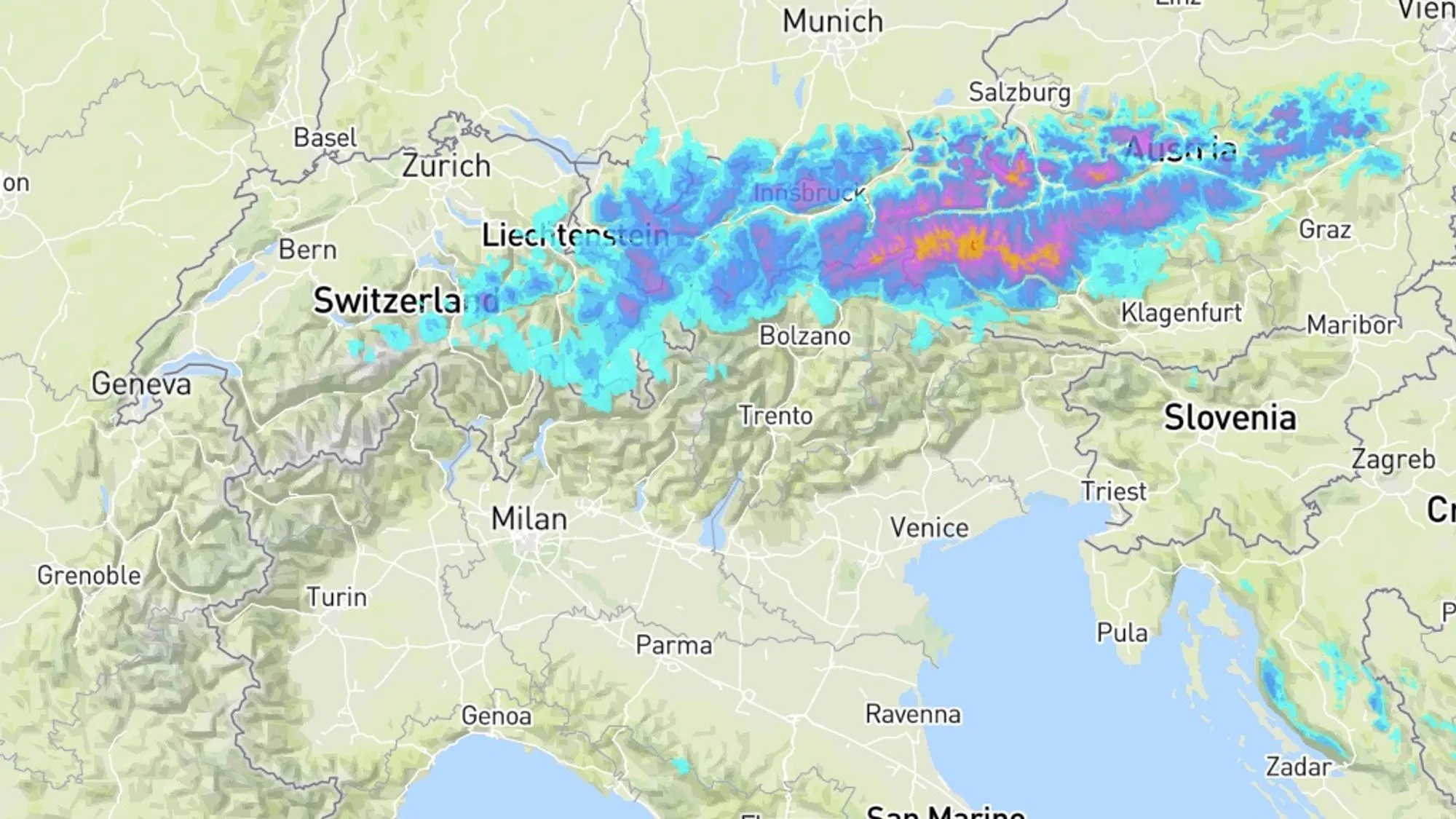
In this update we focus on the details of the snowfall that can bring a reasonable dump tomorrow, especially in the eastern areas of Austria. We also reflect on yesterday and consider the avalanche danger that will increase, partly due to the strong wind causing the snow to drift.
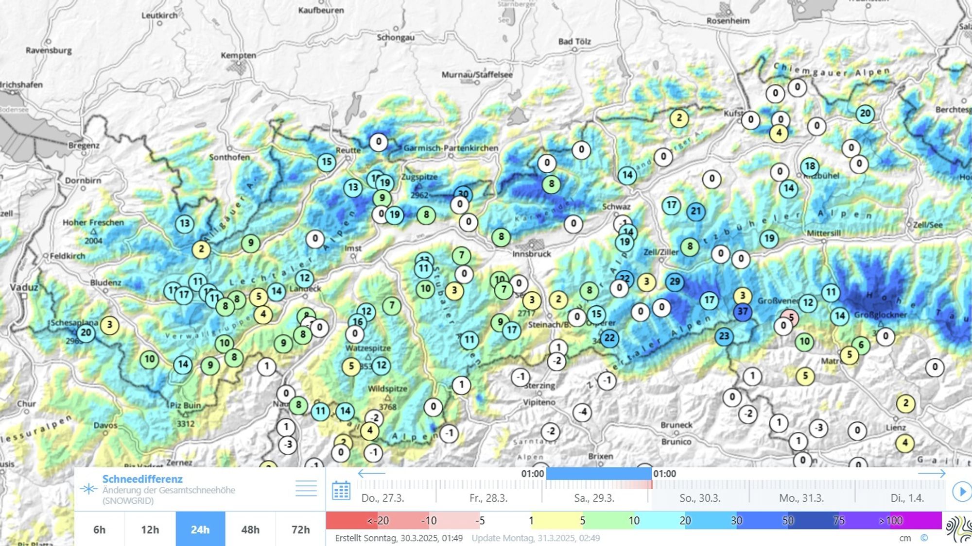
Refresher at altitude yesterday, regionally 40 centimeters
A disturbance over the Balkans brought cloud and precipitation to the eastern half of the Alps yesterday. In the Dolomites, where I am currently staying, it snowed lightly all day. This eventually resulted in about 10 centimeters above 2100 meters. The snow line was clearly high, and this was also the case in Austria and Switzerland. Above 1700-2100 meters, a maximum of 40 centimeters (region Hohe Tauern) came down, but in most regions it was more modest with 10-20 centimeters. This morning, there is still some snow falling in Carinthia above 1700 meters.


- 1cm
- 5cm
- 10cm
- 15cm
- 20cm
- 30cm
- 40cm
- 50cm
- 75cm
- 100+
- 1mm
- 5mm
- 10mm
- 20mm
- 30mm
- 60mm
- 120+
Significant Norstau
The mentioned areas (Zillertal Alps and Hohe Tauern) will get snow again and thus become an attractive destination (beware of the rising avalanche danger!), but more northern and eastern areas will also get a lot of snow. With a northern flow, cooler air collides with the Alps from tonight and with the milder air initially still being supplied from the southeast. This will result in oer 24 hours of snowfall in large parts of Austria. It will only become dry again by Tuesday morning. Both GFS and ECMWF expect 20 to 40 centimeters above 1500 meters on a large scale, and regionally (especially in Salzburgerland and western Styria), up to half a meter may fall. The far east of Switzerland will get 10 to 20 centimeters from this disturbance.
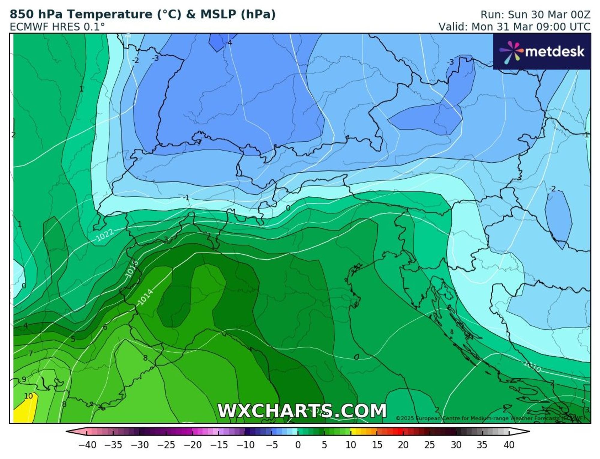
Lower snowfall line
Tonight, we start with rain below 1300-1700 meters, but most precipitation will fall on Monday with a significantly lower snow line. North of the main Alpine ridge, snow will mainly fall above 1200 meters, and here and there, it can even snow down to 700 meters during more intense precipitation on Monday morning.
Wind and rising avalanche danger
The snowfall is accompanied by a lot of wind from the north, with gusts reaching about 80 kilometers per hour above 1600 meters. We are already dealing with a weak base above 1600 meters, and a significant drifting snow problem will be added. The avalanche level in Austria will likely rise from 3 to 4 in many regions, making it advisable to avoid higher steep terrain or terrain with steep slopes above it in the coming days.
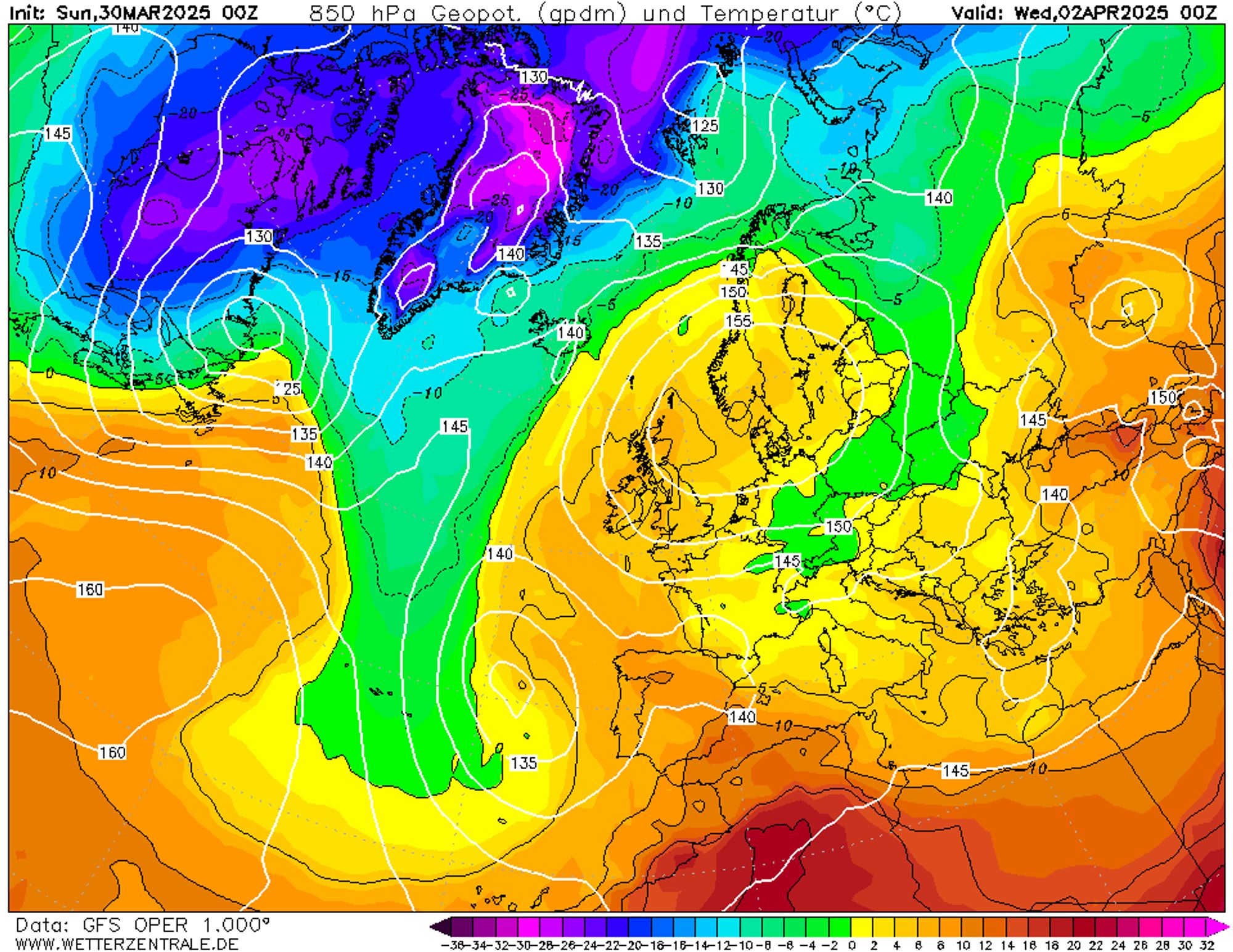
High-pressure situation, gradually milder
A high-pressure area above Northern Europe will ensure stable weather with plenty of sun in the coming week. A (north)eastern flow will bring moderate temperatures with good winter sports conditions in the first days. In the second half of the week, the flow will shift to the south, and mild spring weather will return.
Reaktionen
There is no base in the east of Austria. This winter has been the worst in years. All the late snow falls on nothing. Unfortunately a bad taste for the future.
There is no base in the east of Austria. This winter has been the worst in years. All the late snow falls on nothing. Unfortunately a bad taste for the future.
schufisao - 30 Mar 2025 11:02
With 50cm of fresh snow a base is not needed in my opinion but the weather models differ so much, it could be 55cm or only 10cm in Styria. I have never seen so big differences… That makes me doubt that going there is worth it.
There is no base in the east of Austria. This winter has been the worst in years. All the late snow falls on nothing. Unfortunately a bad taste for the future.
schufisao - 30 mrt 2025 11:02
You can find over a meter of snow on some north facing slopes above 2000m around the main ridge, and don’t forget that 20-40 cm has fallen yesterday in some regions. You can find current snow depths here: https://lawinen.report/weather/map/snow-height/2025-03-30T04:00:00.000Z/-1
Webcams also show plenty of snow (less than normal but certainly a base): https://www.windy.com/nl/-Webcams
.