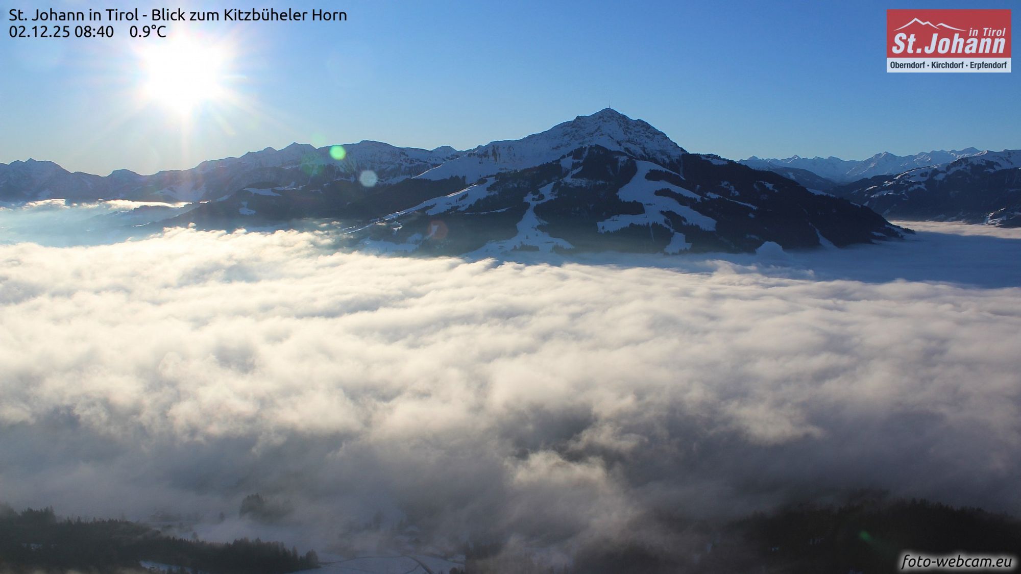
In the coming days, the weather will generally remain fairly calm, with a few days offering some chances of snowfall. No large amounts, but in some areas a small refresher.

Lightly changeable
The Alps continue in the lightly unsettled pattern of recent days. Today, it is mainly cloudy in the Southern Alps, where some light snowfall may occur above 1400 meters. A weak front is approaching from the west, bringing mostly clouds, causing the Western Alps to cloud over as the day progresses. The Northern Alps are in a weak föhn flow, keeping conditions dry and mostly sunny. In the valleys and the Alpine foreland, some low cloud cover is possible.
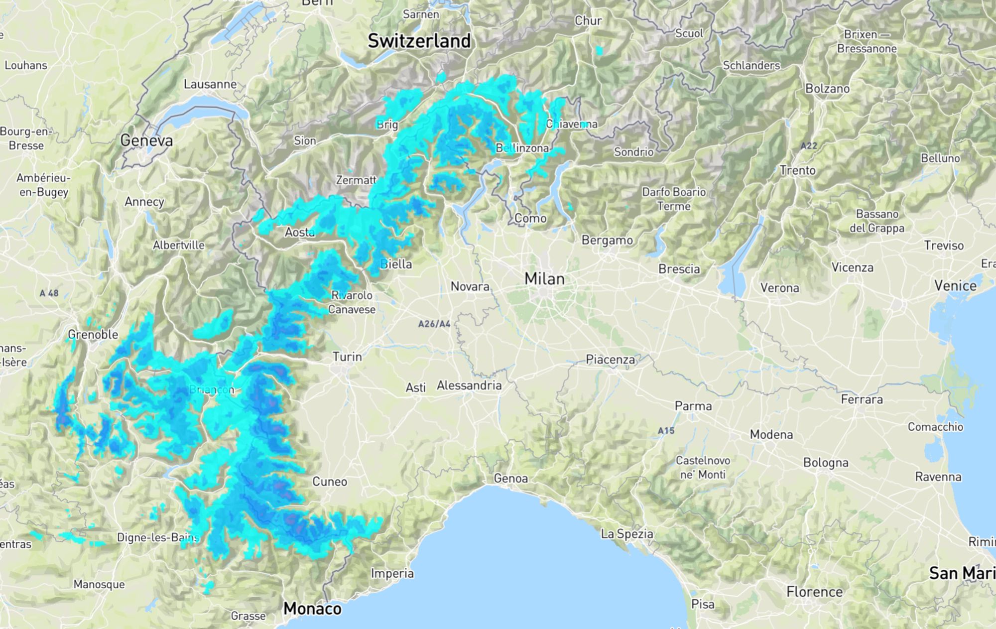
On Wednesday, this light southerly flow persists, bringing some snowfall to the Southwestern Alps throughout the day. Many areas will see just 5 to 10 centimeters, with Vercors/Isère possibly reaching 15-20 centimeters. Further north in the French Alps, less snow will fall. The snow line will generally be around 1000-1200 meters. On Thursday, precipitation decreases, though Piemonte may still see some light snow in the morning. In the rest of the Alps, skies will clear. Later in the day, another weak front will approach from the west.
Friday snow for the Southeastern Alps - or maybe not?
This front will bring some snow to the western side on Friday. Switzerland in particular seems likely to pick up around 5 to 10 centimeters. At the same time, models have hinted at snowfall for the Southeastern Alps in recent days, but the guidance remains inconsistent. GFS continues to show it, and EC also showed snowfall yesterday morning - but in the evening run it did not and kept that part of the Alps dry. This morning, EC again shows little interest, letting the precipitation area slide just to the east. GFS, however, still signals snowfall.
Next week still uncertain
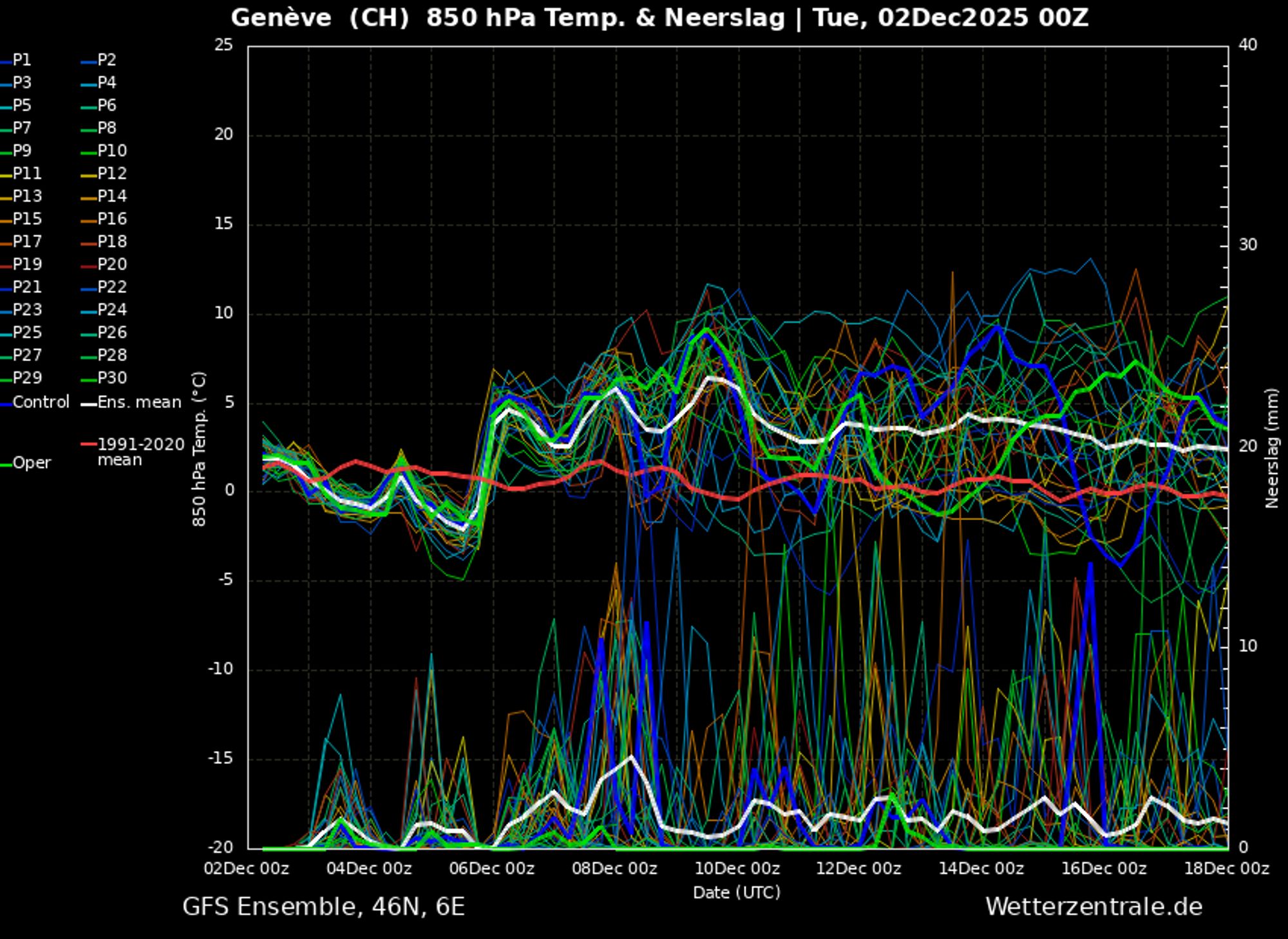
The unsettled conditions seem to continue into the weekend, though without significant snowfall - with more sunshine on Saturday and some showers for the Northern Alps on Sunday. Next week looks relatively mild according to ensemble forecasts, but developments remain uncertain. Strong Atlantic depressions keep the upper-level flow in a southwesterly direction in the European model, transporting mild air. GFS currently shows a bit more precipitation than EC and is generally slightly colder.
Reaktionen
is there indication already, if we can we expect a colder phase + snow from mid december?