First of all, Happy New Year to all powder lovers! It can’t get much worse than last month. After a promising start to the season in late November, it remained persistently mild and dry across most of the Alps. Let’s look back using some numbers. Now that the mild air has finally been pushed far to the south, January looks set to bring a completely different temperature pattern. The dryness will continue for a while, but in about a week, that too seems likely to change.


December was very dry and extremely mild
With the exception of the Southwestern Alps (several dumps in Piemonte, mainly in the Alpi Marittime), December '25 was very dry, with less than 40% of normal precipitation in large parts of Austria, Switzerland, and Northern Italy. Slightly better conditions can be found higher up in Valais and the French Northern Alps, although the snowpack there is also badly in need of a refresh. The monthly maps for Austria below give a good picture.
Cold but not much precipitation in the Alps
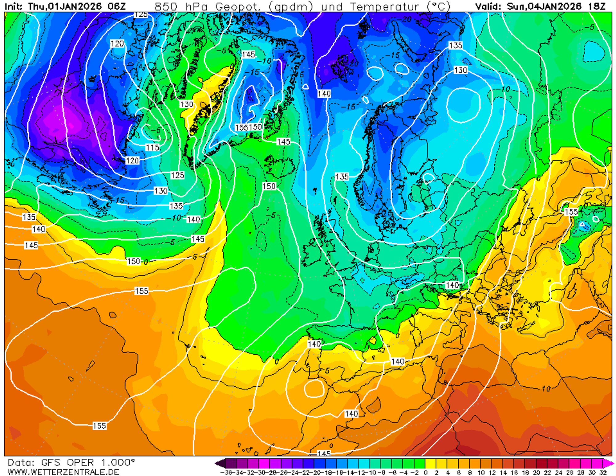
The weather charts look impressive: between a high-pressure ridge over the ocean and a deep low over southern Scandinavia, polar air is sweeping across Northwestern Europe with numerous wintry showers. From about 200 meters, snow will also remain during the day. The low mountain ranges in Belgium, Germany, and Poland will see their first substantial dry snow of the season. In the Harz and Sauerland, 20 to 30 cm could easily fall. Further south, the upper air is less cold, and most of the moisture has already been squeezed out by orographic lift against the mid-range mountains.
The air reaching the Alps is therefore much less unstable than further north. Tonight, temperatures at 1500 meters will also drop below zero in the Southwestern Alps, followed by a few very cold days. Over the weekend, temperatures at 1000 meters will have fallen to -6 °C in Austria and Western Switzerland and to -4 °C in the Western Alps. At 2500 meters, it will be -12 to -18 °C. Winds have eased to force 2 to 4, so windchill will be limited.
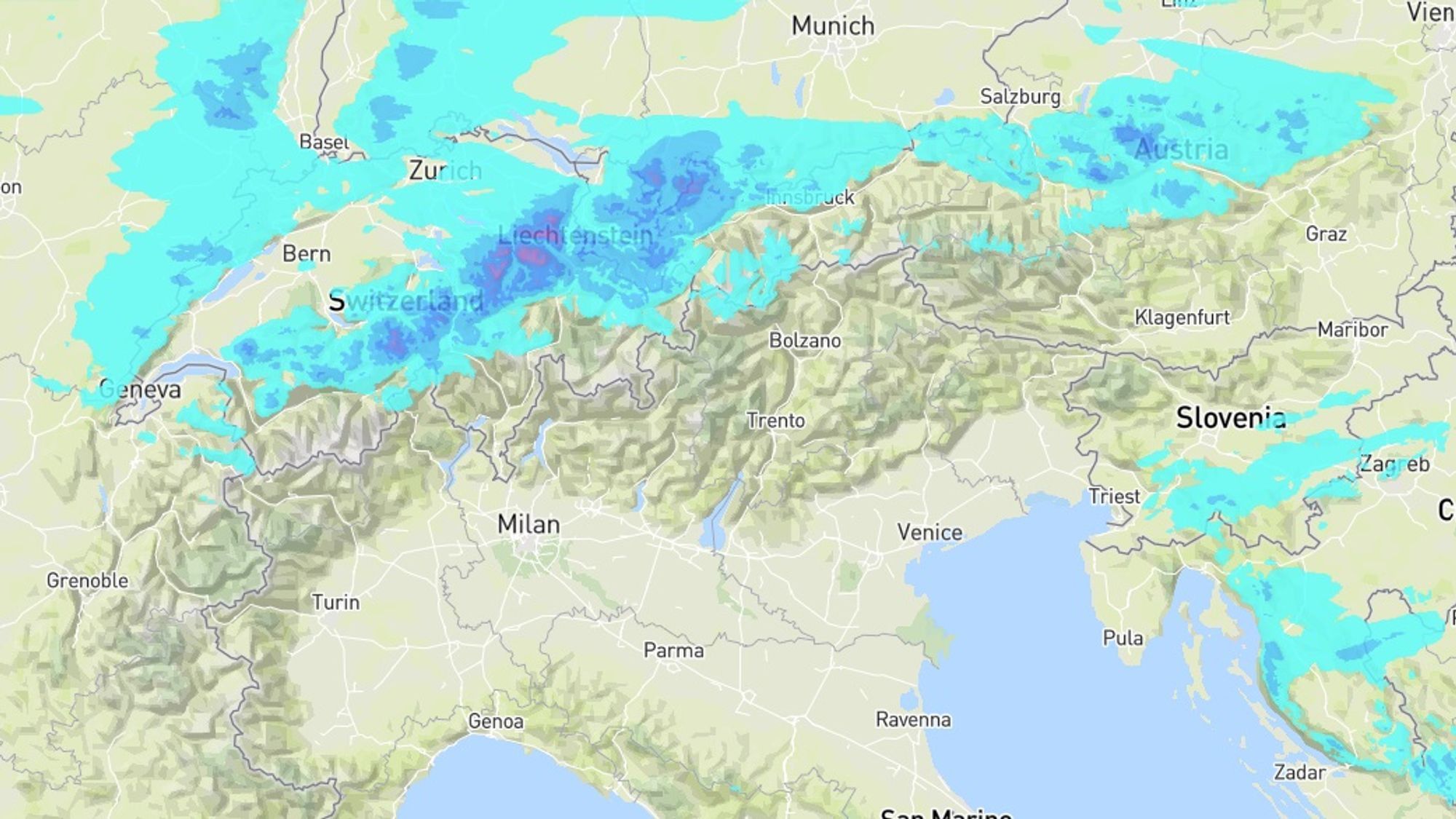
Mostly a few centimeters of powder for the Northern Alps, locally more
While the cold weather in the Southern Alps and inner-Alpine regions comes with plenty of sunshine, the northern edge will see more clouds in the coming days. Between Friday afternoon and Sunday morning, the last bits of moisture will be squeezed out against the first mountain ridges. Forecast precipitation amounts are modest at 2 to 12 mm, but because the air is very dry, this can translate into a fluffy layer of 5 to 20 cm. The best chance for such a refresh is in the western areas along the northern edge, such as Balderschwang, Bolsterlang, Oberstdorf, and Tannheim. In Switzerland, examples include Flumserberg, Braunwald, Unterwasser, Engelberg, and Grindelwald. Further south, amounts decrease, and south of the main Alpine ridge it stays dry, as in the French Alps. In the far north of Tyrol, only a few centimeters will fall, and in Salzburgerland, Upper Austria, and northern Styria around 5 cm, locally up to 10 cm.
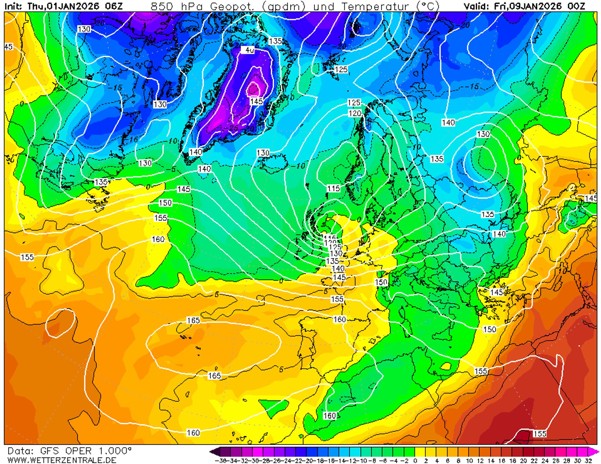
Depressions will likely bring precipitation from January 8
It’s still far off, but we clearly see a pattern where all models show precipitation signals for the western Alps in about a week. Atlantic disturbances will then again gain influence on the European weather. Whether this will indeed come with milder air and rain in the valleys, as in the GFS chart below, remains to be seen. There are also scenarios that assume a northwesterly flow. In that case, precipitation chances also increase, and it stays cold enough for snow at low elevations. Let’s hope these chances are realized this time and that, after the warmth, the dryness in the Alps will also become history. Enjoy the snow in the new year and keep following us for daily powder updates!