- 1cm
- 5cm
- 10cm
- 15cm
- 20cm
- 30cm
- 40cm
- 50cm
- 75cm
- 100+
- 1mm
- 5mm
- 10mm
- 20mm
- 30mm
- 60mm
- 120+
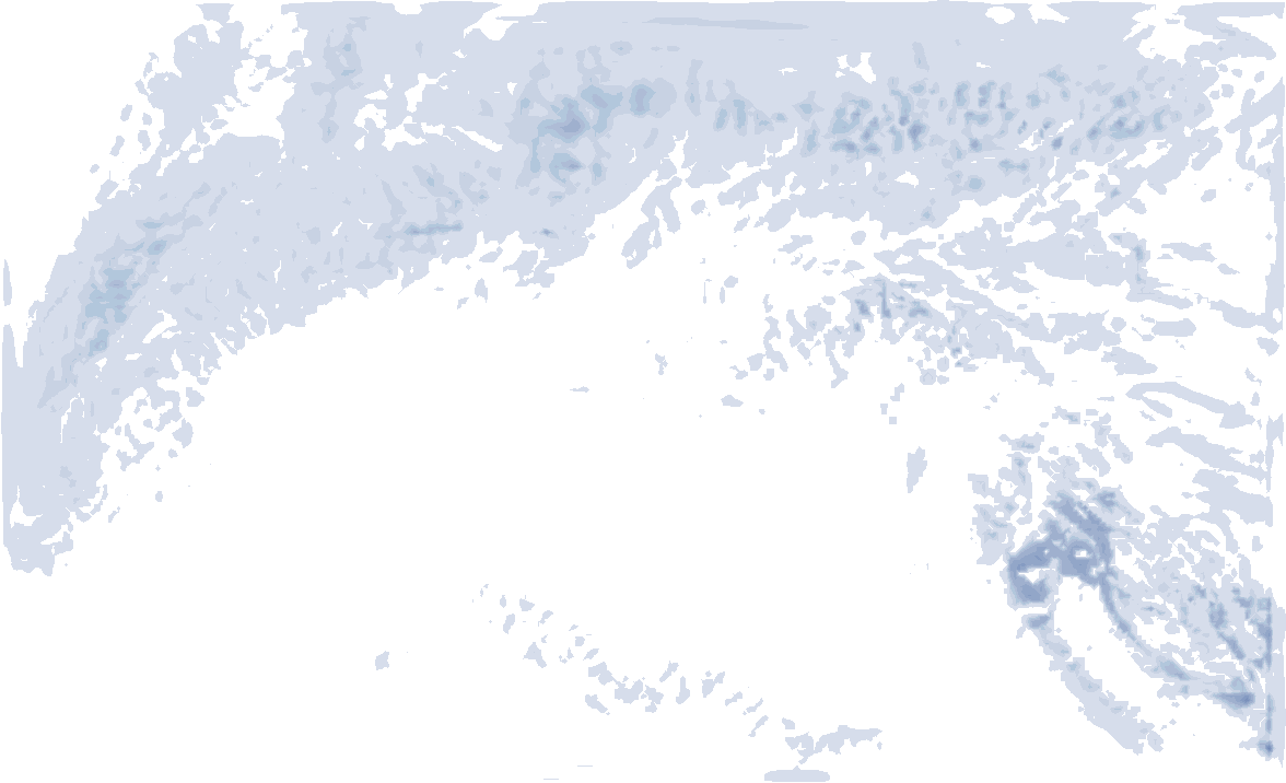
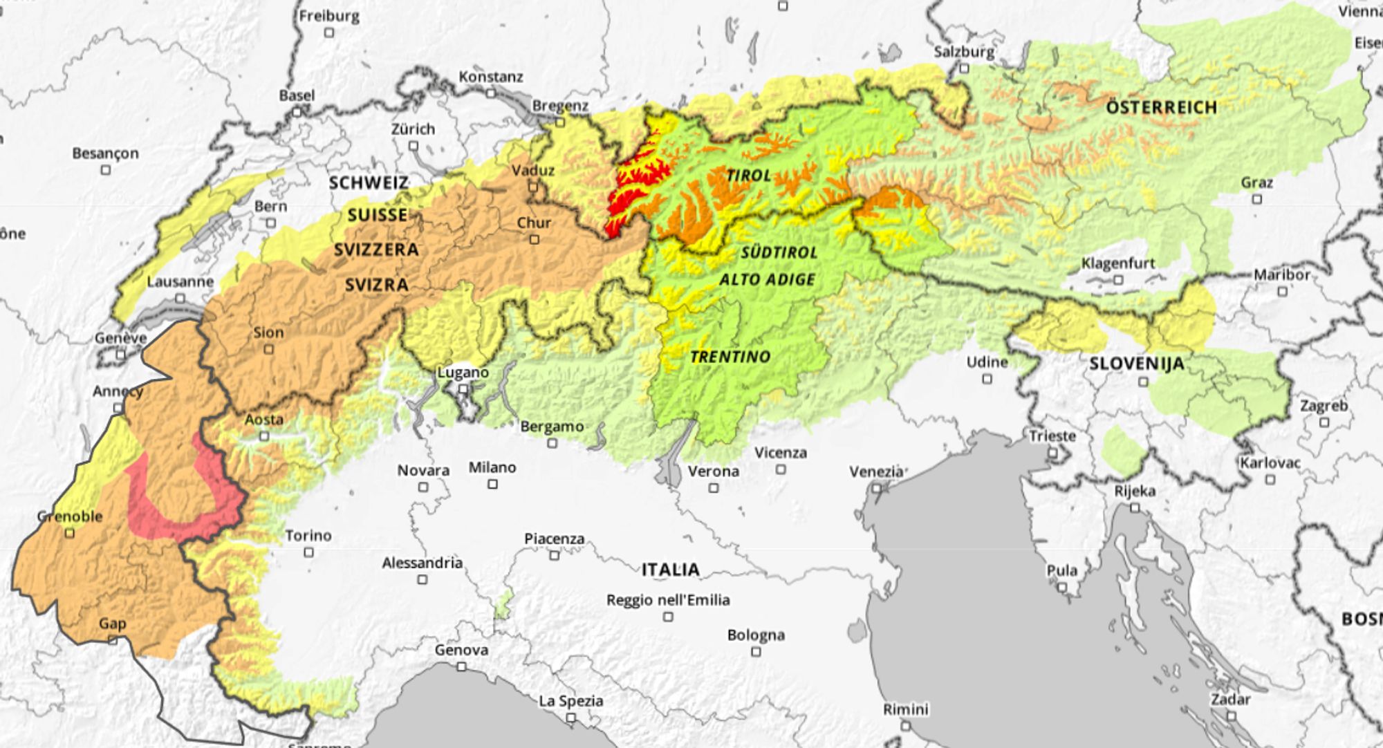
A short warning beforehand: don’t take this 6-day snowfall map too literally.
After the enormous snowfall during PA#3 last week, conditions have now calmed down. Until the weekend there will be little to no precipitation, with a mix of clouds and sunshine. The developments towards the weekend are definitely interesting. In parts of the Southern Alps, the chances of a nice layer of fresh snow are increasing, but for now it doesn’t look like this will happen everywhere.
Quiet week
After the intense snowfall of PA#3 last weekend in the Northwestern Alps, conditions have calmed down again. The video by Arnie777 above lets us briefly relive the fantastic conditions. At the same time, however, there have unfortunately been several fatal avalanche accidents. For this reason, we once again make an urgent appeal to everyone to remain cautious, as unfavorable avalanche conditions are still widespread across the Northern and Western Alps.
From a weather perspective, this week is generally calm, mild, and largely dry. Yesterday, some snow fell on the northern side of the Alps with the passage of a warm front. During this event, the snow line rose, especially in th regions on the northern edge, to around 1,200-1,500 meters. Locally, freezing rain also occurred, causing very slippery road conditions in some areas.
Alternating clouds and sunshine
Behind this warm front, the Alps are now under the influence of mild air, with temperatures around 0 to 6°C at 1500 meters. Supported by föhn winds, the freezing level in the Western and Northern Alps is mostly between 2000 and 2500 meters, while on the southern side it is somewhat lower. The map below shows temperatures at approximately 1500 meters elevation.

- -20°
- -15°
- -10°
- -5°
- 0°
- 5°
- 10°
- 15°
- 20°
The weather pattern therefore remains largely calm, with alternating periods of (higher) cloud cover and sunshine. During the night from Wednesday into Thursday, a weak precipitation area approaches the Northwestern Alps, but as also shown in our forecast, it will remain a glancing blow. Only areas such as Portes du Soleil may see a light dusting of snow above 1500 meters. Elsewhere in the Alps it will stay dry for the time being, with sunny conditions returning during the day on Thursday. However, the southerly föhn is expected to play a larger role at higher elevations, locally leading to fresh wind-drifted snow, especially in Switzerland.
A south-side dump this weekend?
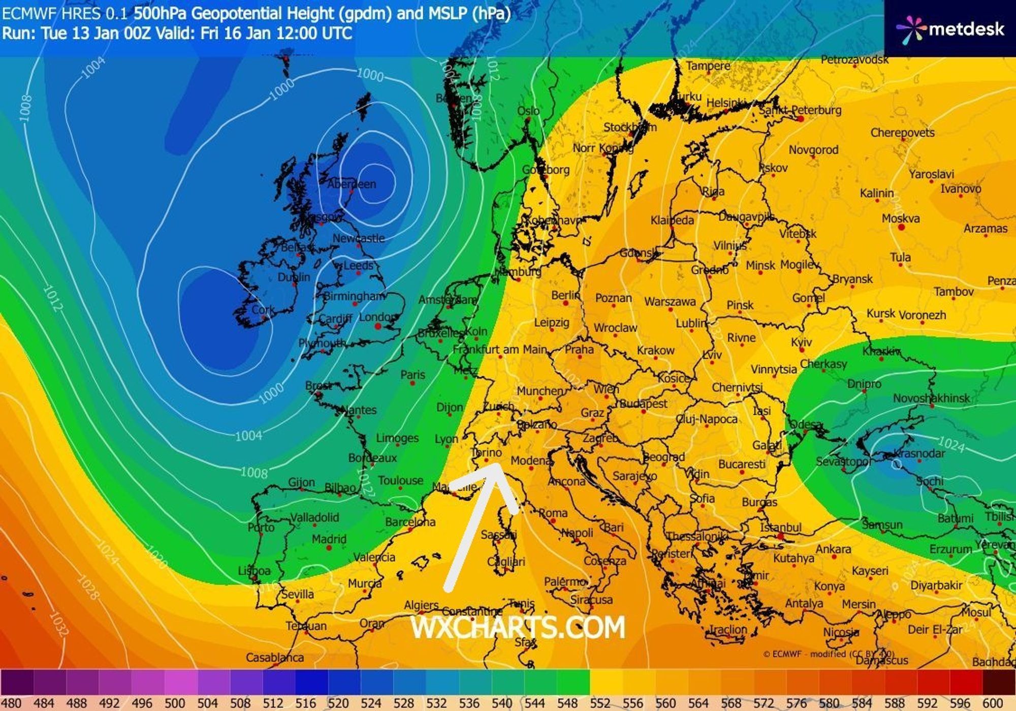
This is related to the approach of a large-scale trough over Western Europe, which will set up a southerly flow across the Alps. According to the current model calculations, this will lead to a Südstau from Friday onwards. Initially on Friday, this will be limited to Piemonte, Ticino, and Lombardy, with the snow line around 1200-1500 meters. Later in the weekend, the flow turns more (south)easterly, and especially Piemonte and Aosta could be affected by a Retour d’Est, allowing snowfall totals to increase significantly.
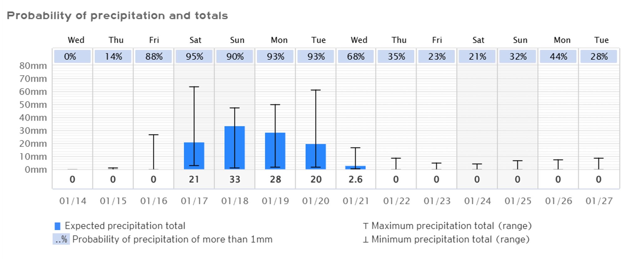
An important point to note: in several model runs over the past few days, the Dolomites remain (largely) out of range, making the forecast for that region more uncertain. Below you can see the differences between the current ECMWF and GFS runs for the reference points Turin and Cortina. For Turin and its surroundings, an unsettled period of 4 to 5 days with heavy snowfall appears fairly solid in both ensembles, while for Cortina you may be in for a disappointment if you focus too much on the GFS model alone at this stage. We’ll keep a close eye on these developments!
Reaktionen
Interesting! What would be the expectations for the south side of the Mont Blanc at Courmayeur? Any significant accumulation? Snowline?
Now this sounds really interesting, heading for Aosta on Saturday. Really keen to see how this develops of course, and keeping my fingers crossed for a serious dump.
Perfect timing! Will be in the area from 19th onwards.
Gressoney,102 mm precipitation until next monday. Less “peaky” and quite consistent with the previous model run.
https://meteologix.com/nl/forecast/3175838-gressoney-la-trinite/14-day-trend
.