After three weeks of mostly dry and mild spring-like weather, winter is set to return to the Alps this weekend. A first front will already bring some precipitation over the next 24 hours and signals a more active snow producer for the weekend. Details are still somewhat unclear, but keep in mind that a PowderAlert may be issued on Thursday or Friday for the period Saturday–Monday.
In today’s forecast we’ll cover:
- A weak front bringing light snow to the Northwest Alps
- Snowfall expected this weekend
- Why there is no PowderAlert yet
- Will the unsettled weather continue after the weekend?
Weak front brings light snow to the Northwest Alps
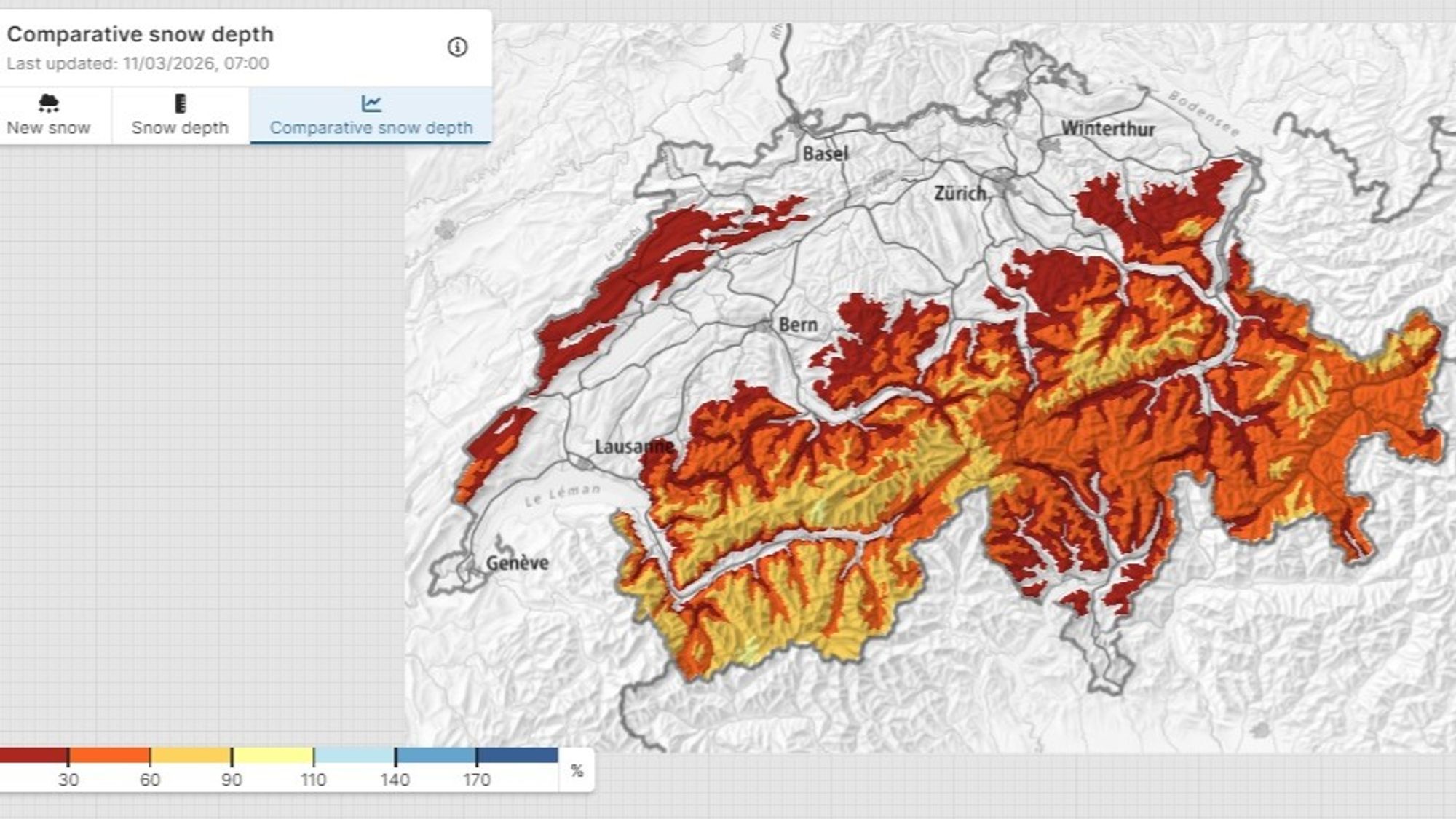
After the intense weather of the first two weeks of February, the atmosphere seemed to take a break. Weeks of mostly sunny and mild weather have now clearly affected the snowpack. The older weak layers have stabilized somewhat (though they are certainly not gone), and on sun-exposed slopes a fresh snowfall would be very welcome.
A first weak front will start this process over the next 24 hours. Today there is already quite a bit of cloud cover over the Alps, and this trend will continue with increasing clouds and the first snowflakes appearing this afternoon along the main Alpine ridge in Savoie and Switzerland. In Austria and the Southern Alps there will still be some sunshine today, with temperatures around freezing at 2000 meters.
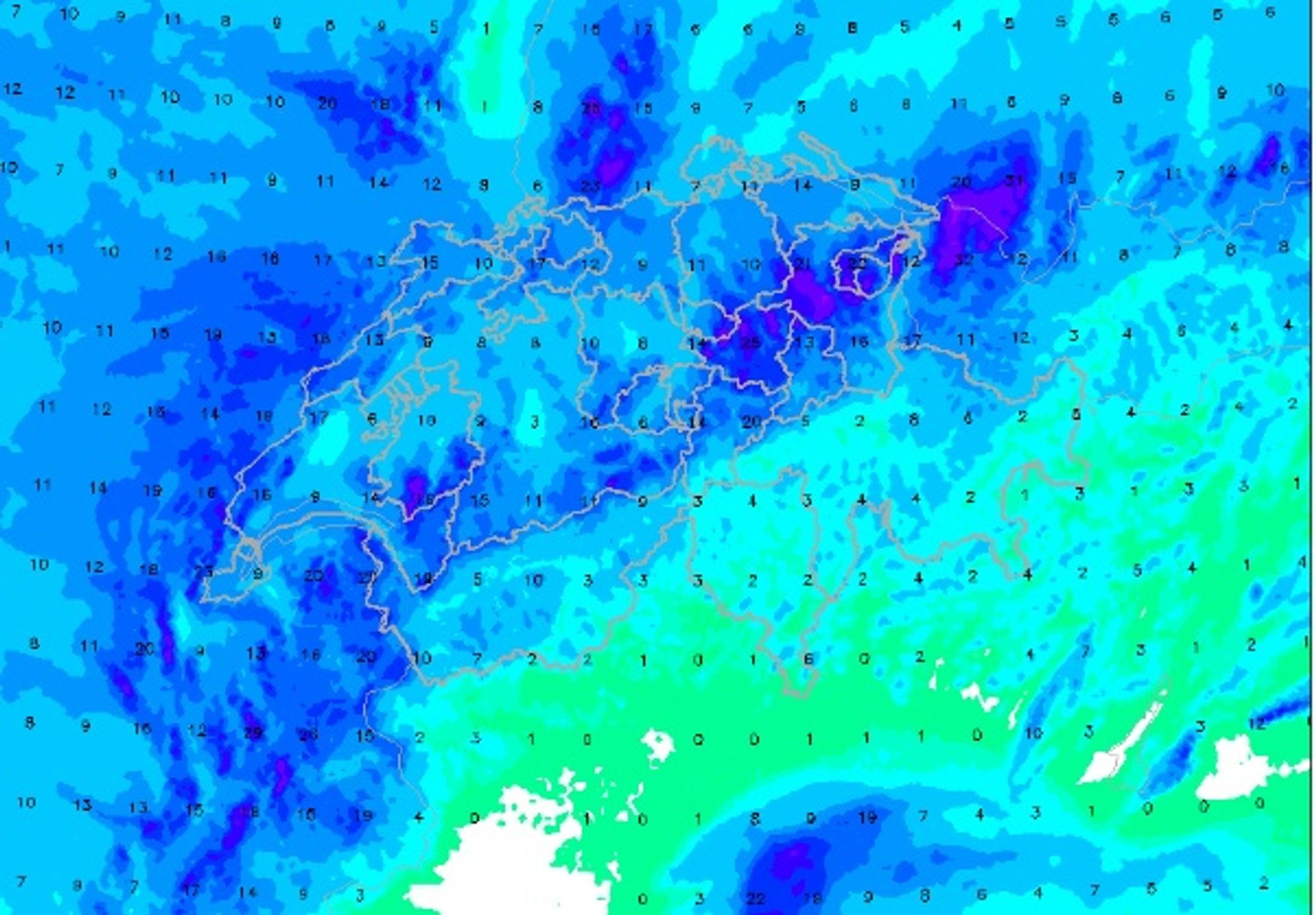
Tonight and overnight snowfall will mainly affect the region between Haute-Savoie and the Arlberg. Expect around 10–20 cm above 1600 meters, with a snowline around 1400 meters. Some snow may fall elsewhere in the Alps, but the front will quickly be pushed eastward by a strengthening high-pressure system.
The high-pressure system will bring clearing skies tomorrow, spreading from the west, and conditions will remain favorable through Friday. Temperatures will rise again with a strengthening southwest wind, bringing a notable thaw up to well above 2000 meters. However, this high-pressure system will not last long, and the strengthening wind is already a sign of the next change in weather.
Snowfall this weekend
Below we describe the most likely scenario, while addressing the uncertainties afterward.
Phase 1
During the night from Friday to Saturday, a precipitation zone will reach the Western Alps. Over a period of about 24 hours we currently expect 20–40 cm of snow in the French Alps and Valais, with the snowline quickly dropping to around 1000 meters. The largest amounts are expected in Savoie and Haute-Savoie, though the Écrins should also receive a decent share. The Maritime Alps appear likely to receive somewhat less snow.
Phase 2
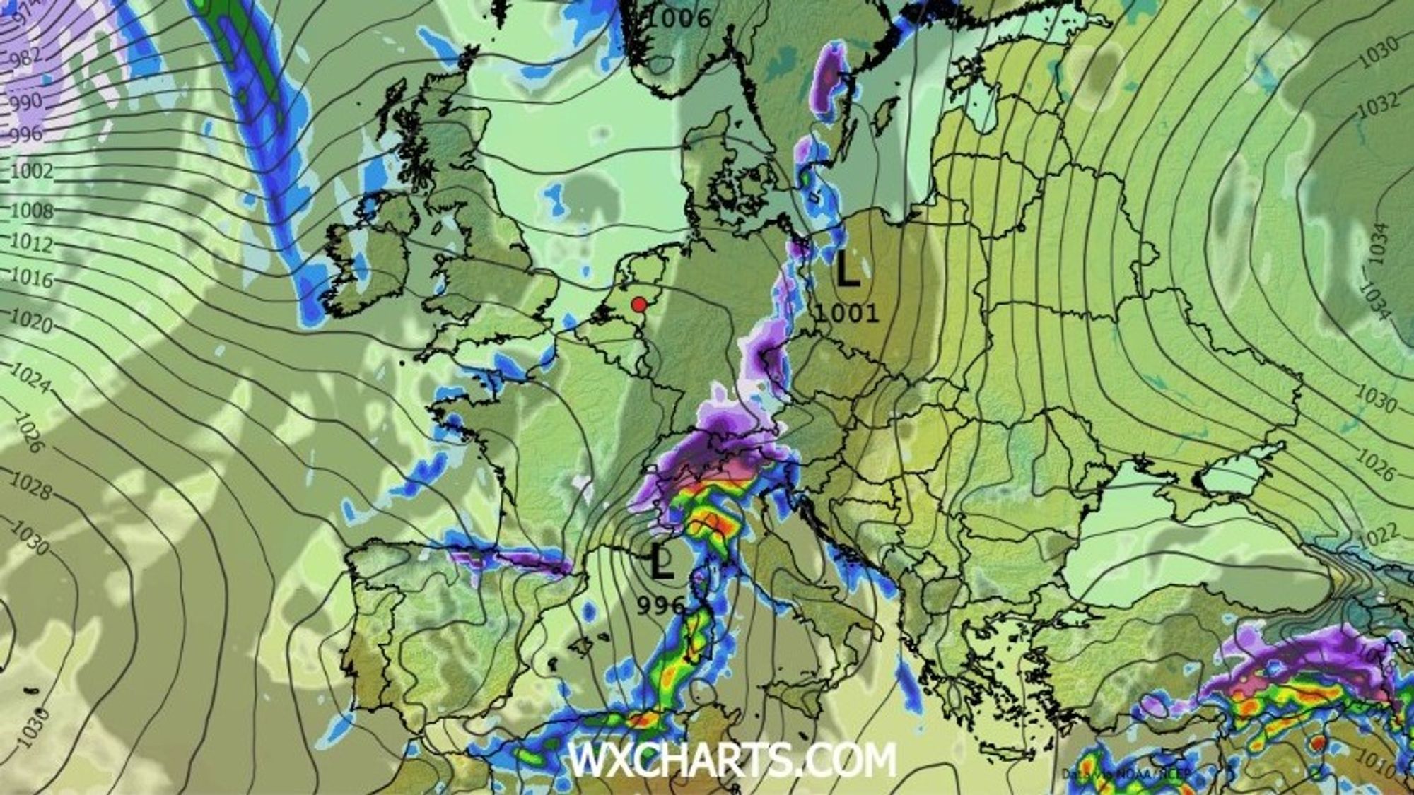
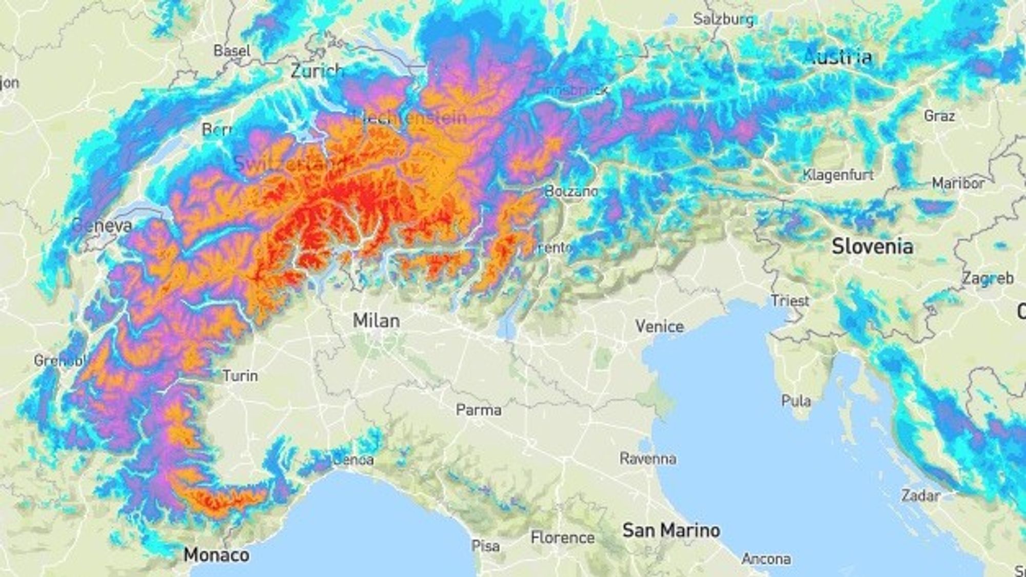
As the front moves eastward across the Alps, a low-pressure core will develop both at the surface and higher in the atmosphere (around 5 km altitude). This low is expected to form near the Gulf of Genoa and then move southward fairly quickly. Despite this movement, it will have a major impact on the precipitation pattern. The system will essentially “swing” the snowfall zone and may create strong southerly stau, particularly affecting Ticino. In that scenario, 50–100 cm of fresh snow above roughly 1200 meters is possible there. The Monte Rosa region and Andermatt would also benefit significantly, and this scenario is currently reflected in the WePowder precipitation forecast.
There are also good chances for 30 cm or more in Piemonte and large parts of Switzerland, while Austria and the Dolomites would likely receive less snow since the precipitation zone may not penetrate that far east.

- 1cm
- 5cm
- 10cm
- 15cm
- 20cm
- 30cm
- 40cm
- 50cm
- 75cm
- 100+
- 1mm
- 5mm
- 10mm
- 20mm
- 30mm
- 60mm
- 120+
Why no PowderAlert yet?
If you’re eager to chase fresh powder, it might be a good idea to start blocking out your days off already, because the snow is definitely coming.
So why hasn’t a PowderAlert been issued yet?
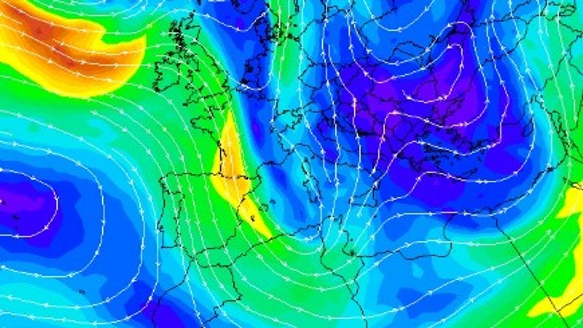
Phase 2 of this snowfall event still contains quite a few uncertainties. The cut-off low responsible for this phase remains inconsistent in both timing and location across the models, which also affects the expected snowfall distribution across the Alps. And of course, we don’t want to send you in the wrong direction.
The snowfall for the core Western Alps during Phase 1 is fairly certain, so if you are aiming for areas like Savoie or the Écrins, you’re relatively safe. That’s especially true if you have a flexible trip planned. However, if your focus is on Piemonte, Swiss regions along the main Alpine ridge or the Arlberg region, we cannot yet provide certainty regarding the expected snowfall totals. We should be able to provide more clarity tomorrow or Friday, and a PowderAlert will likely follow then.
Will the weather remain unsettled after the weekend?
Current forecasts suggest that the snowfall period this weekend will end with a northwest cold front on Monday. This could bring 10–25 cm to the Northern Alps, with a low snowline. In this setup, the Austrian Northern Alps would finally benefit from snowfall, while the French Alps would likely see the least.
After that, a high-pressure system is expected to expand again from the west, bringing another period of sunshine. Temperatures will rise again, particularly in the western Alps where daytime temperatures may climb slightly above freezing at 2000 meters. Further east, warming will likely be more limited because the wind will retain an easterly component.