Yesterday, Coen provided a detailed update for Powder Alert #2. Today, another update:
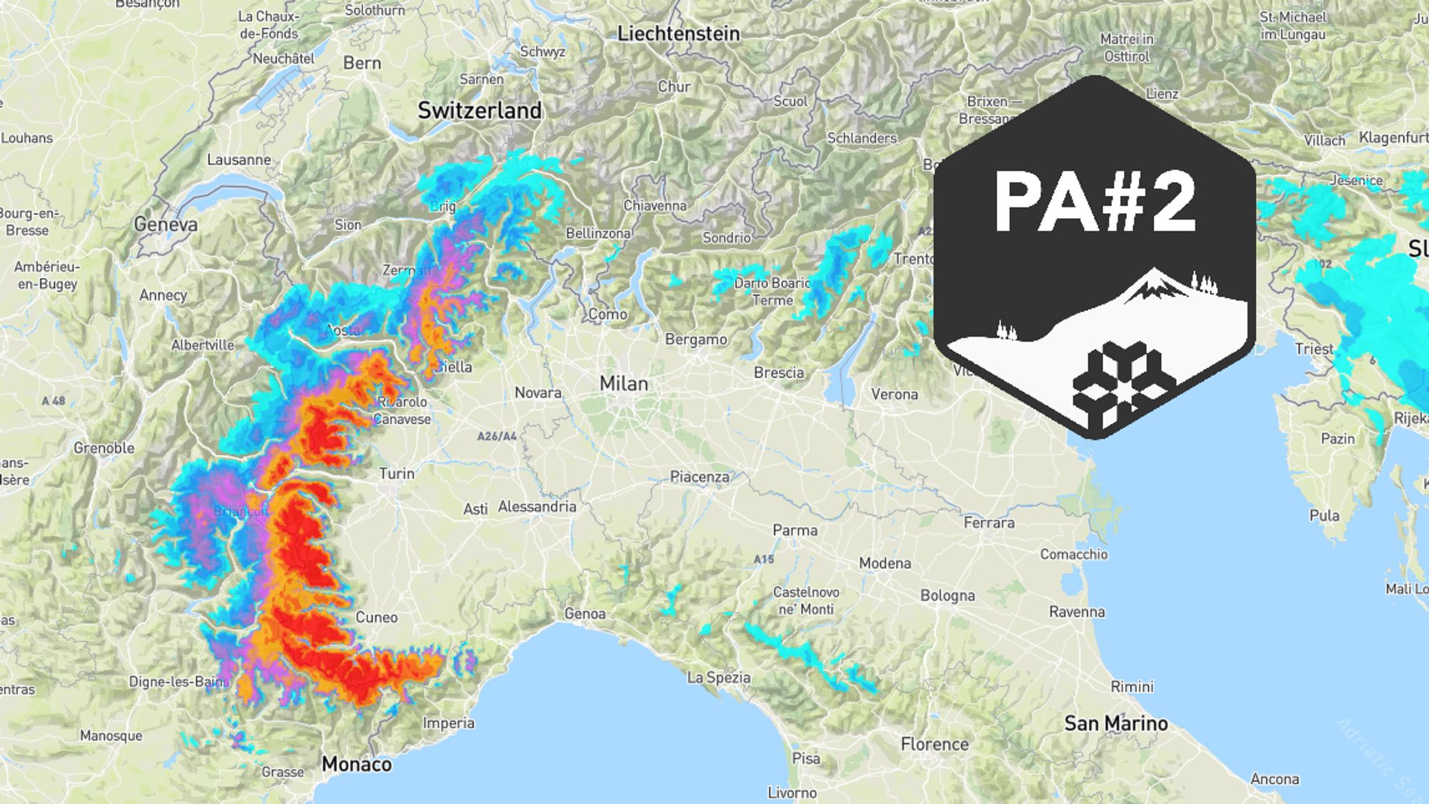
- The area expecting snow has shrunk slightly, but especially Piedmont will still see heavy snowfall in the coming days.
- Which regions will get buried in snow, and where will it be more of a modest refresh?
- Heads up: weather warnings and increasing avalanche danger.
- A look ahead to Christmas and New Year’s week: how cold will it get, and will winter conditions persist?

Southwest already seeing some precipitation, sunny and mild elsewhere
Since yesterday, occasional snow has fallen in Piedmont and the French Southern Alps. However, this snow is light and nowhere exceeds a few centimeters. The snow line is high: around 1800 m on the Italian side and 2200 m in France. Switzerland and Austria remain sunny, calm, and mild. In the western Alps, the Südföhn will strengthen today, with gusts up to 75 km/h in föhn-sensitive spots. This sets the tone for the first days of the coming week, with föhn winds prominent in Switzerland and Austria inner-Alpine and on the northern side.
Five days of precipitation in the Southwestern Alps, peaking from Tuesday
Snow chances remain high in the Italian inner arc through Thursday. It won’t snow heavily for five straight days, but precipitation will come in waves. The heaviest snowfall is expected between Monday evening and Thursday morning, as a low-pressure system settles south of France, boosting the retour d’Est. Not every wave hits the same Alpine sectors: Monday and Tuesday mainly target Alpes-Maritimes and southern Piedmont, while from Wednesday, Aosta and Valais will also see snow. Recent model runs have reduced expected amounts for these latter regions.


- 1cm
- 5cm
- 10cm
- 15cm
- 20cm
- 30cm
- 40cm
- 50cm
- 75cm
- 100+
- 1mm
- 5mm
- 10mm
- 20mm
- 30mm
- 60mm
- 120+
Follow the development of the fresh snow cover in our animation above
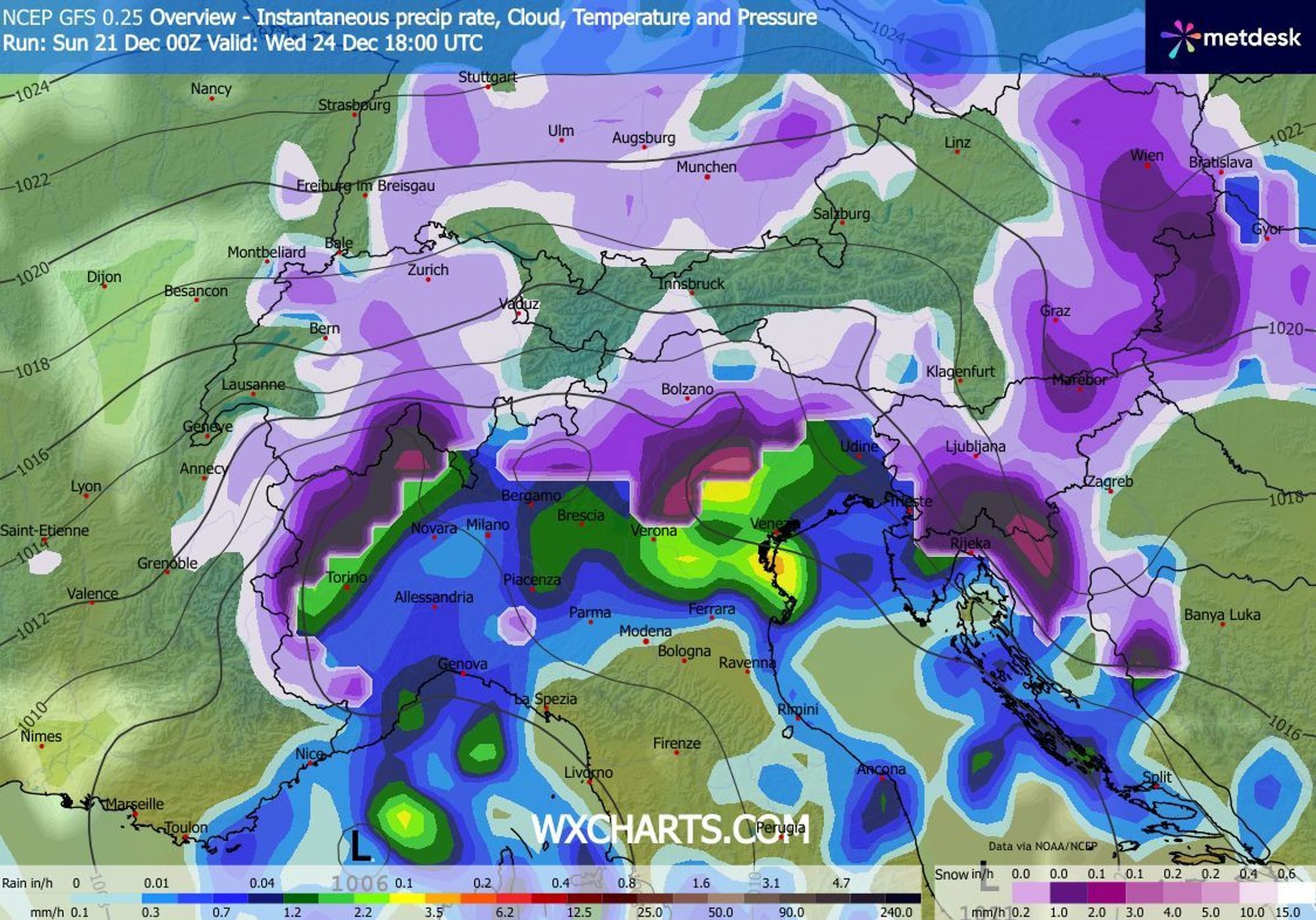
Snow line between 1200 and 1800 m, dropping Thursday
Sunday night, the snow line falls to 1400-1600 m, possibly higher in areas with little precipitation. Monday stays similar, with fresh snow forming above this level. Piedmont may see the snow line drop several hundred meters where snowfall intensifies. Tuesday and Wednesday bring slightly milder air ahead of the next low. Inner-Alpine Piedmont likely stays cold, but French sectors and Aosta/Valais may see rain up to 1800 m. Thursday, colder air flows in from the east, with snow continuing in Piedmont, Aosta, and Valais, and the snow line dropping quickly to 1000 m or lower.
| Resorts expecting 80-130 cm | Resorts expecting 30-80 cm | Most likely 10-30 cm |
|---|---|---|
| Prali (IT) | Isola 2000 (FR) | Zermatt (CH) |
| Limone Piemonte (FR) | Sestrière (IT) | Serre Chevalier (FR) |
| Prato Nevoso (IT) | Champorcher (IT) | Pila (IT) |
| Abriès (FR) | Val Cenis (FR) | Aletsch Arena (CH) |
| Crissolo (IT) | Monte Rosa (IT) | Courmayeur (IT) |
Potentially hazardous conditions, also on the roads
Heavy precipitation will sharply increase avalanche risk in the coming days. The Italian weather service has issued an orange warning for Monday for snow and slippery conditions. Rain and melting snow in valleys may also cause localized flooding. These hazards persist through Thursday. Elsewhere in the Alps, conditions remain calm, though föhn winds in Switzerland and Austria could cause lift closures.
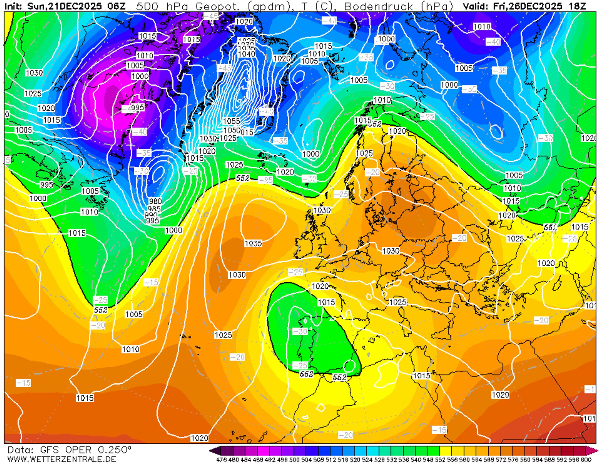
Fairly cold Christmas period
By Thursday (Christmas Day), colder air arrives at higher altitudes. Our model suggests some Sudstau with 10–20 cm snow in the Dolomites, Slovenia, and Carinthia, though not all models agree. Timing would be perfect for Christmas! It will definitely turn colder - a blessing for ski resorts after three weeks of mild weather, where snow cannons can finally do their thing again. Expect moderate cold: freezing level around 600 m in sheltered southern Alpine valleys, up to 1300 m on sunny northern slopes. Nights will be frosty, mostly -5 to -10°C. On December 26–27, sunshine returns to more regions, and daytime temperatures rise slightly, with freezing levels between 1200 m inner-Alpine and 1400 m along the northern rim.
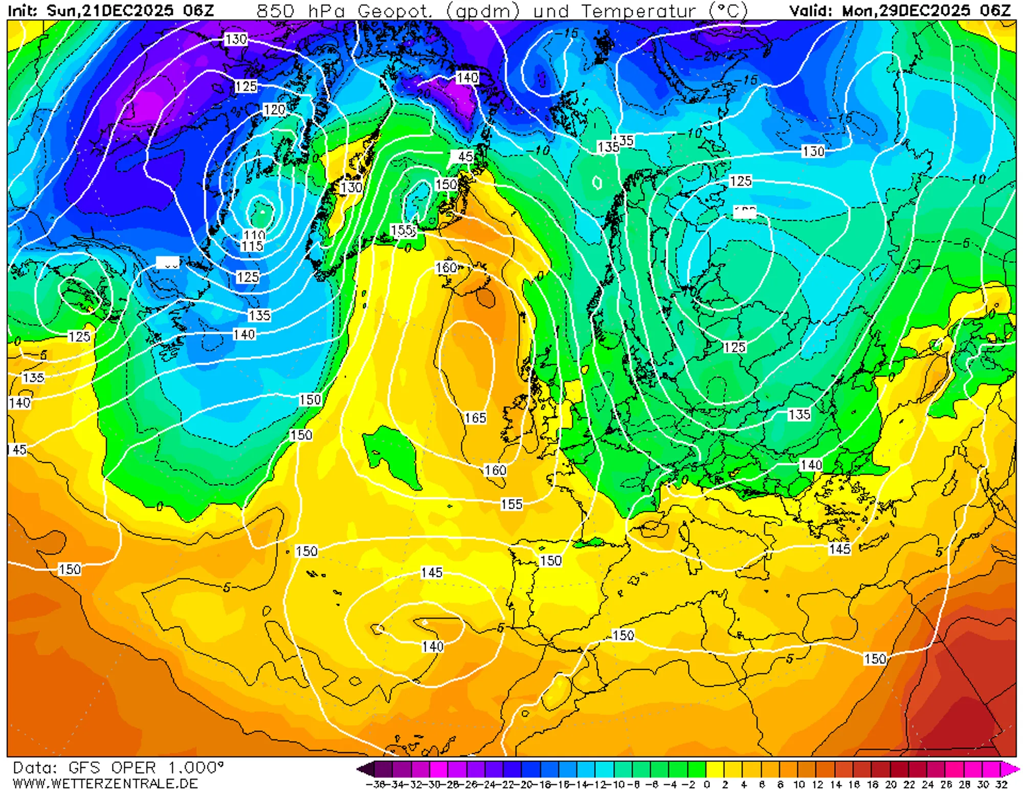
Nordstau as a New Year’s gift?
The high-pressure system dominating from Christmas Day brings dry conditions and more normal temperatures than we had so far this month. For real cold, we have to look far north. A new high-pressure ridge over the Atlantic could shift things at month’s end. Too early to celebrate, but most models hint at a northerly flow from December 29 onward. That’s no snow guarantee - disturbances must accompany the northerlies to get the white stuff. If the high moves east too quickly, precipitation will be suppressed, and the sun returns. A fine balance, but definitely worth keeping an eye on!