Some decent amounts of snow came down on the south side of the Alps last week. PowderAlert #28 was a great even it’s already this late in the season. I scored some fresh snow in Andermatt and on the Corvatsch in St. Moritz. Meanwhile, it has become mild in the Alps. The air is still somewhat unstable today, but high pressure will take over from Tuesday, and you can prepare yourself for some nice tours.
- Looking back at PowderAlert #28
- Unstable for a while
- High pressure dominating the weather the rest of the week
- Please note: wet snow avalanches
Looking back at PowderAlert #28
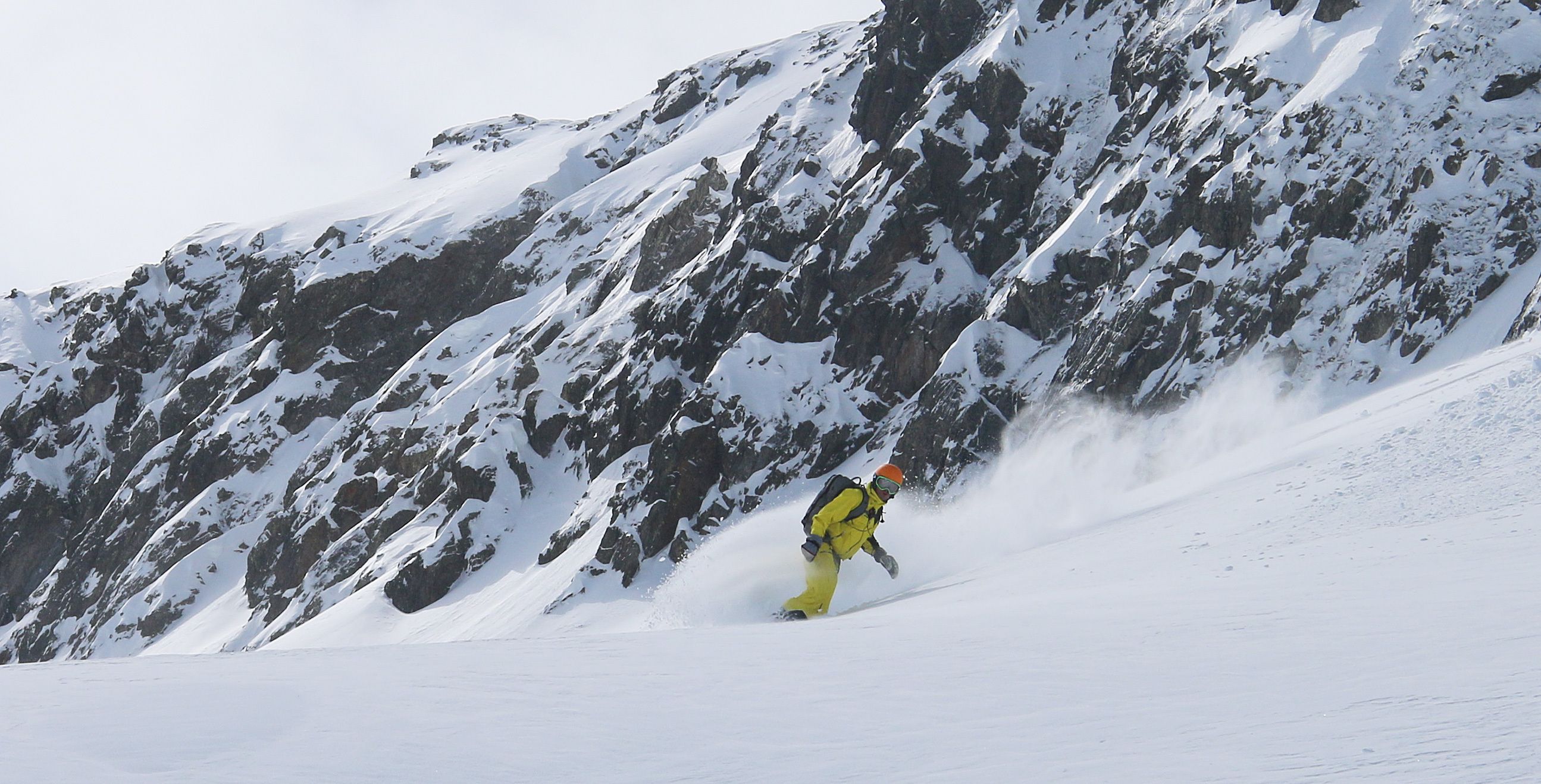
The Alps were dominated by a current from the south last week and that resulted in a lot of snow for the southern Alps. It snowed heavily particularly south of the Gotthard, Monte Rosa and east of Mont Viso. Locally there was more than 1 meter of fresh snow coming down above 2000 meters. The bordering regions also got their share and that was my call for a small road trip in Switzerland (it’s in Dutch, but you’ll love the pictures). It was not crowded in the resorts, but the people who were there were full of passion.
Unstable for a while
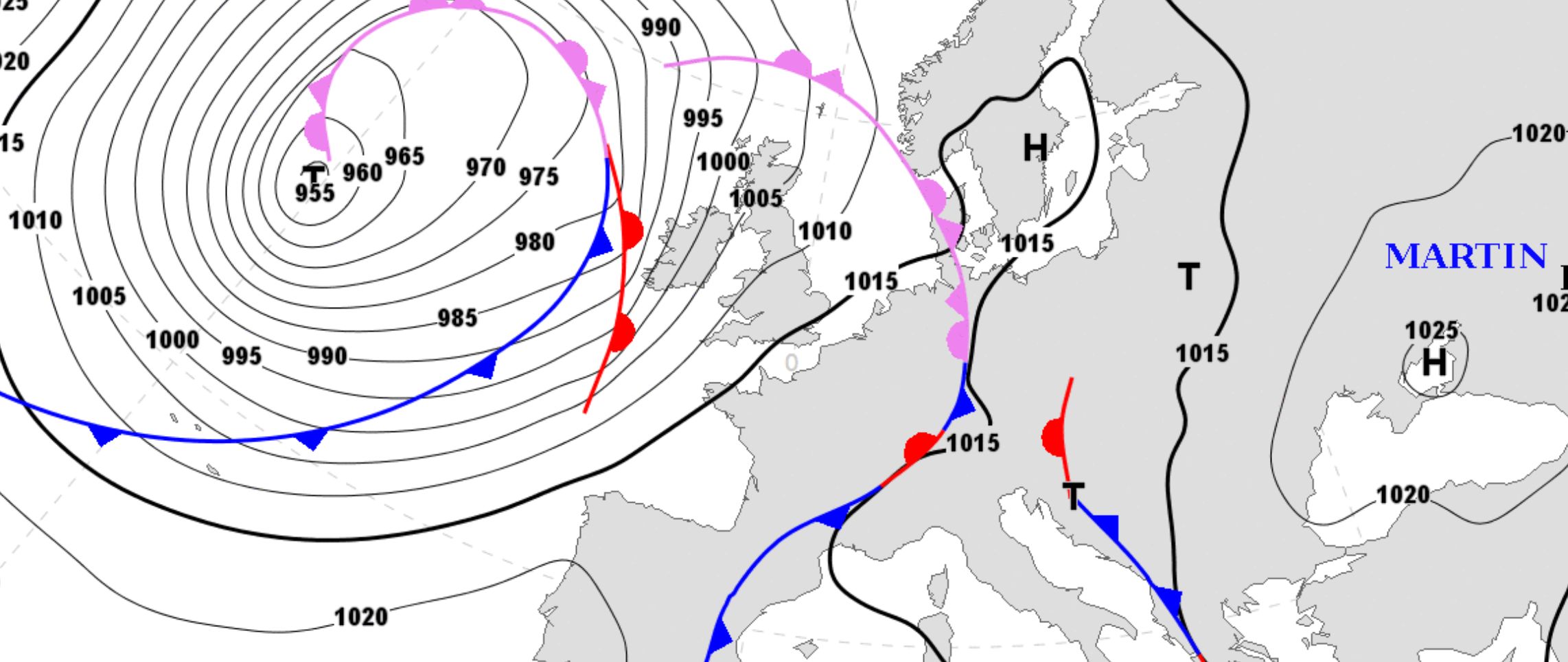
The trip came to an end on Sunday. Unstable air arrived in the Alps and the combination of moisture in the air and mild temperatures is never good for the snow. Even today (Monday, April 16), it remains unstable. The air pressure is a bit lower, which means that showers can occur during the course of the day. The freezing level fluctuates around 2400-2700 meters and the snow line between 2000 and 2500 meters. Please be aware of large wet snow avalanches during the day.
High pressure dominating the weather the rest of the week
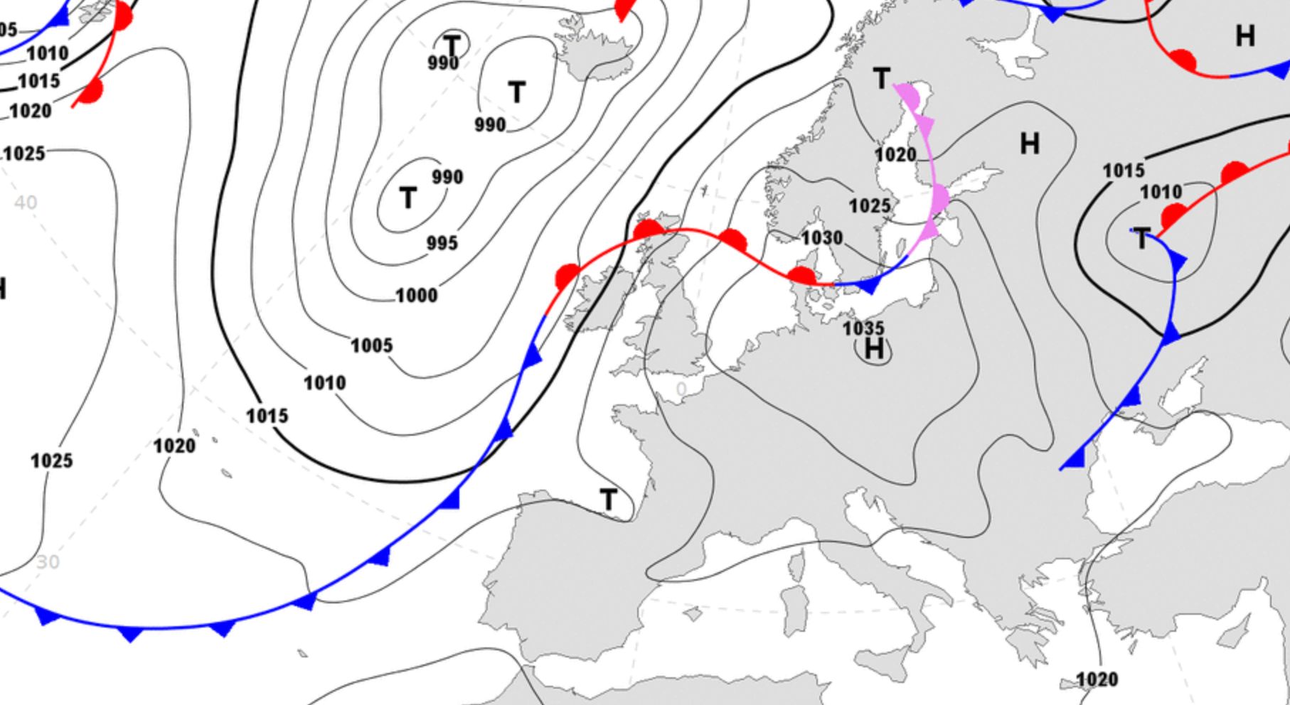
The air pressure in the Alps rises from Tuesday and the instability quickly decreases. It becomes very sunny during the day and the temperatures will rise. The snow can radiate and freeze again during the clear nights. This will result in very nice touring conditions in the high alpine. You can start your tour from the top lifts of the areas that are still open, but also from the parking lots on the famous alpine passes. Please not the rising temperatures during the day which will have a negative effect on the avalanche risk. Please be back down in time! You can see the differences between the day and night temperatures below.


This warm mild weather will dominate the Alps at least until the beginning of next week. After that, the chances of snow may rise. If there is something of snow in the air then I’ll be back again with another forecast so you do not have to miss a flake until the end of this winter.
Stay stoked. Morris