A Powder Alert during this highly changeable week with fluctuating temperatures! Before a high-pressure system takes over, bringing dry weather for a longer period, heavy snow is expected in the Northwest Alps. Don’t expect winter conditions in the valleys everywhere, as the snow line, like earlier this week, will be a regional issue. Moreover, there is still some uncertainty in the snow forecast. For more information, read the full weather report.
Highly variable conditions
I am currently experiencing the changeable weather firsthand in the Northwest Alps. After powder down to 1000 meters on Saturday in large parts of Switzerland, a warm front and associated rain on Sunday made everything wet and heavy up to 2400 meters here in Val d’Anniviers.
Monday night brought cold air with snow, so by Tuesday, I could enjoy about 20 cm of fresh snow in Zinal along with a sunny day. A new warm front on Tuesday night to Wednesday caused a repeat of this pattern. In many places, nighttime snowfall turned into rain at relatively high altitudes. The snow line was mostly around 2000 meters, but in inner-alpine regions and the southern French Alps, it was lower.
The westerly circulation has rapidly increased, leading to partial closures in the northwestern areas. The wind has been strong at higher altitudes, also here in Val d’Anniviers since Tuesday afternoon, with widespread windblown snow. The critical situation in Zinal was made clear when an avalanche was triggered Wednesday afternoon, partly affecting a ski slope.
So, the history of the weather has been changeable and quite mild. The snowpack buildup has been suboptimal due to rain at lower elevations and a lot of snow transport by wind higher up. Given the uncertainty in snow amounts, I wouldn’t specifically advicd to travel all the way to the Alps for this PowderAlert. However, if you are already nearby, there’s still some fresh snow and good conditions to be found. Of course, always be cautious of the avalanche risk. Be sure to check the detailed avalanche bulletins before heading out.

More snow from Wednesday night into Thursday
The dynamic weather will continue in the coming days. The next precipitation arrives from Wednesday night into Thursday. The cooling from this cold front is not very strong, so the snow line will remain relatively high. The front will move eastward in the second half of the night. In Austria, it will remain mostly dry to the east of Tirol.
On the southern side, snow will pass through as well, bringing some fresh snow—up to 20 cm in Adamello. In the far east, there may be slightly more snow in isolated areas. The snow line is too high for a Powder Alert in this region, and it will fall in a very limited area. However, in higher areas (above 1600 meters) such as Nassfeld, 20 to 25 cm of snow could accumulate. In the Julian Alps, there might be significantly more.
Back in the Northwest Alps, the snow line will again be relatively high, ranging from 1500 to 1800 meters, even during the day on Thursday. A new precipitation area will move in from the west, bringing moderate to heavy snowfall. In the French Northern Alps and Lower Valais, expect 5 to 15 cm overnight, with total accumulations of 20 to 40 cm by Thursday evening. The heaviest snow will fall above 2000-2500 meters.

Second front Thursday into Friday
During the day on Thursday, the weather on the north side of the Alps, from central Switzerland eastward, will be mostly dry due to the föhn wind. Behind it, the second, stronger cold front arrives. After the low-pressure system passes, cold air will hit the Northern and Western Alps, bringing more snow, especially for the northwestern stau areas from Haute-Savoie to Vorarlberg. The snow line will quickly drop to the valleys. Initially, only 10 to 20 cm of snow is expected, with possibly a bit more in isolated areas, while inner-alpine regions may see less. To the east of Vorarlberg, snow accumulation will remain limited to 5-15 cm.
This cooling won’t last long, as on Friday, warmer air will begin to creep in from the west. The snow line will rise again. It is still unclear how far this milder air will penetrate into the (North)West Alps. In a worst-case scenario, we may see the snow line rise to 1800-2000 meters in the French Alps and western Switzerland on Friday.
Further east, it will remain colder, but the exact position of the snow line is still uncertain. From central Switzerland eastward, the snow line will likely stay down to the valleys.

Snowfall Friday into Saturday
On Friday, significant snowfall is expected to continue through Saturday morning. Particularly from the Bernese Oberland to the Glarus Alps, 30 to 50 cm of snow could fall, and in the French Northern Alps and Upper Valais, 20 to 40 cm more snow is expected.
Strong winds
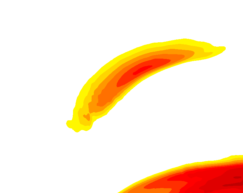
I mentioned the changeable and stormy history of the weather, and it will remain quite stormy in the coming days. This will be caused in part by the strong jet stream directed at the Northwest Alps, as seen above. White-outs and windblown snow at higher altitudes will make conditions challenging and tricky. Be prepared for possible lift closures.

Dry from the weekend on
From Friday night into Saturday, snowfall will decrease. Snow will still fall briefly on Saturday morning, but in a progressively smaller area around central Switzerland. In other regions, it will clear up more and more. A new batch of cold air from the north will push against the Northern Alps. With the exception of some light snow in the eastern parts of the Austrian Alps, it will stay dry, as the high-pressure system takes control.
The very cold air on the northern side (in Austria, it could be -10°C at 1500 meters) will cause a very cold night from Saturday to Sunday, along with a growing pressure gradient between north and south, resulting in a “Nordföhn” situation. Winds in the southern areas, particularly those near the main alpine ridge, may temporarily increase. It will stay slightly milder there, but since the source air upstream is quite cold, the warming effect will be limited.
Where to go?
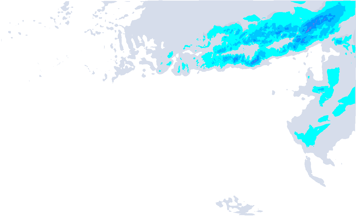
The cumulative snowfall map shows that we expect the most snow in the Northwest Alps. With the incoming warm air on Friday in the West Alps, it’s better to focus on the high inner-alpine treerun areas in the French Northern Alps, Wallis, or further east, where the wind has less effect on the snowfall. Between central Switzerland and the Glarus Alps, areas like Engelberg look like the sweet spot for fresh snow and a low snow line on Friday, though these hotspots could shift. Full snow amounts will be measured by Saturday morning here.
Réactions
Hi @Henri, happy new year to you and the team ! Can you please explain why the same resort in ‘my favourites’ and in the ‘most snow fall’ list shows different snowfall forecasts? Engelberg would be case in point. In MF it shows 20cm at the top yet it shows 55cm for Engelberg in the most snowfall list. I am also trying to understand why your models up until today were forecasting much more snowfall for the west while Swiss Meteo and most other notable European models were forecasting substantially less for some days. Would be great to get your insights.
Any big storms for the Dolomites on the horizon? Going first week in February!
Quote @henri “Given the uncertainty in snow amounts, I wouldn’t specifically advicd to travel all the way to the Alps for this PowderAlert.”
Well I don’t care, I’m going!
Leeees Goooo!! =)
Engelberg would be case in point. In MF it shows 20cm at the top yet it shows 55cm for Engelberg in the most snowfall list.
Titlis and Brunni get different amounts of snow
@richinGR thanks and sorry for the late reply! I think it is like stauchaser said, that the MF was for Brunni and not for Engelberg - Titlis, which was shown in the most snowfall list.
The main problem with this snowfall was that this air mass boundary for Friday was very tricky to predict. With these large uncertainties of the inflow of milder air and the corresponding rising snowline and changes, the snow quantities are very difficult to forecast and change from model to model and model run to model run. Our snow forecast charts are based on the GFS model, which is in most of the cases decent, also in the last event, but if there are more remarks to say about a certain snowfall event, for example if other weather models agree on less snow, you’ll read it in our written weather forecasts here.


