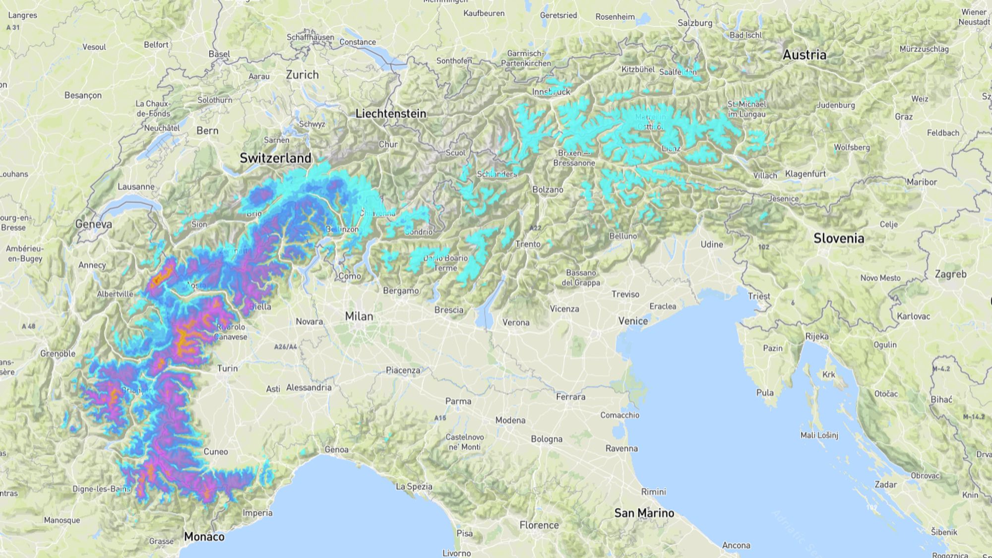
Today there is still a lot of residual cloud cover from the disturbance that brought snow to the Southwestern Alps in recent days. Starting Thursday, a few mild and sunny days will follow again. On Sunday and Monday, a depression will move from Ireland toward Spain, increasing snow chances from the west. The snow line will initially be quite high, around 1500-1800 meters.
Lots of clouds and some regional rain or snow
With 50 to 80 centimeters of fresh snow, yesterday was quite a hit in the Alpes Maritimes. As expected, much less snow fell toward the north and east. Still, the cloud cover left behind some light snow in many places last night, while rain fell below 1200-1600 meters. Precipitation is gradually losing significance, but in Austria and Italy there remains a chance of a few drops or flakes. Meanwhile, skies are clearing widely in the Western Alps, and this afternoon the sun will break through at times in the central areas (Switzerland, Vorarlberg). The freezing level varies from 1500 meters regionally in the Southern Alps to over 2000 meters with some föhn wind on the northern side.
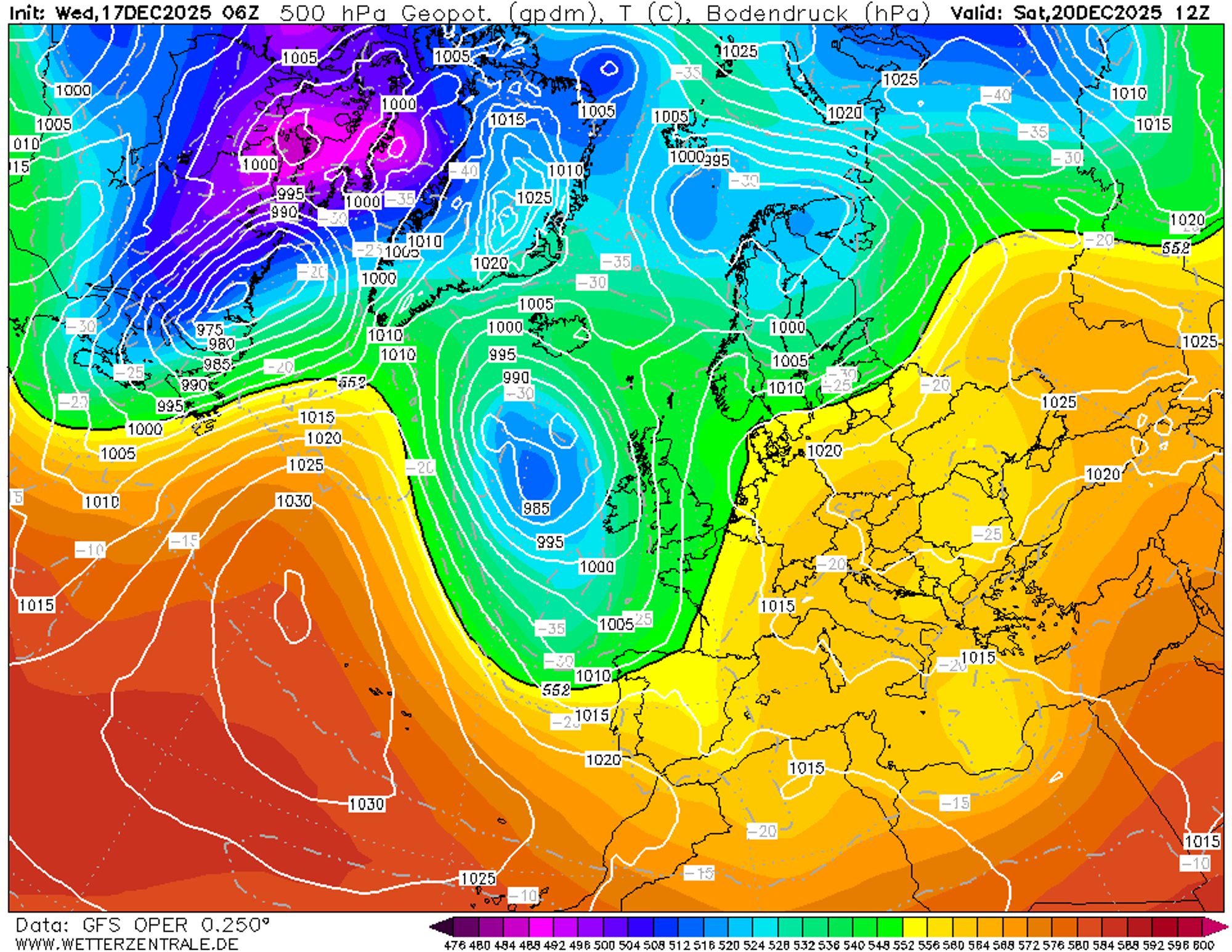
More sun and dry, mild weather through Saturday
Tomorrow, Friday, and Saturday it will become even milder, with thawing up to 1800 meters in the Southern Alps and 2300 meters in the Northern Alps. The sun will return everywhere, making it feel spring-like again. The air will also dry out significantly, so the snow won’t melt as quickly in the weak December sun. On Saturday, the first cloud fields will arrive in the French Alps, then spread over parts of Italy and Switzerland. Between a high-pressure system over Eastern Europe and weak low-pressure systems over Spain and the Mediterranean, a weak and mild southeasterly flow sets in.
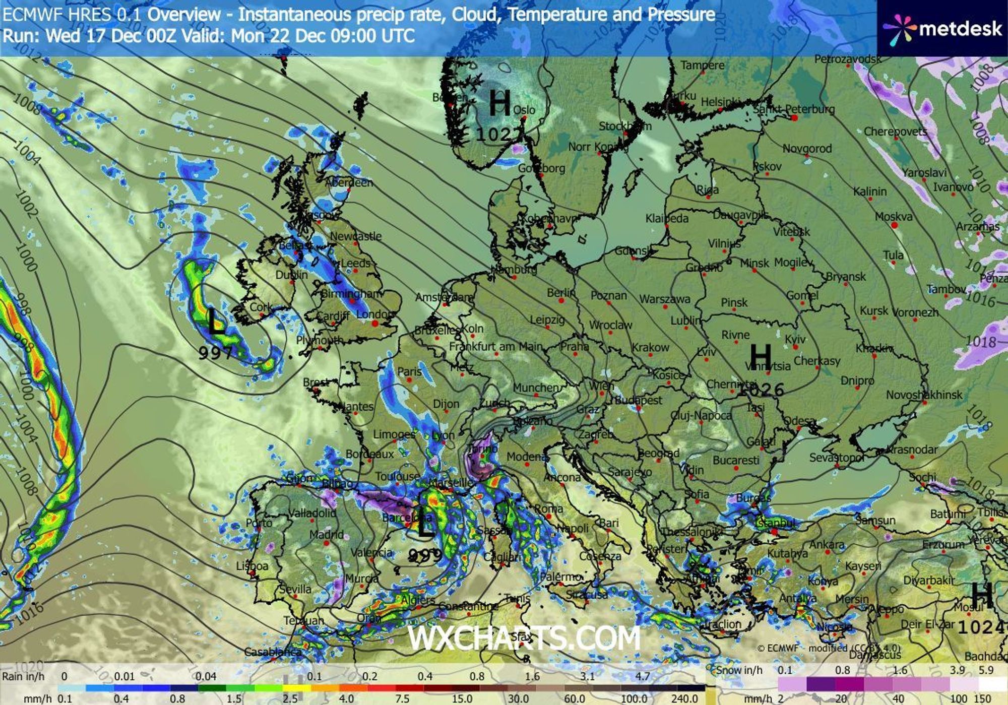
Precipitation on Sunday and Monday, partly rain
The weather maps will undergo major changes next week. To begin with, a depression will move toward Spain or France from the northwest, which could bring a similar situation to the Southwestern Alps as last Tuesday. According to our model (based on GFS), snow and rain will already arrive Saturday in the French Alps and in Piemonte. ECMWF is a bit later, showing most precipitation on Sunday and Monday. The timing and location of precipitation depend on the track of the low-pressure system. The closer it moves south near the Alps, the more regions will benefit. The focus will in any case again be on the French Southern Alps and the western Italian Alps. Regionally, 30-40 centimeters is possible there on Sunday and Monday. For lower areas, this is not immediately good news, as cooler air will only arrive after the precipitation. In the French Alps, there is a high chance of rain up to about 1800 meters on Sunday, dropping somewhat on Monday. In Italy, the snow line is slighly lower and may drop further during the night into Monday.
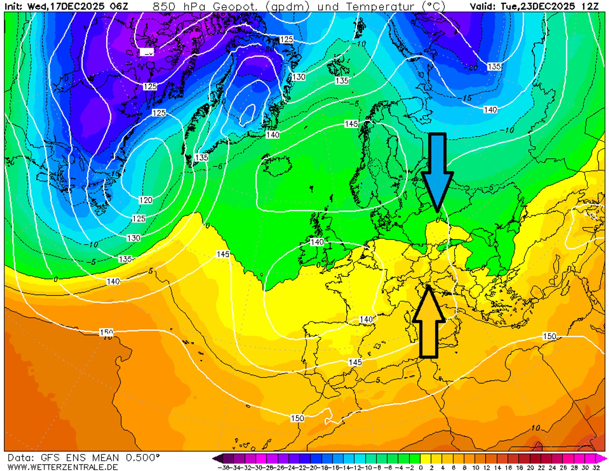
More continental patern next week, but little cold available
Next week brings part two of the major weather map reshuffle. A high-over-low block will form, with high pressure near Scandinavia and low pressure over the western part of the continent, as shown on the map above. The result is a more easterly (continental) flow, causing cooling across the continent. Once again, the exact positioning of the pressure systems will determine the details, but at least until Christmas the situation for the Alps is not ideal. There is simply no real winter cold available in the east yet, so the flow would need to remain continental for a long time or shift northeast to bring in cold air. In addition, the low in this setup is initially too far west, leaving the Alps vulnerable to mild air seeping in from the south.
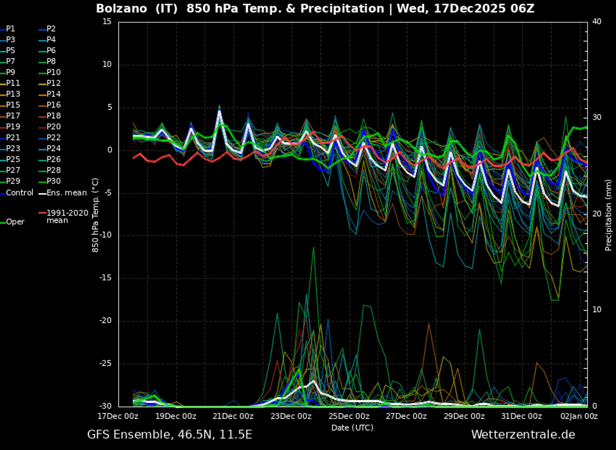
Snow potential remains for the Southern Alps
This southern flow also ensures that snow chances remain on the southern side even after Monday, while north of the main Alpine ridge there will be little to no precipitation through Christmas. The lack of winter cold also means the snow line stays fairly high, mostly between 1200 and 1800 meters. Winter could certainly knock on the door in the longer term, as the weather maps remain promising - see the colder solutions in the ensemble for Bolzano above. In the coming forecasts we’ll undoubtedly provide more details about the potential cold and snow events next week.
Réactions
What are your thoughts on that longer term forecast for 2-3 weeks out? Entirely unpredictable I know but seeing the green and brown come through at 1500m in Saint-Gervais / Megeve after that early season dump is giving anxiety for 2nd week of Jan trip.