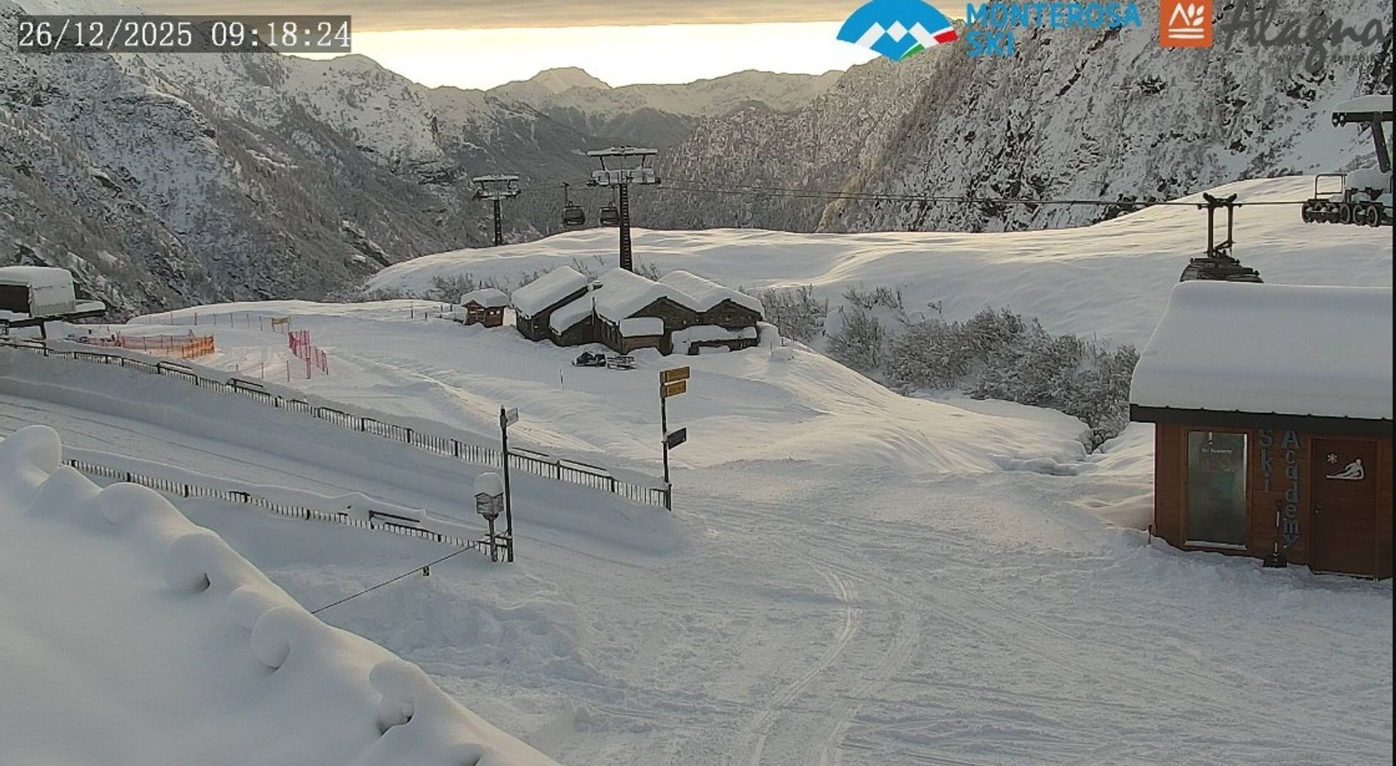
The Retour d’Est has come to an end today. Most of the snowfall over the past two days was concentrated in the ski areas at the foot of Monte Rosa. In the photo above, taken this morning in Alagna, a fresh blanket of snow is clearly visible, with clearing skies approaching on the horizon — finally bringing a change in weather today. With these clearings, descents above the treeline are tempting, but be careful! Strong winds have been at work and avalanche danger is high over a wide area
Snowfall last two days in the Alps
Snowfall over the last two days was mainly focused on the Monte Rosa region and the ski areas west of Turin. Macugnana stood out with around 80 cm of fresh snow, while Alagna and Gressoney also picked up half a meter or more. On the Swiss side, Saas Fee received about 35 cm this time. Around the Aosta Valley, Champorcher saw roughly 40 cm. Further west and north, amounts gradually decreased: about 20 cm in Breuil-Cervinia and at the Grand St. Bernard, 15 cm in Courmayeur and 10 cm in La Thuile.
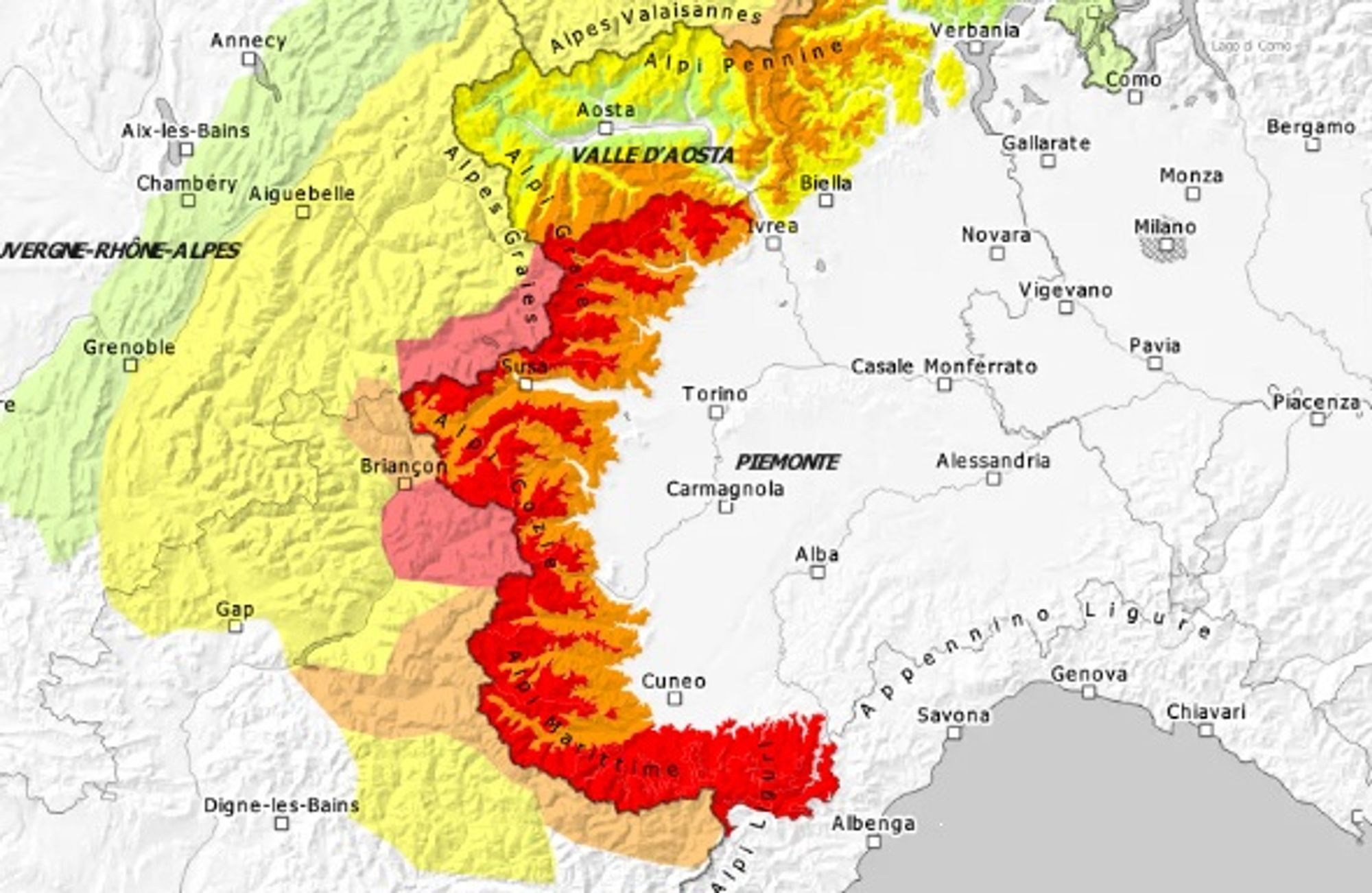
Further south, the largest accumulations fell in the orographic lift zones east of Sestriere. Pragelato received around 40 cm, Sestriere 25 cm, and Cesana also 25 cm. Montgenèvre saw only a few centimeters, while elsewhere along the main ridge — such as Val d’Isère (20 cm) and Abriès (40 cm) — snowfall was more substantial. Southern areas like Limone and Prato Nevoso were hit again with around 50 cm of fresh snow. Locally, the snowpack there has already reached around 2 meters at 1800 m, currently the highest snow depths in the Alps.
In the southern Dolomites, 5–15 cm of snow fell, while Carinthia also picked up 10–20 cm.
Wind played a major role during this snowfall event. Wind speeds of 75–100 km/h were recorded at various locations, which is also reflected in the avalanche bulletins. The combination of large amounts of fresh snow, an unstable base, and strong wind loading is a dangerous mix. Avalanche danger is high on a large scale, even on the French side of the main Alpine ridge. If you do head out, stick to tree runs.
This morning, some residual cloud remains in the Italian inner Alpine arc, but elsewhere the sun is already shining. Conditions stay dry, and with temperatures around 0°C at 1600–2200 m, it feels quite pleasant.
Heavy snowfall in the Pyrenees continues today
While the Retour d’Est in the Alps is winding down, the eastern Pyrenees are still getting hammered today. The easterly flow there — known as the Levante — continues to deliver massive snowfall with low snowfall levels. In the far eastern regions, another 100–150 cm is expected by tomorrow, while areas further west can still expect 20–40 cm. Avalanche danger is also significant here, high in the Cerdagne–Canigou region.
Current snow situation north of the Alpine main ridge
On the northern side of the Alps, the snow situation is quite remarkable. After substantial snowfall around November 21, there has been virtually no significant new snow since. Combined with relatively high temperatures, snow depths at elevation are approaching record lows for late December.
Switzerland provides the most detailed data comparing snow depth to long-term averages. In many areas, snowpack is less than 50% of normal, with the central Alpine ridge and Graubünden particularly hard hit. Below 1500 m, snow is often absent altogether, but conditions above 2000 m are especially notable. At several stations, snow depths this low around the holidays have been measured only once or twice before. Valais also has limited snow, though more snowfall in November makes the situation slightly less extreme. The Austrian Northern Alps show a similar picture, with only around 30 cm of snow at 2000 m. Little change is expected in the coming days.
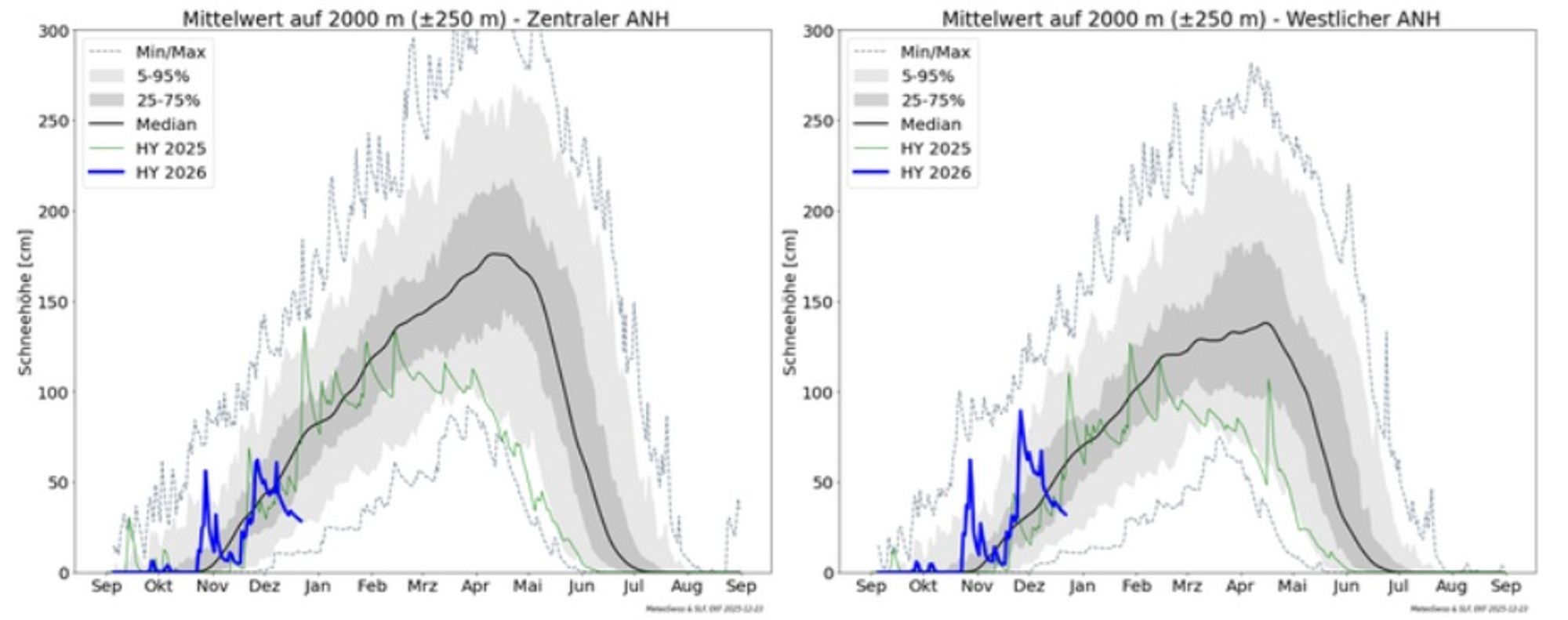
This map shows an average of snow measurements for the central and western Swiss Alpine ridge at around 2000 m, clearly illustrating just how thin the snowpack currently is.
Several days of sunny mountain weather
From tomorrow onward, the Alps will enjoy around three days of sunny conditions. On Saturday, temperatures will rise sharply everywhere, and with little wind it will feel almost spring-like. The freezing level will climb to around 3000 m in the Western Alps! This will certainly affect snow quality, making it heavier, and avalanche conditions will remain tricky in areas with large amounts of fresh snow. Sunday and Monday will again be dominated by sunshine, with mild conditions persisting in the Western Alps. In the east, a cool northerly wind will already bring some cooling at altitude. The cold air plunges into the Balkans, but the Alps will only catch a glancing blow. Little changes on Monday.
Rapid cooling from Tuesday; still no major snowfall
A second surge of cold air moves south from Tuesday onward, this time reaching the entire Alpine region. While temperatures at 2000 m will still be above freezing during the day on Monday, they will drop rapidly from the north on Tuesday, and from Wednesday onward it will be decidedly cold everywhere. Initially, the air mass contains relatively little moisture, meaning no true Nordstau yet. Some snow may fall in regions like Salzburg and Upper Austria, even down to low elevations, but no large accumulations are expected before the New Year.
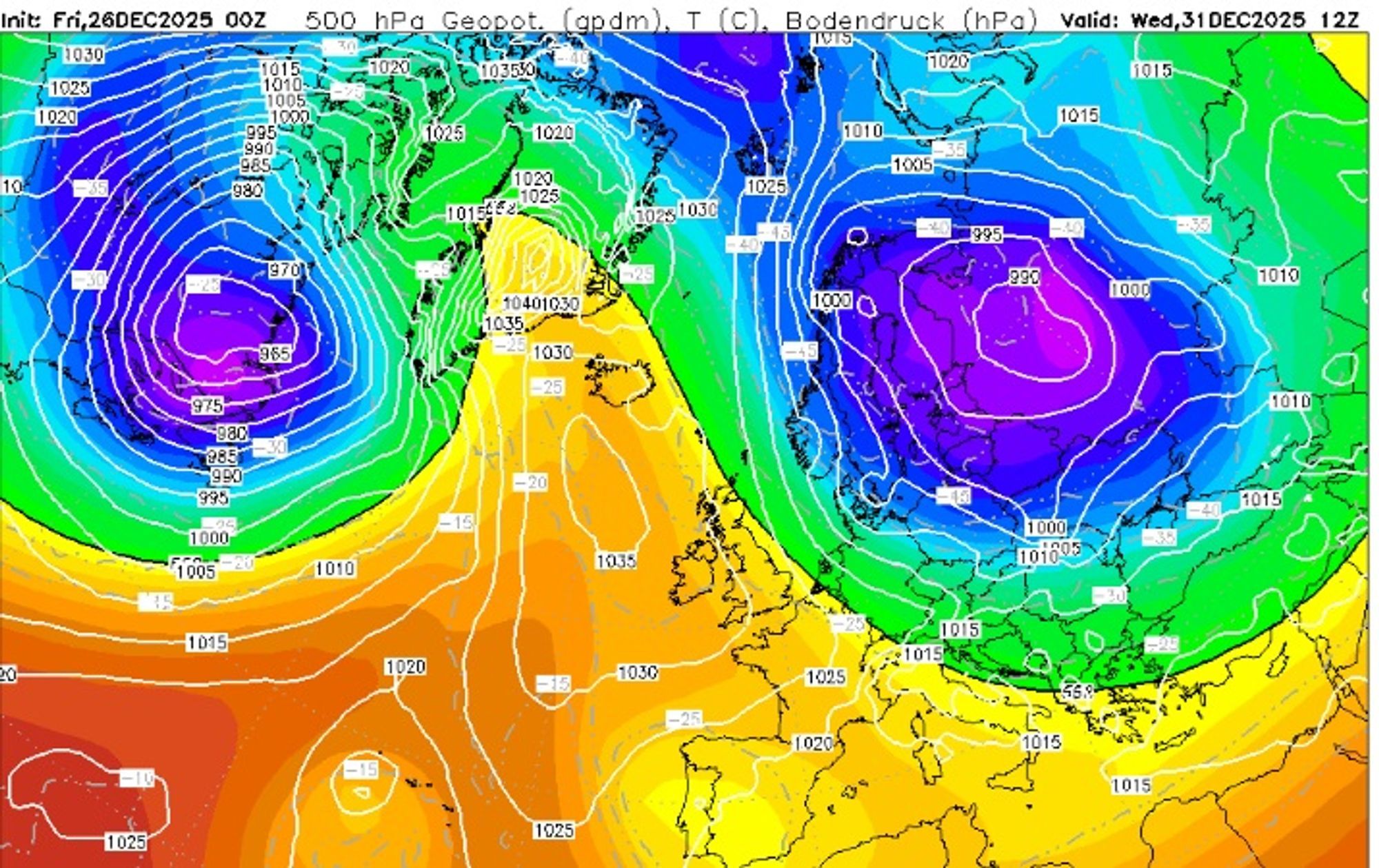
We’re already taking a quick look ahead into 2026, as everyone is eager to know what the snow chances will be like. The New Year starts cold, but a high-pressure extension may keep major snow systems at bay until the weekend. Model guidance still varies considerably, so the cards are far from settled. For now, it looks increasingly likely that a cold northwesterly flow will set up during the first week of the New Year, bringing good chances for significant snowfall.