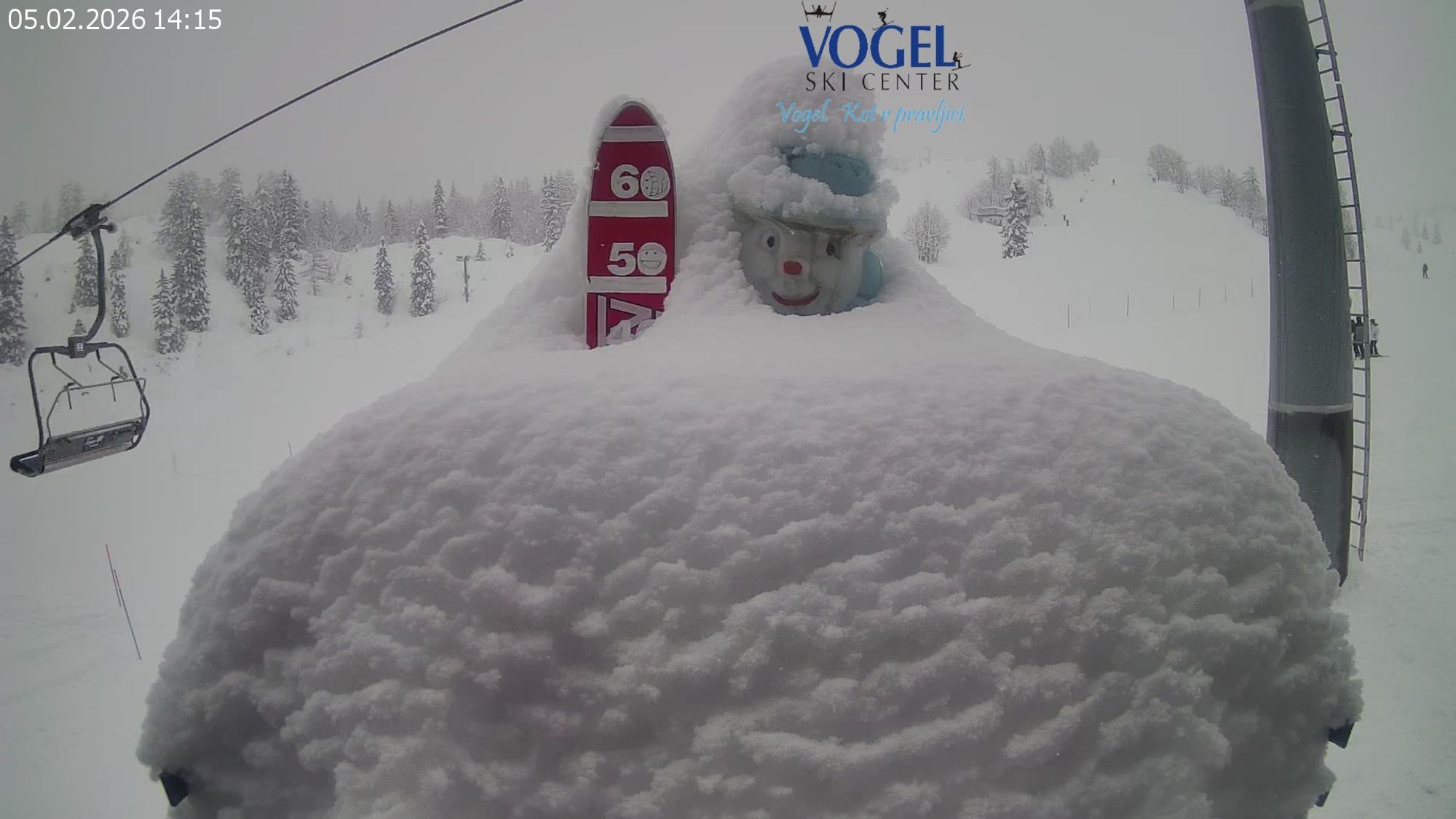
Today, stunning winter scenes are coming in from the Southeastern Alps, where heavy snowfall has occurred. The largest amounts fell in the area from the eastern Dolomites to the Julian Alps. On the webcam at Vogel (with a friendly call right away to all ski resorts in the Alps to also install a measuring stick visible on their webcams, because in my opinion there are far too few of those), it can be seen that more than 40 cm has fallen. And that doesn’t even reflect the full snowfall, as clearing took place in between.

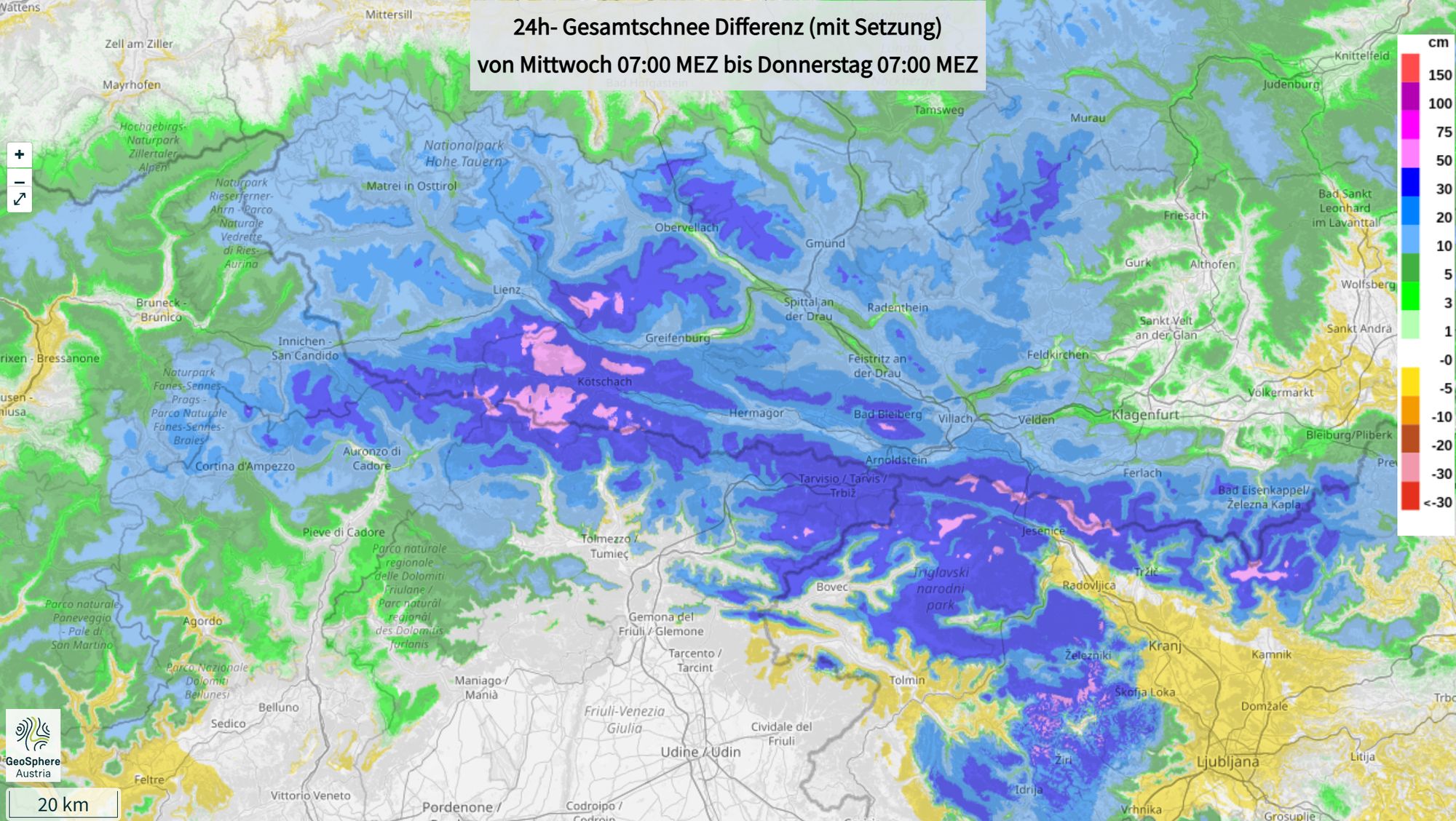
The snow cover change over the past 24 hours (Wednesday 7:00 a.m. to Thursday 7:00 a.m.) speaks volumes. The southern stau has deposited a substantial amount of fresh snow. Note that this shows the change in snow depth, which also includes settling of the snowpack. Actual snowfall amounts are therefore even higher. From Cortina via the Carnic Alps (East Tyrol/Carinthia) to the Julian Alps and the Karawanks, 30-60 cm has fallen, with locally even larger accumulations at higher elevations.
Snow returns from the southwest
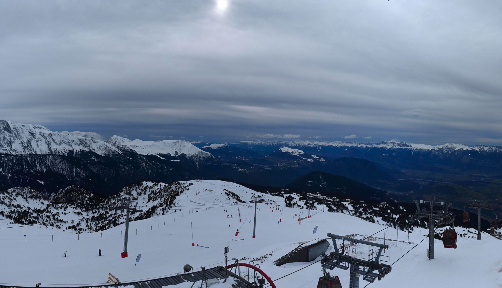
We won’t have to wait a long time before the next snowfall, as a new snow zone approaches from the southwest today. On the Chamrousse webcam above, the increasing high cloud cover is visible, and in the Western Alps snow will begin in most places already this evening. The small low-pressure system will move quickly eastward across the Gulf of Genoa during the night into Friday, preventing a full-fledged southern stau from developing. I expect the largest amounts in the southern French Alps, around 20 to 30 centimeters, with the snow line mostly between 1000 and 1500 meters. In outer regions of the Alps it will be somewhat higher than in the inner Alpine regions. As a result, the Northern Alps do not have to expect significant amounts for now. Here, only a few centimeters will fall through Saturday above 1200 meters. In Switzerland, totals may still reach 5-10 centimeters.
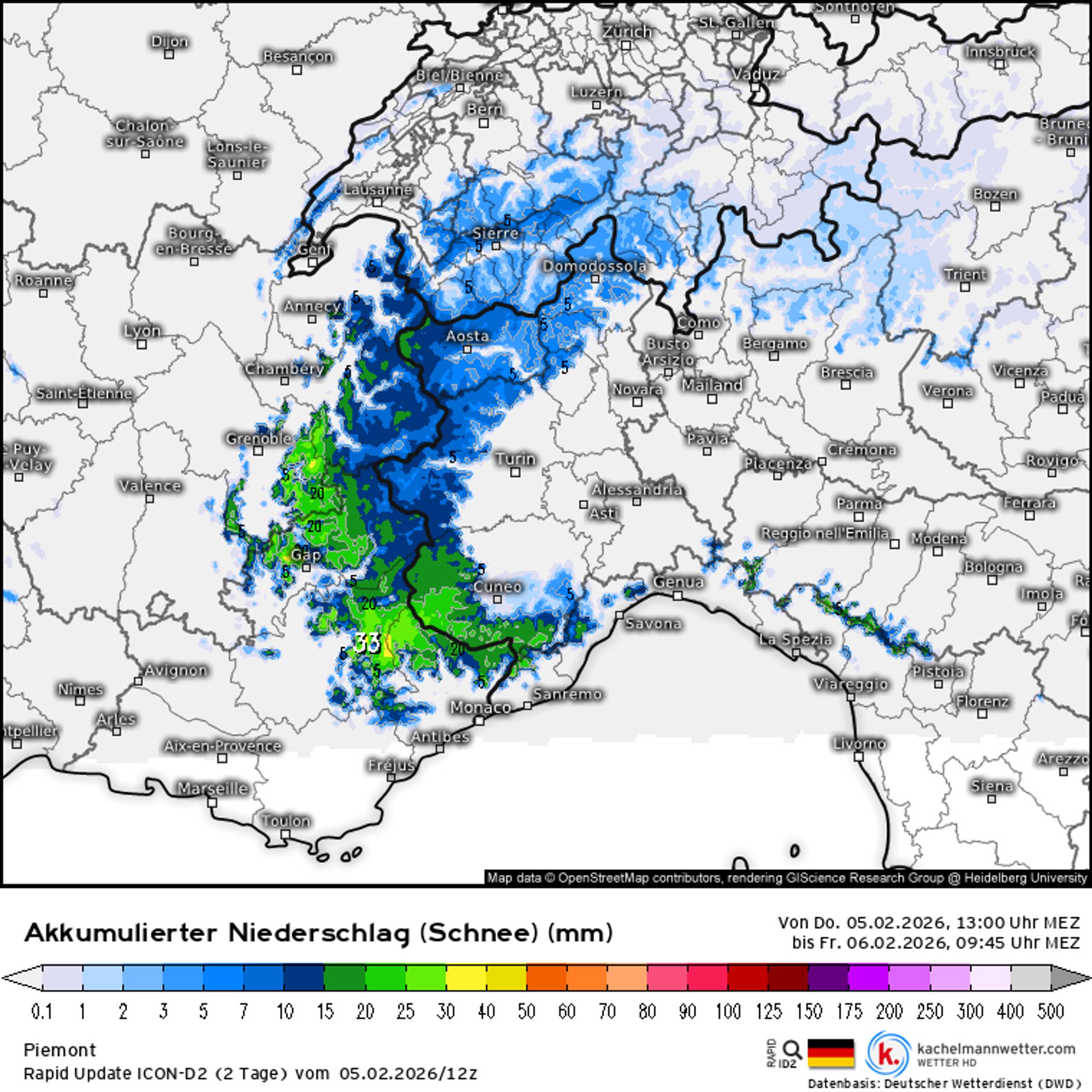
Over the weekend, conditions will be calmer, with a few showers in the Eastern Alps on Saturday and plenty of sunshine on Sunday. From the south, some precipitation will approach the Southwestern Alps on Sunday. This could still bring around 10-20 cm, especially in the Alpes-Maritimes (mainly on the Italian side near Limone & Prato Nevoso), but this remains uncertain. The exact location and track of the small depression off the east coast of Spain (see map below) are still unclear and are the key factors determining this snowfall.
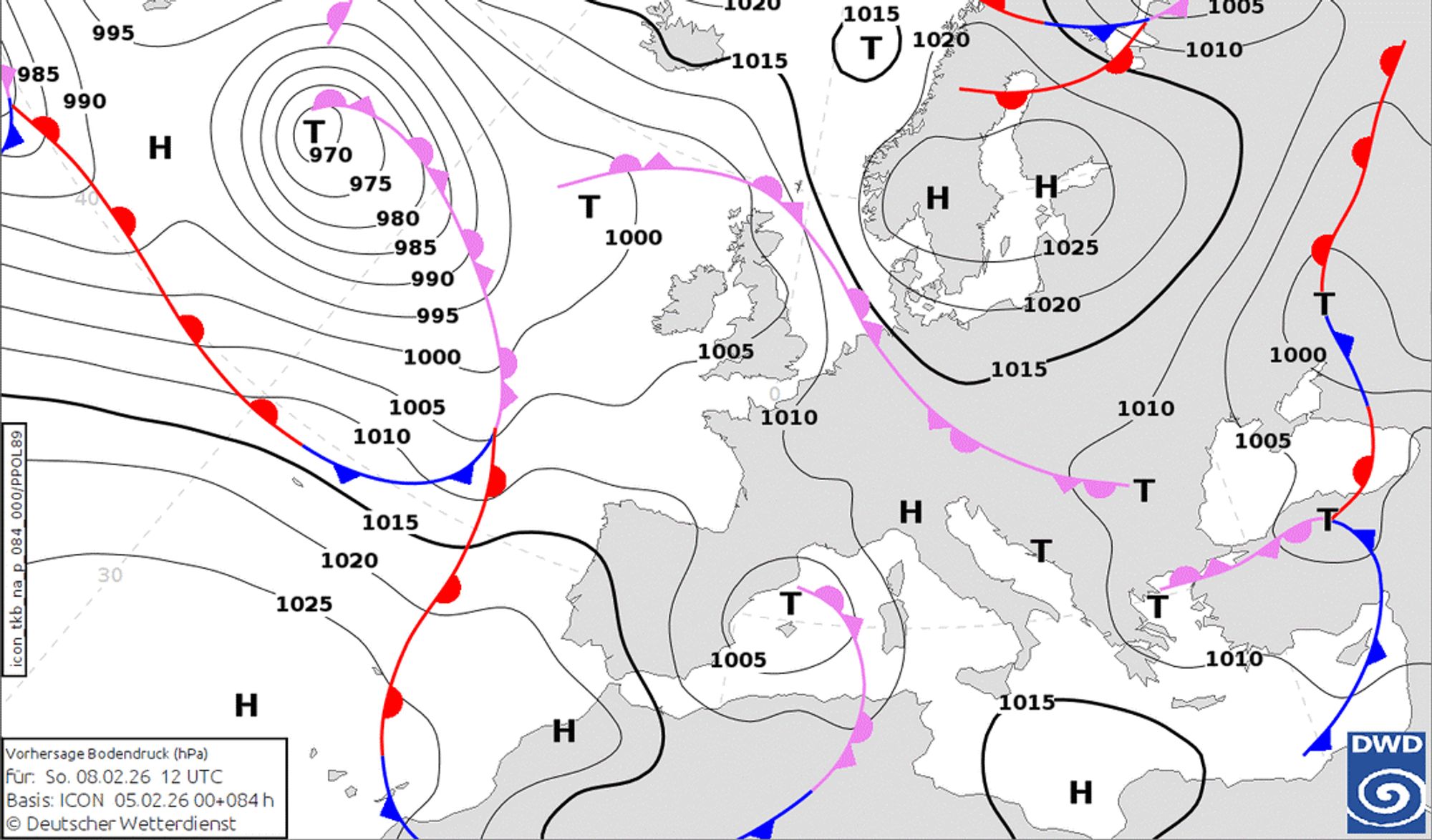
Pattern change, but possibly mild?
Coen already mentioned in yesterday’s forecast a shift toward a westerly circulation by the middle of next week. A new low-pressure system will approach from the Atlantic but take a much more northerly track. This significantly increases the chance of precipitation in the Western Alps. I’m writing precipitation, because its form is also a point of attention. Today’s weather models show a substantial influx of warm air into the Western Alps with this zonal flow, with the snow line in the westernmost areas temporarily rising above 2000 meters. Let’s hope upcoming model runs calculate this differently, but this scenario is becoming increasingly likely. After this peak, cooler air will follow and the snow line will drop again. We’ll keep an eye on it.
Réactions
Thanks for another great update! :D
Any tip on where to ski Saturday - Monday in western alps?