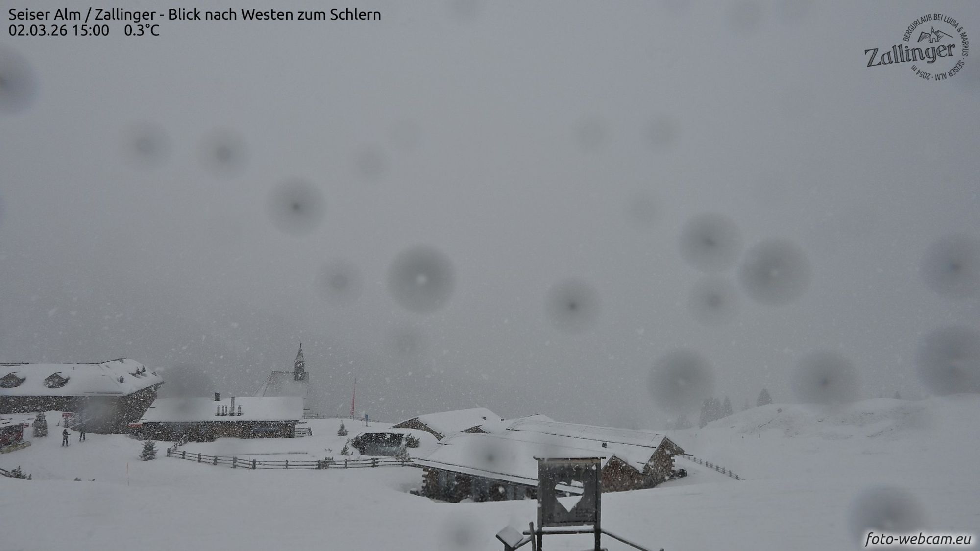
On Monday, clear signs of the start of the convective season were visible on the southern side of the Alps. As the day progressed, cumulus clouds continued to build and eventually developed into (snow) showers. On the Seiseralm webcam, you could even see it snowing heavily for a while yesterday afternoon. In yesterday’s forecast, Chris had already mentioned these showers. However, no significant snowfall is expected in the coming period. Apart from a small chance in the southwestern Alps, conditions will remain largely dry.
High-pressure fortress
The high-pressure fortress over Europe is powerful and currently keeping low-pressure systems at bay. It remains generally mild in the Alps, with slightly cooler air lingering over the southern and eastern regions. This cooler air aloft creates a bit more instability there and, just like yesterday, may trigger a few (snow) showers. In the coming days, high pressure will strengthen even further, meaning showers will largely disappear. At the same time, temperatures will rise again. Especially in the western and northern Alps, the freezing level will climb above 2,500 meters.
Saharan dust
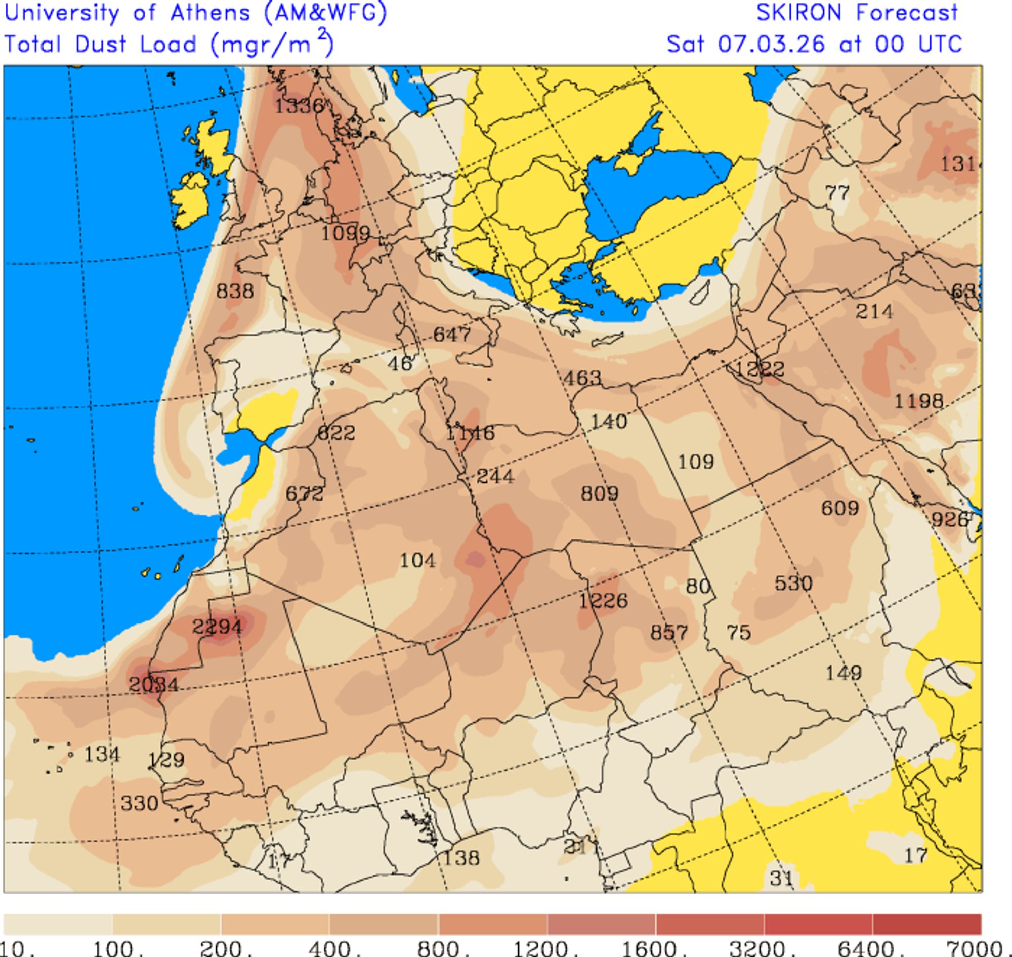
A new plume of Saharan dust will spread across much of Western Europe. The Alps will also be affected, with concentrations increasing from the south on Wednesday and especially impacting the western half of the Alps on Thursday. Since precipitation will be limited, there will be little actual deposition on the snowpack. However, the dust concentration in the atmosphere may lead to more cloud cover than weather models currently suggest. In particular, the western Alps could remain considerably cloudier. The plume is clearly visible in the forecast charts and is expected to reach as far as southern Scandinavia by the end of the week.
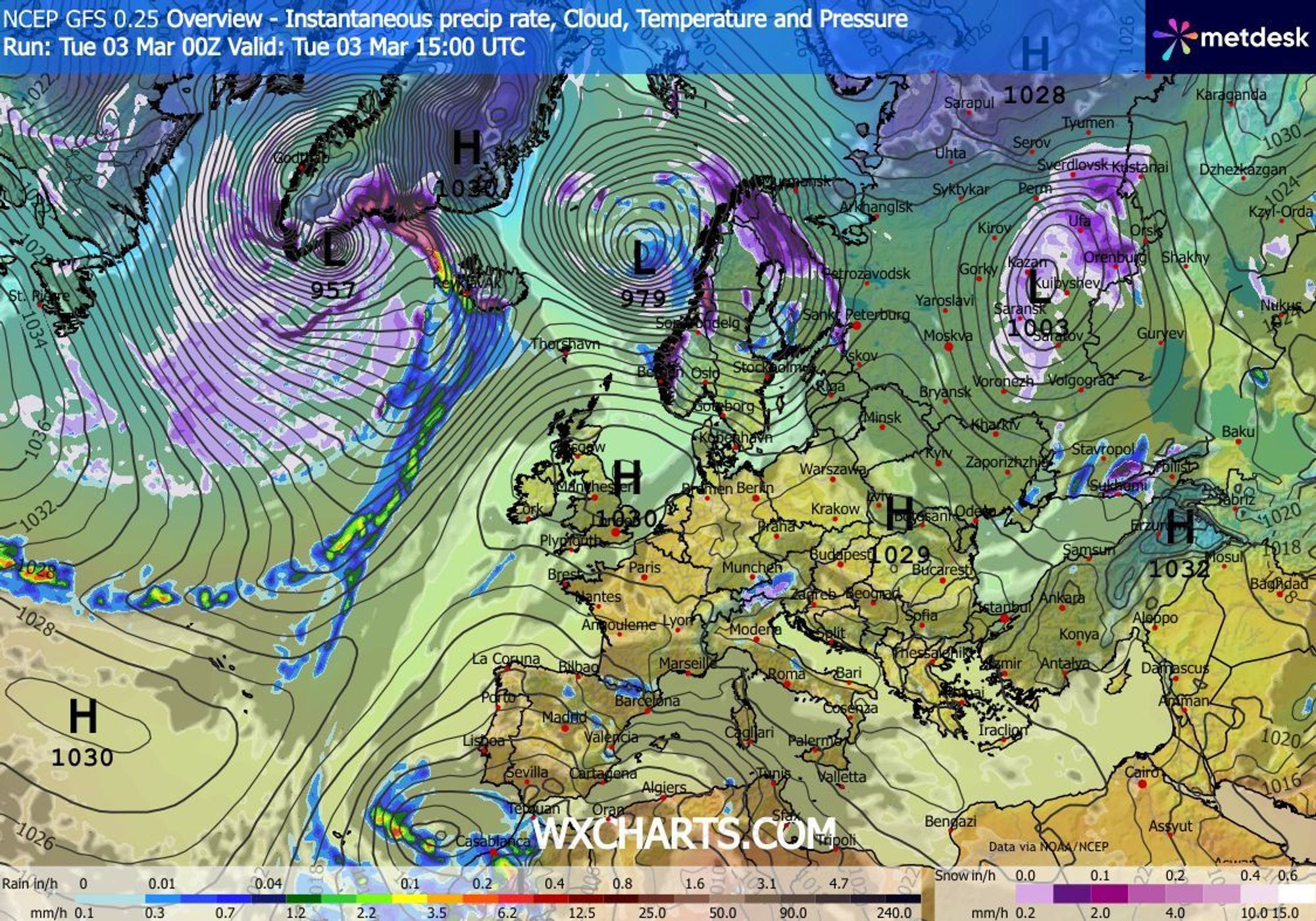
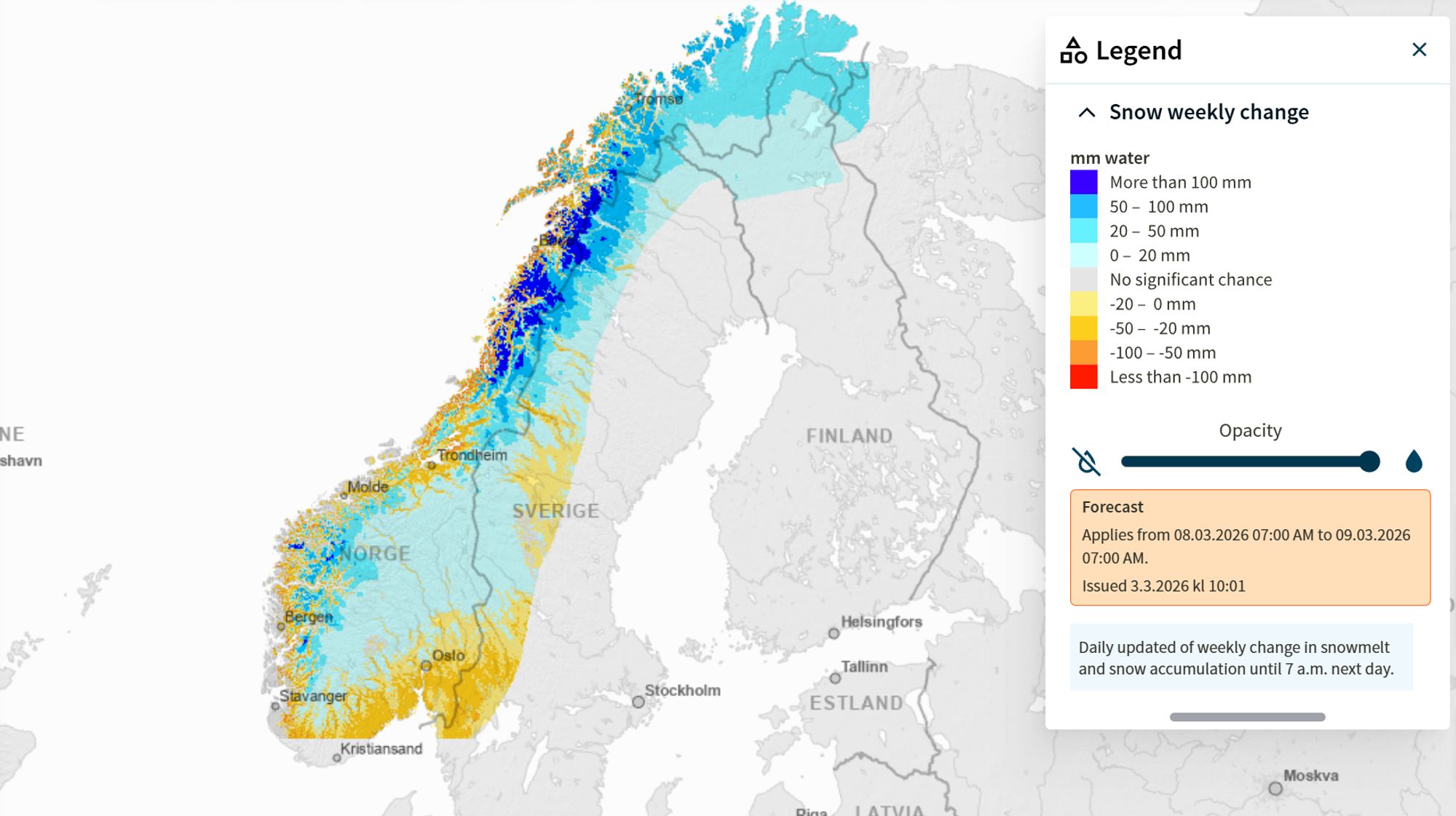
Snow in parts of Scandinavia
Speaking of Scandinavia, parts of the region are in for significant snowfall. Atlantic low-pressure systems are mainly tracking northeastward, directing moist air toward Norway. The deep southwesterly flow also brings in mild air, so coastal areas will see plenty of rain mixed in. For powder conditions, you’ll need to head further north. Be aware that the avalanche danger is regionally high. From today onward, substantial snowfall is expected from Nord-Trøndelag up to Troms. However, in immediate coastal areas, temperatures are often just too mild, as shown clearly on the map. At higher elevations, some regions could see well over a meter of fresh snow.