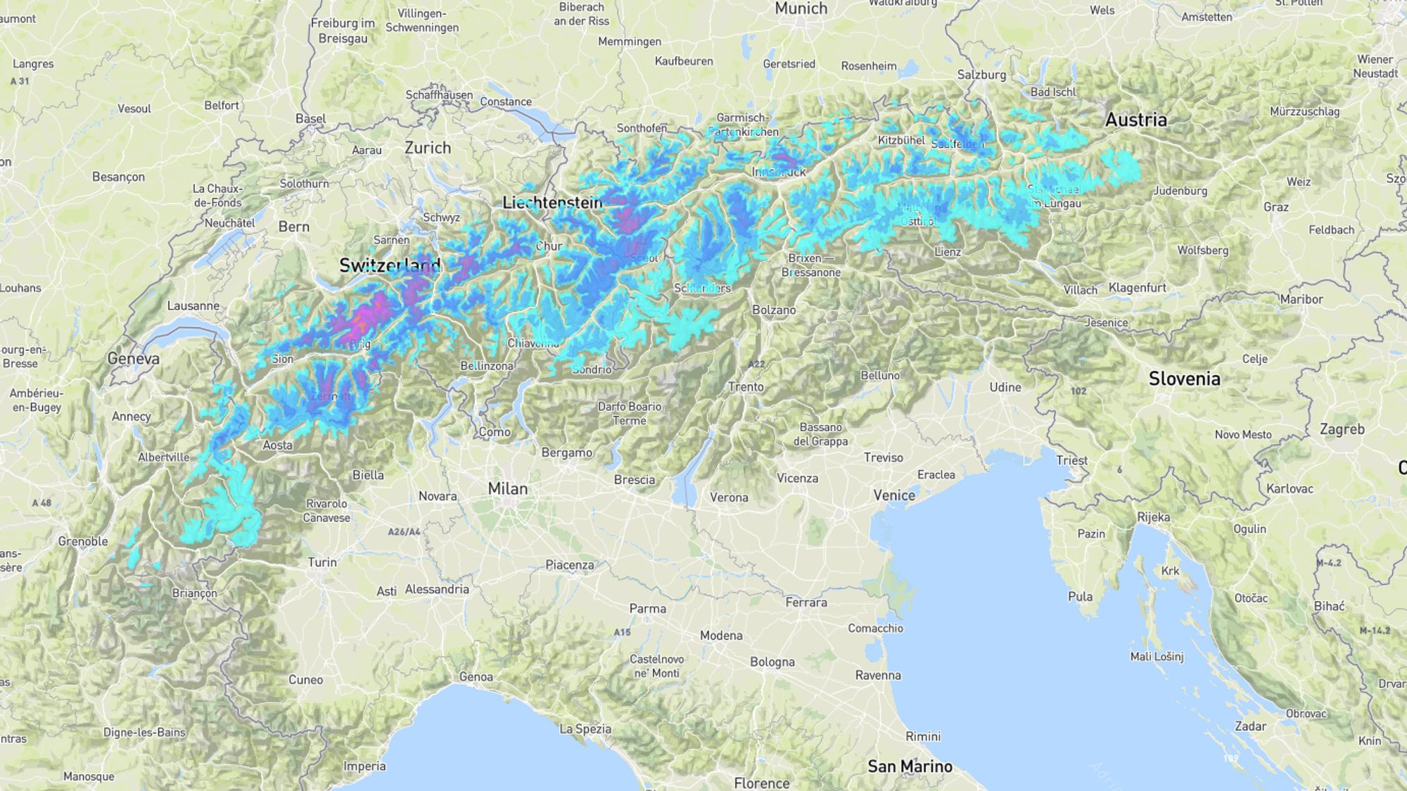
As Henri and I already announced in the previous forecasts, a major change is on the way. After the weekend, the Alps will experience a few days of pure spring weather with plenty of sunshine and positive temperatures up to well above 3,500 meters. The leading edge arrives on Sunday in the form of an active warm front sweeping across Europe, bringing precipitation mainly to the Northern and Western Alps, which unfortunately will fall as rain up to around 2,000 meters.
Already milder on Saturday
Remnants of a disturbance delivered a few centimeters of fresh snow yesterday and last night in various regions. Above roughly 1000 meters, the weather still looks wintry this Friday. Clear spells dominate especially in the Southern Alps. This weekend, things will change in two steps. First, milder air moves in on Saturday and the westerly wind picks up at higher altitudes. In France, the freezing level quickly rises to 2000 meters, but in inner-alpine areas and sheltered valleys in Austria and Switzerland, it remains much colder. Hardly any precipitation is expected on Saturday. at most a few drops or flakes (above 1500 meters) in the Northern and Western Alps.
Widespread rain and snow on Sunday
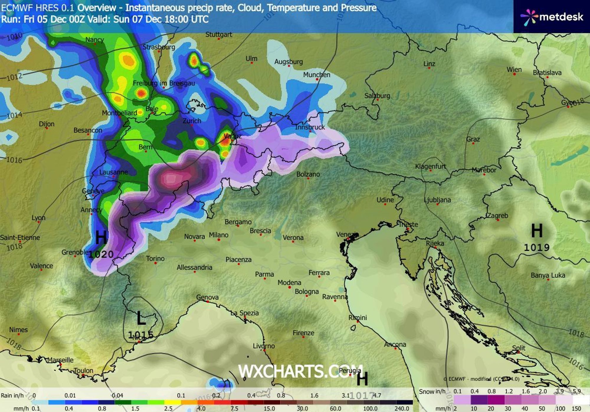
Sunday offers little room for sunshine. From the west, precipitation arrives during the morning, first in the French Northern Alps, Switzerland, and Vorarlberg. By afternoon and evening, the rest of Austria will also be affected. South of the main Alpine ridge and in the French Southern Alps, it stays mostly dry. That’s good news for the snow there because the precipitation comes with further warming of the upper air and will therefore fall in liquid form up to high elevations. On Sunday’s snow map, this is reflected by the lack of color in the valleys.
Snow line between 1600 and 2200 meters
Inner-alpine regions may still see snow down to 1600 meters at first, but in the Northern and Western Alps the snow line is around 2000 meters from the start. By Monday night that will be the case everywhere. It wouldn’t be surprising if it gets even milder in the west, with temporary rain reaching places like Tignes (2100 meters). The heaviest precipitation falls in Switzerland and Vorarlberg: 15–30 mm of rain, 15–30 cm of snow above roughly 2000 meters. Below 2000 meters, the snowpack will take a serious hit in these parts of the Alps. Winds around the warm front strengthen at altitude to force 5–6, and behind it, a strong Südföhn develops in the Northern Alps.
Monday through wednesday: springlike
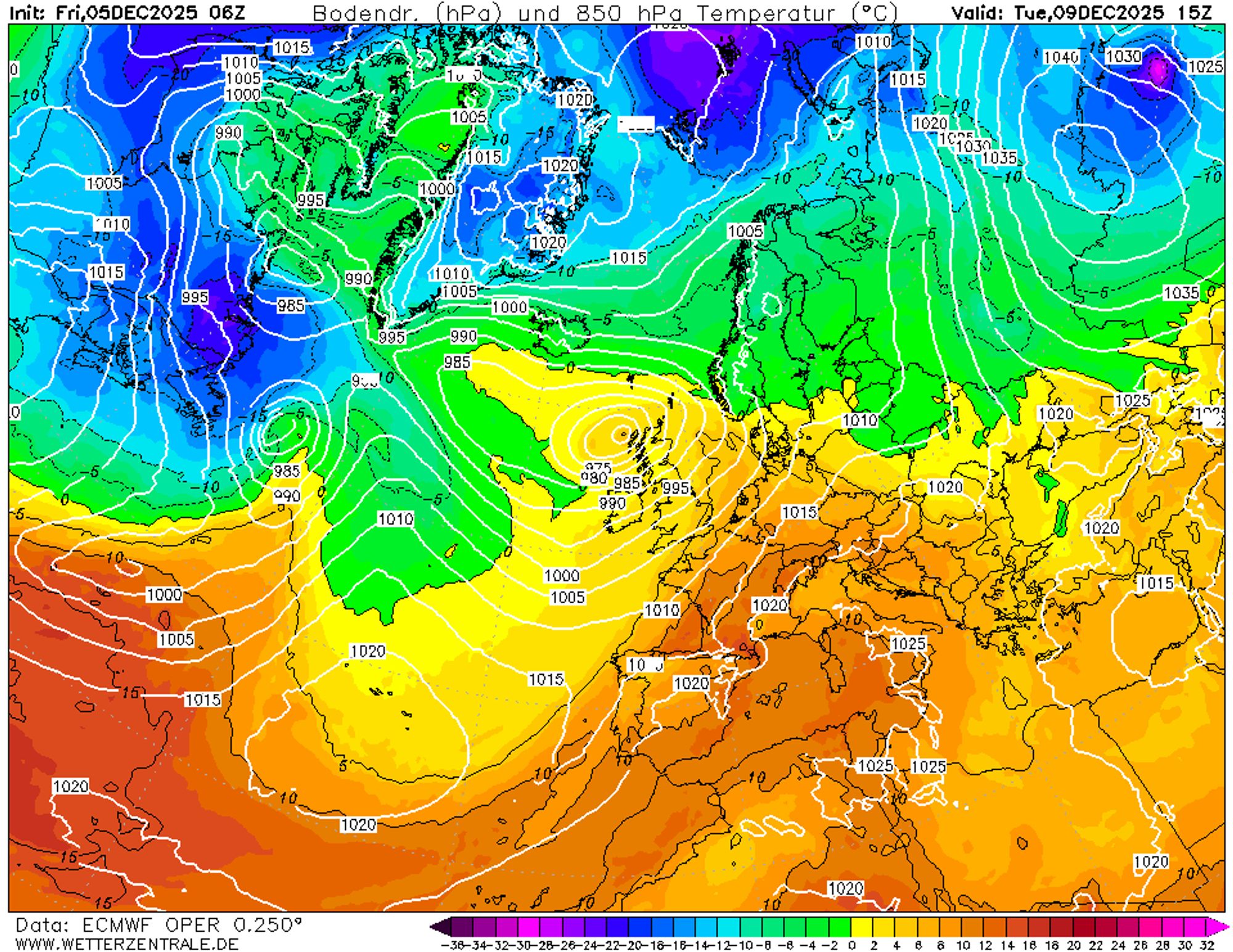
The warmest air arrives from Monday onward as an African high-pressure system extends its influence over the Alps. Between this high and a depression near Ireland, the flow turns southwesterly, drawing air from around the Canary Islands. The freezing level rises during the day to well above 2500 meters and even approaches 3500 meters on Tuesday. The warmest conditions will be in northern valleys; aided by warming downslope winds from the mountains, temperatures there can reach 15 to 20°C. Small silver linings in this warm push are the dry air and the low sun angle. Still, valleys below 1500 meters and south-facing slopes up to 2000 meters will increasingly turn green.
Long term: less mild but wetter
From Thursday onward, the high-pressure link shifts eastward, making the Alps more vulnerable to disturbances from the west. For now, these look like glancing blows, bringing light precipitation only to the west and north. In the eastern and southern Alps, little will change, and sunshine will remain frequent. The freezing level drops to a more normal height of around 2000 meters, but cloud cover and humidity increase on the northern and western sides, accelerating snowmelt in those regions.
Looking out for bright spots
Even before the warm spell begins, we’re already scanning the weather models for signs of a possible return to winter conditions. The 15-day ensemble offers little hope, and this is confirmed by the ECMWF long-range forecast. It shows a significant positive temperature anomaly over almost all of Europe through the holidays. Only around New Year does that anomaly largely disappear, as shown in the charts above.
Reacties
Extreme temperature swings like this are what we should come to expect with global warming. Can’t say I’m surprised.