The weather charts are being reshuffled, and that brings some interesting developments. Of course, there’s the colder air we’ll be dealing with next week. However, once again it doesn’t seem to offer much snow potential for the Northern Alps. For fresh powder next week, the place to be is the Southwestern Alps - and this time the snow is likely to reach more areas than during the previous dump. That’s why it’s time for Powder Alert #2 of the season, in which we look at:
- Which regions have a chance of a dump starting Sunday?
- It will rain in the valleys, but how high will the snow line be?
- What will this dump do to the avalanche danger?
- Long term: when will the cold arrive, and is more snow coming?

Mild starting situation
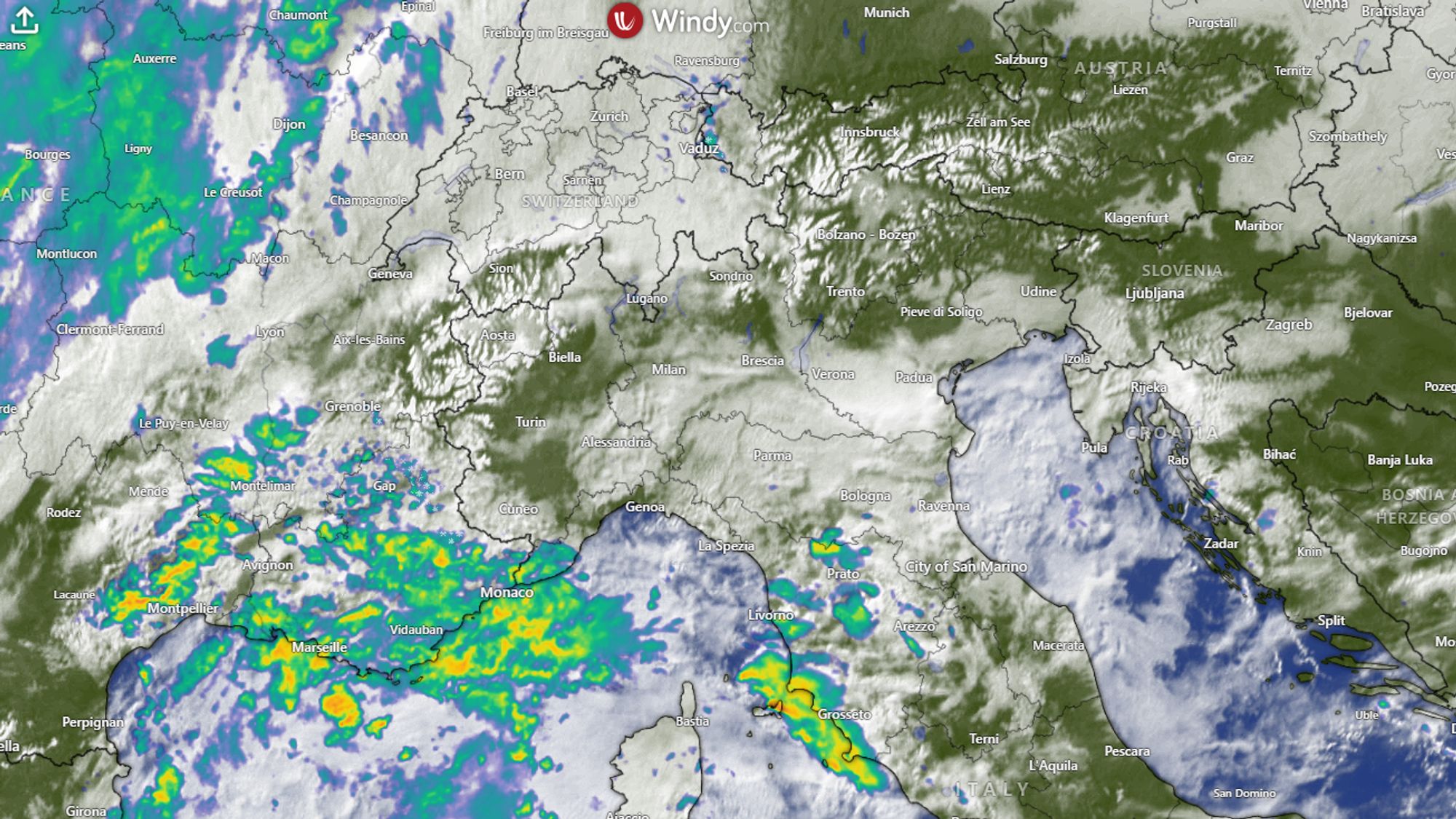
On the combined satellite and radar image above, the bright white patches stand out first - these are the mountain ranges covered in snow. It’s also clear that winter weather has been absent: most valleys are green. It will remain mild for a bit longer, with the freezing level today between 1800 m (Southern Alps) and 2300 m (Northern Alps). Disturbances over France and the Mediterranean are bringing increasing cloud cover to the western Alps, and in the far Southern Alps there will be occasional light precipitation today with a snow line around 1800 m. East of the Vorarlberg region in Austria, the sun continues to dominate.
Not much happening on Saturday yet
On Saturday, little will change in this two‑way split. Precipitation gains a bit of ground but remains limited to the French Alps. More than a few millimeters won’t fall - above roughly 1800 m that means a few centimeters of snow. In Austria and the Italian Dolomites, the sun still sets the scene.
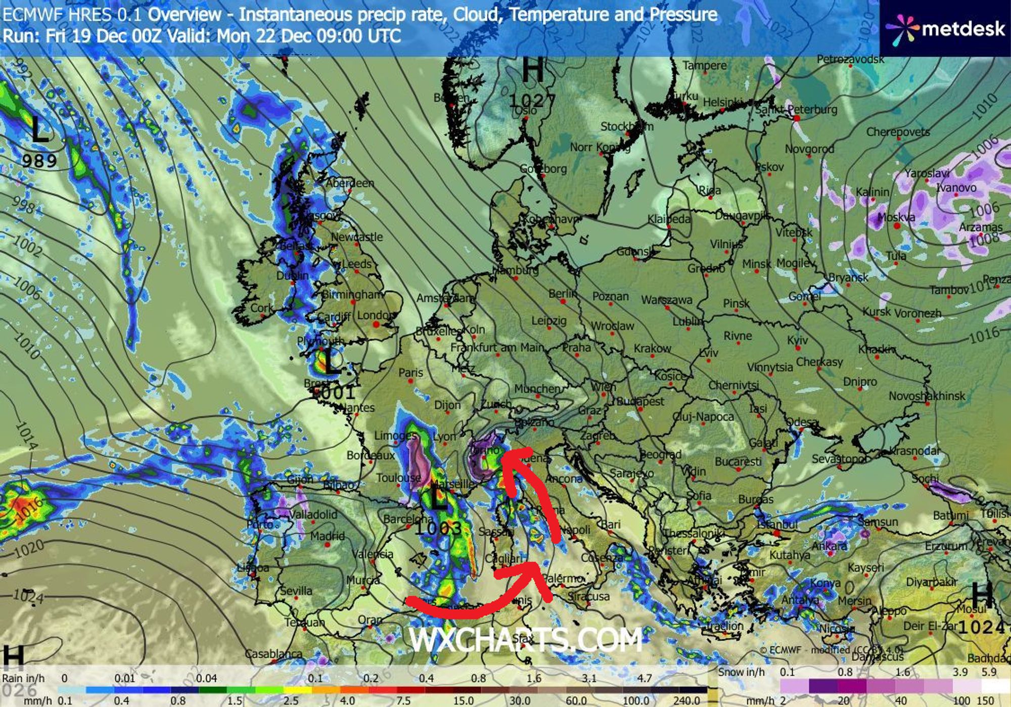
Retour d’Est sets in from Sunday
Over the weekend, a low-pressure system moves from western France southward, ending up somewhere west of Corsica. This creates a zone of moist, unstable air over the sea. Meanwhile, pressure rises north of the Alps, and an easterly flow develops over northern Italy - a retour d’Est.
First precipitation peak with a high snow line
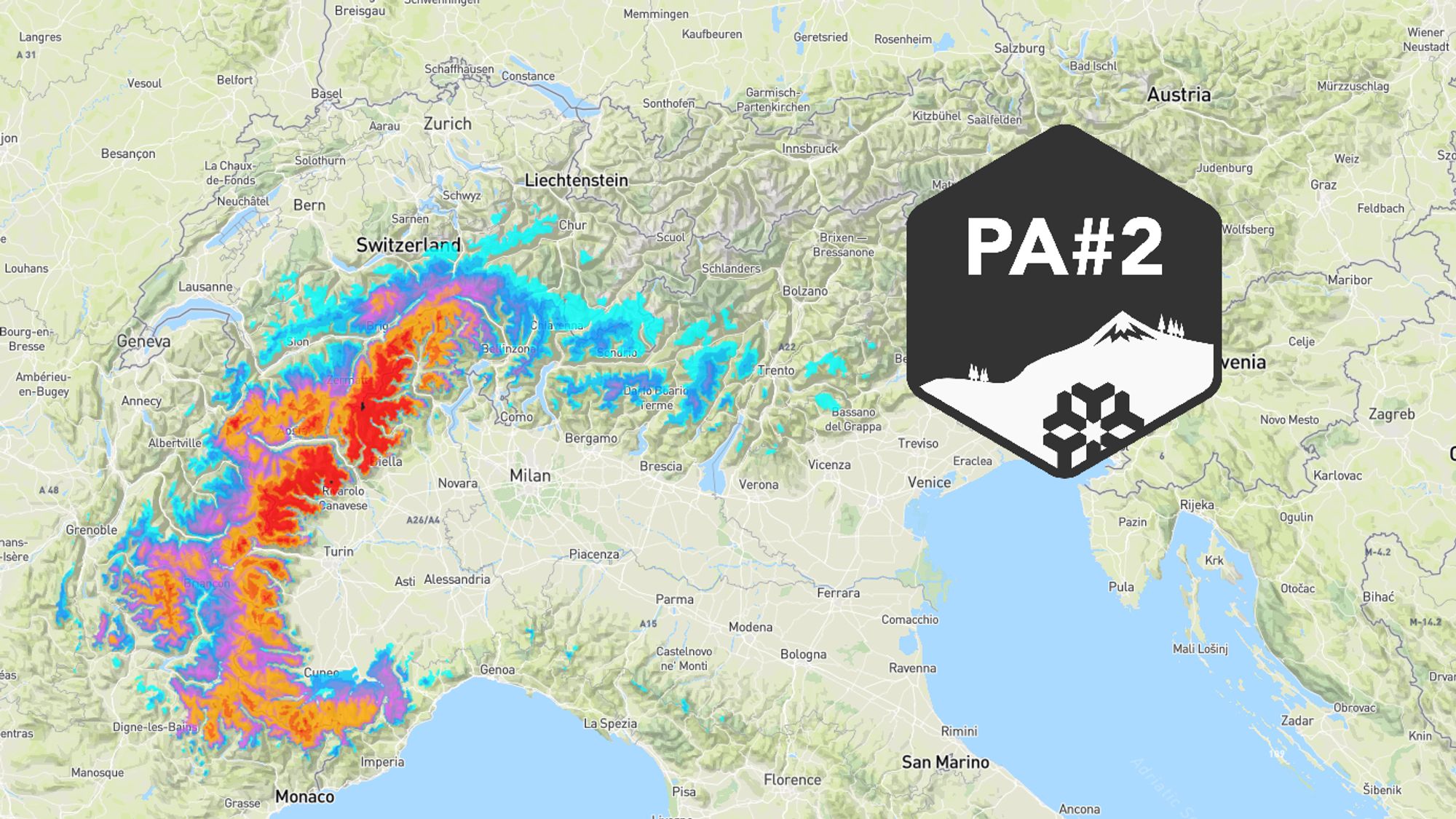
This time, the weather models are fairly aligned regarding the distribution and intensity of the precipitation. It will come in two waves. On Sunday afternoon and evening, the first wave targets the Italian inner arc (Aosta and Piedmont) and the inner-Alpine French regions along the Italian border. The rest of the French Southern Alps will also pick up some snow. The snow line is still high, initially around 2000 m. During the precipitation it will drop a few hundred meters. From about 1800 m upward, 10-30 cm can already be expected on Sunday in Piedmont, Aosta, and the French Southern Alps.
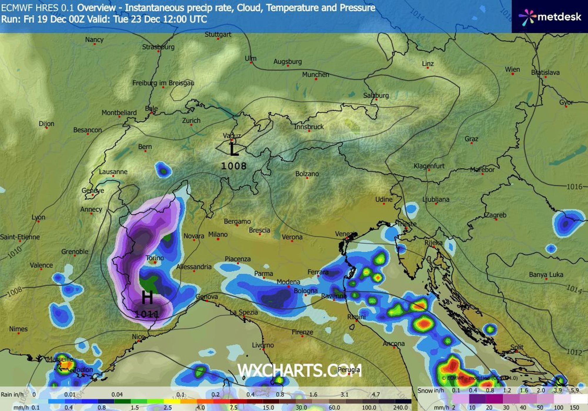
Monday and Tuesday: 50+ cm, locally more than a meter
The second wave starts during the night to Monday and can last well over 24 hours. There is plenty of moisture available, and the southeast to east flow pushes it efficiently against the Italian inner arc and the southern Swiss Alps. Snow will fall lower as well - from 1400-1700 m, locally dropping toward 1200 m during intense precipitation .
| WHERE MORE THAN 50 CM IS EXPECTED: | POSSIBLY OVER A METER: |
|---|---|
| Saas-Fee | Monte Rosa |
| Zermatt / Breuil-Cervinia | Saas Almagell |
| Via Lattea (Italian side) | Champorcher |
| Courmayeur | Staffal |
| Pila | San Domenico |
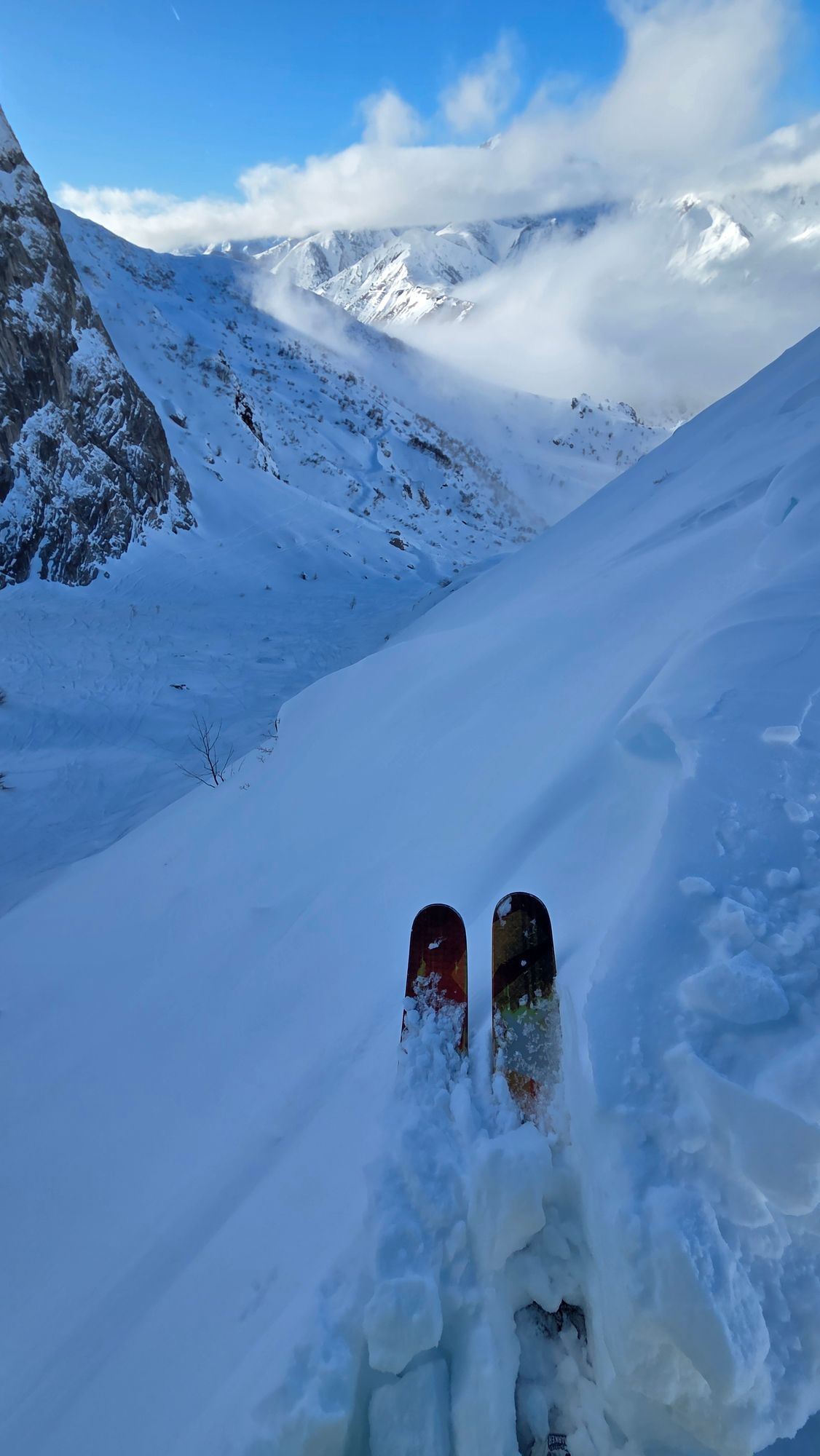
Avalanche danger likely rising to level 3–4 from Monday
Avalanche danger is currently low (mostly level 1-2) after a long dry period. From Monday onward, it will rise sharply in the affected regions, likely reaching level 4 locally. There is a weak layer in the existing snowpack and a hard crust that can create an additional weak layer when new snow falls. Always check the current avalanche bulletin before heading into the mountains.
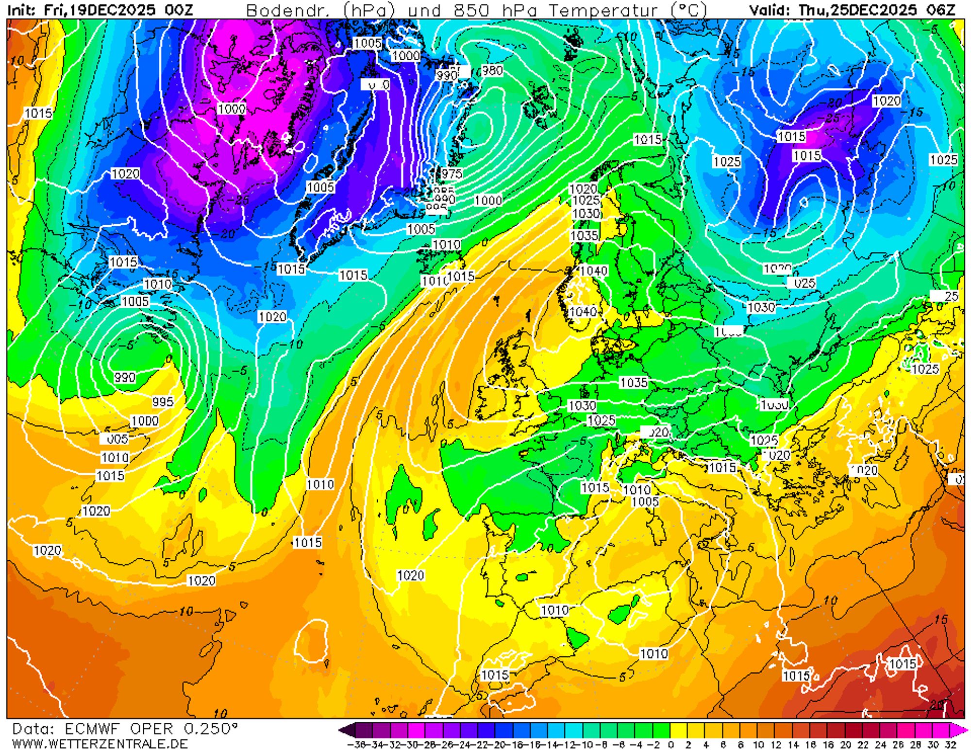
Colder after the dump, snow chances continue for the Southern Alps
It’s clear which regions will hit the jackpot, and that a large part of the Alps will miss out. This means we head into Christmas with a well-below-average snow cover in most regions. The high-pressure system over northern Europe will bring a gradual cooling from December 24 onward, though it won’t become extremely cold. From the 24th, the weather will look wintry again, with the return of frost and daytime highs only slightly above freezing. Above 1000-1600 m it will remain below freezing also during the day. The strong easterly wind will make it feel colder than the thermometer suggests.
Cloud cover will vary, with the best snow chances in the Southern Alps above 1000 m - again mainly in the Italian inner arc. On December 24, precipitation may also develop in the eastern Southern Alps, especially interesting for Slovenia, Carinthia, and the Dolomites. Looking ahead to the period between Christmas and New Year, it appears to stay fairly cold, with a possible intrusion of truly cold air from the northeast later on. The situation is still too uncertain for more details, so keep following our forecasts.
Reacties
But this forecast already changed for Saas Fee? This morning it was showing more than 100cm for the next 3 days and now 36…?
There is always a lot of wishful thinking in the forecasts of Wepowder, especially around Christmas🤣😂🤣
Snow-forecast shows much different scenarios and doesn’t predict any snow for Champocher or Alagna. Limone was great some days ago, but it was wet.