Today the easterly airflow strengthens over northern Italy, bringing at least 24 hours of snowfall to the Southwestern Alps again. In this forecast we look at which areas will benefit from it. We’ll also take a tour through the other regions in and around the Alps where snow will fall today and tomorrow. A white Christmas after all. Finally, we look at the long‑term outlook: will that Nordstau event around New Year actually materialize, or will it be a missed opportunity?

Temporary strong easterly flow with snow on the southern side
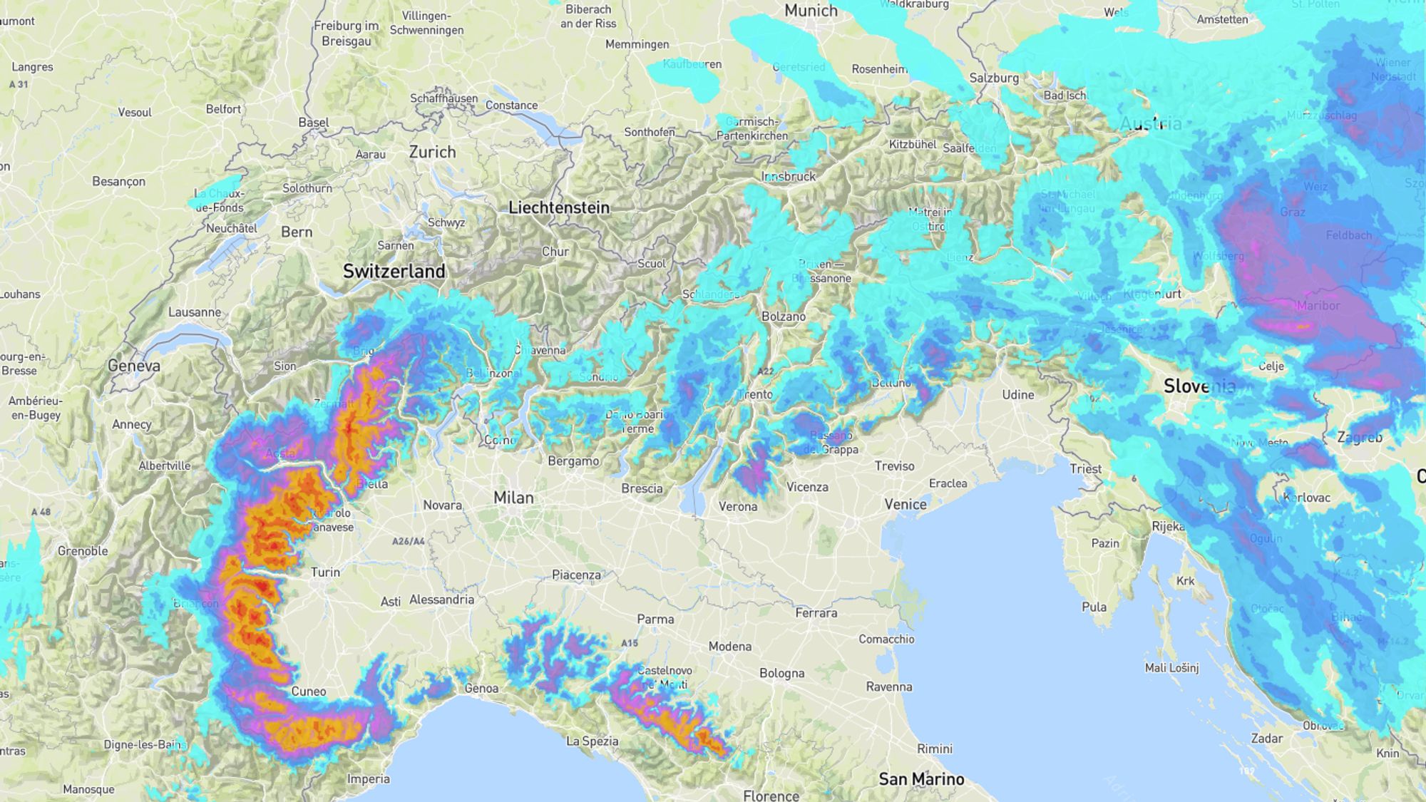
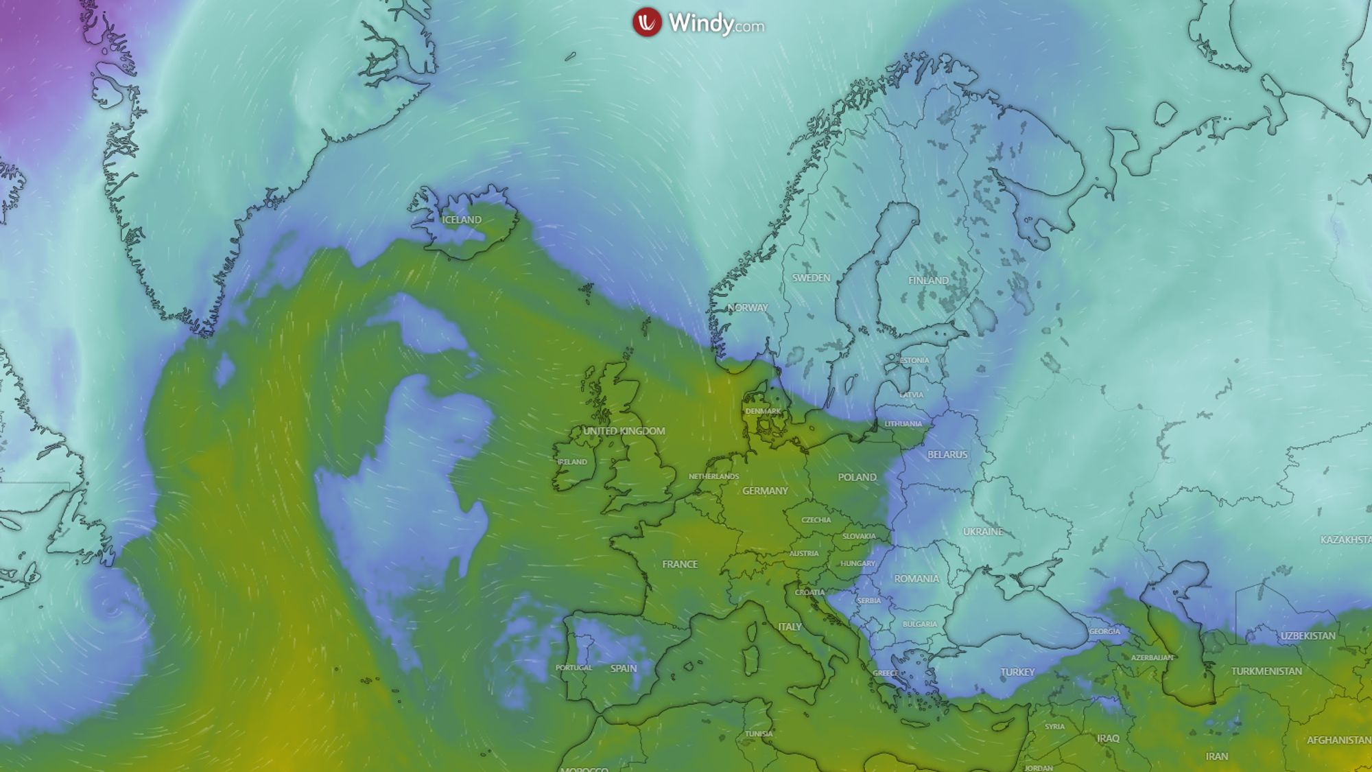
At first glance, the weather map above looks deeply wintry. A strong easterly flow blows across Europe, and a low‑pressure system over the Mediterranean brings precipitation to the southern side of the Alps. However, the cold air currently over the Alps won’t last long. The southeasterly flow - already present over the Balkans - is gradually drawing in milder air from Christmas onward. From December 27, milder air will reach the Alps from the northwest via a detour. Before that happens, it will remain properly cold for another day, with frost reaching into the valleys in the inner Alps and the Northern Alps.
- 1cm
- 5cm
- 10cm
- 15cm
- 20cm
- 30cm
- 40cm
- 50cm
- 75cm
- 100+
- 1mm
- 5mm
- 10mm
- 20mm
- 30mm
- 60mm
- 120+
Animation of cumulative precipitation and fresh snow cover.
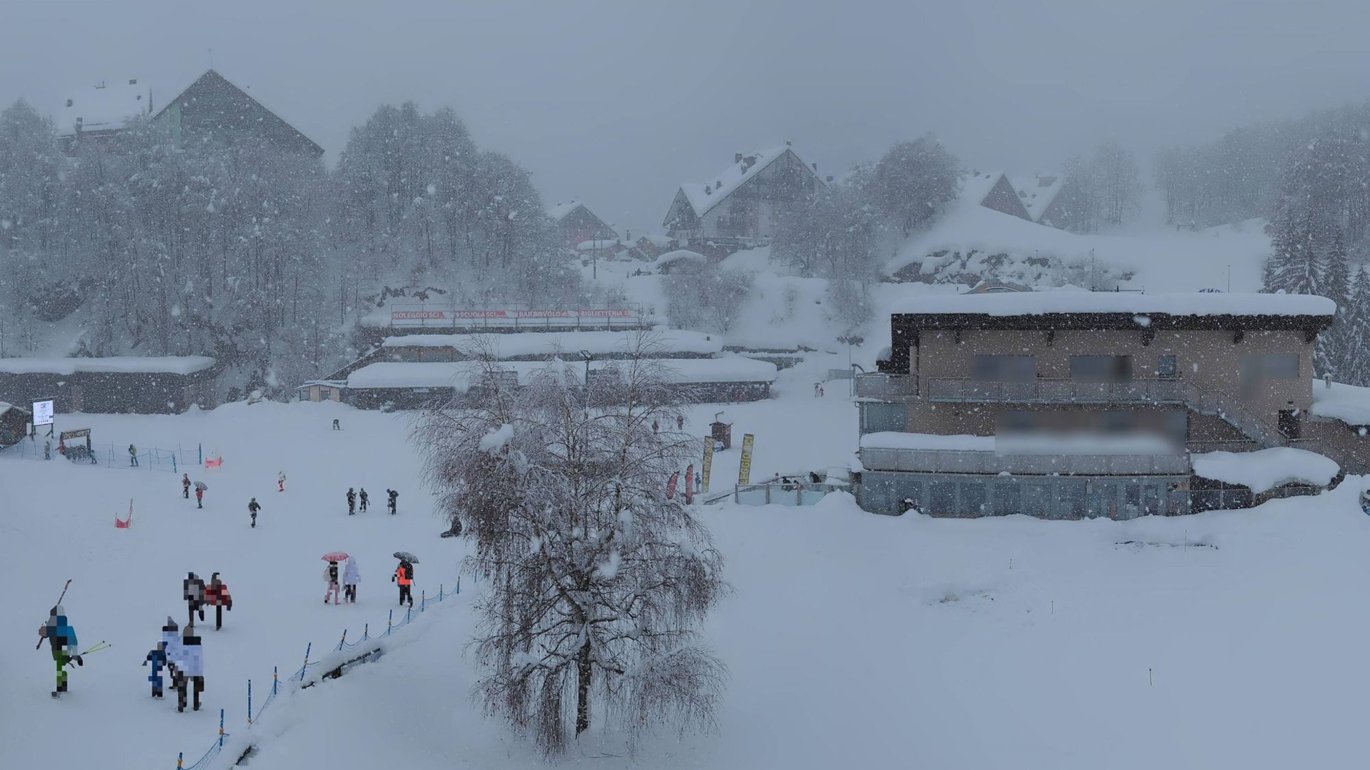
Locally more than 50 cm of fresh snow in Aosta and Piemonte
For the precipitation animation above, a larger part of Europe is shown to illustrate the scale of the snowfall. The intense colors in the Southwestern Alps immediately stand out, so let’s start there. Piemonte has had some time to dig out; during the recent dry and milder phase, the snow up to around 1700 meters became quite wet and heavy. Now, combined with colder air, it has started snowing again. The snowline is dropping to 700-1200 meters and will remain around that level tomorrow.
The new wave of precipitation comes with a strong easterly flow, pushing deeper into the Alps than the previous one. Even the easternmost French areas and the southern Swiss regions will benefit. In the Italian Alpi Marittime, up to half a meter of fresh snow may fall by Friday morning, and other areas also have a good chance of similar totals. Below are some indicative amounts:
| 50-80 cm | 30-50 cm | 10-30 cm |
|---|---|---|
| Prato Nevoso | Zermatt | Isola 2000 |
| Limone Piemonte | Scopello | Montgenevre |
| Crissolo | Cogne | Bersezio |
| Prali | Rothwald | Bonneval-sur-Arc |
| Via Lattea (IT) | Via Lattea (FR) | Val Cenis |
| Champorcher | Saas-Fee | Courmayeur |
| Monterosa | Le Fornet | La Thuile |
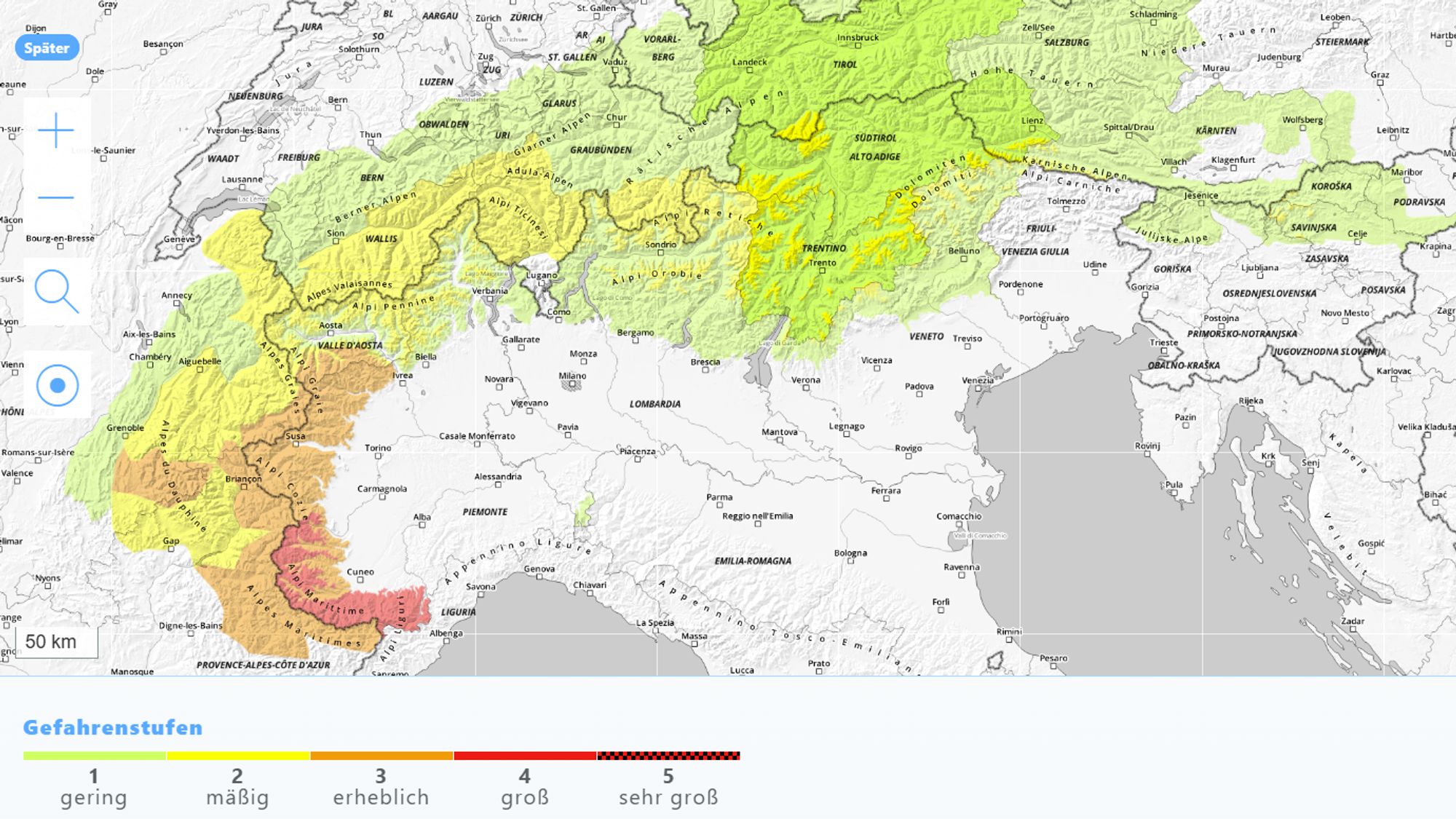
Avalanche danger increasing in multiple regions
More than a meter of fresh snow combined with strong winds is a recipe for avalanche level 4, which is now in effect in the area where the heaviest snowfall occurred. Fresh wind‑drifted snow is causing spontaneous avalanches that can be large. With the mild phase behind us and new cold and snow on the way, little will change in the coming days. The area with level 3-4 will expand northward and westward. Check the most recent forecast here.
Where else will it snow for Christmas?
A green Christmas with bare mountains up to well above 2000 meters seemed likely for many Alpine regions. But in several places things are turning around, with at least a cosmetically white Christmas. In the Alps this includes the Dolomites, where 5–15 cm is expected above 800 meters, and possibly up to 25 cm in the southernmost areas. Slovenia and parts of Carinthia are also expecting a white Christmas, with 5–10 cm from 600–800 meters. In Styria, Burgenland, and Lower Austria, 10–20 cm may fall today and tomorrow even in lower areas, while the rest of Austria will only see a few flakes—often not enough to turn the landscape white.
Possibly half a meter in the Northern Apennines
Outside the Alps, the Northern Apennines stand out: they appear to be in for a major dump, with up to half a meter of snow above 1200 meters in areas like Abetone and Monte Cimone. The Pyrenees will also see snow, but likely no more than 10–20 cm. Winter sports conditions in Eastern Europe are improving as well. The southern Carpathians (Serbia, Romania) can expect 20–40 cm, and the Croatian mountains 10–30 cm.
Dry and milder again
The system over the Mediterranean moves toward Spain on December 26, opening the door for milder air from the southeast. Nights will still bring frost, but during the day the freezing level will rise under mostly sunny skies: to 1200-1600 meters on Friday and 1700-2300 meters on Saturday.
Cold outbreaks from the north
Not only the weather systems but also the high‑pressure areas will follow a retrograde pattern next week, expanding westward. Supported by new impulses over the ocean, a strong high‑pressure block will form near Iceland from Sunday onward. A first polar outbreak will move from Scandinavia toward southeastern Europe over the weekend, brushing Austria. This could make the eastern half of Austria noticeably colder on Sunday and Monday, while the Western Alps remain quite mild.
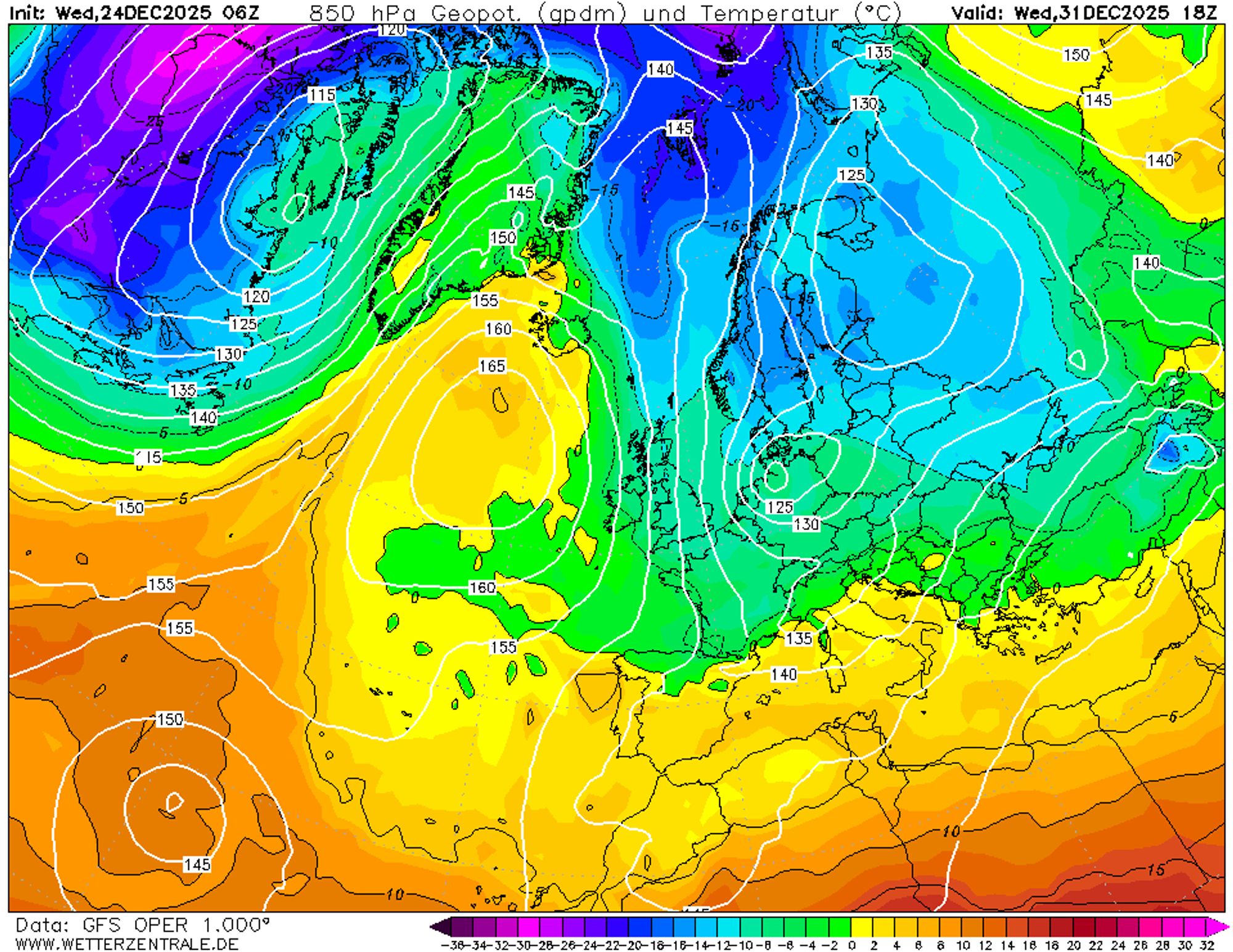
A second outbreak will occur farther west and will likely plunge the entire Alpine region into polar air from Wednesday the 31st. Whether this will also bring significant snowfall (Nordstau potential) remains uncertain. The influence of disturbances and the scale of the cold outbreak are still inconsistent across weather models.
From sunny but cold Netherlands, I wish everyone a wonderful Christmas time. Enjoy the snow if you’re in the mountains, and stay safe!
Reacties
Merry Christmas snow lovers🎄🎅!!
I love using WINDY (premiere version) and putting on the webcam settings on days like today where we’re all desperately seeing how much and where it’s snowed. Nothing better than visual confirmation and the 24hour cam-history is useful. Enjoy the day with the family!
Folks, pls could you recommend me some website, where I could check the snow depth live as it is read by meteostations etc in Val di aoste,
Italy?
Example: https://bollettinovalanghe.regione.vda.it/snow-maps
And Merry Christmas!
Bergfex also does it and you can toggle by reported recent snowfall amounts:-