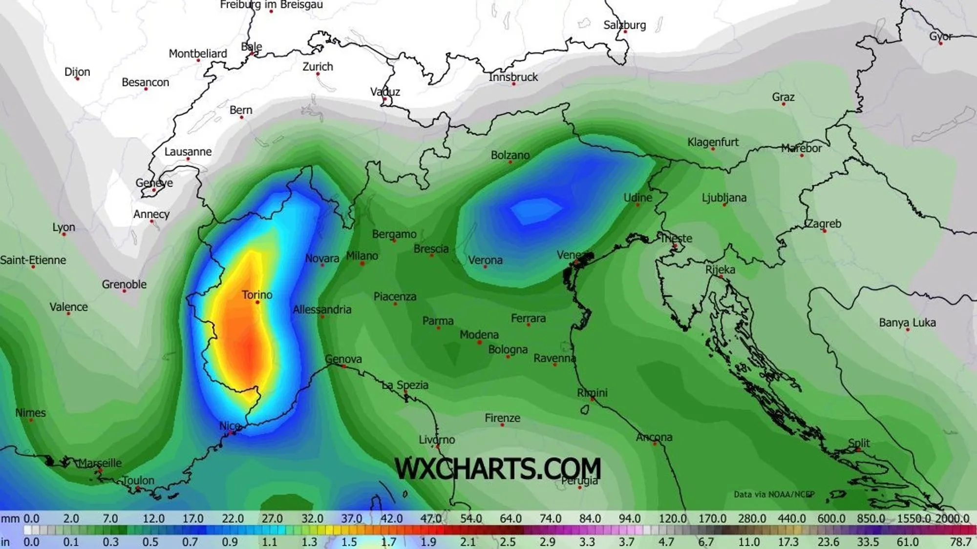
The Alps currently lie between a trough in the west and a high‑pressure system in the east, resulting in a persistent southerly flow. This has caused a significant warm-up, which below 1800 meters can lead to Gleitschnee (glide-snow) avalanches. Higher up, the wind continues to affect the snowpack, causing avalanche danger to vary greatly and change quickly. The southerly flow also brings moisture with it, and for now this seems most likely to produce substantial snowfall in Piemonte above roughly 1400 meters.
Increasing cloud cover and relatively mild conditions
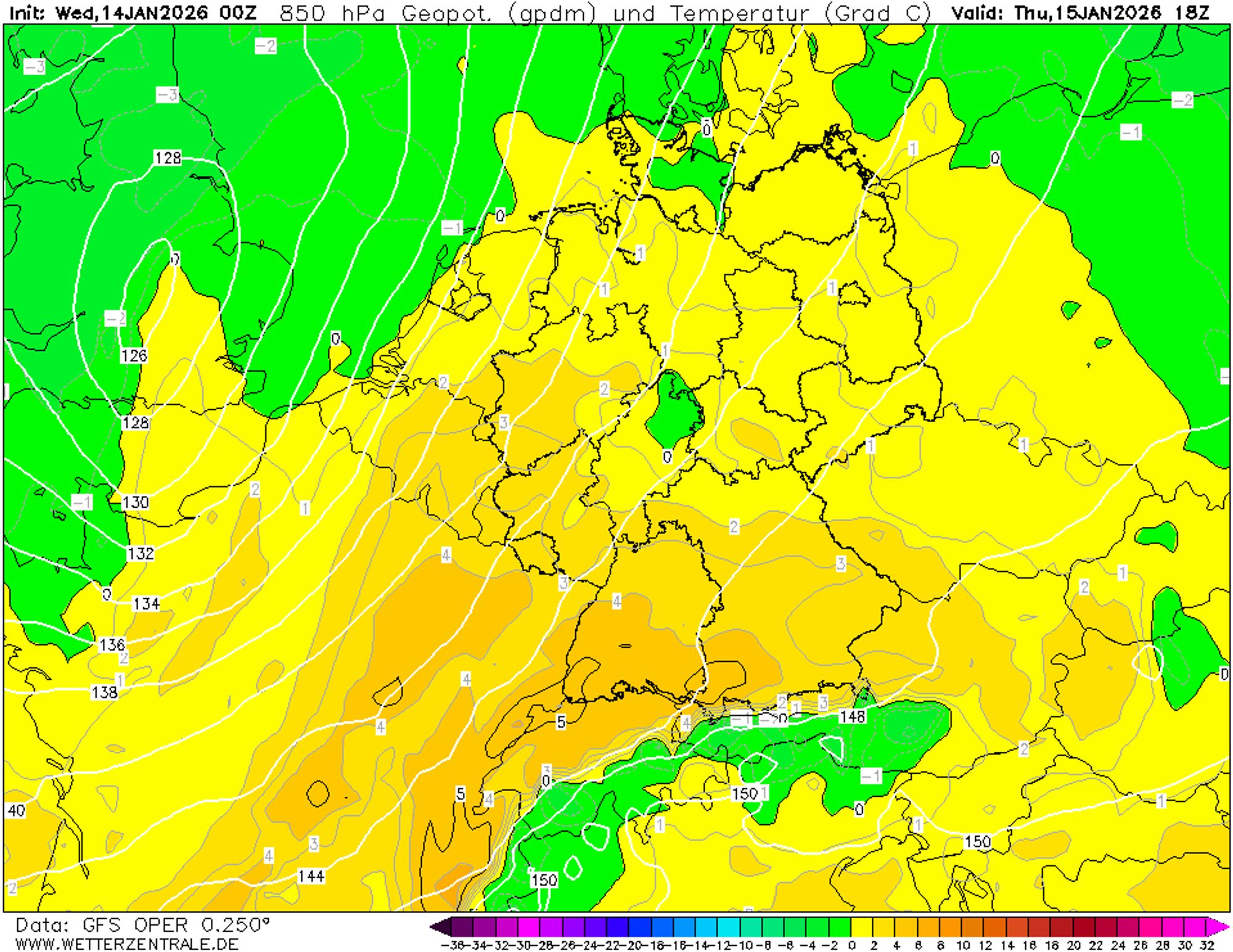
Over the next few days, conditions in the Alps will remain fairly calm. There will still be sunny periods, but remnants of disturbances - especially in the west and south - will bring increasing cloudiness. During the day, the freezing level in the southern Alps ranges between 1400 and 1800 meters, compared to 2000 to 2400 meters north of the main Alpine ridge and in the northern French Alps. As the southerly flow strengthens on Friday and Saturday, these differences will increase further, with the Südföhn gaining strength.
In Ticino, Graubünden, and the far north of Piemonte and Lombardy, some orographic precipitation may occur starting Thursday. However, this likely won’t amount to much: more than 5 to 10 centimeters above 1600 meters is not expected.
Snow in Piemonte from Sunday onward - 50 cm quite possible
Sunday and Monday will likely be the most interesting days. Precipitation arriving from the south will reach the Alpes Maritimes and then spread across Piemonte. The southern French regions along the border should also pick up snow, and with some luck, so will Aosta and Valais. The heaviest snowfall will probably again occur in the Alpes Maritimes and the southern parts of the Italian inner arc.
Model forecasts show totals between 20 and 120 centimeters. As an indication, I’m using the ensemble mean shown in the main map above this report. With that, half a meter currently looks like a cautious but realistic estimate. The snowline is around 1500 meters but may drop by a few hundred meters during more intense precipitation.
Mostly dry and fairly mild in other regions
Yesterday, Henri already mentioned the large uncertainty in model output and rightfully noted issues with some calculations for the southern Alpine. This morning, a clearer trend emerged that we already suspected: under the influence of Eastern European high pressure, the eastern South Alps are likely to remain dry. We’ve seen this pattern repeatedly this season, and in that sense the patern has been very unfavorable for these regions.
For now, the Alps will remain under a southerly flow with correspondingly mild conditions. Only in the final week of January does the chance for colder air from the east increase - though not necessarily with much precipitation.

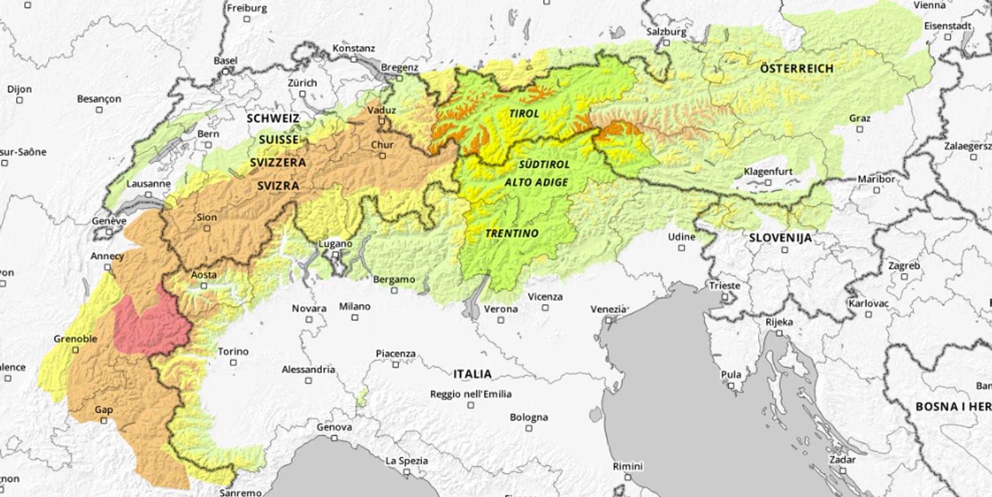
Avalanche Level 3-4 due to wind and a weak base layer
We’ve had a few fantastic days, especially in the western Alps, with plenty of sunshine atop 50 to 130 centimeters of fresh snow. The extreme avalanche danger had been widely announced, leading many freeriders to stick to mellow terrain and tree runs. Given the fatal avalanches above tree line, this was a wise choice.
Now that the danger level in most regions has dropped to Level 3, more lines are becoming appealing. However, the weak basal layer is still present and remains a reason for great caution. Lower, sun-exposed slopes have become more prone to Gleitschnee avalanches due to the warmer weather. Local knowledge and thorough preparation are essential.
Reacties
Any chance the weekend’s snow will extend to the Savoie/Tarantaise valley?
Any chance the weekend’s snow will extend to the Savoie/Tarantaise valley?
TimSt - 14 Jan 2026 13:15
The best chance for a decent refresh is near the border (Val d’Isere, Bonneval, Val Cenis) but probably small to moderate amounts at best.
Thank you. We will be in Paradiski, so slightly further away - but remaining hopeful!
Abries-Ristolas, Montgenevre, Val Cenis (in decreasing order).
Sometimes Val d’ Isere a bit. But Tignes, only half of Val.