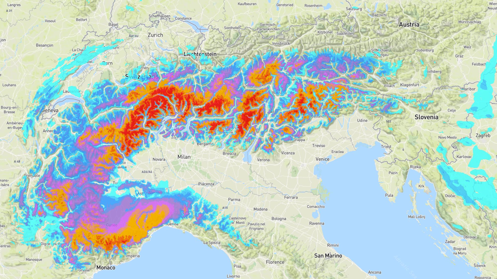
The prolonged dry spell appears to have definitely ended in large parts of the Alps. Over the past week, snow has fallen mainly in the Western and Southern Alps, and in substantial amounts. These are the very regions that look set for another round starting on Tuesday. The base layer is gradually creeping toward normal mid‑winter values, and in some areas even exceeding them. Switzerland and Austria, however, remain notably snow‑poor in many regions, and the upcoming dump unfortunately won’t change that.
This is the perfect moment to get a wePowder Pro subscription. We’re currently offering a 30% discount (with code INSTA30) for access to detailed weather forecasts, the online freeride guide, and the Safety Academy modules! You can find more information about wePowder Pro here.
A refresher this morning in the Northwestern Alps
As expected, it snowed last night and this morning in parts of France and Switzerland. Especially in the Jura and the northwestern regions such as Chamrousse and Portes du Soleil, a nice layer of around 15 centimetres fell at higher elevations. In other regions it was mostly a modest top-up.
Dry and fairly calm weekend
A powerful high-pressure system over Eastern and Northern Europe continues to block the normal westerly circulation across the continent. The jet stream has been positioned well to the south for quite some time now, and it will stay that way for the time being. Before disturbances are drawn in again, the weather from Saturday through Monday will be dry in most places. The clearest skies will be found in Austria, eastern Switzerland and across the entire Southern Alps. Both the Western Alps and the regions east of Salzburg remain prone to cloud cover, though it certainly won’t be overcast all the time.
Maps of the avalanche danger levels in the Alps and Pyrenees today – check the latest bulletins at https://lawinen.report/bulletin/latest
These are fine winter sport days with not too much wind, and above roughly 1,000 meters, wintry conditions with sub-zero dew points. However, the avalanche danger remains elevated, partly due to the recent snowfall. In many areas, danger level 3 to 4 is still in effect, mainly because of the same persistent issues: wind-transported snow and a weak layer in the snowpack.
Südstau phase between Tuesday and Thursday
From Monday onward, disturbances will spread over Spain and France. In the evening, the first snowfall is likely to reach the Maritime Alps and the French Southern Alps. On Tuesday, a full Südstau setup develops, with orographic lifting at all levels and plenty of available moisture. A caveat is the mild air being advected on the front side of the system. This may push the snowline on the French side up to around 1300-1700 meters. In Italy, this effect will be smaller on Tuesday, allowing snow to fall from around 600-1200 meters. On Wednesday, however, the snowline appears likely to rise by a few hundred meters in the Southern Alps.
A comparison between several weather models (total precipitation through Thursday morning)
Widespread 20-40 cm of fresh snow
Our GFS-based model forecasts 50-100 centimetres across nearly all regions south and west of the main alpine ridge. ECMWF is considerably drier, suggesting 20-40 cm with local peaks above 50 cm. Because the smaller models tend to align more closely with ECMWF, I’m remaining cautious for now. The 20-40 centimetres are definitely realistic, and higher amounts appear mainly in the extreme southwest (Maritime Alps) and northeast (Carnic Alps, Julian Alps and possibly parts of the Dolomites).
We’ll keep you updated with daily reports — and perhaps soon Powder Alert 6!
Reacties
I still don’t understand how the forecast works here… I am logged in, using a premium account and I see a forecast for Solden (24 cm) and if I check the forecast without being logged in I see a different forecast (4cm). Looking at the forecast until Wednesdaz next week. How is this even possible? 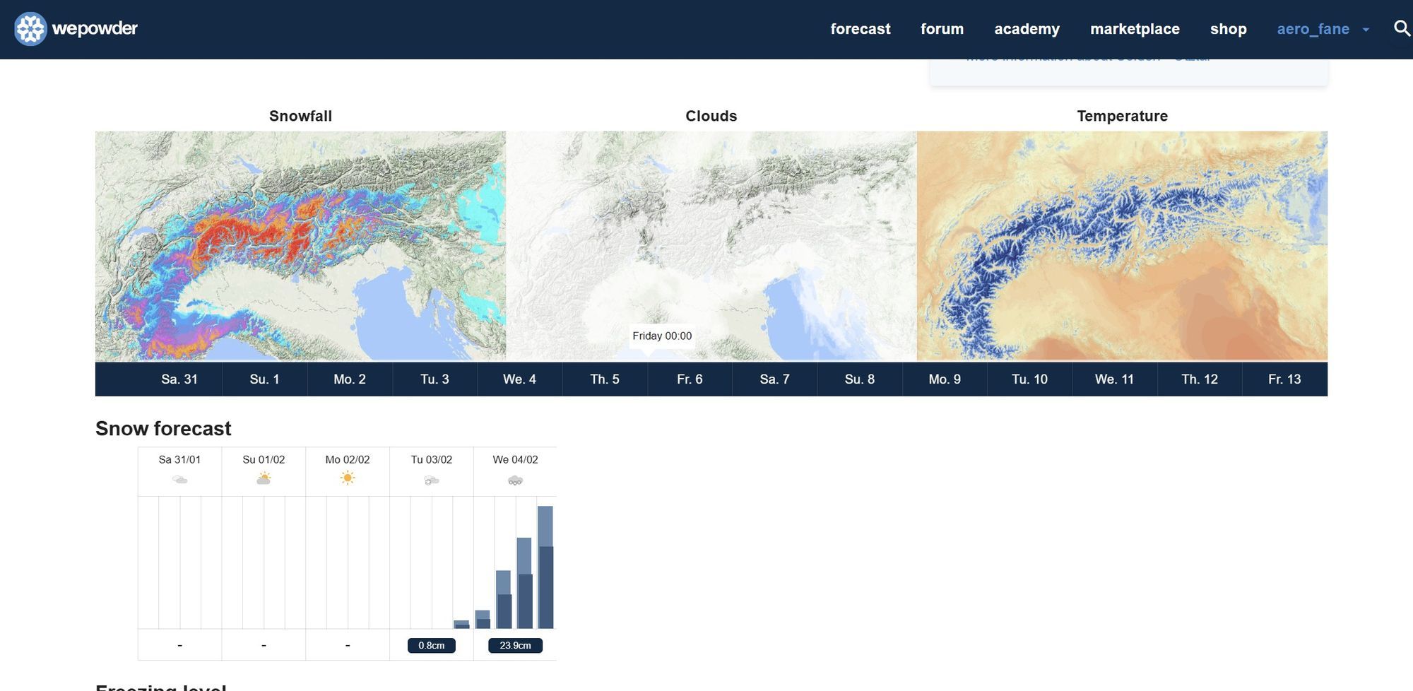
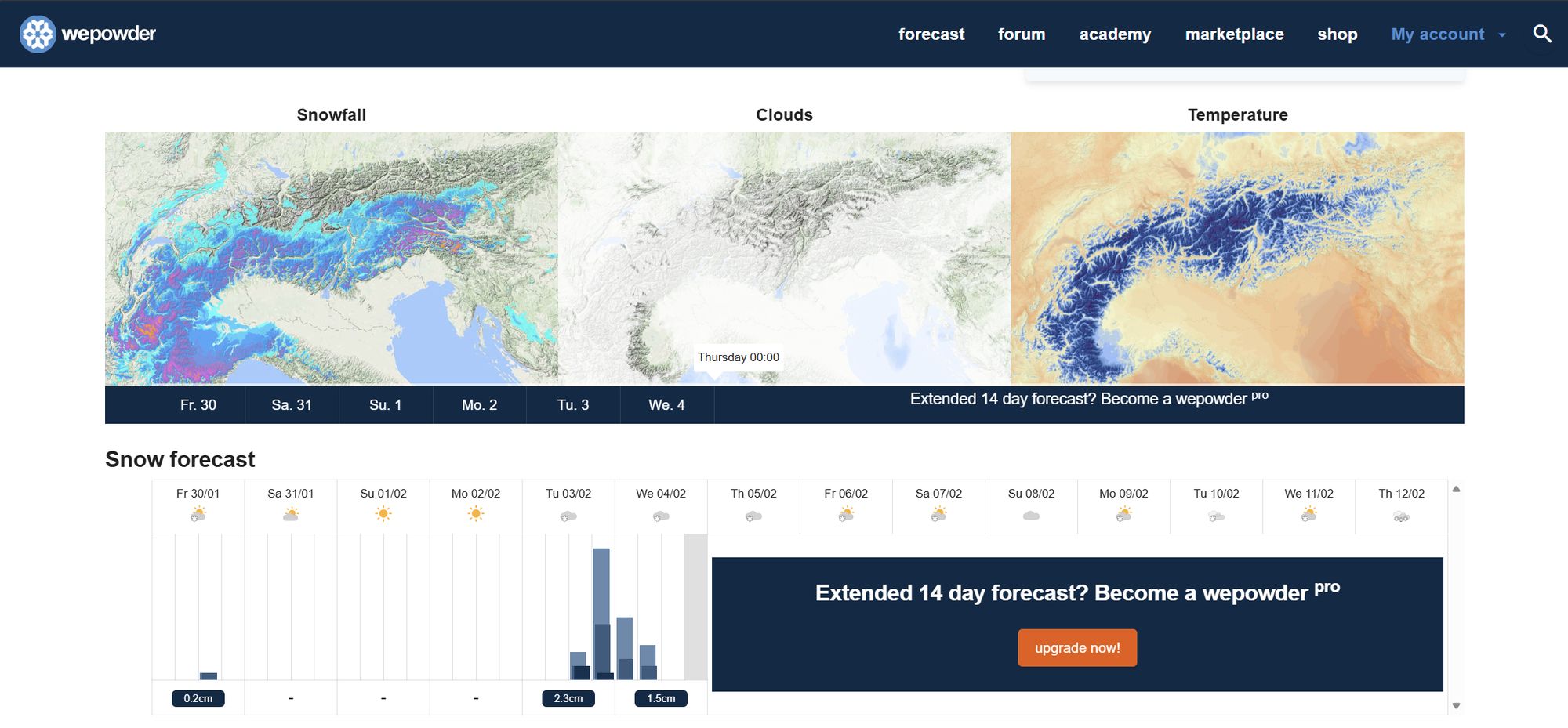
Where did all the nice yellow and red colora foe the south go?! 😡
Weather predictions are really like rolling the dice… I
Having an premium account is actually worse than just checking the regular forecast. I booked again (from one week to another) based on the predictions and of course the forecast changed again. It is understandable that the weather is changing but to be wrong that much (ex Hochgurgl : from 120 cm to 6 cm in the next 6 days ) it is really not acceptable.
I do not understand why do you guys feel the need to show always, probably the best case scenario from your calculations and you also have the confidence to post about it and it the same day to actually show on the predictions on the map that … ups, it will not happen.
If you want a better forecast just check Bergfex as they are more reliable.
I still don’t understand how the forecast works here… I am logged in, using a premium account and I see a forecast for Solden (24 cm) and if I check the forecast without being logged in I see a different forecast (4cm). Looking at the forecast until Wednesdaz next week. How is this even possible?

aero_fane - 30 Jan 2026 20:45
If you have a premium account you can view premium updates that happen more often than the normal one (every 24 hours)
Thanks for the update and for analyzing the different kind of prediction models and scenarios. I am thinking about heading to Passo Tonale in the middle of next week.