The disturbed weather patern that has been causing problems for weeks on the Iberian Peninsula and in North Africa will shift northwestward in the coming days. As a result, the Western Alps will receive a significant dump at higher elevations. That’s why we’re issuing the 7th Powder Alert of the season - albeit with some important caveats:
- Weststau, multiple fronts, and a high to very high snow line.
- Poor weather with strong winds and rain, sometimes up to above 2000 meters.
- A transition zone between 1800 and 2300 meters with a risk of heavy, wet snow.
- At those elevations, avalanche danger level 3 already applies in many places, and it will increase further.
- Where to go? The boundary regions appear to be the safest for now.

Strong westerly flow incoming
For weeks, low-pressure systems moved from the Iberian Peninsula toward North Africa and the Mediterranean. This caused major problems, with flooding and storm damage in Portugal, France, Spain, and Morocco. But there were also upsides: snow depths in the Pyrenees and other Spanish mountain ranges increased significantly. Even Portugal’s only ski area (Serra da Estrela) received a rare dump - see the images below.
The situation is finally shifting. The high-pressure system over Scandinavia is giving way to incoming low pressure, and the Azores High is returning to the weather charts. The result is a strengthening westerly circulation with lots of precipitation, but also milder maritime air. Coming weekend we’ll move to the rear side of the disturbances. That’s when the mild air supply will be cut off and the snow line will drop again.
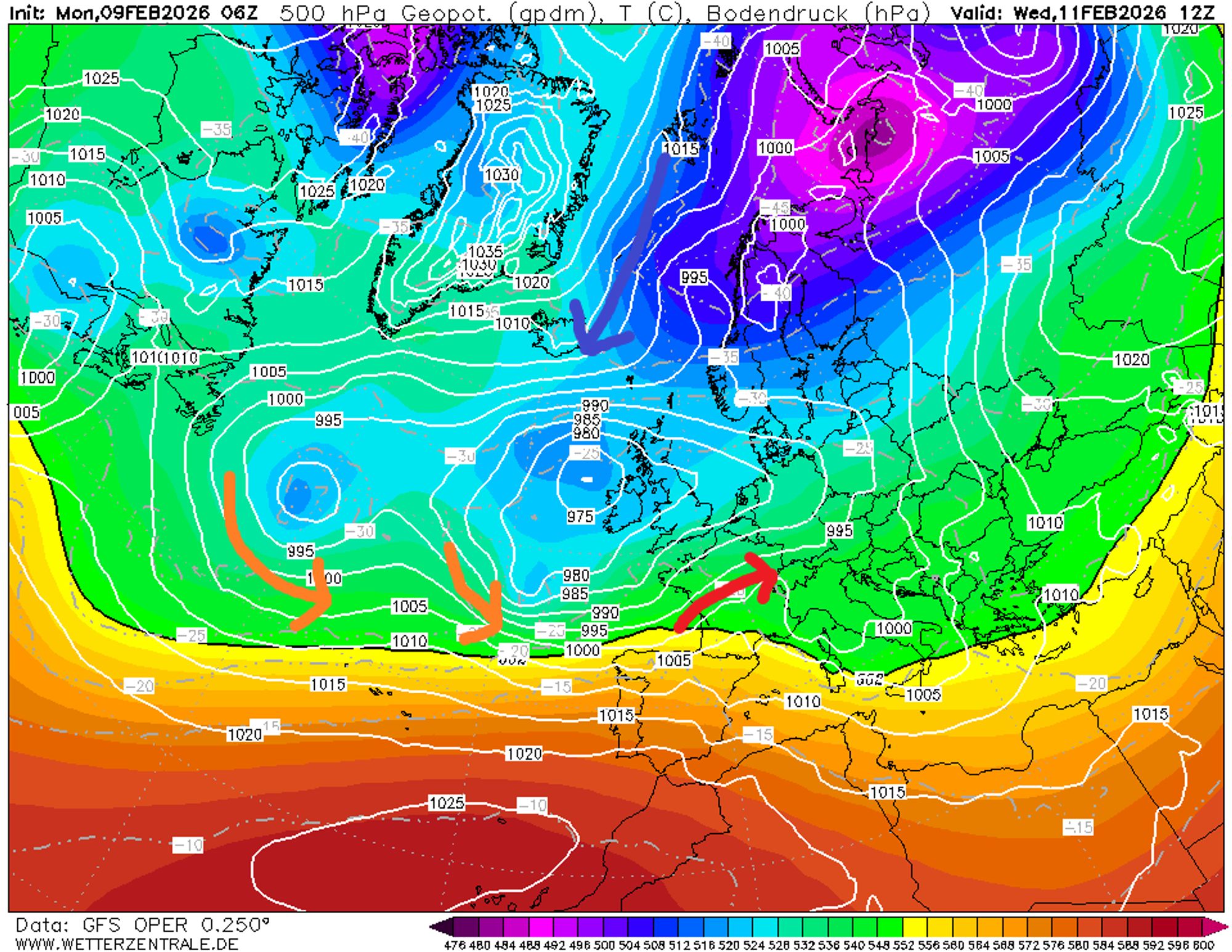
First precipitation tonight and tomorrow with a rising snow line
Today, conditions in the Alps are still relatively calm. It’s quiet, partly cloudy, and on the southern side some light snow is falling above 1200 meters here and there. During the night, a warm front will reach the Western Alps. Precipitation will fall across the entire French Alps, and by morning it will also have reached Piemonte, Aosta and Valais. The wind will blow from the west and will be noticeable above the treeline, with gusts up to 80 km/h above 2000 meters.
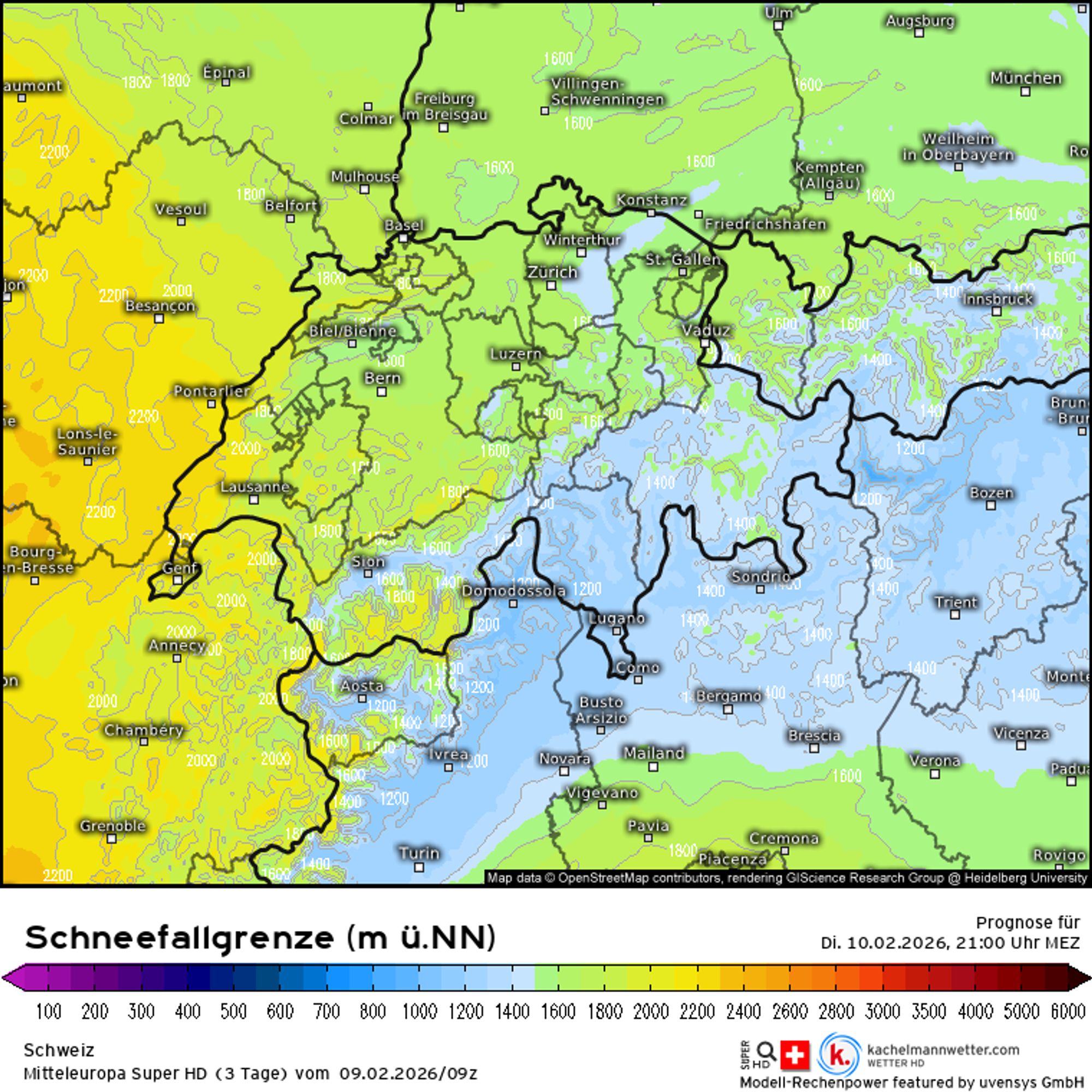
Tuesday will bring a dry spell at first, but later in the day more rain and snow will move in from the west. The snow line will start the night and Tuesday morning between 1200 and 1600 meters, but will rise throughout Tuesday to 1600-2000 meters in France, 1300-1800 meters in Switzerland, and 1300-1600 meters in Italy. As the westerly flow strengthens, remaining cold pockets with a lower snow line will be mixed out.
Wednesday and Thursday: intense precipitation and strong winds
Wednesday and Thursday are not days to venture out at high elevation. Snow will fall almost continuously in the Western Alps due to alternating fronts and convective precipitation enhanced by weststau. In addition, strong westerly winds will prevail, with multiple storm‑force peaks above 2500 meters. Gusts may exceed 120 km/h. It’s likely that many lifts will be closed on both days.
Wind combined with rain will heavily impact the snowpack below 1800 meters. Higher up, wind‑drifted snow will become a major issue, falling on top of an unstable and already wind‑affected snowpack. Check the latest avalanche bulletin here.
Wind speeds at around 3000 meters reach 40 knots (8 Bft) to 60 knots (11 Bft). Maps: WRF, wetterzentrale.de.
Highly variable snow line
On Wednesday, the mildest air will be found on the eastern side of the Alps. Supported by a west‑föhn, the freezing level in Piemonte, Aosta and Valais will rise to 1600–2200 meters. In the French Northern Alps, it will be between 1400 and 1700 meters, with a slight downward trend in the afternoon.

- -20°
- -15°
- -10°
- -5°
- 0°
- 5°
- 10°
- 15°
- 20°
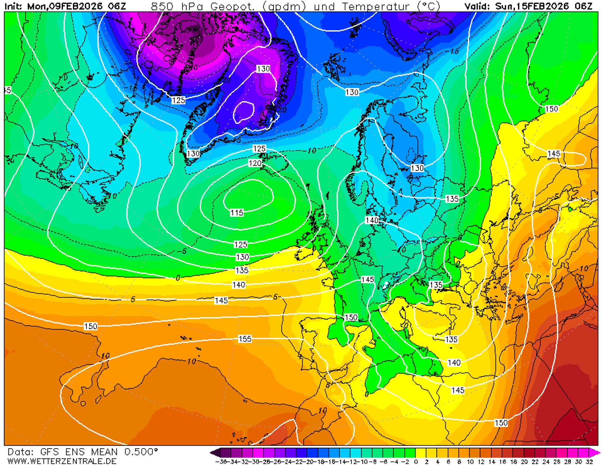
View the animation of the 850 hPa temperature (around 1500 meters altitude) for an indication of the fluctuating snow line.
During Wednesday night and into Thursday, a new warm sector will again cause a significant rise, with rain up to 1700-2000 meters in most regions. On Thursday evening, cooler polar air will move in and lower the snow line by around 500 meters. Under these highly variable conditions, little snow accumulation can be expected below 1800 meters. Between 1700 and 2300 meters, a transition zone will form with likelyhood of heavy, wet snow.
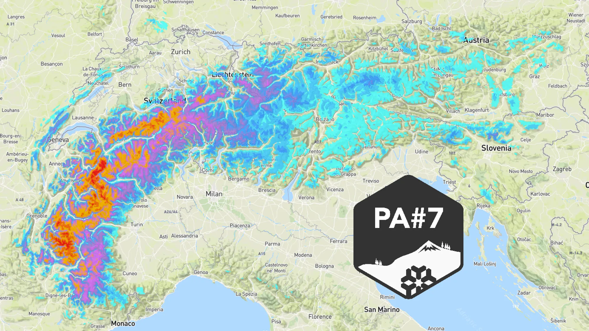
How much snow will fall in total?
Weather models are largely in agreement for the Western Alps. However, uncertainty remains in the boundary regions of this Powder Alert - particularly eastern Switzerland, the Italian Southern Alps, and Vorarlberg in Austria. Below is an estimate of fresh snow expected between today and Friday morning above 2000 meters:
French Northern Alps
This PA peaks here, with more than 80 cm and likely outliers above 100 cm in areas such as Chamonix, Tignes, Huez and La Plagne.
French Southern Alps
Most snowfall in the north: 70+ cm around the Écrins. Further south, mainly 20-50 cm. The Maritime Alps come off poorly this time with 5-15 cm because they lie in the lee during a WNW flow.
Piemonte
Ranging from almost nothing in the Maritime Alps to more than 50 cm in the northern areas along the French border.
Aosta
The wettest region in Italy over the coming days. Near the French border (Courmayeur, La Thuile) about 80 cm may fall; further east considerably less (Cervinia 40 cm, Champorcher 20 cm).
Lombardy
Around 10-20 mm/cm expected, though many areas lie partly below the snow line.
Switzerland
Around 80 cm in western Valais, gradually decreasing eastward along the main ridge but still around 50 cm in the central part and 30 cm in the east.
Austria
Currently expecting 20-30 cm in Vorarlberg and less than 20 cm in Tirol. The snow line is lower here, but precipitation uncertainty increases from Thursday onward.
Long-term: colder over the weekend
Friday will again be unsettled with precipitation and a high snow line. From Saturday onward, a temporary northerly flow will develop, reducing precipitation while temperatures drop to more wintry values. Sunday and Monday could turn out to be two beautiful ski days.
Where to go?
We can’t repeat it enough: avalanche danger is exceptionally high this season! Today, Italian rescue services sounded the alarm after 10 avalanche fatalities in one week. “There are many dangerous points that are difficult to recognize from the ground,” one rescue service said. “Even experienced skiers struggle to find truly safe routes.” We recommend waiting until after the upcoming dump and then reassessing which areas are safest. If you still want to head out, focus on the highest treeruns in regions not directly exposed to the storm. Think of areas on the edges of this PA, such as the southern French Alps, the eastern half of the Swiss Alps and later possibly Vorarlberg.