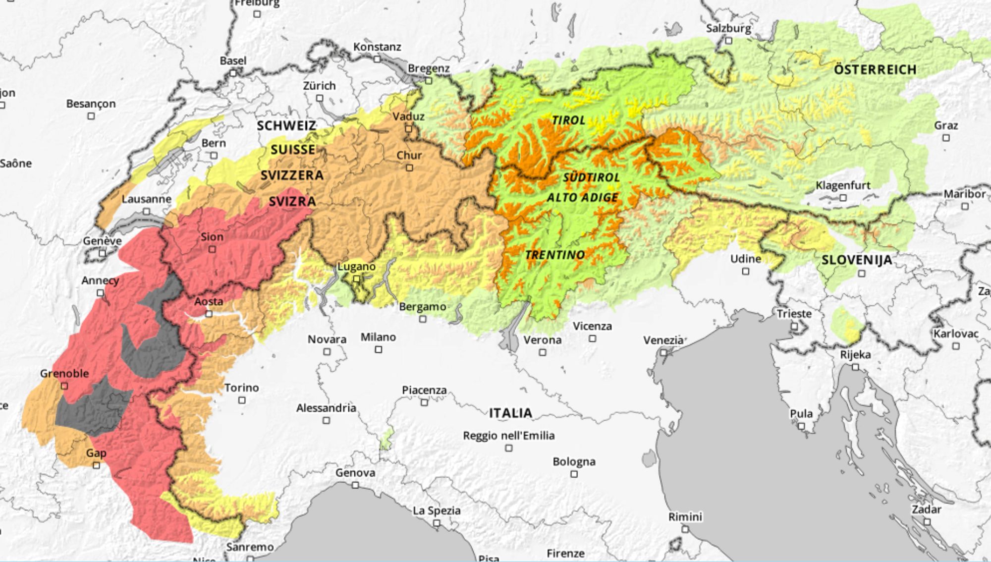
It’s a turbulent week in the Western Alps. Heavy snowfall and avalanche danger level 4, locally even 5, in large parts of the French Northern Alps. This creates a difficult situation for higher-altitude villages such as La Plagne, where a lockdown is in effect tonight. In addition, at the time of writing (Thursday evening), the road between Tignes 1800 and Tignes Le Lac is closed due to preventive avalanche blasting to reduce the risk of spontaneous avalanches. The peak of the Western Alps snowfall has passed, but snow is still expected in other parts of the Alps in the coming days, and PA#8 is already on the horizon.

Loads of fresh snow
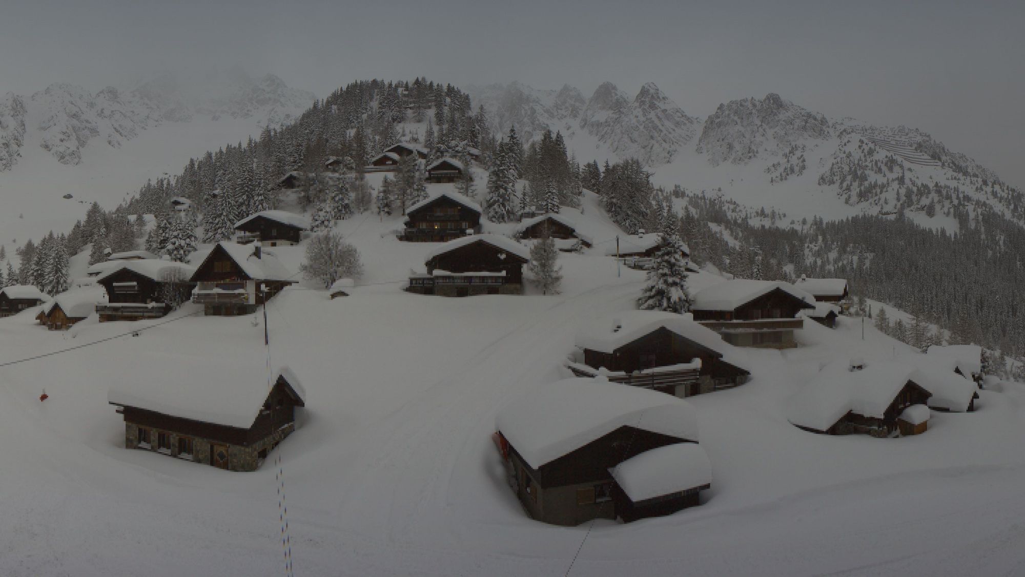
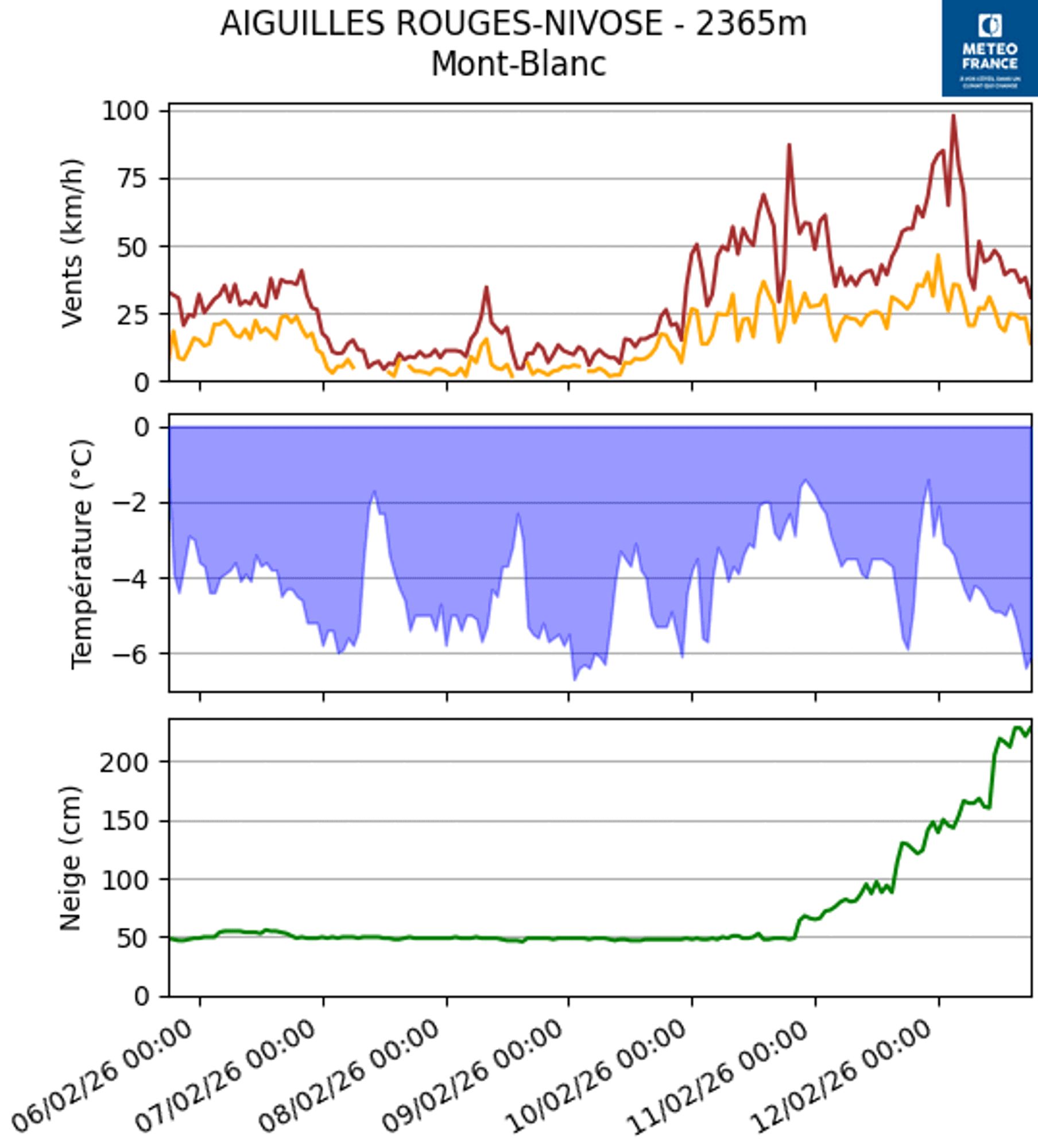
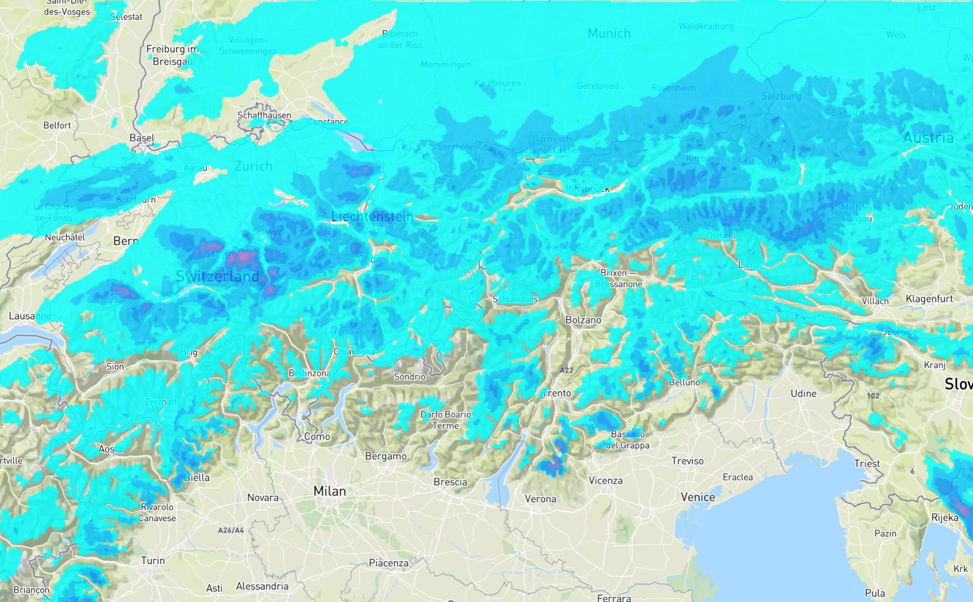
In the past 24 hours, 30-60 centimetres of snow has fallen at higher altitudes, as Coen mentioned yesterday. In some places, even more. The Nivose of Aiguilles Rouges (2365 m) now looks truly impressive with over 1.5 metres of snow in the past two days. The Swiss measuring station L’Ecreuleuse at 2252 metres has also received around 120 centimetres of fresh snow. The snowfall was accompanied by stormy winds higher up today, as you can clearly see in the Instagram post from Val d’Isère below.
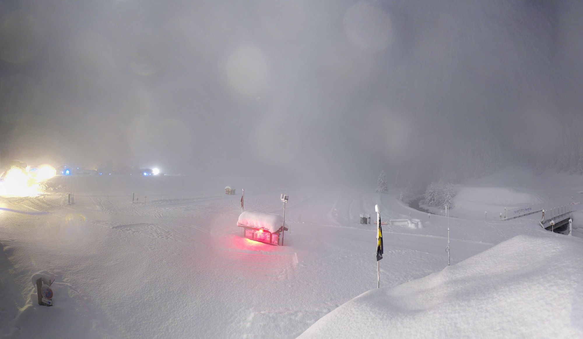
It shows how things are going in the Western Alps and that the avalanche risk is, logically, exceptionally high. The snow line is generally a bit lower than expected, but lower down (especially below 1500 metres), the snow is pretty heavy in many places. There was some rain there overnight from Wednesday to Thursday. We can conclude that it did indeed become milder in between, but that this did not cause any major damage because the precipitation intensity was usually somewhat lower. In the morning, the snow line dropped again (with a slight fluctuation during the day), and colder air has now flowed in again. On the webcam image from Champagny (1470 metres), for example, we can see snowfall again, and during these intense showers, the snow line has even dropped below 1000 metres in several places.
What will happen in the coming days?
What will happen tomorrow (Friday)? First of all: the avalanche risk remains high to very high, so many high-altitude ski areas will open later than planned or remain (partially) closed. Large spontaneous avalanches are still possible, such as the one in Courmayeur today. During the day, it will be dry and the sun will break through quickly. It will also become milder, so the heavy snow lower down remains a point of attention. In the Western Alps, the freezing level rises to around 2000 metres, and in the French Southern Alps and southern Piedmont it is even a few hundred metres higher. On Friday, the focus will be mainly on the non-steep, higher tree runs. The coming days are simply not the time to dive into steep and high alpine terrain. Even in areas where less extreme amounts of snow have fallen, the situation remains tricky.
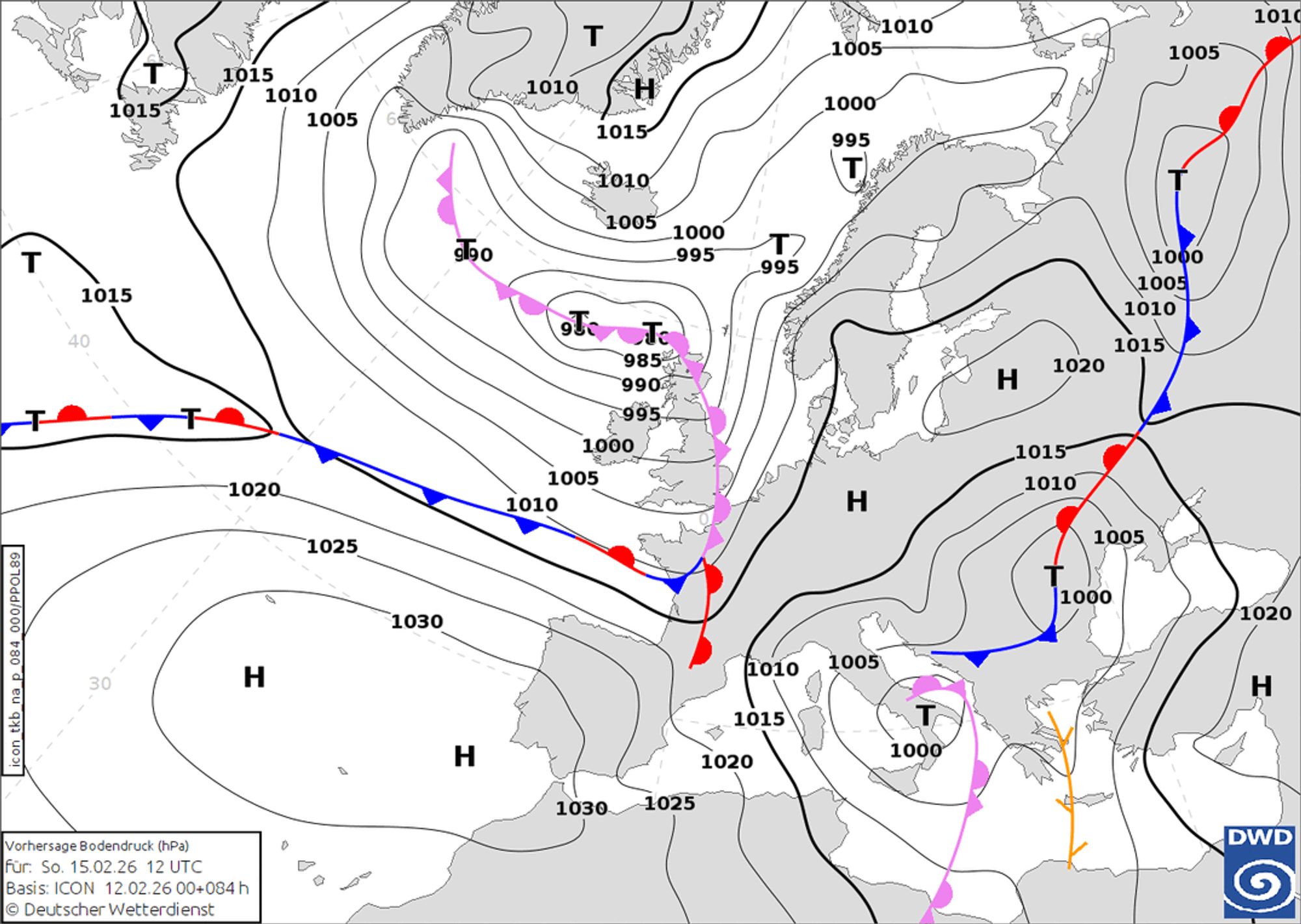
From the west, cloud cover will increase during the afternoon and it will eventually start to snow in the south-western Alps. This is due to a small trough at altitude and the development of a small-scale low-pressure area above the Mediterranean coast of southern France. The low-pressure area will quickly move further to the south-east, limiting its effect on the southern Alps on Saturday. In addition, cold air with snow will move in from the north-west on the northern side of the Alps, which will eventually cause a Nordföhn on the southern side. This pressure gradient will increase rapidly from the west during the day on Saturday, which will not only cause the snowfall to weaken, but also bring strong winds. Nevertheless, according to most models, 30-40 centimetres of snow may fall in a limited area in the south of Piedmont until then. Further north, the amounts will generally be limited to 5-15 centimetres, but as Coen said yesterday, it is important to nowcast this for details.
At the same time as this Nordföhn in the Southern Alps, precipitation will also follow on the northern side with this cold air. It will reach the Northern Alps in the course of Saturday, but will not be as intense. For most Austrian/Swiss areas, I expect 10-20 centimetres. In Switzerland, I also expect up to 30 centimetres to fall in the stau areas until Sunday morning with this cold air. The snow line will drop rapidly from 800-1000 metres to most valleys. On Sunday, a temporary high pressure influence will bring calmer weather. Milder air will be brought in from the south-west and the pressure and temperature gradient between the northern (cold) and southern (milder) Alps will largely disappear.
PA#8 in sight
Towards the end of the weekend, a new low pressure system with snowfall will reach the north-western Alps, which could cause a real Northweststau. Both EC and GFS show serious amounts below until Tuesday morning, with half a metre of snow higher up. This means that PA#8 will approach quickly. Both models hint at a snow phase lasting longer than 24 hours, with up to a metre of snow possible in the real Nordstau areas (but this is still uncertain at the moment(!)). Even though it will initially be a bit mild in the Western Alps, the snow line does not look too bad this time. In the Western Alps, it will temporarily be around 1500 metres on Sunday night and Monday morning, but will drop below 1,000 metres across the entire north-western side. We will, of course, keep you informed!
Reacties
Thanks for the update! What days will be good powder days to head out (Chamonix/Verbier area…maybe st.Anton)?
Thanks for the update! What days will be good powder days to head out (Chamonix/Verbier area…maybe st.Anton)?
oshriabutbul - 12 Feb 2026 23:14
cham will be way too dangerous in my opinion.
Thank you, it’s off my list. Considering either Verbier and since I might have missed the timing to be there for the fresh pow, then st.Anton is the second option.
Will sunday be good anywhere? Looking stormy on most forecasts
What can we expect in the Jungfrau next week?
@moritzthepowderdog northern Alps are fine on Sunday. With the Nordföhn, areas around the main alpine crest and on the southern side will see stronger winds, mainly in regions like Ticino, Aosta, Isère, Écrins, etc. During the evening, it will get stormy from the west with the new system moving in.