About a week ago, dry and mild weather took control of the Alps, and with March now on the calendar the situation remains blocked. Warm-core high-pressure systems over the continent are holding on stubbornly. Still, there is something to report: in this forecast we take a closer look at cloud fields and the (delayed) precipitation chances in the Southern and Western Alps. We also search for glimmers of hope in the longer term, because after a warm spell in February or March, an intrusion of polar air almost always follows at some point in spring.

Cloudier with light showers mainly in the Southern Alps
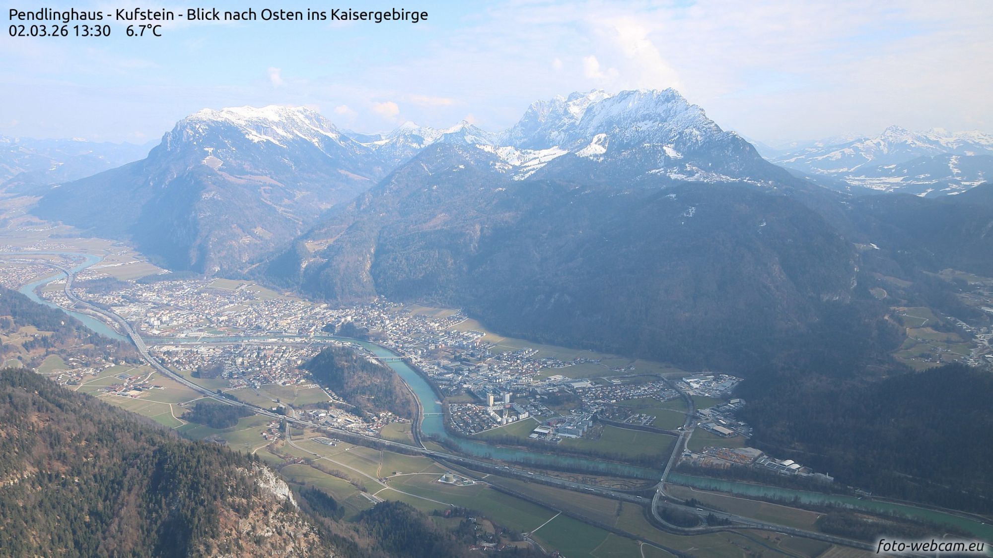
Today the flow is southerly, with convection and some orographic lift in the Southern Alps - a typical spring phenomenon when temperatures rise sharply. Cumulus clouds develop there, along with a few showers, with a snow line around 1600 metres. Above 1800 metres, a few centimetres of snow or graupel may fall locally. In most areas, however, it stays dry. Especially in the inner Alpine regions and along the northern side of the Alps, sunshine dominates. It is mild, with the freezing level around 1800 metres in the Southern Alps, rising to about 2400 metres in the north. Especially in the east, the sun is regularly dimmed by high cloud and Saharan dust.
Little change on Tuesday
Tomorrow will also be mild, with a few showers mainly affecting the eastern half of the Alps and leaving no significant snowfall. There will be sunny breaks as well, and in the western half conditions will be downright sunny in most regions.
Freezing level rises toward 3000 metres on Wednesday and Thursday
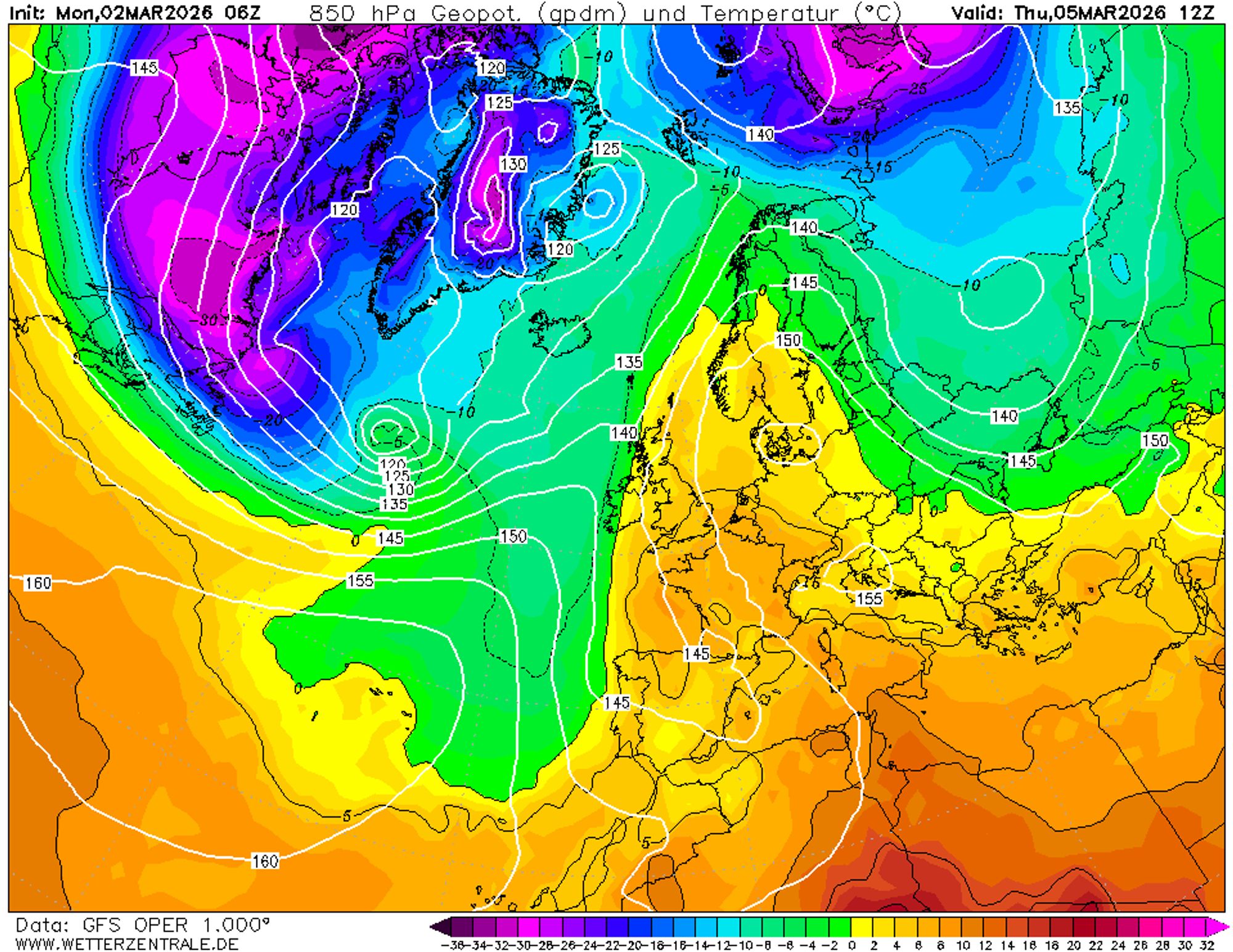
Between a ridge of high pressure over the continent and a weak trough west of France, a southeasterly flow is establishing. A new surge of Mediterranean warmth reaches the Alps. Temperatures at 850 hPa (around 1500 metres) rise to between 5 and 8°C in the coming days. The freezing level climbs to around 3000 metres in the west as early as Wednesday and reaches that level everywhere by Thursday.
Rain and snow for the Pyrenees from Thursday
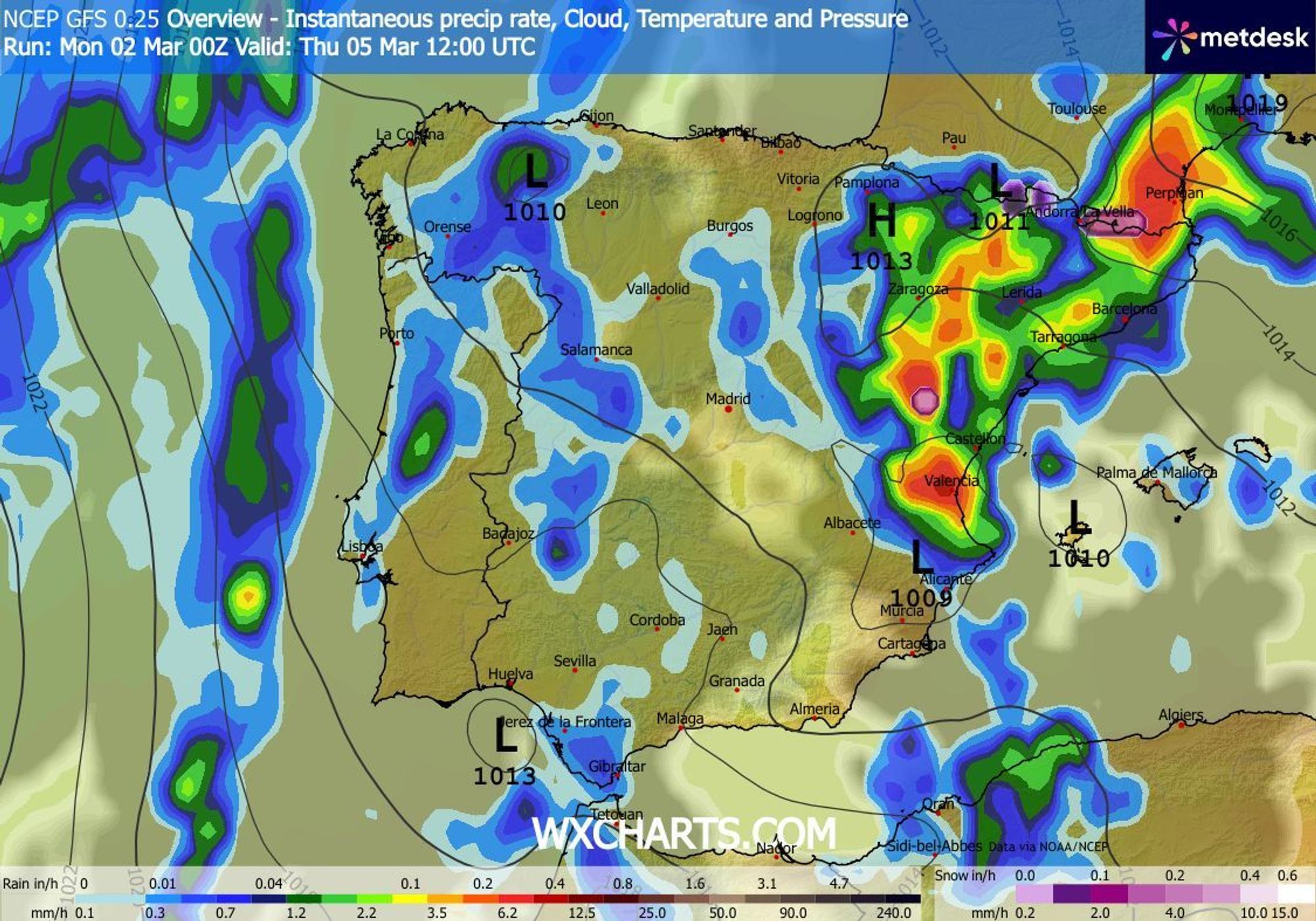
As in the Alps, a few spring showers will develop along the southern slopes of the Pyrenees. From Thursday through Saturday, conditions become markedly more unsettled. A disturbance over Spain causes showery precipitation clashing into the mountains from the south. Most of the precipitation is expected to fall in the eastern half, around the main ridge. This is not all good news: with the snow line very high, the snowpack below 1700-2000 metres will mainly suffer from rain. Only above that level is fresh snow expected, with 20 centimetres well within reach.
Finally some precipitation from Friday onwards?
Over the past few days, several weather models indicated a spell of precipitation for the southwest around midweek. Very little of that remains today, and it now even appears that conditions will stay dry everywhere. For the time being, sunshine dominates, in the Southern and Western Alps occasionally filtered by thin high cloud and/or Saharan dust in the atmosphere.
According to the latest weather charts, precipitation chances only increase from Friday or Saturday onwards, when a low-pressure system settles over Spain. Any precipitation will likely remain limited to the French Alps and Piedmont in Italy. In the mild air, the snow line will again be relatively high, at least above 1500 metres. The outlook for the coming weekend remains quite uncertain. In the Western and Southern Alps, at least take into account more cloud and wind, and follow our updates over the coming days for more details on any potential snowfall.
The ensemble for Grenoble clearly shows increasing precipitation chances from Friday onwards. In Innsbruck, the signal mainly points to a few spring showers next week; the overall pattern remains spring-like.
Polar air not heading for the Alps anytime soon
The ensembles above give an indication of precipitation chances for the Western Alps (Grenoble) and further east (Innsbruck). In the second half (longer term), a few members show colder air with T850 dropping below zero, but these clearly form a minority. Conditions are, however, likely to become gradually less mild.
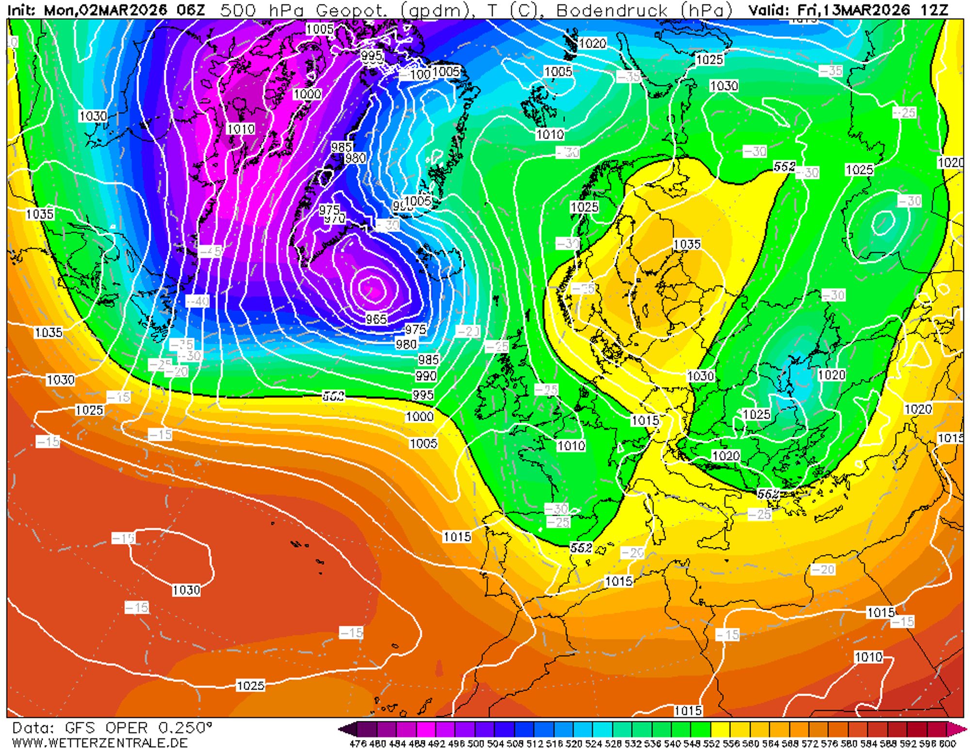
In the most favourable scenario, a depression could move from Ireland towards France, bringing precipitation to the Western Alps, as shown on the GFS chart below. High-pressure systems remain in place over Eastern and Northern Europe, however, keeping precipitation chances in the eastern half very low for the time being, aside from an isolated spring shower.
Reacties
I cannot understand how some people can deny climate change exists
it’s clearly obvious
how does your forecast for prali and others go from 100cm in next 5 days to 1cm. i understand how models work but it seems like you guys may want to consider looking at the outputs. within 5 days should be reasonably solid. outside that, its not…
Looks like mild spring weather dominates for now, with only light showers in the Southern Alps. Fingers crossed for Friday precipitation!