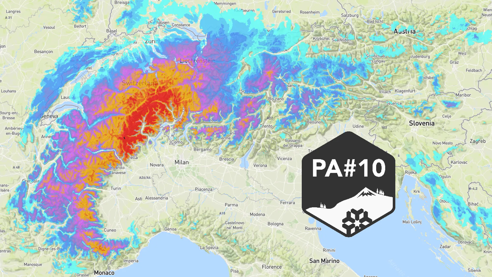
Yesterday it was finally time for Powder Alert 10 of this season. In this update we check the latest output from the weather models. Where will it snow, how much can we expect, and how long can we enjoy fresh powder? Milder air looks set to return fairly quickly.

Focus still on the western half
Henri outlined the synoptic situation yesterday, and by now the weather models are largely in agreement. There are still some minor differences regarding the exact position of the low‑pressure system that is set to develop. The outlook for Sunday and Monday is also not fully settled yet. That is why we start with a model comparison of the total precipitation up to and including Tuesday. The amounts shown on the maps below are in millimetres of precipitation, but from around 1500 metres you can roughly convert these to centimetres of snow.
Regionally more than 1.5 metres possible
All models clearly place the focus of the precipitation in the Swiss-Italian border region, covering Aosta, northern Piedmont and Lombardy, and in Switzerland the cantons of Valais and Ticino. With the exception of UKMO, all models show well over a metre of snow, with peaks of up to 140 cm (UKMO and ECMWF), 170 cm (GFS) and even 190 cm (GEM).
For the French Alps the models indicate 20 to 40 cm, while further south in Piedmont (including the Maritime Alps) 40 to 70 cm is possible. Similar amounts also seem likely in the more northern and eastern parts of Switzerland.
Snow from the west and the south
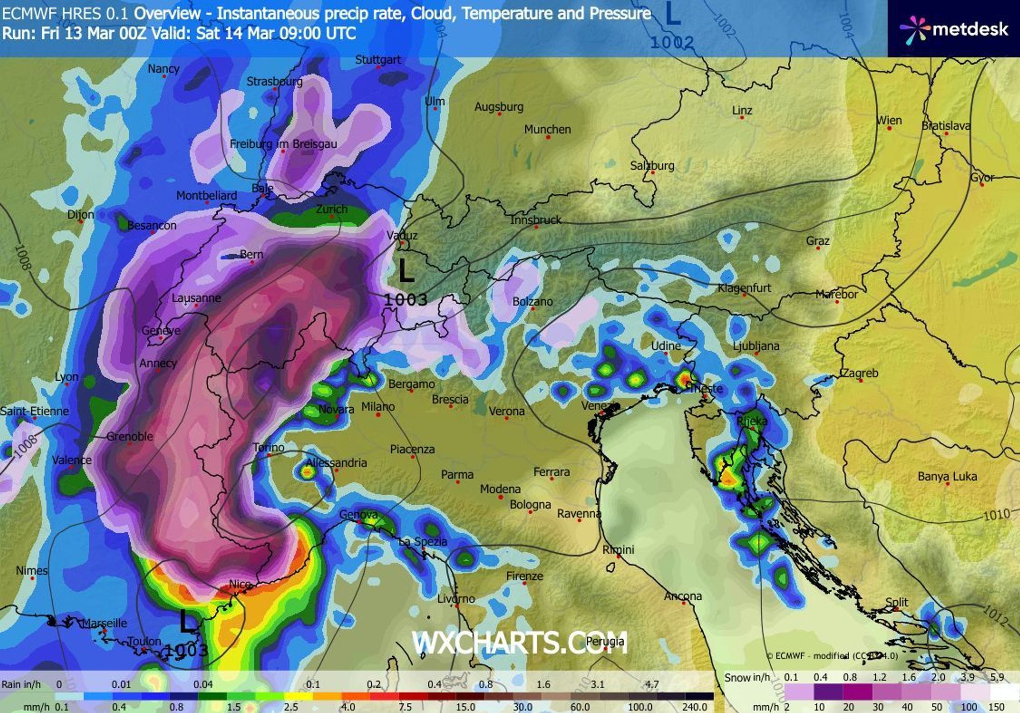
Snowfall in the French Alps will mainly come from the front moving in from the west early on Saturday morning. Snow will fall there for much of the day, but towards the evening the focus clearly shifts to Switzerland and Italy. This is linked to the development of a Genoa low, which causes Südstau and from Saturday afternoon also a retour d’est. An ideal setup for the Italian inner arc and southern Switzerland.
The largest snowfall totals in Switzerland are expected in Andermatt, Rosswald, Bosco Gurin, Saas‑Grund, Zermatt and Saas‑Fee, with more than a metre and locally even well over 1.5 metres of powder. In Italy, similar amounts are likely in San Domenico, Macugnaga, Craveggia, Alpe Devero and Staffal.
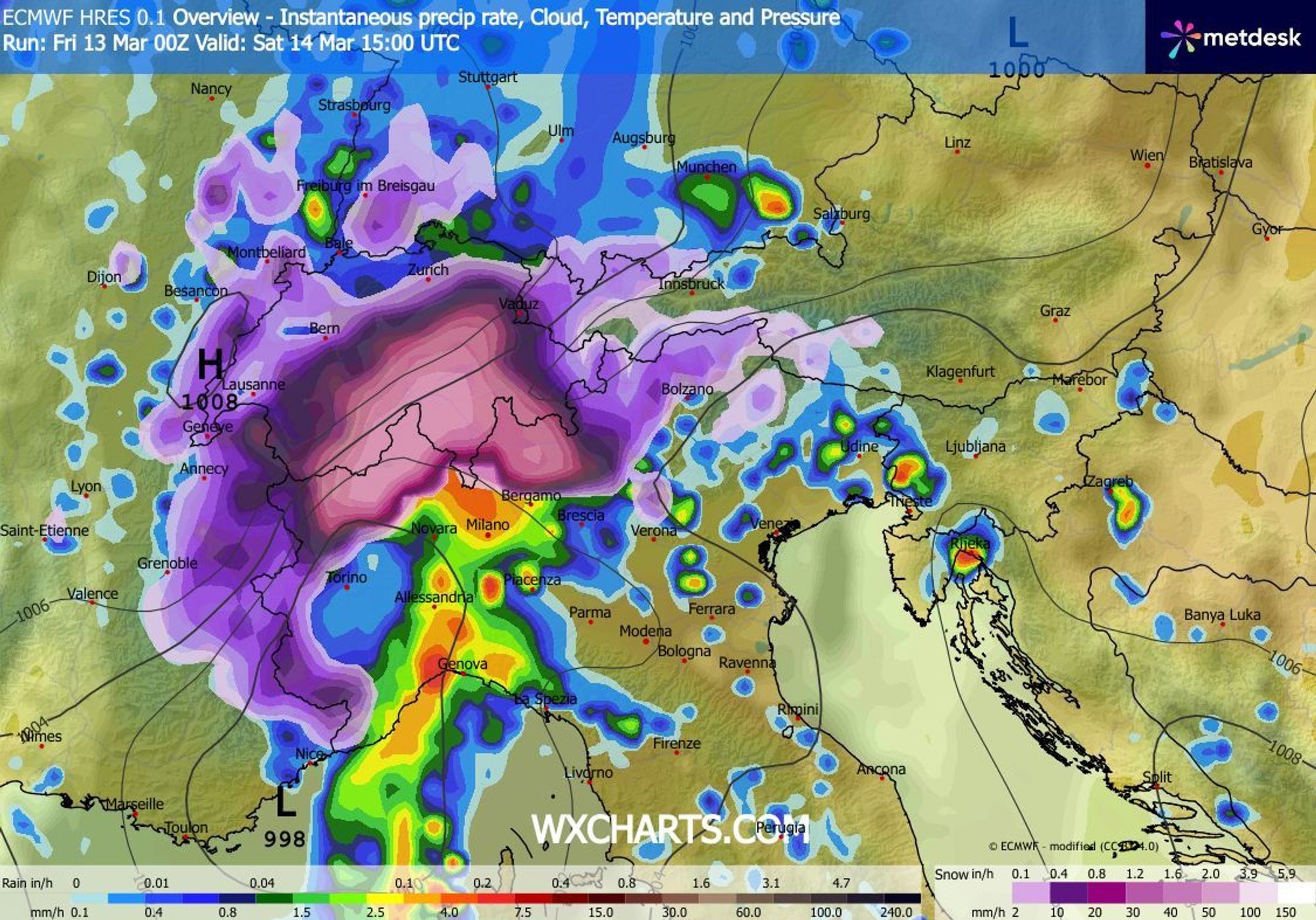
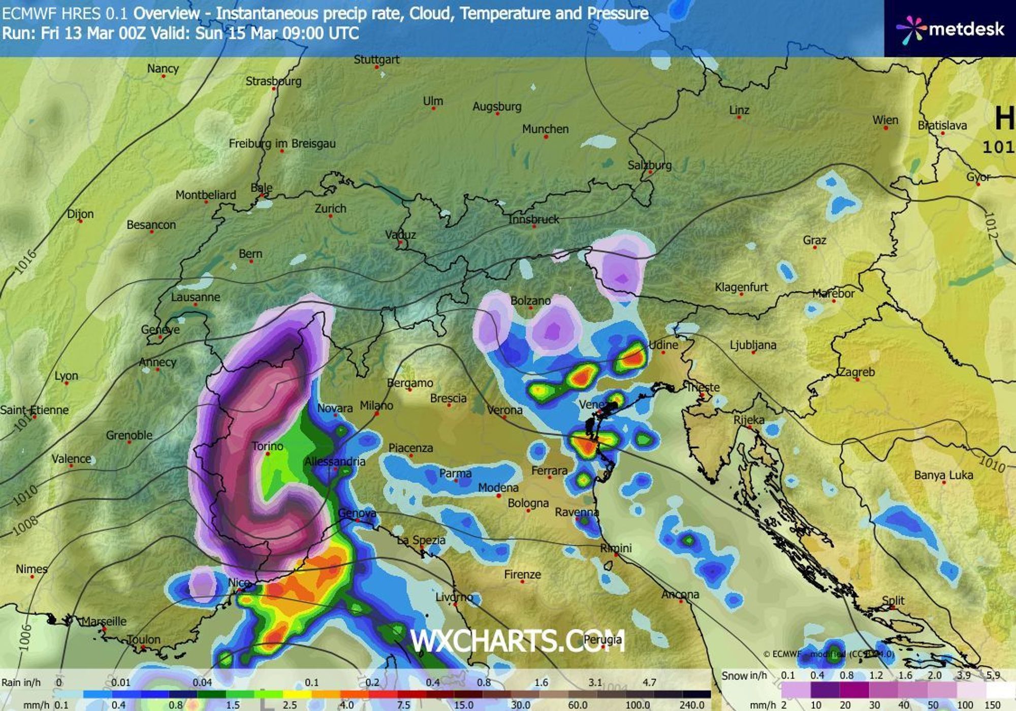
Sunday: lingering retour d’est, elsewhere a few showers
On Sunday morning, snowfall will mainly persist in Aosta, Piedmont and the French areas directly along the Italian border. From Saturday evening through Sunday afternoon, convective precipitation will also affect the eastern parts of the Southern Alps. These showers are partly fuelled by the warm waters of the Adriatic Sea. They will reach the Dolomites, and likely also southern Tyrol and western Carinthia. There you can expect a refresh of 10 to 20 cm, with up to 30 cm possible in the Belluno Dolomites and the Ötztal Alps.
Snowline drops from 1600 to 600 metres
The first flakes will fall between 1300 and 1600 metres, but cooling sets in quickly. By Saturday morning, snow will fall from around 800 metres in France and Switzerland and around 1000 metres in Italy. During periods of intense precipitation, snow may locally reach the lower valleys on as well (around 600 metres).
Watch the snowline drop; forecast for Saturday 06:00, 12:00, 18:00 and Sunday 00:00 (kachelmannwetter.com)
How long will the pow stay good?
On Sunday it will be largely dry in the French Alps, allowing skiers to enjoy the fresh powder. The base is still in good shape almost everywhere above around 1500 metres. The snowfall is not accompanied by much wind, but avalanche danger will undoubtedly rise to Level 3 or 4 due to the fresh snow falling on the existing hard base after three snow‑free weeks. From Monday onwards, conditions also become more stable on the Italian side.
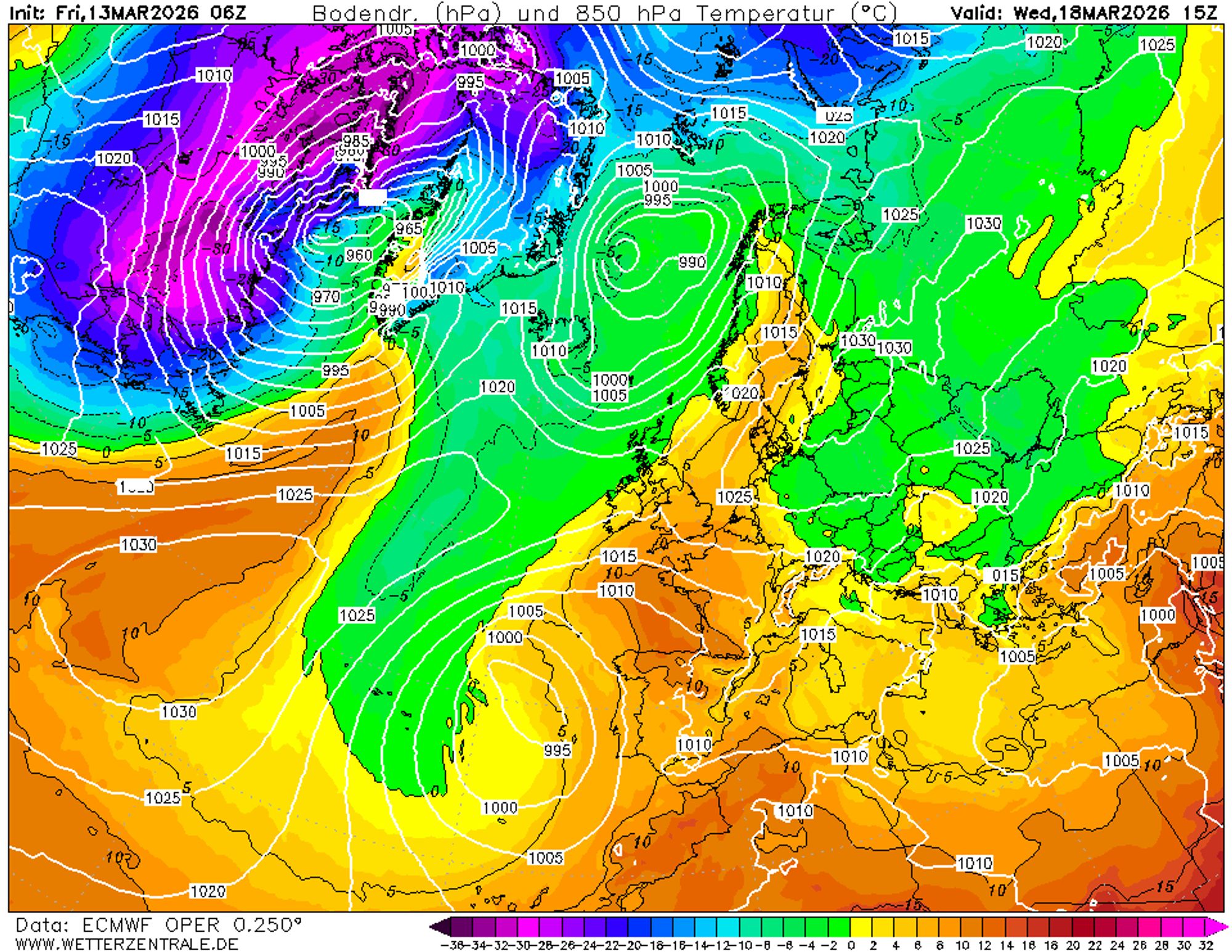
On Monday and Tuesday temperatures will remain fairly moderate, with a freezing level around 1500 metres in Austria, rising to about 2200 metres in the southern French Alps. Powder will mainly be found above these elevations and, as always, will last longest on shaded slopes. From Wednesday onwards, there is a high chance of a warm spell pushing in from the south, with a further rising freezing level.