Not only the Alps are getting a good basis for the season, because in the Pyrenees, a severe cold spell at the weekend will bring a lot of snow to the western regions. Locally, a metre of snow is even possible! Developments in the Alps are also exciting, but since small differences can still have a big effect on the snowfall distribution in the Alps, we’ll have to wait for that.
In this weather report:
- Half a metre of fresh snow for the Eastern Pyrenees
- Major snow dump in the Western Pyrenees this weekend
- The Alps too enter a snowy phase
- Uncertainty in the weather models!
Half a metre of snow in the Eastern Pyrenees
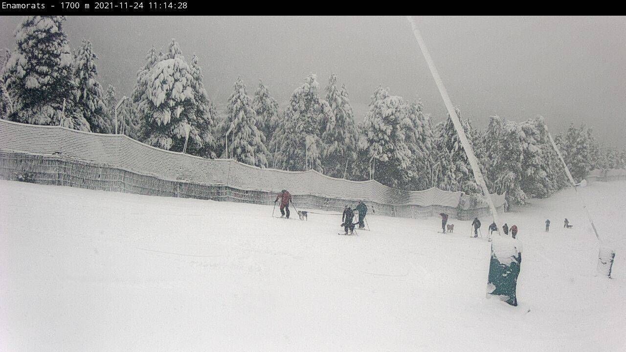
As expected, it is currently snowing well in the eastern Pyrenees under the influence of a small low-pressure area off the east coast of Spain. Leader at this moment is Vall de Boí, with 50 centimetres of fresh snow measured at 2500 metres. The snowline in some places was even well below 1000 metres. Because of the southeastern flow, the areas Vall de Núria and Vallter 2000 also received a lot of snow (about 30 to 50 centimeters is possible here), but also ski areas like La Molina - Masella received a nice layer. The latter therefore opens some ski lifts from this weekend. Also, the first tour skiers are already on their way here. Further to the west, the snow amounts are still limited by this snowfall, but there’s a lot more on the way.
")
")
Another snow dump
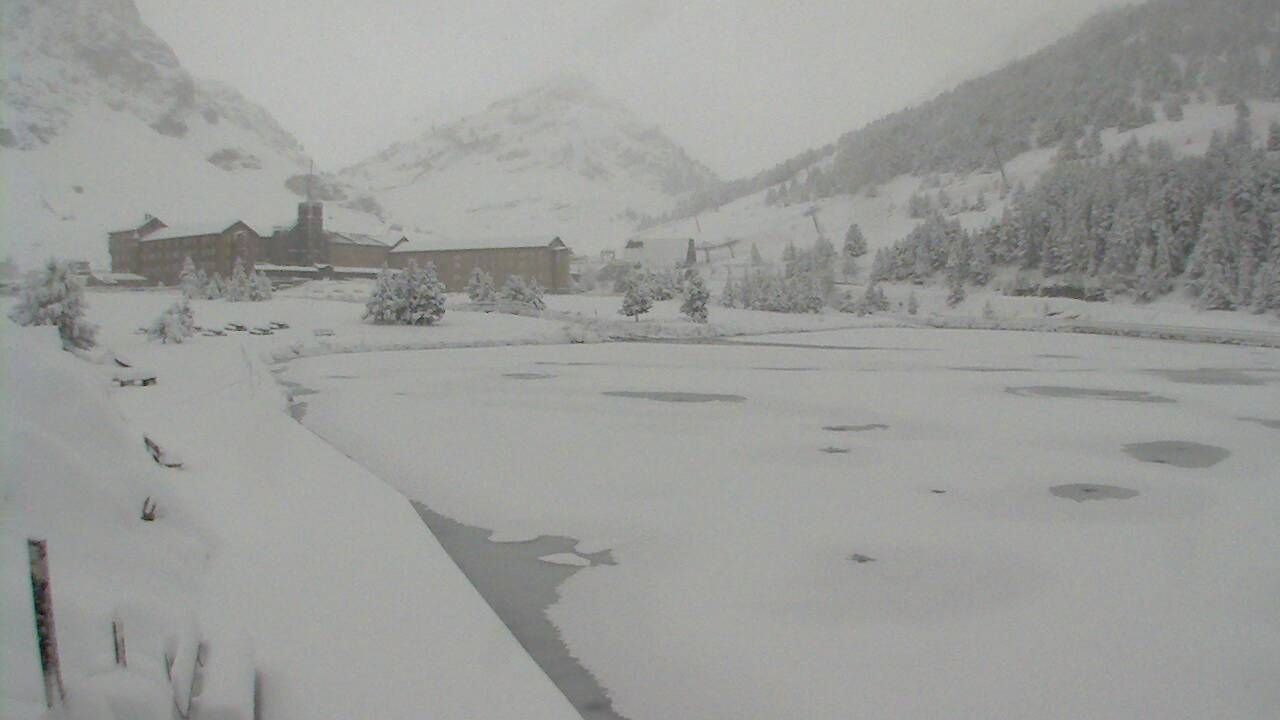
During the weekend, the north-western areas of the Pyrenees will be affected, with up to one metre of snow. An arctic outbreak with a strong flow of cold and humid air mass from the north hits the Pyrenees and will deliver loads of snow especially in the western regions. French areas such as Gourette and Pierre Saint Martin will be well served with at least half a meter of snow, but also the Spanish border areas in Aragon such as Candanchú, Astun and Formigal can look forward to a big dump. Baqueira-Beret will probably also receive around 30 to 40 centimetres until Sunday, which makes the timing of the early season opening this weekend perfect here as well. Although the area with the strongest precipitation with over 200 millimetres (potentially 2 metres of snow!) is more towards the Picos de Europa, the most western areas of the Pyrenees could receive 70 to 100 centimetres of snow. Due to the supply of arctic air, the snow can also fall long into the valleys. All in all, a wonderful winter season start for the Pyrenees!

")
Snow from the southwest in the Alps
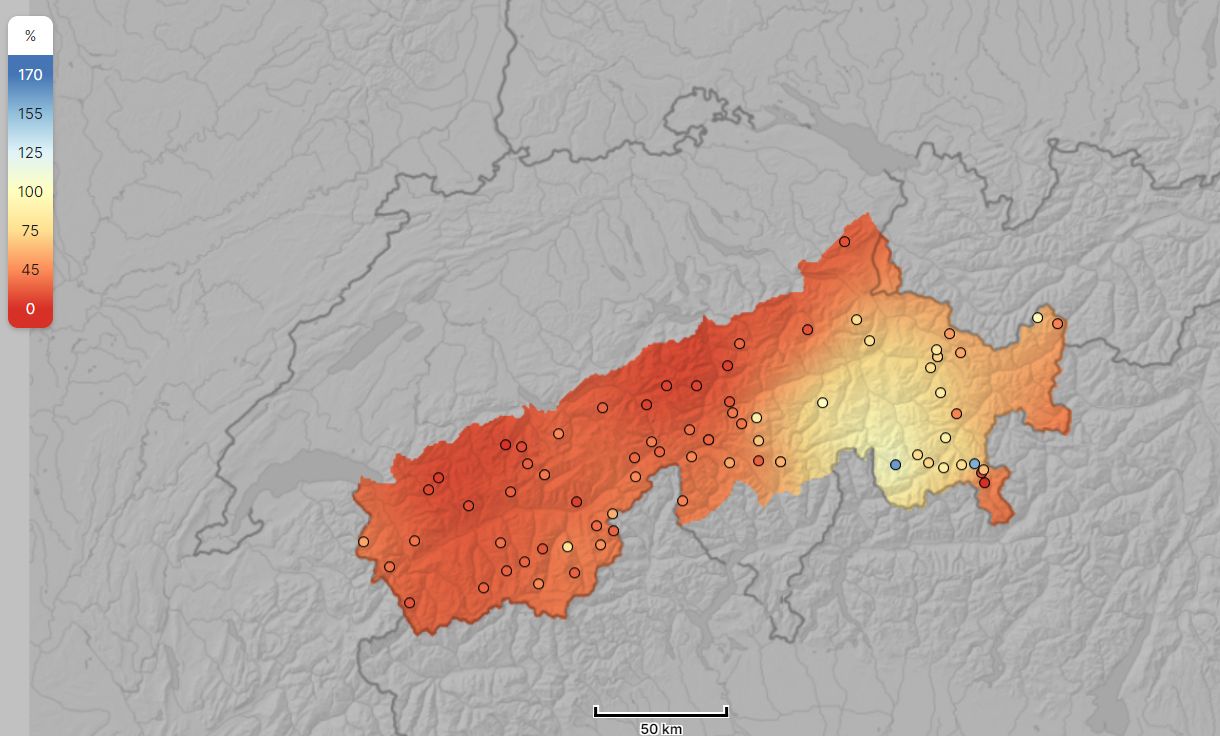
We can also expect a few things for the Alps in the coming period. We are on the eve of a very changeable and also snowy period in the Alps. Snow that is very welcome, as you can see for example in the relative snow levels of Switzerland. The quantities that will fall will initially not be as high as in the Pyrenees.
The first snow will follow tonight in the southwestern Alps. From the southwest, the same low pressure area that caused the snow in the Pyrenees today will also give this region some snow. I’m expecting about 20 centimetres of snow for the Alpes-Maritimes. The precipitation will move away a bit quicker, so it will clear up soon. In the rest of Piemonte, there will be a maximum of 10 centimetres.
In the course of Thursday, the snowfall will spread further eastwards. In the rest of the southern Alps it could snow 5 to 10 centimetres. When cold air arrives from the northwest during Thursday evening and night, the föhn on the north side will end and it will start snowing lightly here as well. On the northern side of the Alps, it will initially stay at around 5 to 10 centimetres of fresh snow until Friday in most valleys.
")

More snow yet to come, but where?
After Friday, things get really interesting and we can expect more snow. These developments are related to the low pressure area that we see here above the North Sea. During the weekend this depression will move southeast over the Netherlands. Until Monday especially the Northern and Western Alps will stay under the influence of this depression and we can expect a nice layer of snow in these regions, but also in the (central and eastern) Southern Alps we can expect snow. For the time being, the main area of the precipitation seems to lie above the Northwest Alps, but the differences between the models as well as the individual model runs are still very big! It’s possible that next week will also be characterised by successive precipitation from the northwest, but with the uncertain developments over the weekend I find it still too tricky to look that far ahead.