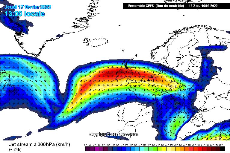
A large part of Europe is under the spell of the strong jet stream, which is sending one storm after another from west to east. These storms will have a major impact on the weather in the Alps in the coming days with rain, snow and very strong winds. As a result, many lifts on the northern side of the Alps will be closed and the avalanche risk will persist due to Triebschnee, among other things.
Rain & snow in the Northwest Alps
A strong low pressure system over the northern part of the Atlantic Ocean is determining the weather in Europe at the moment. A warm front caused quite some precipitation yesterday in the north-western Alps with a snowline reaching 2000 metres. Many villages and the lower areas received 10 to 30 millimetres of rain and locally even more.
Wet snow avalanches
On the webcams you can see the impact of this rainfall. Yesterday morning the village of Schröcken at an altitude of 1200 metres still looked quite wintery with a fresh layer of snow, but due to the rain that wintery setting has now disappeared. Also note the wet snow avalanches (top right) due to rising temperatures and moisture input from the rain. In the coming days, we will also have to deal with the risk of these wet snow avalanches on all slopes below 2000 metres.
These wet snow avalanches are not the only problem, because with wind speeds of up to more than 150 kilometres per hour in the mountains on the northern side of the Alps and inneralpine regions plus the recent snowfall above 2000 metres, we also have to be very careful in high Alpine terrain. These conditions create wind slabs that can easily be triggered! Keep an eye on the avalanche reports!
Storm
The driving force behind these turbulent days is the jet stream which lies just north of the Alps and fires one depression after another at Europe. Today, the Northern Alps (especially the areas along the northern edge) still have to deal with rain and snow showers with a very high snow line. Further inland you’ll find sunnier weather. Temperatures have risen to over 15 degrees by the strong westerly flow and the accompanying Westföhn, with local temperatures in the Eastern Alps even exceeding 20 degrees.
Very warm
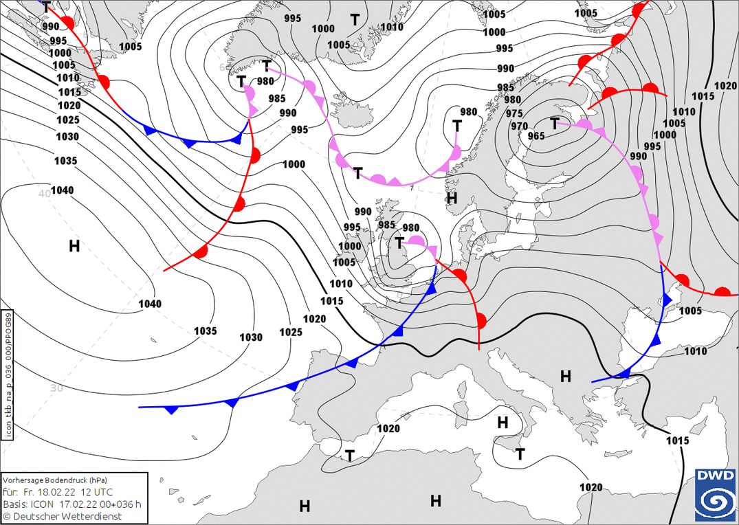
Tomorrow the Alps will be influenced by a new strong low pressure system with the core over Great Britain. The Alps will be in the warm sector with temperatures up to 8 to 10 degrees at 1500 metres and a freezing point above 2500 metres. Winds will still be strong along the northern side of the Alps, but the inneralpine areas and the southern Alps will be a bit more sheltered.

")
Cold front tomorrow evening
Tomorrow night we will see an approaching cold front from the northwest. The wind will pick up again and we can expect some 10 to 20 centimetres of fresh snow in the north-western Alps with a snowline dropping from 2000 to 1200 metres. After some residual precipitation in the morning, the northern Alps will see a rather quiet Saturday. Only the southeastern Alps will get snow all day.
On Sunday, a new depression will again bring some snow and especially in the morning a strong westerly flow in the Northern Alps. However, it will remain a few centimetres of snow above 1200 metres. In the course of the afternoon it might clear up a bit, but again we won’t have to wait long for new snowfall.
A lot of snow for the Northwest Alps
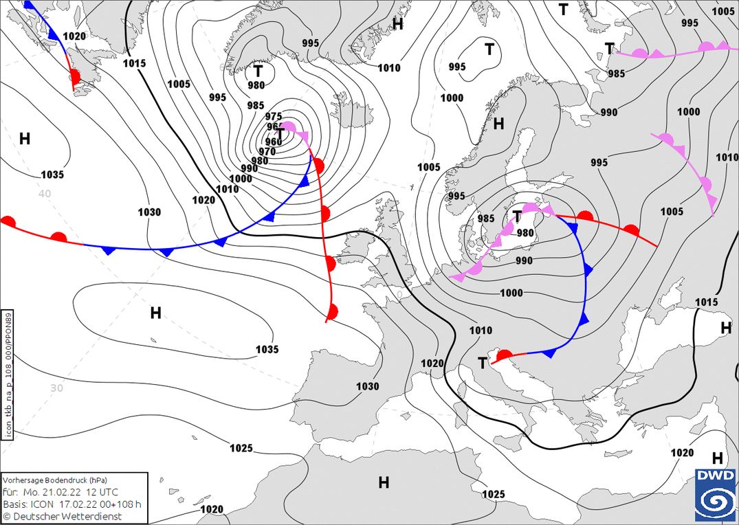
In the night from Sunday to Monday, a new cold front with a lot of precipitation will follow. The flow is turning more and more to the northwest, which means we’ll also see a rapidly falling snow line that may eventually drop below 1000 metres, but probably not into the lowest valleys. Especially the north-western Alps will get a substantial amount of snow with possibly half a meter until Tuesday. More information about this snowfall (PA#6) will follow during the weekend.