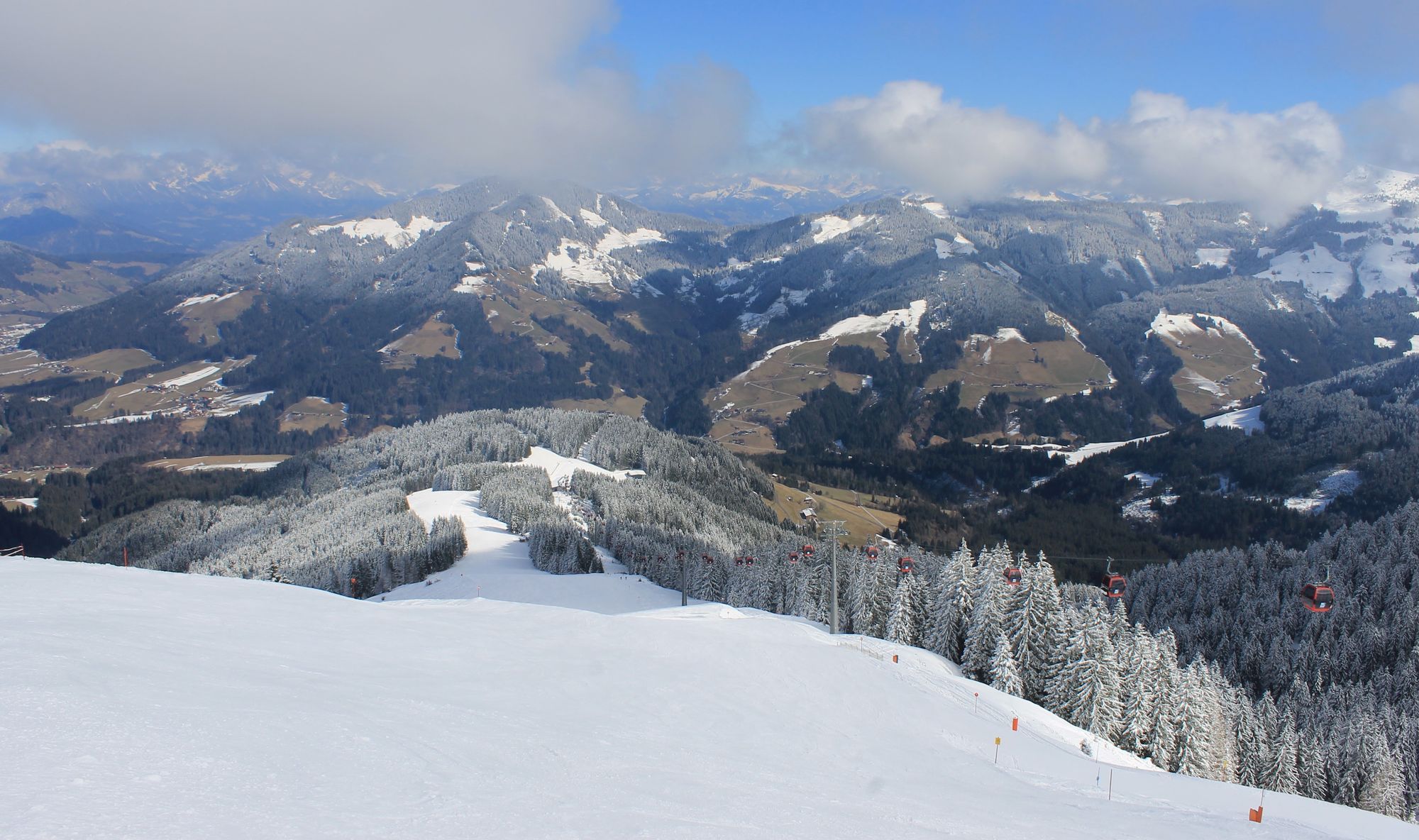
Determining the snow level can cause meteorologists headaches from time to time, but the uncertainty can also occasionally cause a positive surprise where the snow level is significantly lower than expected beforehand. It’s high time to dig a little deeper into the subject. In this article, I try to answer the following questions about the snow level:
- What is the snow level?
- Is the snow level equal to the freezing level?
- Why is the snow level not the same everywhere?
- What is atmospheric cooling by melting?
- Which methods are available to determine the snow level?
Snow level and freezing level
Before I delve deeper into how to determine the snow level, let me briefly explain exactly what the snow level is. This is because the snow level is not the same as the zero degree isotherm (freezing level). In fact, it can often still snow below the freezing level and thus with positive air temperatures. The freezing level is the height at which the temperature is exactly 0 degrees. The snow level is the height above which precipitation falls in snow form (to be precise, the ratio is 50% rain and 50% snow). If the intensity of the snowfall is high enough, snow may settle despite positive temperatures. In our weather reports, we use either the term snow line or snow level.
Of course, you can make estimates based on the freezing level or temperature measurements, as the snow level is strongly related to the temperature of the air mass, but there are many other processes that can have an impact on the final snow line. Much better is to know the temperature structure and humidity of the entire air column.
There is no general snow level for the whole Alps in a weather situation. This often causes me to talk about a range (e.g. a snow level between 1500 and 1800 metres) in my weather reports. The snow level during a snowfall event is rarely constant. It often drops with the arrival of an approaching cold front, or rises when milder air moves in during the snowfall.
From snow to rain
Higher up, all precipitation falls as snow. During the descent, the snowflake may fall below the freezing level. Depending on the humidity, it takes a while for a snowflake to melt. Especially if the air in which the snowflake falls is reasonably dry, sublimation (from solid to gas) can cause the snowflake to cool, as energy is extracted for this purpose. If dropped further into an environment with positive temperatures, the snowflake may still melt afterwards. If the air is more humid, the snowflake will melt faster and thus also become a raindrop faster. The snow line is then higher.
Cooling due to melting
Sometimes the snow level can even vary considerably from one valley to another. One process that causes this is atmospheric cooling due to melting. The cooling often occurs when a warm front passes. The incoming warm air slides over the cold air. Especially in the inner-alpine and narrow valleys, the shallow cold surface layer can maintain itself better and longer because the warmer air sometimes struggles to reach all the valleys. The narrow valleys in particular often have a greater cooling effect because there is simply less volume to cool down. As a result, the snow line can be surprisingly low. In addition, high variability is possible, with differences a few kilometres away or even within a single valley.
For this cooling you need two key ingredients: strong precipitation and a weak wind. A strong wind is often the killer for this cooling by melting. It will mix the different air layers better and will cause a rising snow level. Moderate to intense precipitation is needed to extract more heat from the air through the melting process of snowflakes.
Atmospheric cooling by melting thus takes place during substantial precipitation amounts (at least 2 mm/h), which often makes the air very humid. This is because the melting process also requires energy. Energy that is extracted from the surrounding air in the form of heat. Cooling by melting allows the temperature in the entire air column to drop to 0 degrees (term: isothermal). The air cools, which can also cause the snow level to drop along with it.
Weather models struggle with this complex process, which can sometimes make for a surprisingly low snow level. It is quite possible that the snow level could end up more than 500 or even 1,000 metres lower than previously expected without the process of atmospheric cooling by melting. However, snow falling over many hundreds of altitude metres will be very wet due to temperatures close to freezing. For real powder snow, we still have to look for spots higher up the mountain.
Methods to determine the snow level
Now I want to go into a little more depth for those who are interested and want to get started determining the snow level themselves. We cannot always rely solely on temperature to determine the snow level, but how can we still often know reasonably well from which altitude it will snow? For that, we have some methods that can help us.
- Wet-bulb temperature
- Theta-e temperature
- Relative topography
Wet-bulb temperature
Numerical weather models often use the wet-bulb temperature of 1 degree Celsius as the snow level. This is the temperature measured with a thermometer with a wet cloth attached. Due to evaporation, the wet bulb temperature is lower than the normal temperature. How much lower depends on the humidity.
Theta-e method
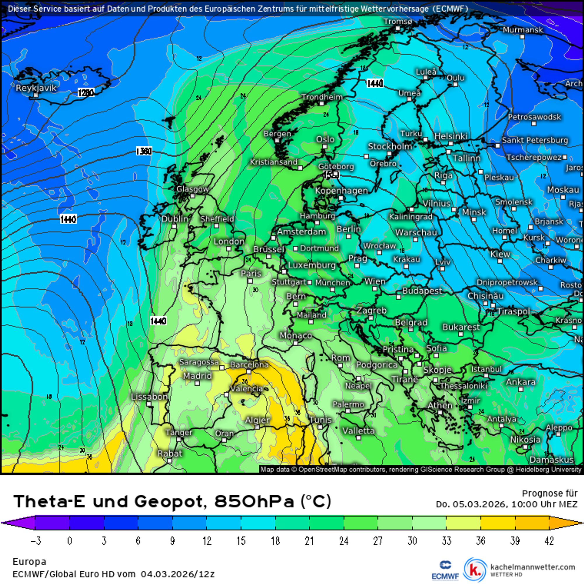
Another method is using the theta-e temperature. Theta-e stands for equivalent potential temperature. I don’t want to go into too much detail on this, as it requires another detailed explanation of potential temperature, but the theta-e also takes into account both the temperature and humidity of an air parcel. To determine the snow level using the theta-e, there is a formula resulting in a snow level at sea level for a theta-e at the 850 hPa plane (about 1500 metres altitude) of 12°C. For every 12°C you add 1000 altitude metres. So with a theta-e of 30°C, we will see a snow level of around 1500 metres. The calculation you can use based on the charts is: (Theta-e – 12) / 0.012. However, you need to take the model topography into account, which means these charts cannot always be interpreted literally by non-experts. In addition, this rule of thumb remains an approximation and cannot be applied directly to every weather situation.
Relative topography method
In addition, the method of layer thicknesses between pressure surfaces, also known as relative topography, is used to determine the snow level. It may sound a bit complicated, but relative topography represents the thickness of a given layer of air and is thus a measure of the average temperature in this column of air. Layer thicknesses are often used to determine the type of precipitation that falls because it is easier to predict the thickness of a given layer of air than the temperature at a given altitude. A typical layer thickness used to determine precipitation type is 500-1000 hPa.
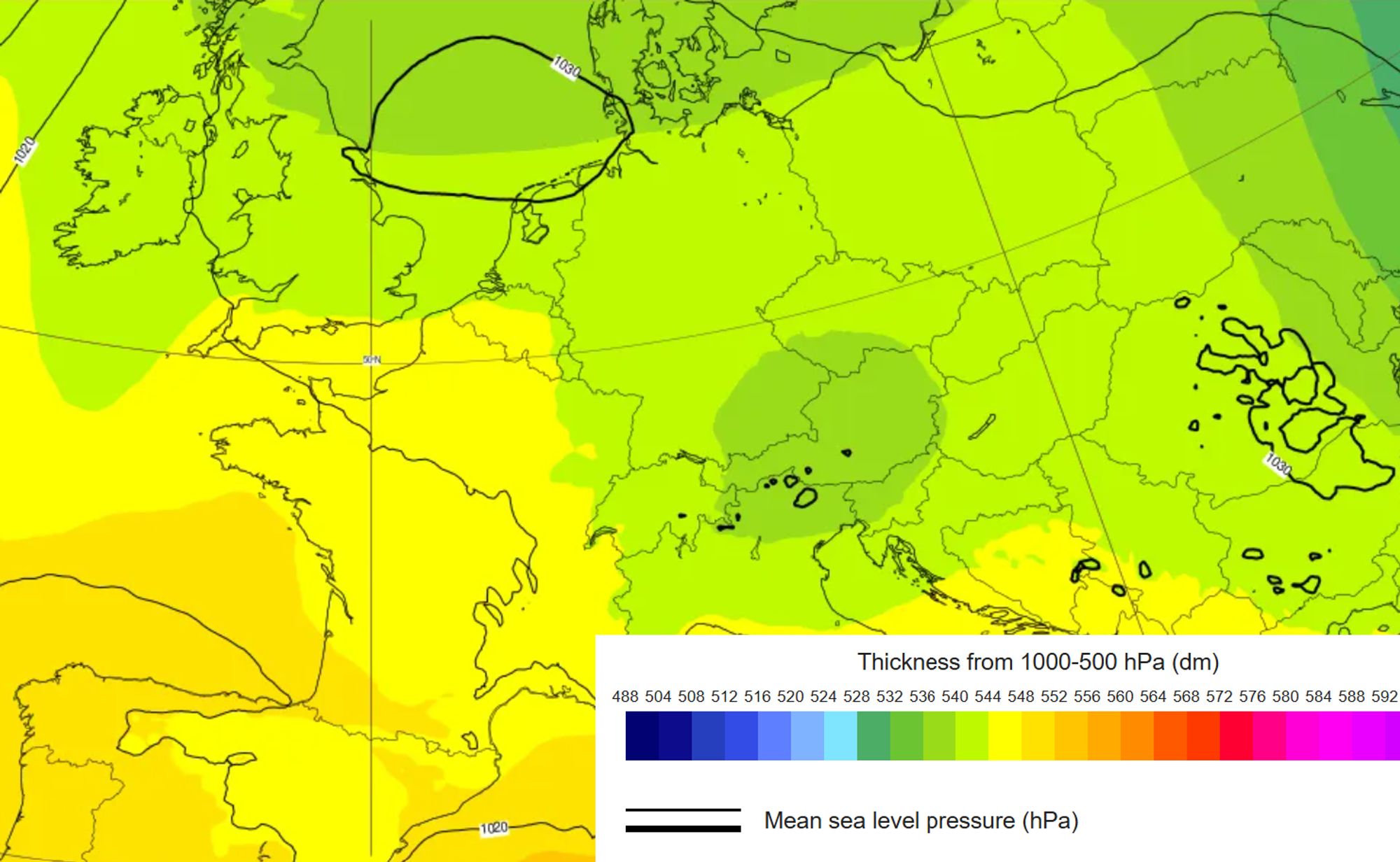
Areas with relatively low thicknesses are associated with a relatively low average air temperature in the layer in question. If the layer is thicker, we are dealing with a relatively higher average temperature in that layer. The measure of layer thickness is given in so-called geopotential decameters (gpdm). 524 gpdm gives a snow level at sea level. For every 12 gpdm more, we need to add 1000 metres to arrive at the snow level.
Due to the assumption of a so-called moist-adiabatic atmosphere in this layer, weather situations such as an inversion (where we cannot accept this assumption) can lead to large differences between the expected and actual snow level. So it’s important to realize that such methods cannot always be applied. Finally, I should also point out that these methods can often only be used with regional models that have a high enough resolution and thus also reflect the topography of the Alps reasonably well. From coarser models the model topography is insufficient and you can only get information about the snow level in the Alpine foreland. So be cautious when working with the charts yourself, and don’t jump to conclusions too quickly.
Want to read more background articles about the weather?
- What is a nordstau?
- What is a südstau?
- What is föhn?
- What is the jet stream?
- What are high- and low-pressure systems?
- What is an ensemble forecast?
Sources:
- Pehsl, C. (2010). Modifikation der Schneefallgrenze in komplexer Topographie. Diplomarbeit Universität Wien.
- Rohregger, J.B. (2008). Methoden zur Bestimmung der Schneefallgrenze, Diplomarbeit Universität Wien
- Meteoschweiz
- Geosphere Austria