Föhn is an incredibly interesting weather phenomenon but also a notorious spoilsport for freeriders. This downward wind causes temperatures to rise to almost summer values even in midwinter, and can also create a storm that triggers a critical avalanche situation. All in all, föhn is an important topic to take a closer look at. Prepare yourself for a föhn storm of information, because in this article I will try to answer the following questions:
- What exactly is föhn?
- How is föhn created?
- How do you recognise föhn (on weather maps)?
- Where is föhn a problem and what can be the consequences?
Downslope windstorm
Föhn is the name of a downslope windstorm that can regularly cause problems in the Alps. The powerful wind with often very heavy gusts accelerates down the leeward side of a mountain. Such downward windstorms can be found in all mountain ranges. There is the Bora in the Balkans (Dinaric Alps), the Chinook in the Rockies and the well-known föhn in the Alps. Although they all look alike, they are not all identical. This article focuses on the classic föhn in the Alps.
How is föhn created?
Why is it that the air on the leeward side can accelerate and warm up so much compared to the windward side? Usually, the process of föhn is described with the so-called thermodynamic föhn theory. It is a widely used, but simplified, explanation of the process of a foehn wind. In order to prevent the entire text from becoming as dry as the föhn itself, I will go into a little more depth at the end of the article to describe the entire process of föhn for those who are interested. For now we stick to the simpler explanation.
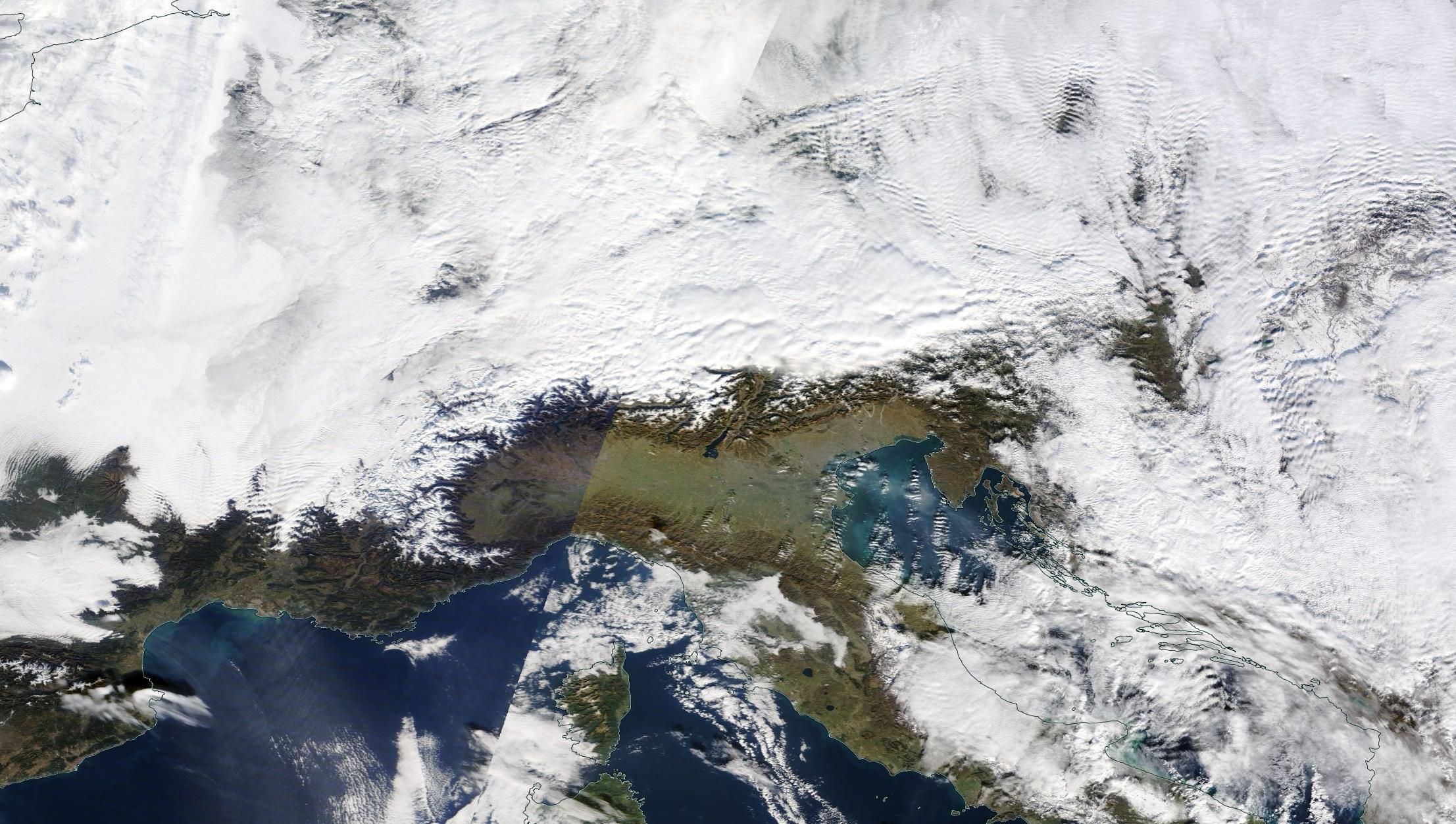
Let’s suppose we have a southern flow with moist air masses transported from the Mediterranean Sea to the Southern Alps. This air hits the Alps and is forced to rise. As it rises, the air expands and cools. If the air can cool down sufficiently, condensation (and thus cloud formation) occurs. Eventually, precipitation will be produced and there might even be a Südstau (or, the other way around, a Nordstau in the Northern Alps). The condensation process releases heat, which can cool the air by up to 0.6 degrees per 100 metres altitude in these saturated conditions. The precipitation removes moisture from the air. Once we reach the main ridge of the Alps, the air is drier and the descent can begin. The drier air can warm up much faster (1 degree per 100 metres), which explains the temperature difference between the north and south sides.

How do you recognise föhn?
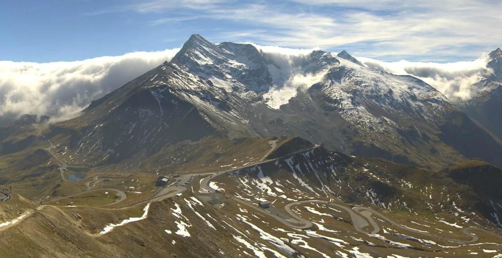
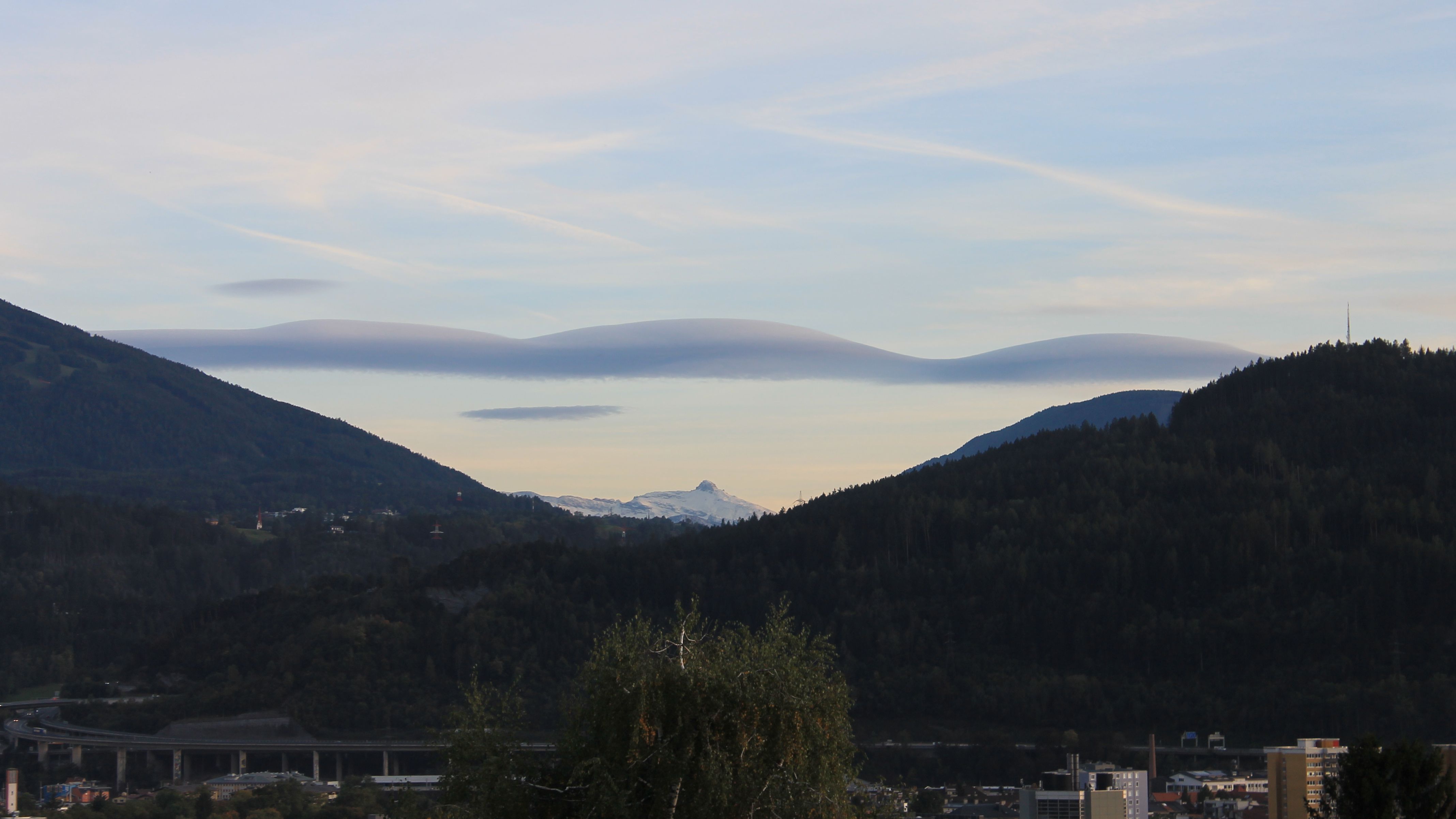
A föhn storm is often accompanied by spectacular clouds called Altocumulus Lenticularis. The lens-shaped clouds seem to hang still in one place, while the wind speeds around and in the clouds can be very high. Before the föhn breaks through at lower altitudes, you can often already recognise these föhn clouds because the föhn has already broken through at high altitudes.
Another feature to recognise föhn is a föhn wall near the alpine main ridge. The clouds in most cases do not come much further than this border because the descending air quickly causes the clouds to dissolve. This is why you can see an impressive wall of clouds.
Detecting föhn in the weather charts
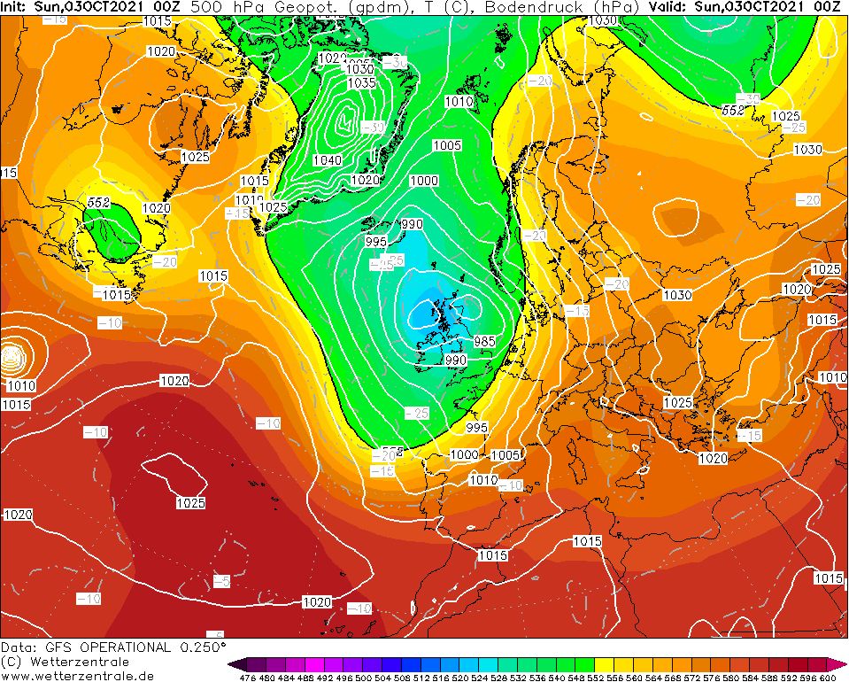
How can you detect föhn on the weather charts? Important factors to keep an eye on are the locations of the high and low pressure systems, the pressure difference between the Northern and Southern Alps and the temperature differences in the higher air layers. An ideal setting for a powerful Südföhn is created when a low pressure system approaches from the (south)west and is (depending on its strength) located approximately above the British Isles. This can create a pressure gradient over the Alps, which in this case means that you have high pressure over the Southern Alps and low pressure over the Northern Alps. Usually, a few hectopascal pressure difference can be enough to initiate föhn, but in order to feel the stormy wind down into the valleys, the rule of thumb is that the pressure difference should be at least 4 to 6 hPa. An ideal case for Nordföhn is when a depression is located east of the Alps. On the western flank of this depression, cold air from the north is brought to the Alps, which then roars down on the south side.
Consequences of föhn
The air dries up considerably during föhn, which can cause temperatures to shoot up. Dramatic temperature rises can occur within a few tens of minutes with föhn. In an extreme situation where cold air of polar origin is cleared, the foehn can cause a temperature jump of 20 degrees. These large temperature differences are more common with Südföhn than Nordföhn, because the source area of the latter is much colder.
At the same time, wind gusts of 140 kilometres per hour are easily recorded on exposed mountains and in föhn valleys. The föhn storm can also melt a fresh snow cover without a problem. When the föhn continues during the night, the temperature (even in clear air) can remain fairly constant. In Vorarlberg, during a strong föhn storm in early October, a tropical night was measured in October for the first time in the whole of Austria. The temperature stayed above 20 degrees the whole night.
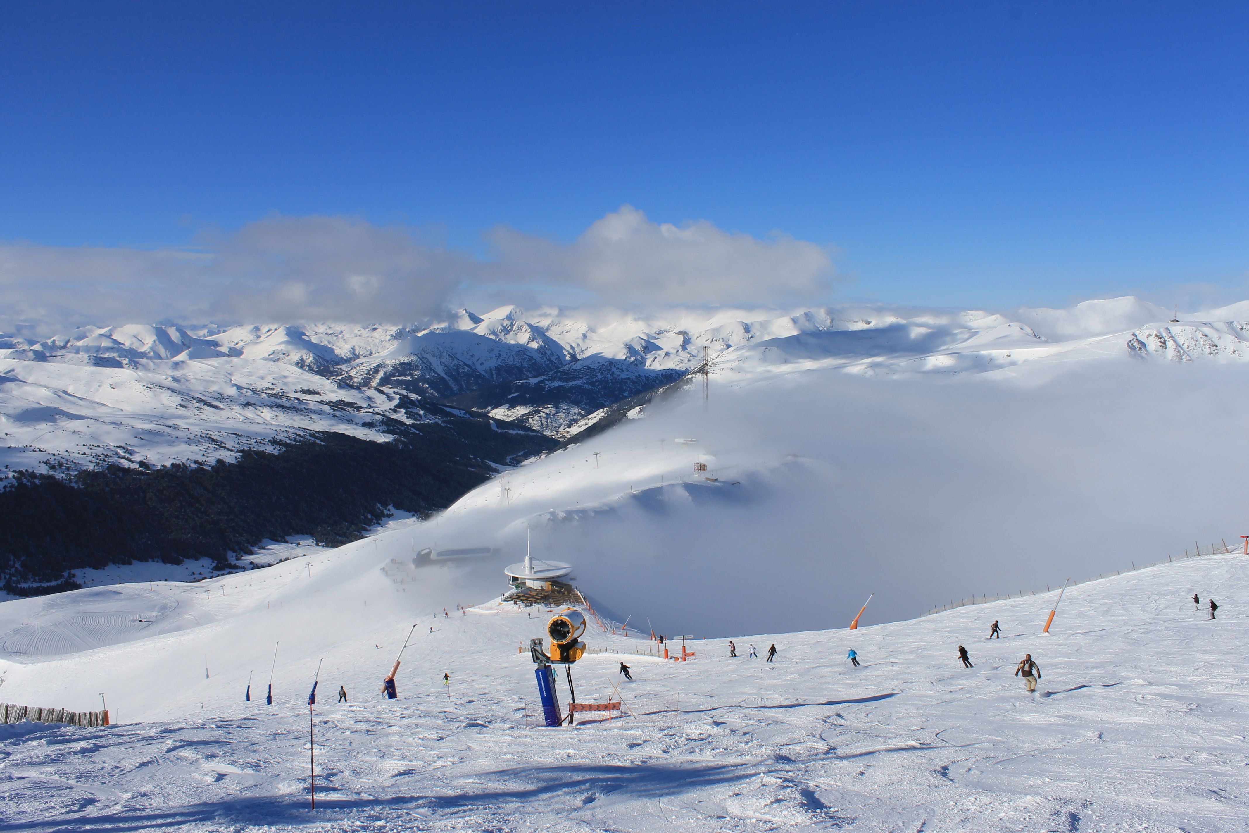
Of course, there is also an increased avalanche risk with föhn. Not only do you have to deal with a sudden rise in temperature that potentially keeps frost out even at higher altitudes, but also with avalanche problems due to the strong winds (triebschnee).
Where and when is föhn a problem?
Not every area and valley is equally sensitive to föhn. It is mainly the north-south oriented valleys that are hit hardest. A few examples in Switzerland are the Rhine Valley, Glarus, Uri and the Haslital. In Austria, for example the Wipptal (Brenner), Gasteinertal and Brandnertal are all guaranteed to have to deal with stormy winds when a Südföhn prevails. In the Southern Alps, you notice Nordföhn as a rule also the best in the valleys located more or less perpendicular to the main alpine ridge. Ticino, Valle Ossola, Aosta are some examples that can be hit hard. Further to the east, you can find föhn in for example parts of Vinschgau and the Eisacktal.
Areas that are less affected by the foehn are usually located in a valley parallel to the alpine main ridge. As a perfect example, Kühtai near Innsbruck is often still open during a Südföhn period while the surrounding ski areas all have to close down. If the föhn is particularly strong, it is of course possible that the lifts will close here as well. The impact can also be felt on a larger scale during strong föhn storms. For example, a strong Südföhn can reach far into Germany.
Nordföhn is most common in spring, when we often have to deal with northern currents in the Alps. In principle, Südföhn can occur throughout the year, although it is more unlikely in summer. October is considered a typical föhn month, but also in the winter months the Northern Alps regularly have föhn.
Four processes
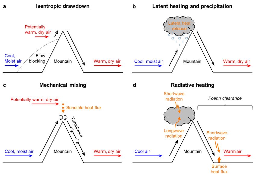
Finally, we will go into a little more detail. The thermodynamic föhn theory with precipitation as the only explanation seems to describe everything, yet it often happens that föhn occurs on one side of the Alps while there is no precipitation on the other side. This means, therefore, that this explanation is incomplete and other processes are at play. Nor can this theory fully explain the extreme warming on the leeward side of the mountain. In reality, there are no less than four mechanisms at play. The contribution of an individual process strongly depends on the weather situation, but it appears that the above process is not even the most dominant one. The four processes are:
- Latent heat and precipitation
- Mechanical mixing
- Solar irradiation
- Isentropic drawdown
The first one I have described above. In addition, you have two fairly simple concepts: mechanical mixing and the input of solar radiation. The effect of mechanical mixing during föhn can be compared to a fast-flowing river: turbulence arises which causes the upper layer to mix with the air above it. This is also the case with föhn when dry air from above the ‘föhn river’ is mixed, allowing the föhn to heat up even more. The input of solar radiation speaks for itself. Föhn ensures most of the times that on the leeward side of the mountain the clouds can clear and the sun can shine, causing the surface to warm further through the extra energy input.
Isentropic drawdown
Then we need to talk about the last process - Isentropic drawdown. This is the most dominant factor in föhn and probably needs a little more explanation. In this process, the air mass comes down from higher layers. The air from this height is drier and has a higher potential temperature, which means that when this air mass is brought down, the temperature can increase more due to the warming. As you can see in the illustration, this process goes hand in hand with the blocking of the flow on the windward side of the mountain range. Only the air from higher altitudes can flow down the leeward side, resulting in strong warming. With strong föhn, it is possible for the origin of an air parcel in the valley on the northern side of the Alps to be approximately 2000 metres higher above the Southern Alps and the Po valley.
Read also
References:
- Richner H., Hächler P. (2013) Understanding and Forecasting Alpine Foehn. In: Chow F., De Wekker S., Snyder B. (eds) Mountain Weather Research and Forecasting. Springer Atmospheric Sciences. Springer, Dordrecht.
- Elvidge, A.D., Renfrew, I.A. (2016). The Causes of Foehn Warming in the Lee of Mountains. Bulletin of the American Meteorological Society, vol 97, issue 3, p455-p466.
Replies
Thanks for the well documented article. At some point, maths and physics do play a role!
Föhn = 1/2 Alps cheering + 1/2 Alps crying…
trying to get my head around this fascinating article, can you explain this “As it rises, the air expands and cools.” … I thought, as air mass rose, it cooled, and condensed, rather than expanding ? Hot things expand, cold things condense right? But I guess my understanding is about to be undone :)
Good question @@rich_a_potter!
It is all about the so-called adiabatic expansion. Since air pressure decreases with altitude, a rising air parcel (in this case due to the orography) is able to expand. With this expanding process the parcel will cool (the internal energy decreases). As long as there is no condensation taking place, this dry-adiabatic lapse rate, the rate of cooling, is 1 degree/100m. When the parcel has cooled down so much it reached saturation, condensation is taking place. The process of condensation releases heat, so with further lifting the parcel cannot cool down with 1 degree/100m anymore, but with 0.6 degrees/100m.
Brilliant @@Henri thank you :)