Every winter, we eagerly wait for the word Nordstau to appear in the weather reports. For many, the term Nordstau is of course familiar, but we always receive a lot of questions. In this article, I try to answer the following questions about a Nordstau:
- How does a Nordstau situation evolve?
- Is every Nordstau the same?
- What does a Nordstau mean for the weather in the rest of the Alps?
- How can you recognise a Nordstau on the weather charts?
The Alps as a barrier
^The jet stream:
The jet stream is decisive for the winter weather in the Alps. All information on this subject will follow in a subsequent article.
The weather at our latitude is strongly influenced by the jet stream. This strong wind blows high up in the troposphere at around 10 kilometres. The position of this jet stream determines the path of the depressions and thus where it can snow in winter. A Nordstau generally requires a meandering jet stream that has a more meridional (north-south) pattern instead of the usual zonal (west-east) pattern.
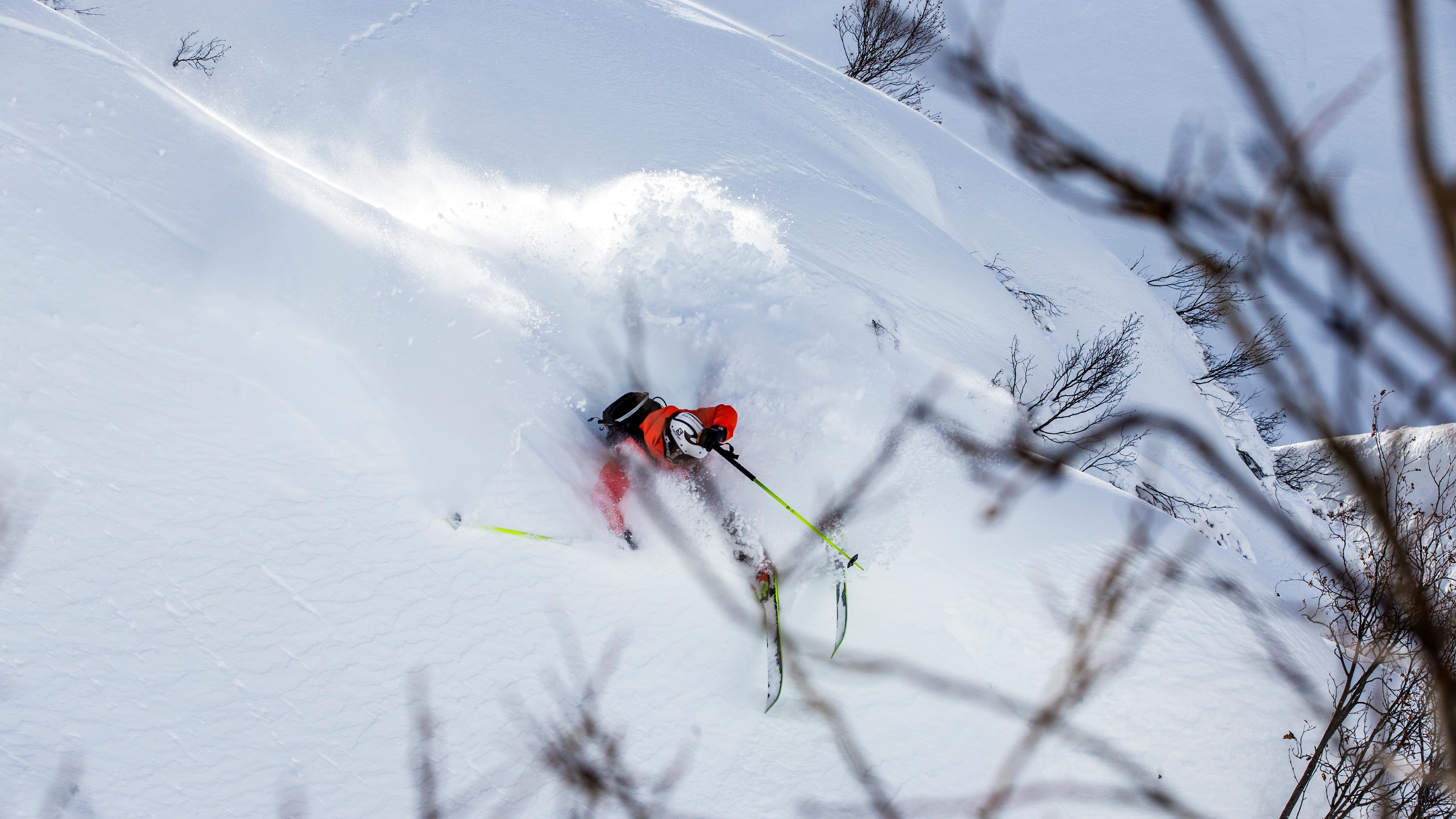
This northerly flow allows polar air to pick up moisture over the North Sea and spread across central Europe. The moist air mass of Arctic origin can reach the northern side of the Alps. The mountains form a natural barrier, forcing the air to rise. As it rises, the air cools, condenses (clouds form) and it can snow heavily. The meteorological term for this process is the orographic enhancement of precipitation.
Where do we see the most snowfall?
In general, precipitation during a Nordstau is less intense than during a Südstau, but in an ideal setting, a Nordstau can last for days. The total snow accumulation can still be considerable. Just think back to January 2019, where the Northern Alps received record amounts of snow after a days-long Nordstau.
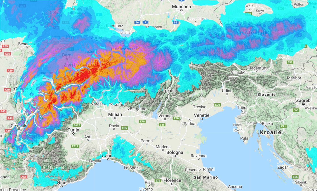
With a Nordstau, we are always talking about a few regions that will get hammered with snow, such as the Glarus Alps and Engelberg in Switzerland and the Bregenzerwald, Arlberg and Karwendel in Austria. If you look at the locations on the map, you can see that they are all on the northern edge of the Northern Alps. Here, the moist air hits the first high mountains and is forced to rise sharply, resulting in heavy precipitation.
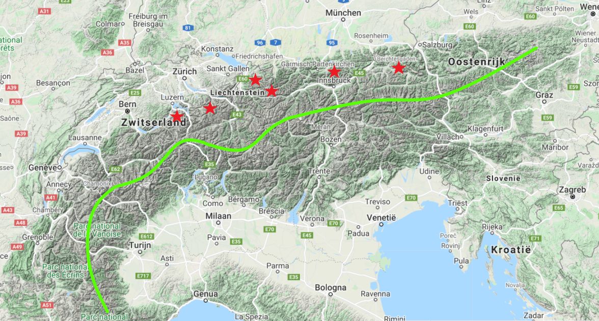
Inner alpine areas generally receive a lot less snow. In Tirol, for example, you notice the difference particularly well between the north and south sides of Innsbruck. While the Nordkette is still part of the Karwendel and forms the first large barrier after the Alpine foreland, the air can already descend a little after this mountain ridge. Directly south of Innsbruck, therefore, the snow quantities remain a lot more limited. In places where there is no mighty barrier at the edge, the snowfall can penetrate further and the inner alpine areas can benefit more from the Nordstau.
The Northern French Alps can also benefit from a Nordstau, but how much depends strongly on the air pressure setting. If the high-pressure area approaches from the west, it may already slowly clear up in this region, while still bringing further snowfall to the rest of the Northern Alps.
Nordföhn
If a Nordstau is taking place in the Northern Alps, föhn conditions often prevail in the Southern Alps. When the air masses from the north have reached the alpine main ridge, the descent begins. The snowed-out air is drier and can therefore warm up more quickly during this descent. A typical Nordföhnsituation with high temperatures arises in the Southern Alps. A detailed explanation of the concept of föhn in the Alps will follow in the next background article.
Although the border between the two weather types in the Northern and Southern Alps can often be very sharp, ski resorts close to the Alpine main ridge (approximately 10 - 20 kilometres) still have to deal with clouds and/or precipitation, especially when the flow is very strong. The further south you go, the better the weather gets. If Nordföhn occurs in the Southern Alps, the stormy wind can have a major impact on the avalanche risk.
Nordweststau
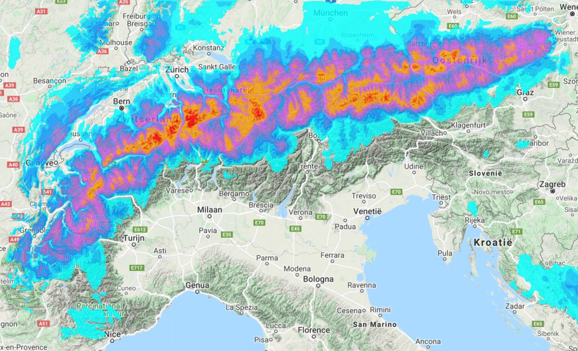
Not every Nordstau is the same. With a flow from the north, the areas I already mentioned will receive a lot of snow, but if the wind comes more from the northwest, it quickly becomes a different story. In this case, the heaviest precipitation is expected between the Mont-Blancmassief and the Arlberg, as you can see very clearly in the image above. With a northwesterly flow, a large part of Austria is located on the lee side of the main precipitation and receives much less snow.
")
")
Nordstau in the weather charts
To recognise a nice Nordstau in the weather charts, you need a certain setting. You can say approximately that we need a high pressure blockade west of us to allow the flow to turn to the north. With a high pressure area (H) west of the UK and low pressure (T) east of the Alps, the arctic outbreak I mentioned earlier will reach the Alps. Note that small shifts can easily occur up to a day before a Nordstau and can throw a spanner in the works. It is important that the high-pressure area doesn’t get too close to the Alps, because in that case most of the precipitation will move further to the east. While the Balkans will get most of the snowfall, the Alps will stay mainly dry.
Read also:
Replies
“Just think back to January 2019, where the Northern Alps received record amounts of snow after a days-long Nordstau.” Snowmageddon. Good times.
Exactly, in 2019 I remember we were ski touring near the resort Wurzeralm in Austria with 3 meters of snow base!
Will this happen again on 2023?