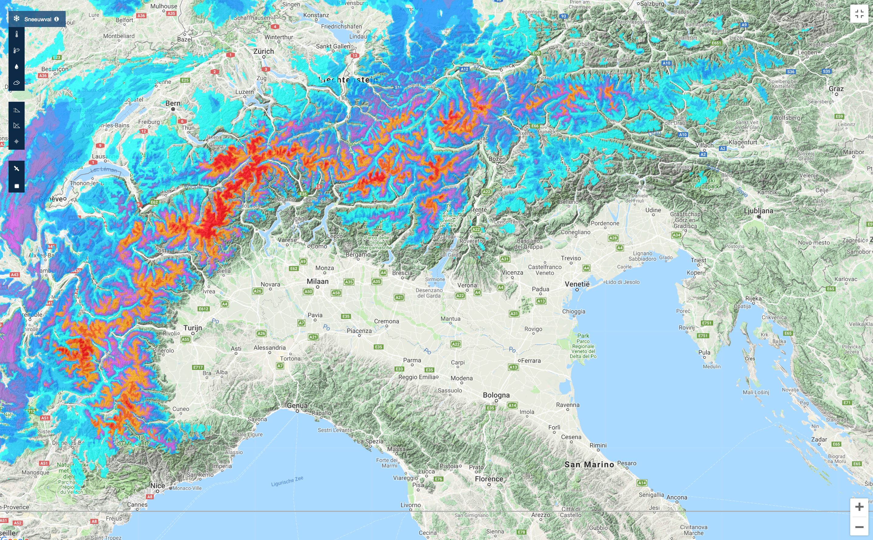
It’s snowing in the Alps since Saturday. Most of the snow came down on the border between Switzerland and Italy in the last 36 hours. On average there was about 50-100 cm of fresh snow and locally even more than that. Meanwhile, the temperature is rising rapidly, but it will be colder with significant amounts of fresh snow for the high alpine from Monday.
- Looking back: most snow on the border of Italy-Switzerland
- Higher temperatures today (Sunday)
- Colder and snow for the western and southern Alps from Monday
- Rising temperatures after Wednesday
Looking back: most snow on the border of Italy-Switzerland
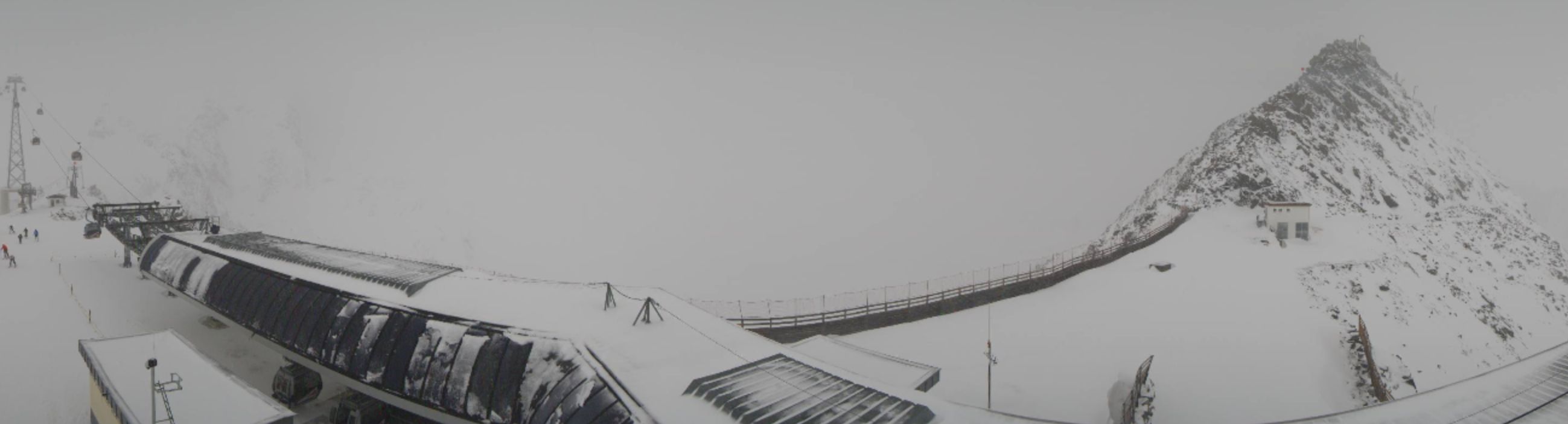
Warm and cold air collided above the Alps last Saturday. Especially on the border between Italy and the south and southeast of Switzerland a lot of snow came down. On average about 50-100 cm of fresh snow above 2200 meters and locally even more. That resulted in great images. (Do not click if you can’t handle the stoke anymore;)).
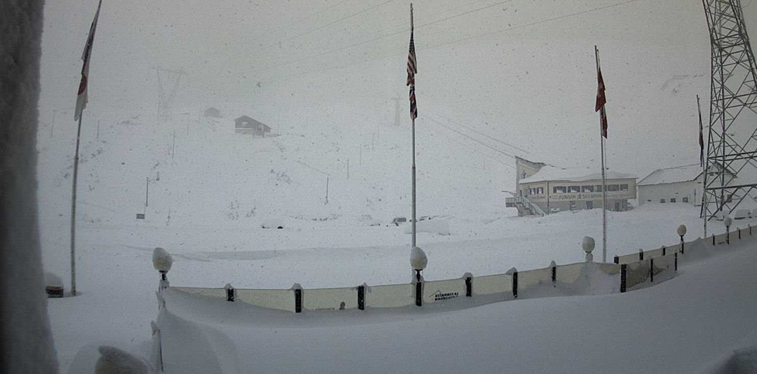
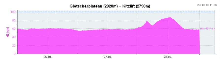
The glaciers of the Passo Stelvio, the Passo Tonale, Sulden am Ortler, Val Senales, the Corvatsch, the Diavolezza en Laax got significant amounts of fresh snow. This improved the conditions (and they needed it!).
The amounts of snow that came down in the rest of the Alps in the last 36 hours are (clearly) less with on average 10-30, locally 50 cm of fresh. And that snow is having some hard times. There is currently a strong south to south-easterly wind especially on the glaciers on the north and west side of the Alps. And op top of that: higher temperatures came in. The strong wind transports the fresh snow and it also melts due to the rising temperatures. The conditions have improved a bit because of the new snow, but great conditions are still far away.
Higher temperatures today (Sunday)
Mild air is coming in with a strong wind from the south today. A southern Föhn is kicking in in the northern Alps and the temperature is rising rapidly. Especially in Austria, we see the conditions deteriorating rapidly. The snow below the tree line is going to have a hard time just sticking around and the wind makes a mess of it above the tree line. The cause of all this is a low pressure area. You can clearly see on the images 1 and 2 below how the warm air is getting pushed from the south all the way to Germany. That results in rising temperatures in the entire Alps.
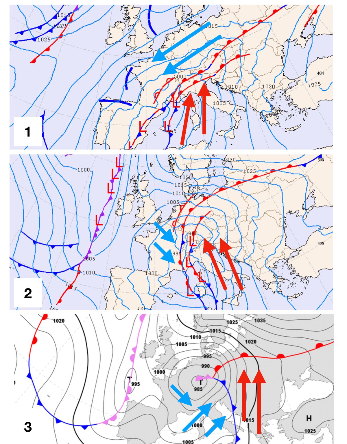
At the same time, you can see that cold air from the west is making its way into the western Alps (picture 2) and there are already a lot of clouds against the highest peaks of the Italian Piedmont, Aosta, Gotthard and the bordering peaks of Switzerland and France. The snow line is very high because of the mild temperatures (2500-2700 meters or higher on the French and Swiss side of the border and around 2000-2500 meters on the Italian side). The snow line will drop rapidly towards the 1200-1800 meters from Monday afternoon.
Because of the high snow line and the large amounts of precipitation expected, there is a weather warning for the south of Switzerland, but also the rest of the southern Alps will have to deal with extreme weather.
Colder and snow for the western and southern Alps from Monday
Cold air will arrive in the western and southern Alps from Monday afternoon/evening. Because it is a lot colder, the precipitation above 2000 meters will come down as snow. This will result in significant amounts of fresh snow in the French, Swiss and Italian Alps up to and including Wednesday. Most of the southern glaciers in Austria will also get some snow. It’s a great first dump for the high alpine!
TIP: check our forecast page which resort will get the most snow
Rising temperatures after Wednesday
The cold weather will end from Thursday and under the influence of a warm southern current, it becomes milder in the Alps. Let’s hope that the snow cover in the high mountains is thick enough to get through this warm period. Wednesday and Thursday are great days on the glaciers, but afterwards it gets really too mild. For cooling you can go to the Freeride Fim Festival in Amsterdam where the faceshots will het you from the big screen of the cinema. There’s no freeride in the Alps yet. The snow that comes down now is only the first dump, there is no base, the glacier ice was still visible last week and the glacier crevasses were open and exposed. We still need a lot of snow, but the first dump is a fact.
Stay stoked, Morris
Replies
Remarkable is Santa Caterina di Valfurva at similar altitude of Passo dello Stelvio more than 1 meter fresh snow in 24h. Just check the photos at Sunny Valley house
@@michaelengelvonkaspa
Amazing amounts of fresh snow. Dinner is served ;)
Woah! Stone is here and not going anywhere;)
@@meteomorris any specific glacier recommendations for wed/Thurs? I have the days off and am looking to get back too it.
Thanks!
@@MorningBrewer looks like there is some extra snow on its way for wednesday/thursday. I wonder if they will open the Stelvio. Best bet would be Zermatt/Cervinia although they might be closed with all the snow in the forecast. Will give you an update tomorrow.
@@meteomorris you are the man. Thanks for the tips, and looking forward to tomorrow’s update. Looking forward to another awesome winter!