After the passage of cold air on Saturday/Sunday, it quickly became warmer in the Alps during the night to Monday. Especially on the north side of the main alpine ridge the snow is melting fast. The snow line is also rising on the south side of the main alpine ridge due to higher temperatures, although orographic cooling (due to the stau on the south side of the Alps) does its best not to let the snow line rise too much. Cold(er) air flows into the Alps in the night to Tuesday and you can expect a lot of snow on the south side of the main alpine ridge on Wednesday and Thursday. In this forecast:
- Northern Alps: considerably warmer and melting snow below 2000-2400 meters on the north side of the main alpine ridge
- Southern Alps: lots of rain and lots of snow in the high alpine
- Colder air coming in on Tuesday
Northern Alps: considerably warmer and melting snow
A short sign of winter resulted in a white world on the northern side of the main alpine ridge on Sunday. The resorts at lower elevations flocked the social channels in large numbers and the various booking sites probably saw their bookings rise in the past 48 hours. It’s pretty quiet on the social channels of those resorts today. They’re not reporting the rain and the melting snow.
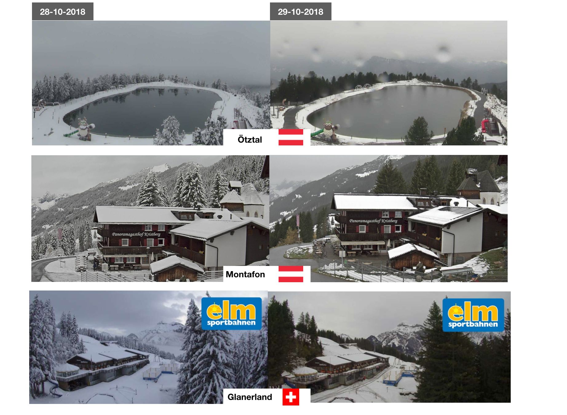
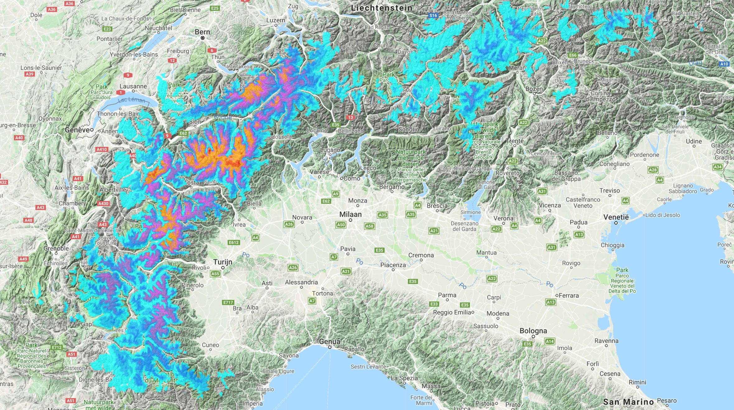
I don’t like to write it, but the temperatures are rising on the north side of the main alpine ridge. The above comparison of today with yesterday shows that well. The incoming [southern current I talked about yesterday] (https://wepowder.com/en/forum/topic/259957) causes some rain locally, but especially results in rapidly rising temperatures. The snow is melting fast. The map below also shows how fast and how much snow has disappeared in the last 24 hours on the northern side of the main alpine ridge (yellow and brown/orange areas). The Swiss region of Graubünden got a lot of snow, but it’s disappearing fast.
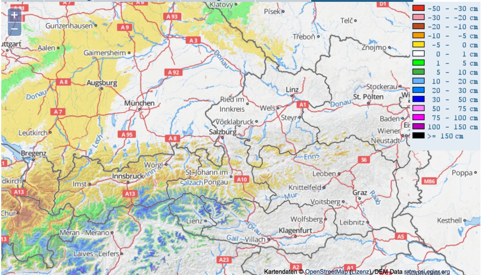
It is also clear that there is snow falling on the southern side of the Alps (the blue colors). It has also become milder there. But because of the orographic cooling, it’s still cold enough during the intense periodes of precipitation to bring wet snow above 1800 meters and dry snow from 2200 to 2500 meters.
Southern Alps: lots of rain and lots of snow in the high alpine
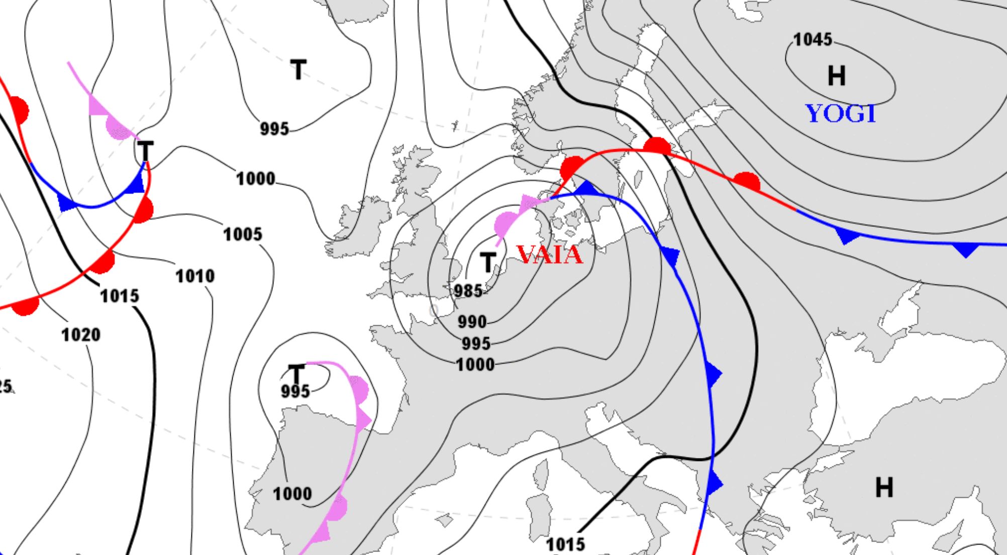
Before I start talking about the snow, let’s talk about all the rain first. That is extreme. For the complete southern Alps there is a weather alert. It can rain long and intense especially in Carinthia and the Dolomites. You don’t have to expect snow here, but especially a lot of rain. The Genoa low Vaia is more like a hurricane that pushes enormous amounts of rain to the south side of the main alpine ridge. Whoever sees the videos in this article knows that this is serious. We are dealing with a weather event that occurs once in 30 to 100 years. There is so much rain, you can not imagine that if you are not on the spot.
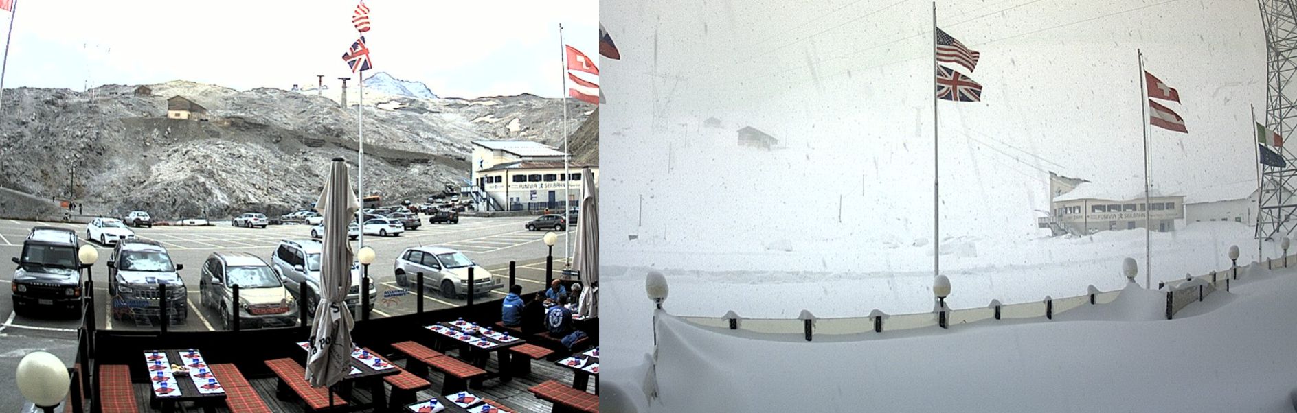
At the same time it is snowing heavily at high(er) altitude. A week ago, a nice Italian pasta was served on the terrace on the Stevio Pass. Now there is snowfall on the menu. There is at least 150 cm already there and there will be more snow coming down this week.
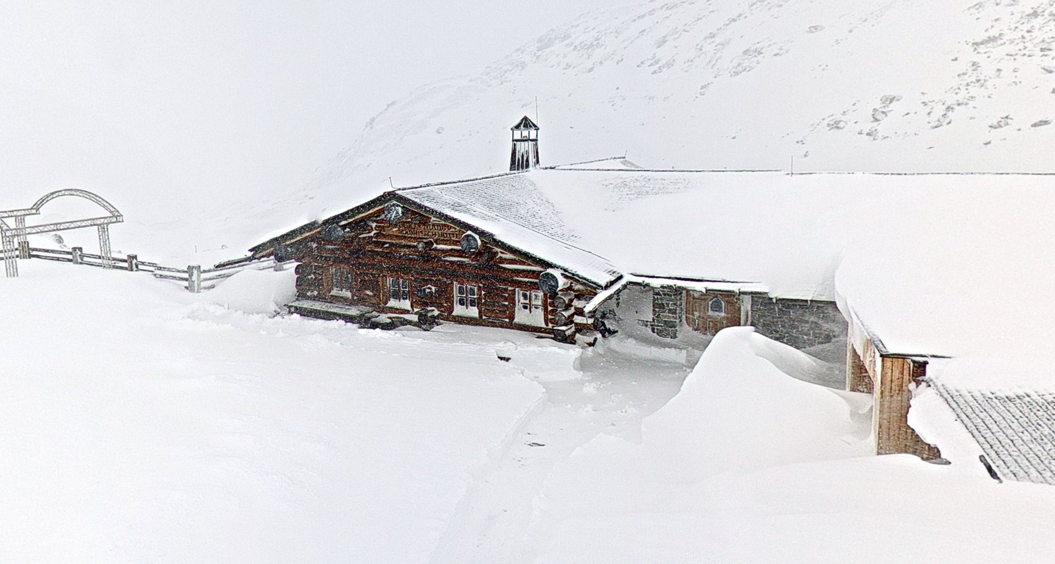
The center of gravity was between the Swiss Engadin (southeastern Switzerland) and the bordering Ortler area in Italy yesterday, but it will move via the Gotthard region towards the Monte Rosa today. Ski resorts such as Zermatt, Monte Rosa and Cervinia are seeing huge amounts of snow coming down today. But also the rest of the Haut Valais (the most southern areas of the Valais), the Aosta, the Gotthard, the Piedmont and the bordering regions in France will get a lot of snow in the high alpine.
The snow mentioned above will come down the next 24 hours, with the snow line fluctuating around 2400 meters in the north. It will be around 2000-2400 meters on the south side of the Alps. Especially around the Monte Rosa, it can drop a bit more.
Colder air coming in on Tuesday
It quickly gets colder in the Alps in the night to Tuesday. Cold air penetrates the Alps from the west and the snow line then drops rapidly towards 1200-1500 meters in the French Alps, the west and south of Switzerland and the Italian Alps. The precipitation amounts then quickly decrease.
There is a new depression coming in on Wednesday and Thursday which will bring a lot of snow to the southern Alps again. More about that tomorrow.
Conclusions:
- Highly improved conditions on the glaciers of Italy and those of Zermatt, Saas Fee and those around St. Moritz.
- The conditions will also improve on the glaciers of Sölden and the Pitztal, because of the snow coming over the main alpine ridge.
There’s a lot of snow in the forecast for the high alpine until Wednesday/Thursdayfor, but it will rapidly gets warmer and sunnier after that. This weekend will be great for some first turns on one of the glaciers, but it’s way too early to think about freeriding. The snow that comes down now is only the first dump, there is no base, the glacier ice was still visible last week and the glacier crevasses were open and exposed. We still need a lot of snow, but the first dump is a fact.
Stay stoked,
Morris