
- 1cm
- 5cm
- 10cm
- 15cm
- 20cm
- 30cm
- 40cm
- 50cm
- 75cm
- 100+
- 1mm
- 5mm
- 10mm
- 20mm
- 30mm
- 60mm
- 120+
The Alps have a tumultuous week ahead. We first start with spring-like warmth, before diving into a changeable phase from Wednesday onwards. There will not be much snow everywhere and föhn will also play a big role. Where it will go wild: the southern Alps. The snowline will still be a bit of a problem.
In this weather report:
- Very mild
- Precipitation from the west first
- Südstau intensifying
- Strong föhn on the northern side
- Where to go?
- -20°
- -15°
- -10°
- -5°
- 0°
- 5°
- 10°
- 15°
- 20°
Very mild
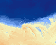
Before this will happen, it will still be very mild in the Alps. Temperatures of 15 to 20 degrees have been passing by in recent days, but Wednesday too will remain quite mild, although temperatures do take a small step back. This can also be seen on the temperatures at 1,500 metres in the map above. On the northern side, it will remain warm even after that due to an increasing föhn flow. More on that later.
Some increased concentrations of saharan dust in the air may cause some more cloudiness and some more colourful sunsets. Further impact is likely to remain limited due to not-so-high concentrations.
Precipitation first from the west
Precipitation followed first from the west on Wednesday evening. In the north-west Alps, from Savoie to eastern Switzerland, 5 to 15 centimetres of snow could fall. Higher up, though, as it will not be cold. The snowline will be between 1,600 and 2,000 metres. Further east, a lot less is already falling, including around the Arlberg. In Austria, it is mainly the northern areas on the alpine edge that may temporarily get some drizzle. Inneralpine areas here remain mostly sunny.

Südstau intensifying
Next up is the real deal. A large trough turning the upper-level flow to the southwest, allowing moist air to hit the southern Alps. No air masses of arctic origin of course, so the snowline will be a thingy, but one with a lot of moisture.
During the night from Thursday to Friday, the first precipitation will follow in the southern Alps. Friday afternoon and evening, as well as Saturday during the day, the intensity will increase, so it could snow a lot. The snowline currently seems to be able to stay at around 1,800 metres for quite some time. In narrow, inner-alpine valleys also lower of course, but so in many areas it only gets really good from 2000 metres onwards.
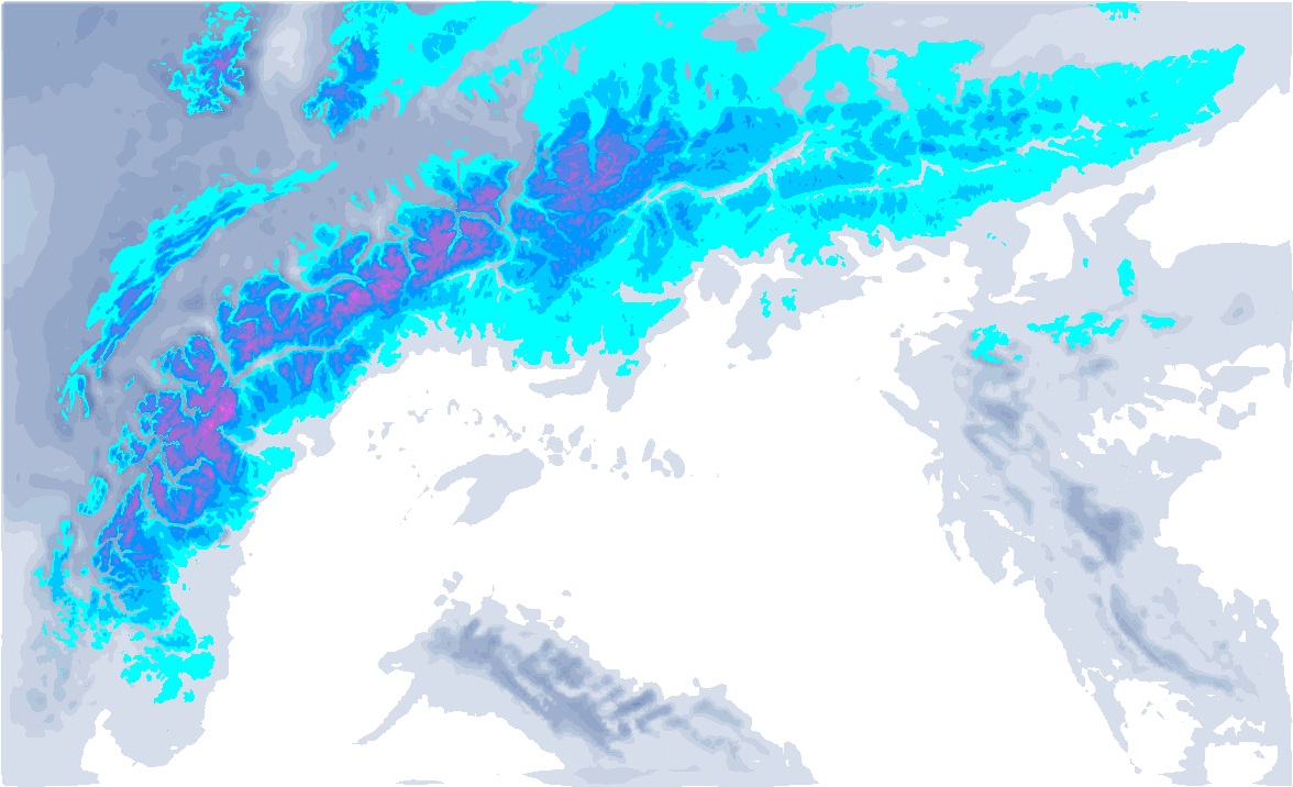
From eastern Aosta to Lombardy, half a metre, to locally in the high mountains a metre, of snow could start to fall. The French southern Alps will also pack in quite a bit of snow, with up to well over half a metre of snow especially in the higher areas of the Alpes-Maritimes. To what extent the western areas in Piedmont will also get that much snow, also largely depends on Saturday’s snowfall. Further east (around the Dolomites) the amounts decrease sharply, especially towards the alpine main ridge. The further south, the more these areas benefit from this snowfall.
The second convergence zone of the southern Alps around the Julian Alps could also see a lot of snow (especially above 1800m), but most areas here do not reach high altitudes, so there seems to be a lot less possibilities here.

Strong föhn on the northern side
In the northern Alps, from France to Austria, it will be windy and mild with an increasing southerly föhn. Lift closures higher up, no fresh snow, high temperatures with again up to over 15 degrees in the föhn valleys and dry conditions can be expected here. Over the course of Thursday, this föhn flow develops, but especially on Friday afternoon and Saturday afternoon, we see the pressure difference between south (Bozen) and north (Innsbruck) peaking in the föhn diagram above, which could make it quite turbulent. Typical north-south föhn valleys will notice this more, valleys/areas perpendicular to this flow often have it a bit better during such a Südföhn.
Where to go?
That seems clear now: the western and central side of the Southern Alps. While much of the Alps remains in the mild air with föhn, only here can buckets of snow start falling higher up. So, as mentioned, the snowline is a thing to keep an eye on. Nowcasting is also important here. Saturday’s snowfall is also important to keep an eye on.
Sunday, some colder air seems to flow in from the west, which could cause some föhnig in the south-west Alps with high winds and slightly milder conditions higher up. This is of course something to take into account. Further east (e.g. Lombardy) this seems to become less of a problem.
Later in the week I will try to write another update…
Replies
Thank you!!!
Hello Henri, thanks for a forecast. What do you think about Livigno, could it pick up more snow than what is forecasted by your model?Thanks for reply.
Thanks
Thanks