It’s time for PowderAlert #2, a nice (early) Christmas gift! This isn’t necessarily about the first snowfall starting now, but rather about the big dump expected from the weekend onward. A lot of snow will fall, especially at higher altitudes, but there are a few caveats we need to discuss, and with the current uncertainty, we must keep a close eye on things.
Haven’t read Chris’s previous weather update yet? I recommend doing so first.
In this weather update, I will cover the following topics:
- First snowfall starting today (Thursday)
- A calm Saturday
- The real storm follows after that
- Wind, lots of fresh snow, and a regional old snow issue
- Will it warm up quickly?
- Where to go?
- New updates will follow
First Snowfall Starting Today (Thursday)
Today, the first snowflakes will fall, but it’s not the main focus of this PA. Key points about this snowfall are:
- On Thursday, snowfall started with a high snowline (around or just above 2000m) – the cold air will really move in by evening. Snowline will drop below 1000 meters.
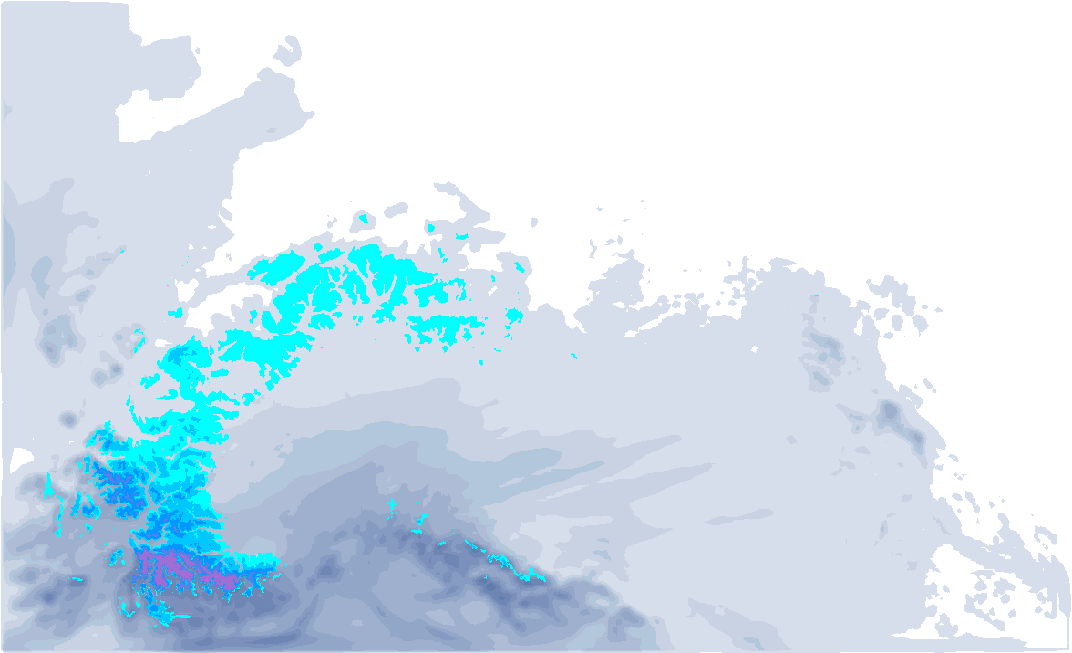
- Main focus for the Northwest Alps. 20-40 cm above 2000 meters. The most snow in the French Northern Alps (from Belledonne to Mont-Blanc).
- A cold front will bring snow to almost all regions. Austria: 10-20 cm (most in Vorarlberg), Southern Alps: 5-15 cm, Julian Alps: 20-40 cm at higher altitudes.
- Strong winds on Friday. Very heavy gusts (over 150 km/h!) at higher altitudes in the inner Alps and on the southern side. Many lifts in these areas will be closed.
- On Friday some weak stau from the north in the Austrian Alps during the day.
Calm Saturday
On Saturday, new clouds will quickly move in from the northwest. By the afternoon, this could bring light snowfall to Wallis and Haute-Savoie. For the rest, the day will be relatively calm between the two snow phases. Temperatures at 1500 meters will still be below freezing, but it will be slightly milder compared to Friday.
The real storm follows after that
On Sunday, the northwesterly winds will pick up again, bringing the Christmas PA. Ahead of the cold front, some mild air has moved in, causing the snowline to start around 1500m. Fortunately, cold air will quickly follow, bringing the snowline down to the valleys, no longer a problem.
The snowfall will reach the Alps in several waves. On Sunday and Monday, the Northwest Alps will be in the firing line, but by Tuesday morning, the focus will shift to the Northern Alps of Austria. In the French Alps, it will be mostly dry by Tuesday, with possible clearings. From the night into Wednesday, snowfall will be confined to Tyrol and areas east of it. Even on Christmas Day (Wednesday), it could still snow in Austria, but the amount is still uncertain.
Increasing avalanche danger
Before we talk about snow amounts and where to go, we first need to address the avalanche risk. Of course, alarm bells should go off with the following signs:
- Large amounts of snow are possible in large parts of the North and Northwest Alps.
- This will often fall on a base with moderate to weak stability, including a persistent old snow problem.
- From time to time, snowfall will be accompanied by strong winds (on Friday, Sunday, Monday, and probably Tuesday). Wind slabs will be an additional, major issue.
Right at the start of the Christmas holiday, when many skiers head to the Alps, this snowfall brings a significant risk. In recent years, conditions around Christmas have often been poor, and the appeal of such a heavy snowfall can be very tempting for many skiers.
Read the avalanche bulletins and only go out if your avalanche knowledge and skills are up to date. If not, stay on the slopes! Do you know anyone in your family or friends circle spending the Christmas week in the Alps? Send them a message to inform them about the upcoming snowfall and risks.
Will it warm up quickly?
The big question over the past few days has been: when will warm air move in? It seemed that with the high-pressure system from the northwest around Christmas, a warm front could follow, allowing warm air to reach the Alps.
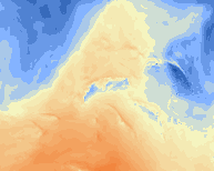
The temperature maps above show that the cold air is slowly running out, but the new forecasts since last night paint a more positive picture. It appears that the high-pressure system will settle in during Christmas without bringing significant rainfall. What does this mean exactly?
It will become a bit milder, but not as warm as initially expected. Below, you can see the temperature at around 1500 meters on Boxing Day (Thursday). With temperatures just above freezing in the Western Alps and just below freezing in the Eastern Alps, the temperature rise will be less pronounced. From the east, some cold air may still move in, potentially causing light snowfall in Austria. More details will follow in an update, as this is, of course, a weather forecast for 6 days from now.

Where to go?
Here’s an indication of where the hotspots will be:
From the French Northern Alps to Vorarlberg, the heaviest snowfall will occur on Sunday and Monday. The most snow will fall in the typical northwest stau areas (from Mont-Blanc to the Glarner Alps). Heading further into the inneralpine regions, snowfall amounts decrease. Between 1500-1800 meters, about a meter of snow is expected by Tuesday, with lower amounts below that. Snow accumulations higher up will be difficult to measure due to the expected winds.
For most Austrian ski resorts east of Vorarlberg, I expect 40 to 80 cm, but the additional snowfall on Wednesday could push total accumulations to 80 to 100 cm in some areas further east.
It will be harsh in the high mountains starting Sunday. Avoid going too high, as you’ll be caught in a white-out, and I expect many ski resorts will struggle with the combination of heavy wind gusts, large snowfalls, and rising avalanche danger. Many higher lifts could initially be closed.
Higher tree runs in the Northwestern Alps will be the place to be. The avalanche danger isn’t completely gone in terrain between the trees, but the wind will be less intense at those altitudes. Snowfall will start on Sunday, and the fresh snow will be limited at first, but by Monday, it will get deep. If you’re too low, the base will still be missing, but above 1000 meters, you can start enjoying good conditions from Tuesday onwards.
Further east in Tyrol and Salzburgerland, the base isn’t ideal everywhere for powder turns between the trees. Sunday is still too early here, and snow will only begin in the afternoon (starting with a higher snowline). On Monday, the snowfall will intensify, reaching the valleys, but it won’t get deep here until Tuesday. So, plan for a slightly later start here.
New weather updates to follow in the coming days
Got questions about this PA? Ask them in the comments, and Chris and I will do our best to help. Of course, we’ll keep you fully updated on developments, and another PA update will follow later this week.
Ride safe!
Replies
Which would be better, Les Contamines or down by La Rosiere and St. Foy?
Which would be better, Les Contamines or down by La Rosiere and St. Foy?
Chester_Tartsnatcher - 19 Dec 2024 18:33
Hi Chester, fresh snow amounts will be similar (circa 50 cm expected around 2000m) but Les Contamines may be a bit more sheltered from the wind. See for example the below map of expected max wind gusts Monday night.


