After an active week with multiple disturbances, we are now dealing with a prolonged high-pressure situation. The result is more and more sun and, in the long term, rising temperatures. Today and tomorrow it will still be cold in the Alps with an icy northerly wind at higher altitudes

Avalanche level 3 to 4
Especially the Western Alps received a lot of precipitation (50 to 150 mm), which sometimes fell as rain above 2000 meters. In the forecast on Friday, we indicated where you can expect the best conditions. Due to the fresh snow and the unstable layers in the snowpack, partly caused by the wind and fluctuating temperatures, huge avalanches occurred in France. Today, the situation is still tense with avalanche levels 3 to 4 in large parts of the Alps. In the coming days, the snowpack will settle, gradually reducing the risk of avalanches
Over half a meter of fresh snow has fallen in Breuil-Cervinia the past days
Cold with strong winds on Sunday and Monday
The depression that brought snow to Germany and the Benelux in recent days has moved on to Eastern Europe but still affects the weather in Austria. Today, cloud continue to drift in from the north with regional light snowfall in Upper Austria and Lower Austria, with a maximum of a few centimeters. The Western and Southern Alps are already basking in sunshine today, but in the lowest valleys, fog and low clouds may persist all day. At higher altitudes, a strong to stormy north wind is blowing, and at 1500 meters, it will not get warmer than -6 to -8 degrees. On Monday, clear spells will also gain ground in Austria. Otherwise, there is little change, although the sharp edges of the cold will soften a bit. South of the main ridge, it warms up to 0 degrees at 1500 meters, while in the Inner Alps, it will be about -5 degrees at that altitude. The night brings strong frost in most valleys, between -10 and -15 degrees.
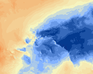
The development of the temperature at 850 hPa level (circa 1500m) according to our weather model, based on GFS
Endless high-pressure, uncertain how mild it will get
As previously announced, we expect the sunny high-pressure weather to last at least a week. There is still a lot of uncertainty about the temperatures. The European ECMWF model predicts +5 degrees at 1500 meters in France and Switzerland starting Tuesday, and later in the week elsewhere as well. The American model (GFS) calculates the high-pressure ridge slightly more to the north, allowing fairly cold air from the northeast to continue flowing in. In that case, it will not get warmer than -2 to +2 degrees at 1500 meters most of the week.
Sunny, small disturbance possible on Wednesday/Thursday
With an air pressure of 1030 to 1040 hPa, we don’t expect much active weather for the time being. On most days, the sun will shine from start to finish. On Wednesday and/or Thursday, there may be more cloud and a spot of rain or a flake of snow during the passage of a weak warm front. Due to the lack of airflow, low clouds may still be present in the lower valleys (below 700 meters), where temperatures will barely rise above freezing. There are no signs of a weather change for the coming weekend either.
Replies
There are some hopes for this to stop around 24-28
Is there anywhere in the alps for the coming weekend, where good snow can still be found with some touring?


