It’s winter in the Alps, and we’ve already welcomed several zones of snowfall. The last episode of this unsettled period is on its way, and it will bring even more precipitation. Time for Powder Alert #1, where we look at:
- What is the current snow situation in the Alps?
- How much snow will fall through Wednesday?
- How much will the snow line rise today and Monday in the warm sector?
- Rapidly increasing avalanche risk: what are the dangers?
- A look at the long term: milder conditions ahead
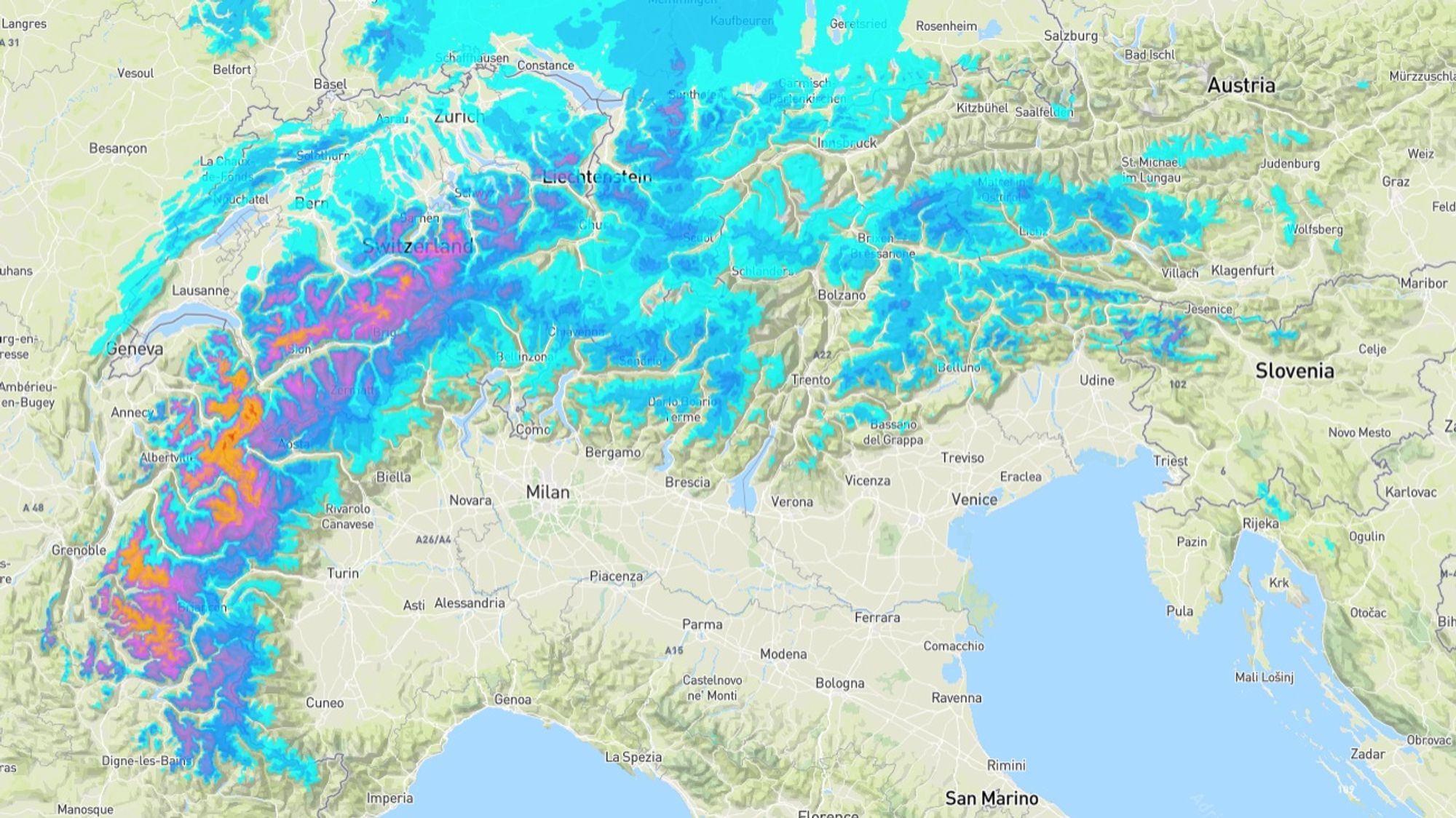
Dream start to the season in many regions
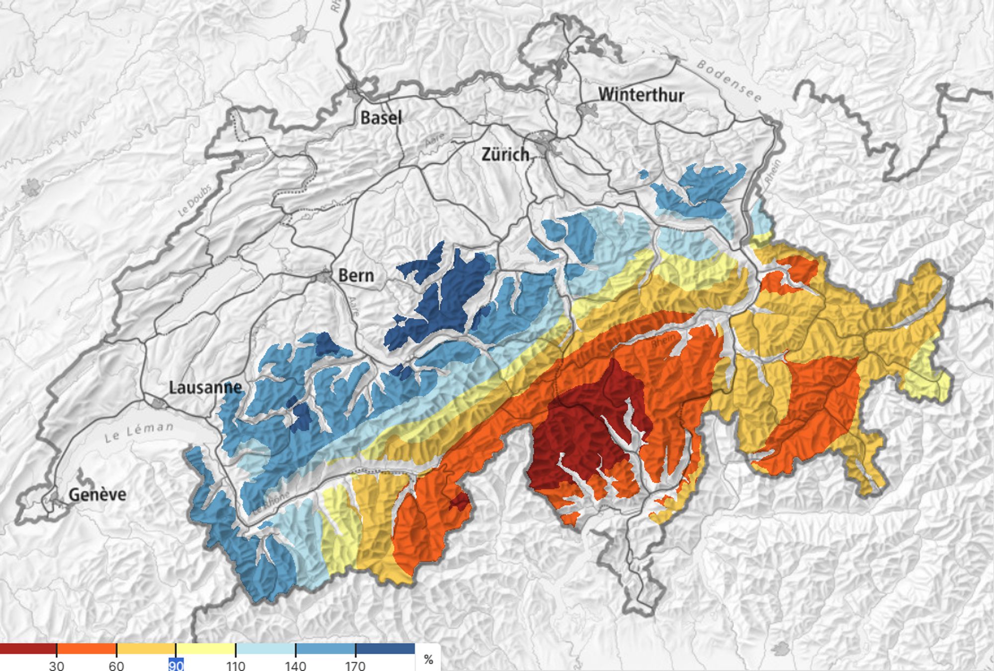
The cold spell came at exactly the right time. All high-altitude ski resorts have opened as planned or will open next weekend, often with more pistes available than in previous years. There’s also plenty of snow off-piste, with good freeride opportunities regionally, especially inner-Alpine and in the Western and Northern Alps. It’s not all perfect everywhere, as shown on the map above. South of the main Alpine ridge in Switzerland, there’s far too little snow, and the same goes for northwestern Italy south and east of the ridge. An exception is the Alpes-Maritimes / Alpi Marittime in the far south, where a local retour d’est occurred on Friday. Heavy snowfall lasted for several hours, the snow line dropped to the city of Cuneo, and above 1500 m more than a meter fell (Limone Pancani, 1879 m, 123 cm in 24 hours).
Milder first, then colder again
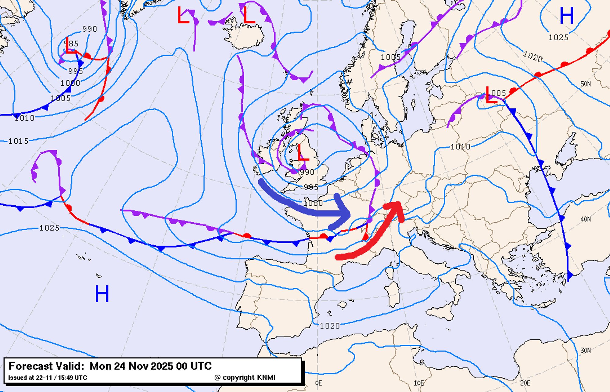
The depression bringing precipitation from Sunday evening is currently over the British Isles. On the weather map, we see an elongated occlusion (merged warm and cold fronts) stretching across Central Europe to the Atlantic. A secondary low is forming northwest of Spain, moving along the westerly flow and about to bring significant precipitation to the western Alps. A high-pressure ridge west of Ireland ensures a northerly flow over the Atlantic. The Alps remain in warming air Sunday and Monday east and south of the occlusion. After a wintry Sunday morning, the freezing level rises this afternoon to 1800 m in the French Alps and around 1500 m in Switzerland and western Austria. The inner-Alpine and the southeast (e.g. Dolomites) remain colden with a freezing level around 1200 meters. That’s also the altitude from which snow will initially fall. From Monday evening, the flow shifts to northwest everywhere, and the freezing level drops to 700–1100 m. This new batch of polar air will linger for a few days over Central Europe.
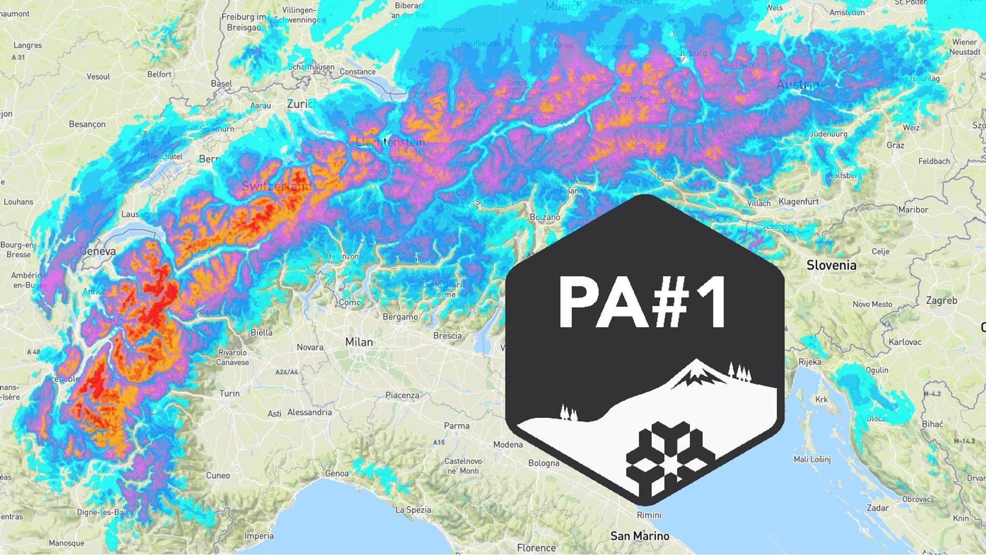
Monday: Heavy snow in the west and northwest, rather high snow line
From Sunday evening, the occlusion moves into the French and Swiss Alps, followed Monday by the secondary low. Result: almost continuous precipitation from the French Alps through Switzerland to Austria’s Vorarlberg. Expected totals through Tuesday: 20–70 cm, with the highest amounts in areas like Alpe d’Huez, Val Thorens, Tignes, Chamonix, Glacier 3000, and Avoriaz. Vorarlberg should see about 30 cm. Key point: the snow line Monday in the warm sector with rain below circa 1400 m (Vorarlberg) to 1800 m (French Alps), so maximum amounts only above that altitude.
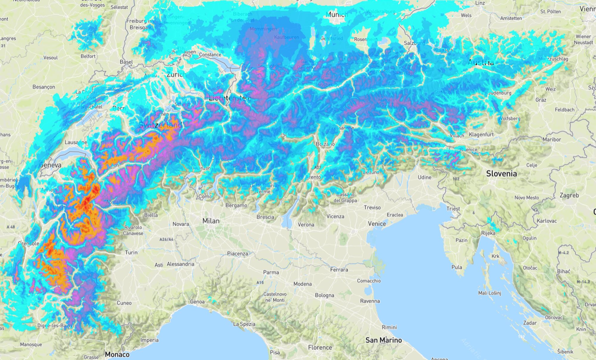
Tuesday: Snow in more regions
On Tuesday, snowfall spreads across all of Austria, with the snow line dropping into the higher valleys. The central and eastern Southern Alps will also get snow. Many places will see 10–40 cm added Tuesday. In the Western Alps, locally above 2000 m, likely a meter will have fallen since Sunday.
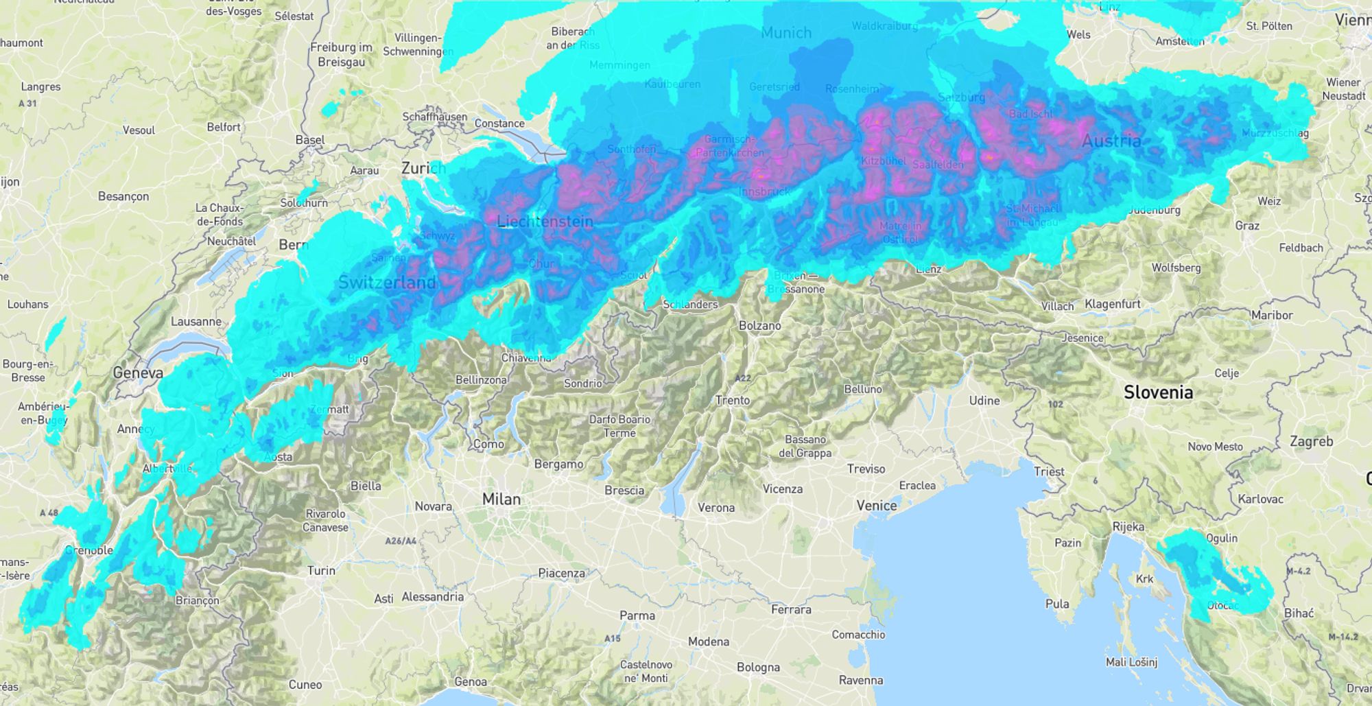
Wednesday: Nordstau with fluffy snow from 600 meters
By Wednesday depressions move into Eastern and Southern Europe, and we enter a northerly flow with cold, drier air. A classic Nordstau develops, with snow in Switzerland and Austria from about 600 m. Above 1000 m, expect beautiful dry powder. Amounts depend on how rapid the air masses stabilize from the west. A ridge from the Azores High will expand east Wednesday and Thursday, suppressing precipitation. For now, I estimate a conservative 15 cm north of the main ridge in Austria and eastern Switzerland, with positive surprises up to 30+ cm possible. Expect just a few centimeters at most in the French Alps on Wednesday.
Avalanche danger rising sharply
Intense cold in recent nights has created a strong temperature gradient in the snowpack, promoting faceted crystal formation. These angular crystals lose bonding strength, creating a weak layer that, combined with incoming snow, could significantly increase avalanche risk. Current danger level 2–3 will undoubtedly rise by at least one level in coming days. Be extremely cautious, especially in high Alpine terrain. Check the latest situation at https://avalanche.report/bulletin/latest.
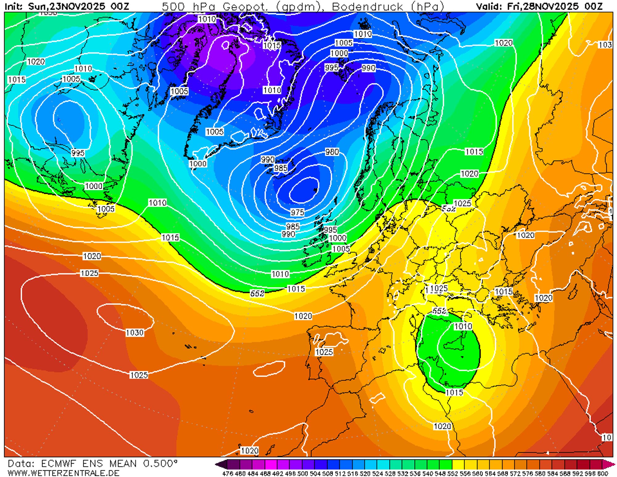
Thursday and Friday: Preservation under high pressure
The Azores ridge suppressing Nordstau later on Wednesday will lie over the Alps by week’s end. A strong westerly flow builds over the ocean, but first, it’s dry and fairly sunny for a few days. Thanks to high pressure and dry air, the fresh snow remains well preserved. Nights bring moderate to strong frost and the daytime freezing level will be between 600-1400 m on Thursday and 1200–2000 on Friday (northeast to southwest).
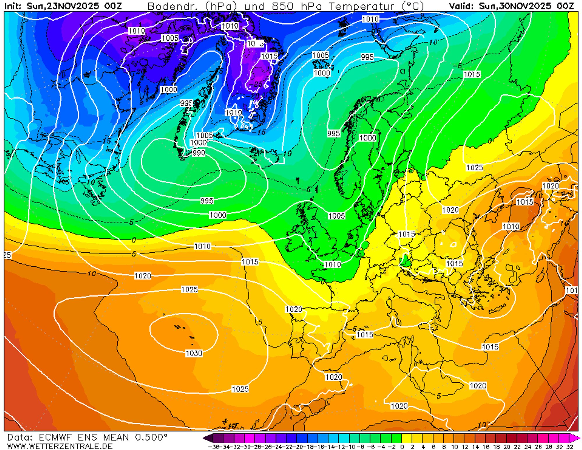
New disturbances and slightly milder from Saturday
From next weekend, frontal influence likely increases again. Air alternates between maritime polar and maritime subtropical origin, with snow lines varying between 1000 and 1800 m. We’ll dive deeper into the long-term outlook in upcoming forecasts.
Replies
its not easy to see it snow everywhere accept Monte rosa.
please tell me there is hope for the next time around or should I skip buying a pass here this year?
there seems to be a patern forming that doesn’t include us