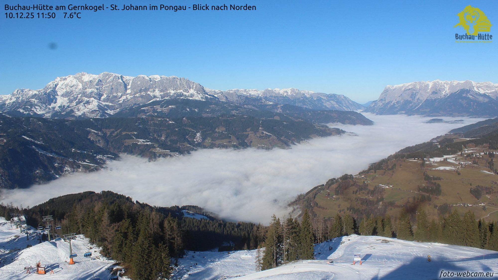
In many parts of Europe, date records were broken yesterday, and that could happen again today. But where is it extremely mild now, and where are temperatures lagging behind? And is there still hope for fresh snow at Christmas? We’ll check in this forecast.
High temperatures in dry air
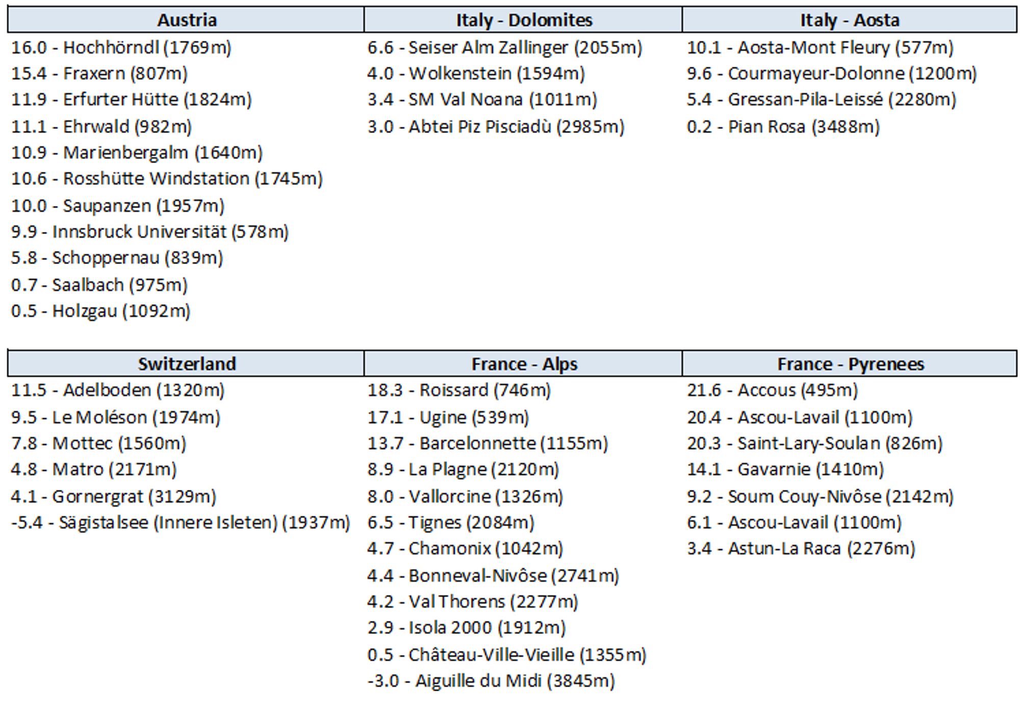
As Henri set out yesterday, we’ll have to go all the way to Scandinavia to find fresh powder in the coming days. The Alps remain under a high-pressure system with mild upper air, which will gradually cool down a bit over the next few days. Below is a selection of yesterday’s maximum temperatures in the Alps and Pyrenees. What stands out immediately is that the air is far too warm even at high altitudes, with a freezing level around 3500 meters (summer level). Even where temperatures exceeded 10°C yesterday, dew points stayed negative. This means the air is very dry, so the snow doesn’t melt quickly, especially since there’s hardly any wind. Today, temperatures will show similar extreme values.
Inversion conditions
However, some valleys stayed under the inversion all day yesterday and didn’t get mild at all (for example, Holzgau, +0.5°C at 1,092 meters). An inversion is a situation where the temperature profile in the atmosphere is reversed: the temperature rises with altitude instead of falling. This happens when a layer of warm air acts like a blanket over colder air near the ground. Because cold air sinks, it collects in valleys, and in December and January the sun is often not strong enough to break up that cold, gray layer. Valleys with lots of shade during the shortest days are also prone to much lower temperatures than the surrounding mountains in calm weather. Last night, frost was widespread in both lower and higher valleys. Higher up, it stayed well above freezing almost everywhere up to at least 2500 meters.
Mild air from the south and west
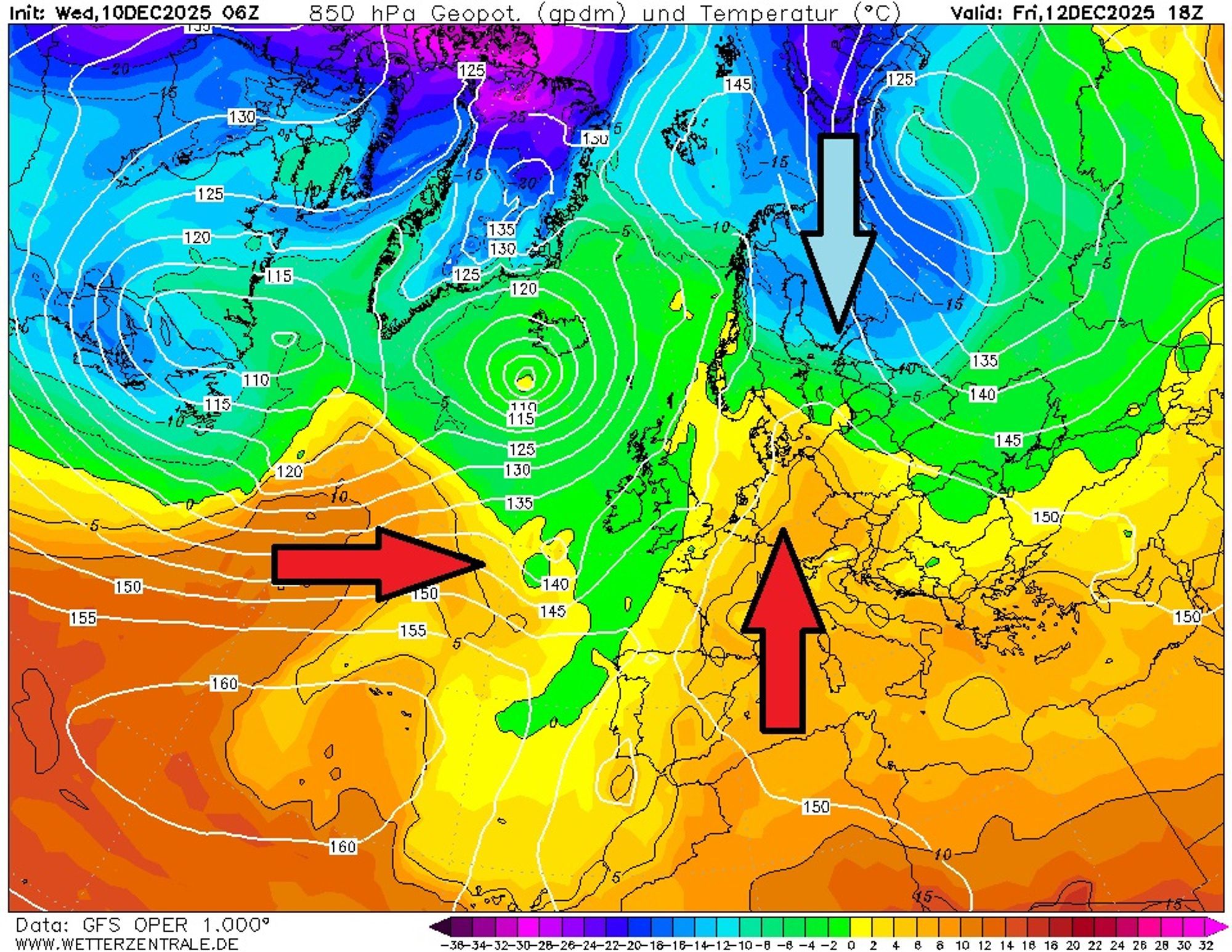
On Friday’s weather map above, the huge high-pressure system over the Mediterranean stands out, with a ridge extending toward Scandinavia. On its eastern side, cold air temporarily flows south, aided by a low over Russia. This cold remains limited to Finland and the northern half of Sweden and Norway and will be pushed back from Sunday onward by milder air from the southwest. The continent is being flooded by mild air masses from both the south and the west. Those from the south will dominate Alpine weather for now. The current pattern of lots of sunshine and frorsy nights in the valleys will continue for about another week. At 1500 meters, temperatures will range between 4 and 8°C, putting the daytime freezing level around 2500 meters. Still mild, but not as extreme as it currently is. Some valleys will keep dealing with inversion conditions while the mountains bask in sunshine.
More unsettled and colder toward Christmas?
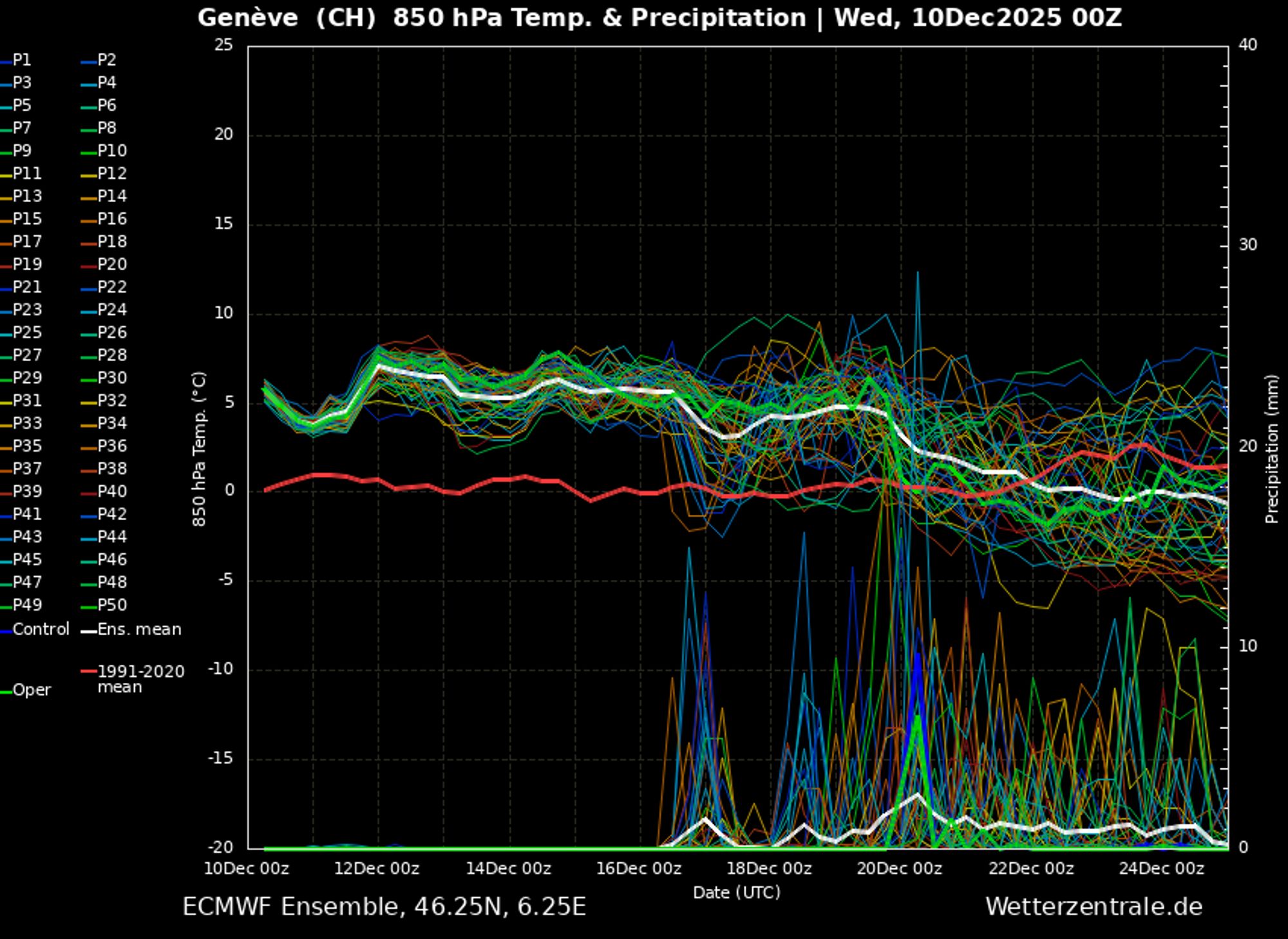
For France and Switzerland, we see the first precipitation signals appearing on December 17 in the long-range forecast, which could indicate a breakthrough of the westerly flow. For Austria those signals are much weaker, and average pressure after December 20 stays around 1020 hPa - a value not associated with much precipitation. High-pressure systems over Russia and Eastern Europe remain stubborn. So it’s far from certain that the westerly flow will dominate in the long term. It’s more likely that in the run-up to Christmas we’ll see air coming from the north or northwest without active fronts in the Alps. A true winter outbreak seems unlikely but chances of falling temperatures are increasing, with possible wintry touches above 1000 - 1500 meters as Christmas approaches.