A powerful high-pressure system is currently developing in the region around Iceland, and it’s making the hearts of winter enthusiasts beat faster. This rare setup has the potential to send Arctic air masses with snowfall from the far north toward Europe. For the Alps, however, there are still several complications. That’s why we’ve been cautious with our forecasts and unfortunately, that caution is still necessary. In this forecast, I’ll look at the reasons why major snowfall is unlikely for now and what the longer-term prospects look like. First, we’ll take a moment to examine the current situation, which is still causing high avalanche danger in some regions.
Regionally still high avalanche danger
On Friday, Coen discussed the avalanche risk in areas with fresh snow and advised staying below the treeline for the time being. Anyone who ventured higher took a serious risk, and over the weekend things went wrong in several places. A number of large avalanches were triggered, and unfortunately there were casualties. Along the French-Italian border, only the area south of the Grande Casse still shows level 4 danger. In other regions it has been downgraded to level 2-3, but the risks remain significant. Be especially alert on steep slopes above the treeline, where wind slabs and a weak layer beneath the fresh snow are lurking.
Sunday and Monday: sunny and mild
The high-pressure system near Iceland extends toward the Alps, blocking the outflow of cold air. Under this ridge, the weather is clear and pleasant, with overnight frost and dry afternoon thawing up to 2000-2400 meters. Meanwhile, winter is returning in full force to Norway. A northwesterly storm is developing along the coast and on the mountain tops, bringing snowfall down to sea level. Eastern Europe is also seeing regional snowfall, for example in the Tatra Mountains.
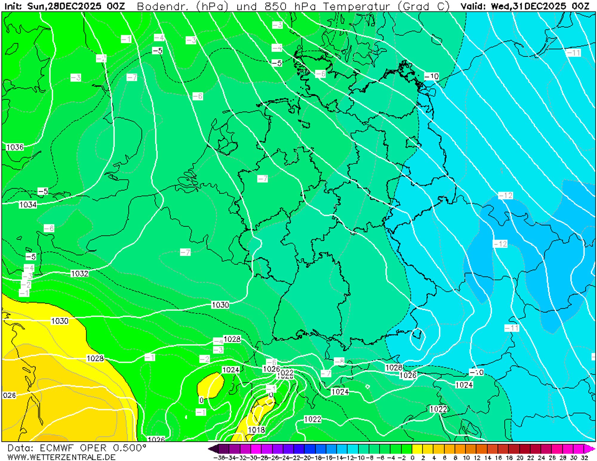
Tuesday: the first push of cold air
The high-pressure ridge shifts slightly southwest, causing significant cooling especially in Austria and Switzerland. Along the main Alpine ridge and north of it, the freezing level drops into the valleys. The French and western Italian Alps experience high-pressure influence and a northerly föhn, making the cooling there much less pronounced. From northeast to southwest, temperatures at 1500 meters on Wednesday range from -8°C to +2°C. The situation is too transient and the pressure too high for a proper Nordstau, but Austria will likely see some snowfall. Areas north of the main ridge and east of Innsbruck have the best chances, though amounts will probably stay below 10 cm. Elsewhere it remains dry, with sunny spells especially in the southern and western Alps.
Wednesday and Thursday: temperature split
While Austria likely remains in the cold air, the western and southern Alps may warm up again midweek. The east-west temperature contrast therefore remains clear. Cloud cover persists mainly in Austria, while south of the main ridge and farther west the sun will shine in many places. Some light snow may still fall in eastern Austria.
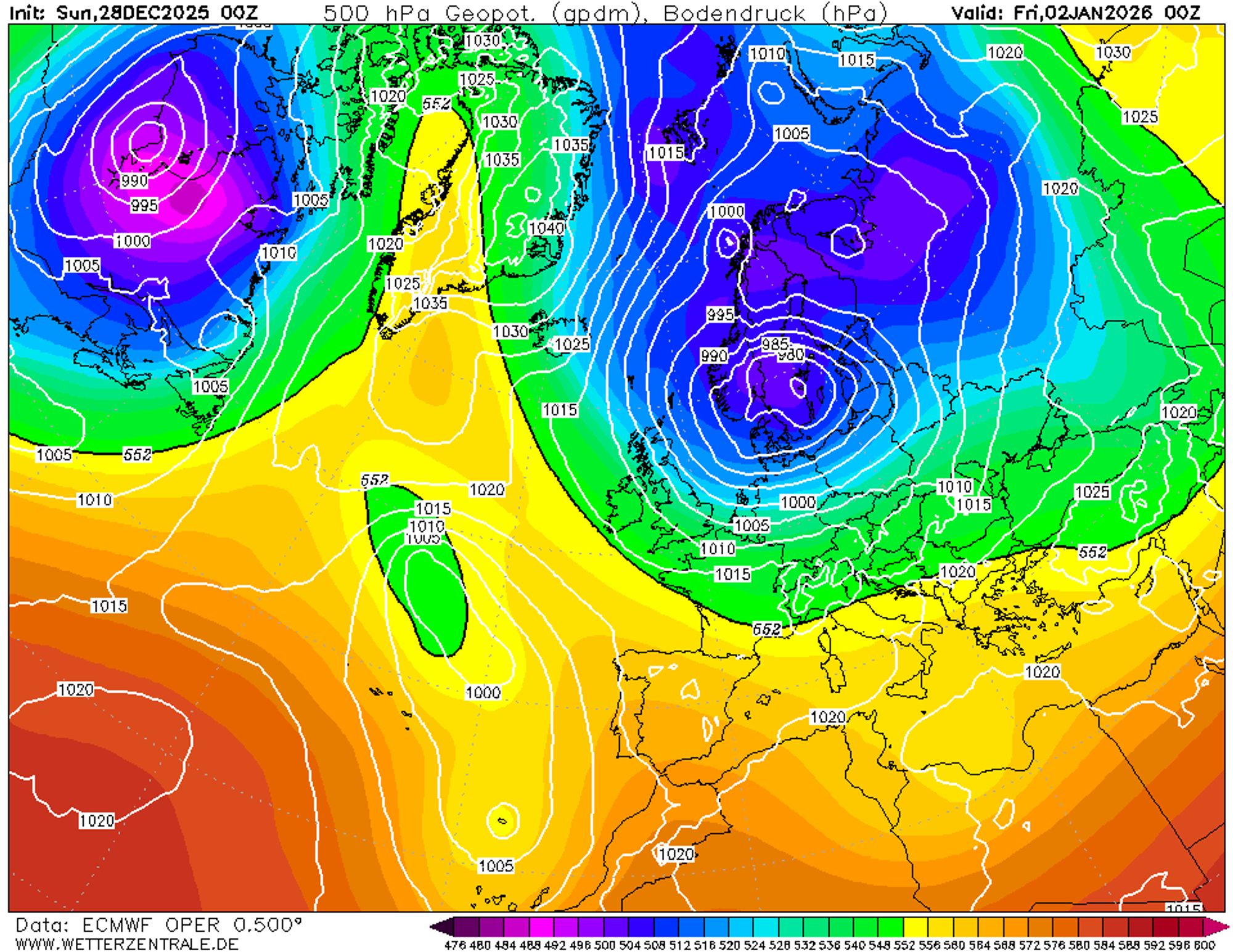
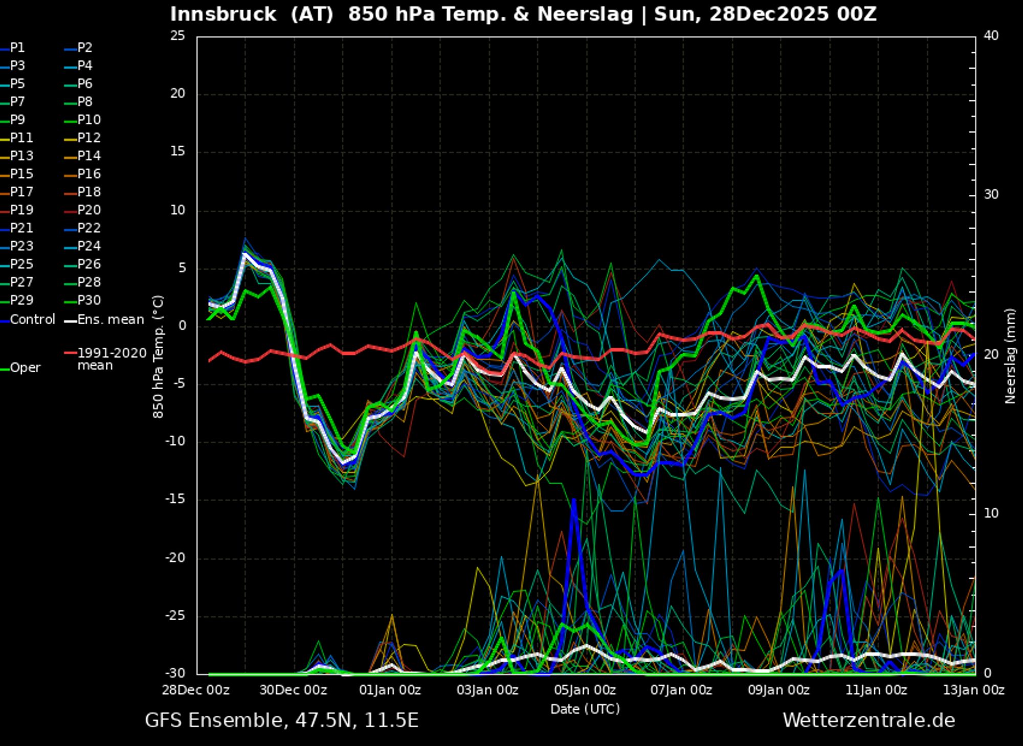
From Friday onward: major uncertainty
On the weather map for Friday, we see the high-pressure system over Iceland and Greenland shifting slightly westward. At the same time, a depression filled with arctic air sits over Scandinavia. If it were to move south, the entire continent would be plunged into snow and cold. But we’re not there yet. The Scandinavian low seems reluctant to move, and a new low-pressure system west of Portugal is pushing back.
Model output still shows scenarios with cold and snow, but less favorable outcomes are also possible. For example, the low near Portugal and the one over Scandinavia could merge, with the axis ending up west of the Alps. In that case, we would have to wait even longer for snow, as the flow would turn southerly again. So take the snow signals for next week with a grain of salt. There is still potential, but whether it will be realized remains uncertain. Hopefully we can provide more clarity in the coming forecasts.
Replies
What’s up with all the lack of snow in North of alpine ridge the last years? Maybe it’s a penalty for all the import of gas (Austria) and so called bank and wepon neutrality (Switzerland)…
The weather model is really locking itself up. For the northern alps it’s really needed with two bigger snowfalls. Lots of stones in the high and no snow cover in the low.
A sad situation for the North side of the Alpes this year… It all started well, but meanwhile no fresh snow has fallen for about a month already… Hopefully next week the weather (forecast) will turn for the better!