Cold air will expand across large parts of Europe in the coming days. In many places this cold will also bring snow, but most parts of the Alps remain very poorly supplied. Snowfall is expected in Scandinavia, Scotland, parts of Spain, the Balkans, the German low mountain ranges, and the Ardennes.

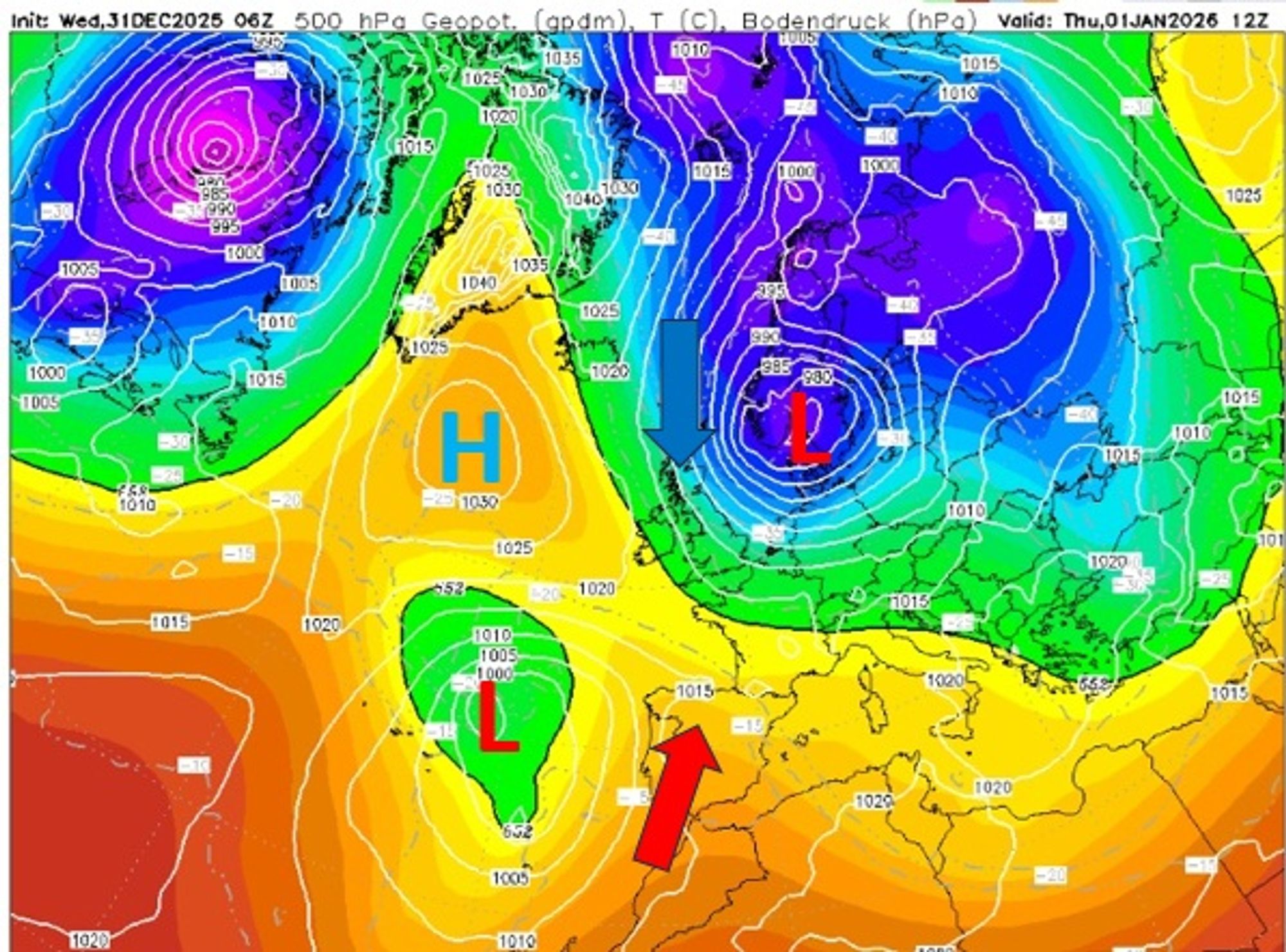
A deepening low-pressure system will settle over southern Scandinavia on January 1st. Along its western flank, a pool of very cold air is pushed toward the European continent. This circulation will persist for several days, allowing the cold to penetrate deep into Europe — eventually reaching Spain, central Italy, and the Balkans.
Snowfall in many places, even lower areas
Circulating around the low-pressure system is a pocket of bitterly cold air, with temperatures around -40°C at 5 km altitude. Over relatively warm seawater, this guarantees active shower development. The Baltic Sea, Norwegian Sea, and North Sea will therefore act as snow-shower factories in the coming days. Where these showers make landfall, significant snowfall is possible where the air hits higher terrain.
In Scandinavia — as discussed earlier this week — most showers will hit the Norwegian west coast near Trondheim, but snow will also fall across central Sweden. In the Scottish mountains, accumulations of up to 30 cm are easily possible. In the German areas Sauerland and Harz and the Belgium Ardennes, 15–40 cm could fall between Friday and Monday.

Snow map Monday showing peaks in snow for Ardennes, Harz and Sauerland
Expected snowfall for the Alps mostly vanished …
For nearly ten days, weather models have been fooling us. That happens from time to time, but rarely so consistently and for so long. Last week, it seemed only a matter of time before a northerly flow would finally develop and deliver snow to the Northern Alps.
A small amount of snow has fallen in the far east (Dachstein), with a bit more to come, but true orographic snowfall against the Alps now appears unlikely. Instead, an alternative — potentially precipitation-rich — scenario briefly took centre stage. Earlier this week, there was talk of an active precipitation zone forming along the boundary between cold winter air advancing from the northwest and milder air moving northeast from Spain.
Weather models notoriously struggle with situations involving sharp air-mass boundaries. While earlier in the week there was still a chance that this zone could produce active precipitation in parts of the Alps, it has now become clear that the boundary will end up further south and east. As a result, this precipitation scenario has also disappeared from the Alpine forecast.

Eventually, the cold air does reach parts of southern Europe, bringing snow to areas of Spain. Ski resorts in Aragón, such as Formigal and Javalambre, may see snowfall from Sunday onward, while the western Pyrenees could already get snow on Saturday. The Balkans will ultimately receive a substantial snowpack as well.
Alpine weather through the weekend
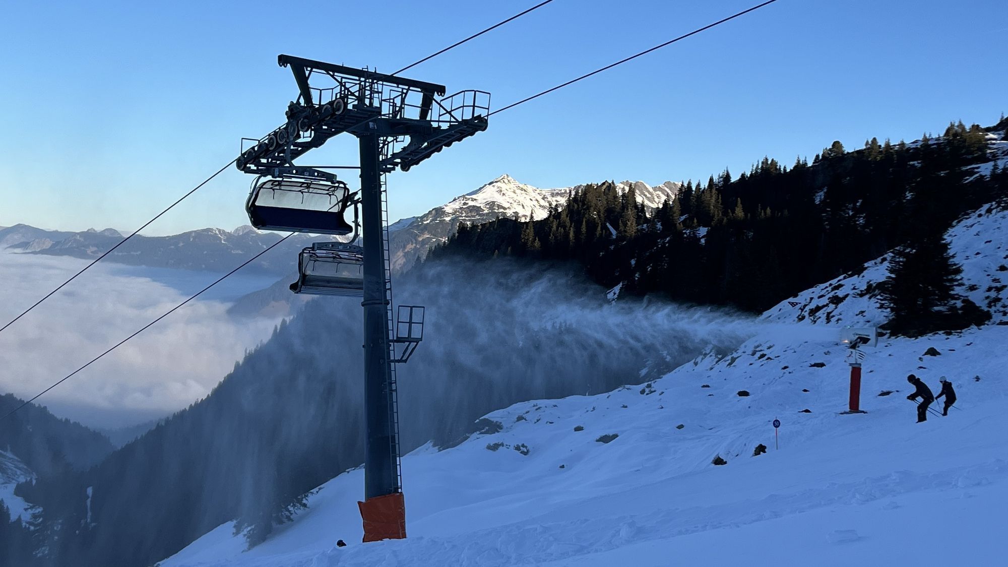
This New Year’s Eve is cold and mostly sunny in the Alps. During New Year’s night, 5–10 cm of snow may fall on the northern side of the Alps east of Salzburg, while most other regions remain dry. The New Year begins largely dry and sunny, with a temporary moderation of the cold. Temperatures at 2000 m rise to around -2°C in the Western Alps and -5°C in the Eastern Alps. The wind — which was strong at altitude today, especially from Tyrol eastward into Austria (over 50 km/h) — will ease for a time.
On Friday, winds increase again and cloud cover thickens along the northern Alpine rim. Light snowfall follows into Saturday (5–10 cm), with local maxima at the foot of the Arlberg and Säntis (up to 15 cm). Temperatures drop once more, and the weekend will be characterised by mostly sunny but cold winter conditions in the Alps. The jet stream brings strong westerly winds at altitude (up to 100 km/h possible), and with temperatures around -10°C at 2000 m, it will feel decidedly cold.
- -20°
- -15°
- -10°
- -5°
- 0°
- 5°
- 10°
- 15°
- 20°
Careful with new snowdrifts
Where loose snow can be transported by the wind, extra caution remains essential. It doesn’t take much to push avalanche danger higher — something we’ve seen again this week in Austria and along the French–Italian Alpine ridge. Strong winds will also affect these regions, and very little is needed to trigger the weak base layers. See, for example, this quote from the Piemonte avalanche bulletin:
In the last few days easily released wind slabs formed at intermediate and high altitudes. The new snow of last week has bonded in particular on sunny slopes. Large-grained weak layers exist in the old snowpack on shady slopes.
Happy New Year
Experience shows that weather models struggle with long-range forecasts when cold air is transported so deep into Europe. For that reason, we will skip the long term forecast for today.
With this final update of 2025, we wish all readers a fantastic 2026 filled with powder-rich adventures!
Replies
At least thank for the cold winter weather. We are praying for more snow coming weeks. And I have to admit it something inspiring with tougher weather models, like it used to be.