It’s erratic winter weather in Europe with strong night frost and lots of snow in unusual places. Yesterday, powder turns were possible in the Sauerland, where the snowpack has grown to 40 centimeters. The Alps remained mostly dry during this cold spell, but that will change starting Thursday. Wind will also play a major role. Don’t take the snow maps too literally, as there are still some uncertainties in the forecast. For example, it’s still unclear to what extent the eastern Northern Alps will see snow. In addition, a warm sector will pass through, temporarily bringing rain up to 2000 meters in the Western Alps. In this forecast, more details about the upcoming change and how and where it will deliver the much-needed powder.

Today and tomorrow: snow mainly in Eastern and Northwestern Europe
It’s winter across large parts of Europe, and snowfall is concentrated in the same regions that have already seen snow in recent days. On the Balkans, a huge amount of snow fell in the mountains, followed by a brief mild spell. This zone has now shifted north and today brings fresh snow mainly to Croatia, Slovenia, and Hungary. Precipitation likely won’t reach further north than Carinthia, where a thin layer may fall. Elsewhere, it stays dry with sunny spells and moderate frost, severe forst below -10 above 2000 meters. Snow showers remain active in many Northwestern European countries, allowing more small ski and cross-country areas to open. Wednesday will stay dry and cold. In the Western Alps, clouds will gradually increase - a sign of a very different weather pattern ahead.
From Thursday: unsettled with precipitation and temperature swings
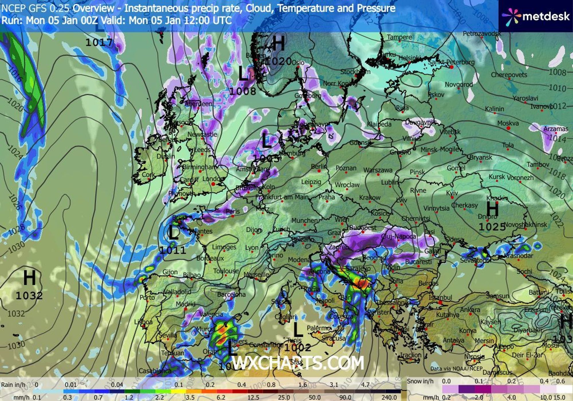
The high-pressure ridge that currently brings a cold northerly flow will weaken from Wednesday, allowing the airflow to become westerly. Depressions will quickly gain ground and look set to become quite active. A main low of about 985 hPa will reach Denmark on Wednesday, and on Thursday a secondary low will form near the English Channel, which could deepen into a serious storm by Friday night with a core pressure around 970 hPa. This depression will bring the first precipitation to France and Switzerland from Thursday afternoon or evening.
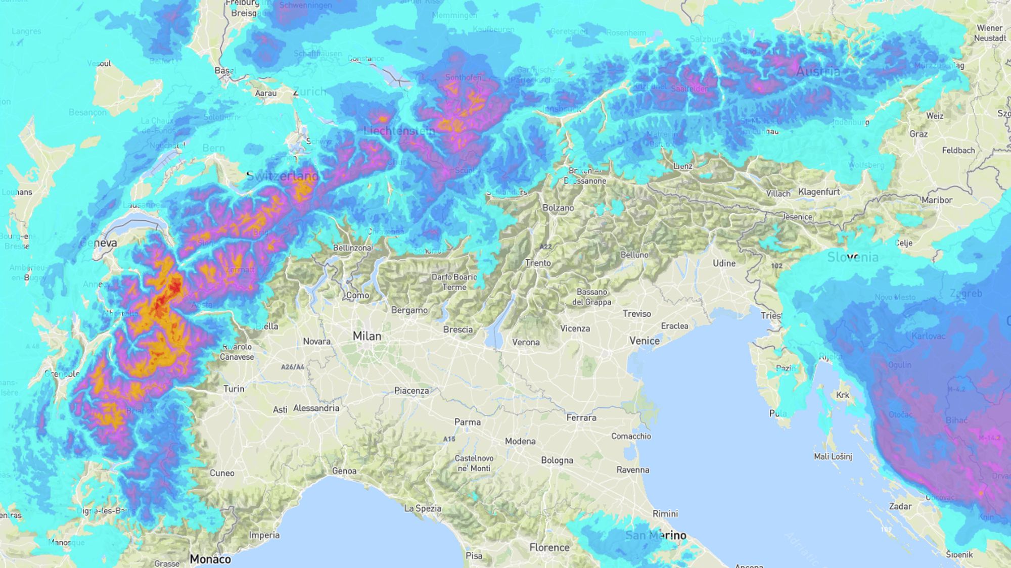
10 to 30 cm above 1500-2000 m until Friday morning
This first wave of precipitation will likely bring 10 to 30 cm of snow to the French Northern Alps and Swiss Valais by Friday morning. Much less will fall in the valleys because a warm sector is present on the eastern side of the storm system. The snow line will peak somewhere between 1500 and 2000 meters early on Friday.
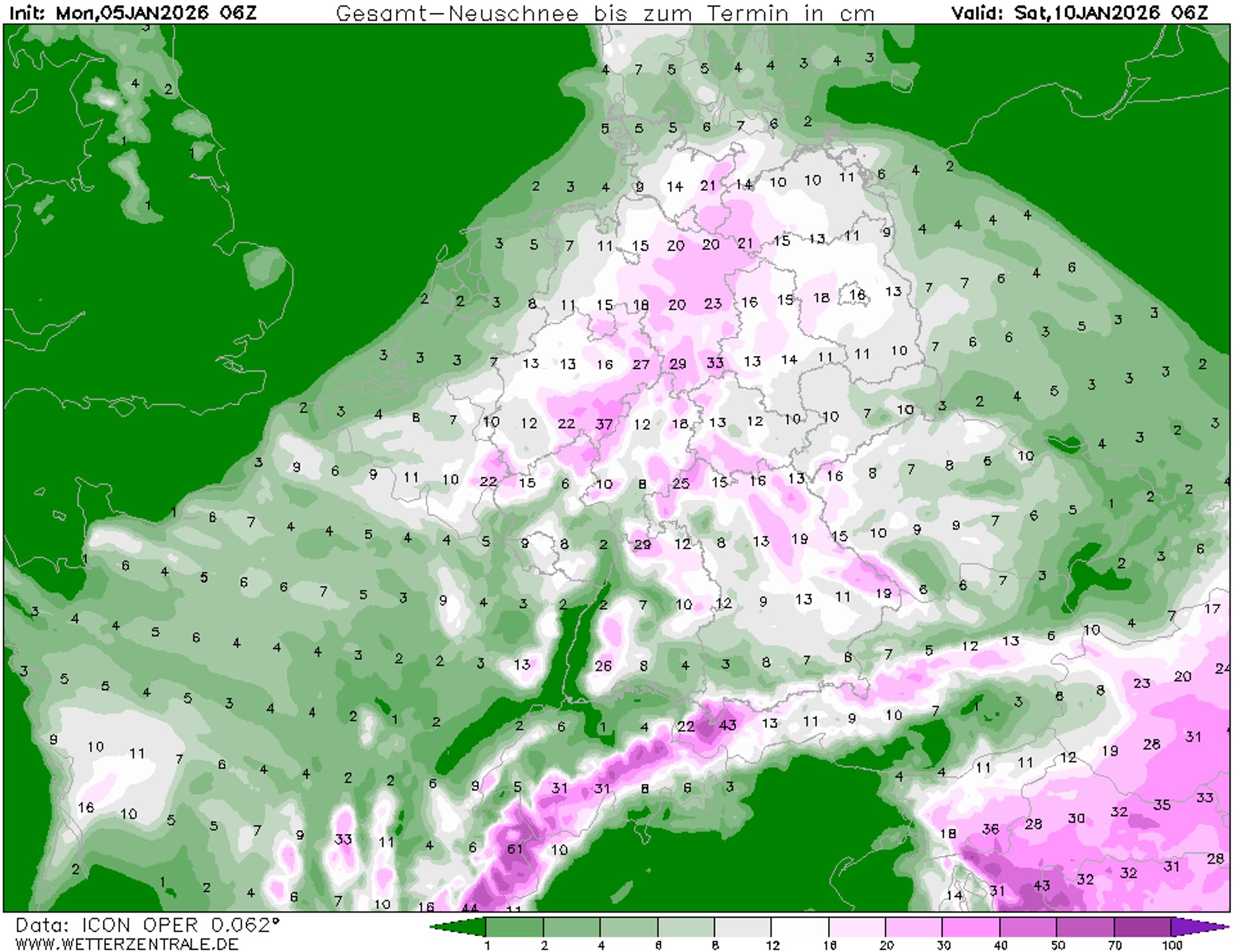
Regional totals reaching 50 cm by Saturday
On Friday, we’ll return to cold air behind the depression. The snow line will drop to 1000 meters or lower, and a strong northwesterly stau will develop. The French Northern Alps will benefit most, but other regions will also see snow. Where this stau becomes most active depends on the depression’s track and resulting flow direction. Models still vary too much for precise predictions. I expect several stations in the French Northern Alps to hit 50 cm of fresh snow by Saturday. Other stau regions will generally see 20–30 cm. The best candidates are the Swiss Northern Alps, the Jura, Valais, and Vorarlberg. Snow will also fall elsewhere in Austria north of the main ridge, but timing and amounts remain uncertain. For example, the ECMWF model shows snow in Austria starting Friday, while the American GFS model places it mainly on Saturday and Sunday.
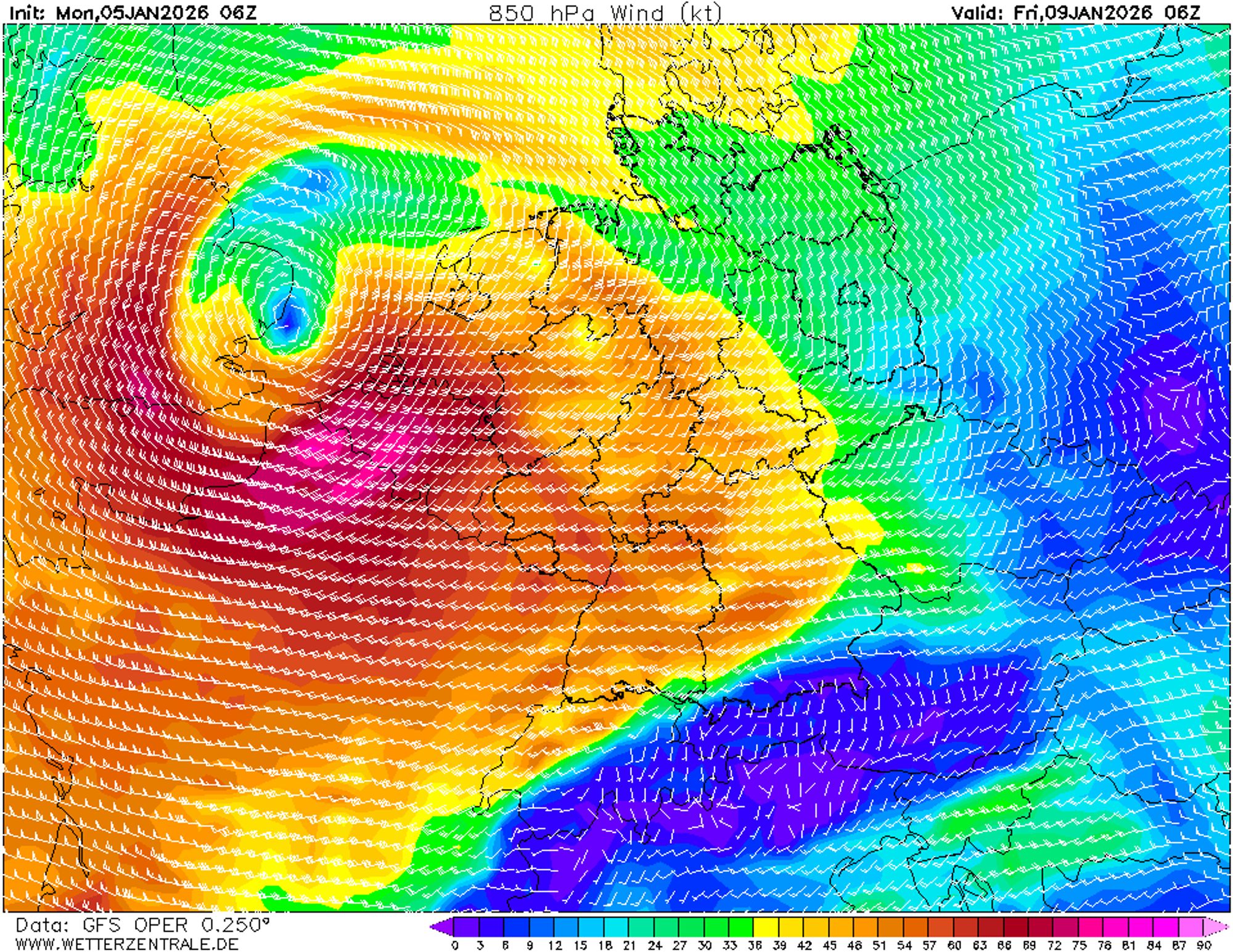
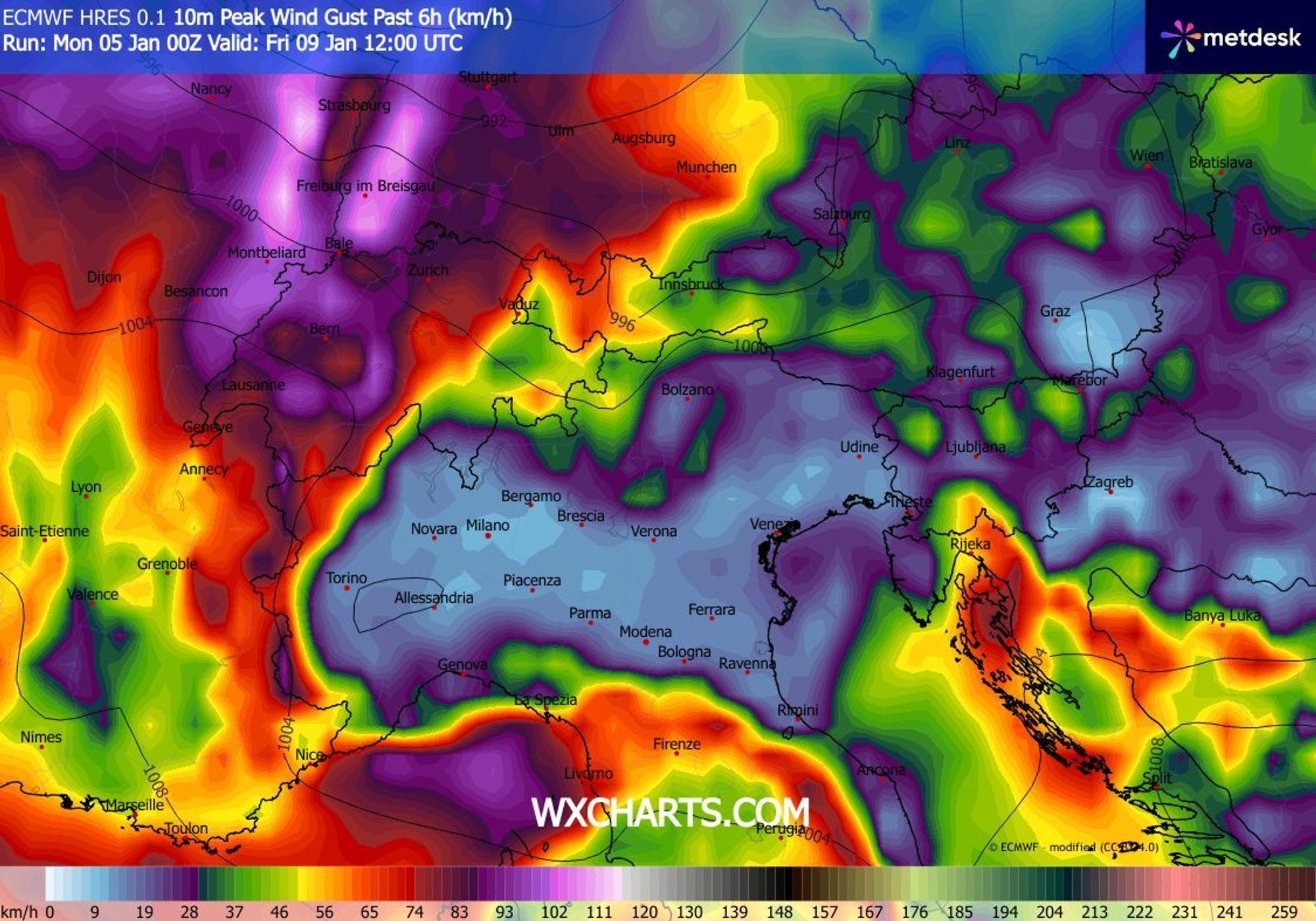
Wind will sharply increase avalanche danger
Snow on Friday and Saturday will come with strong winds from west to northwest, with gusts over 75 km/h. This will create wind slabs and cornices, quickly raising avalanche danger. Check the latest updates here.
Unsettled pattern likely to persist
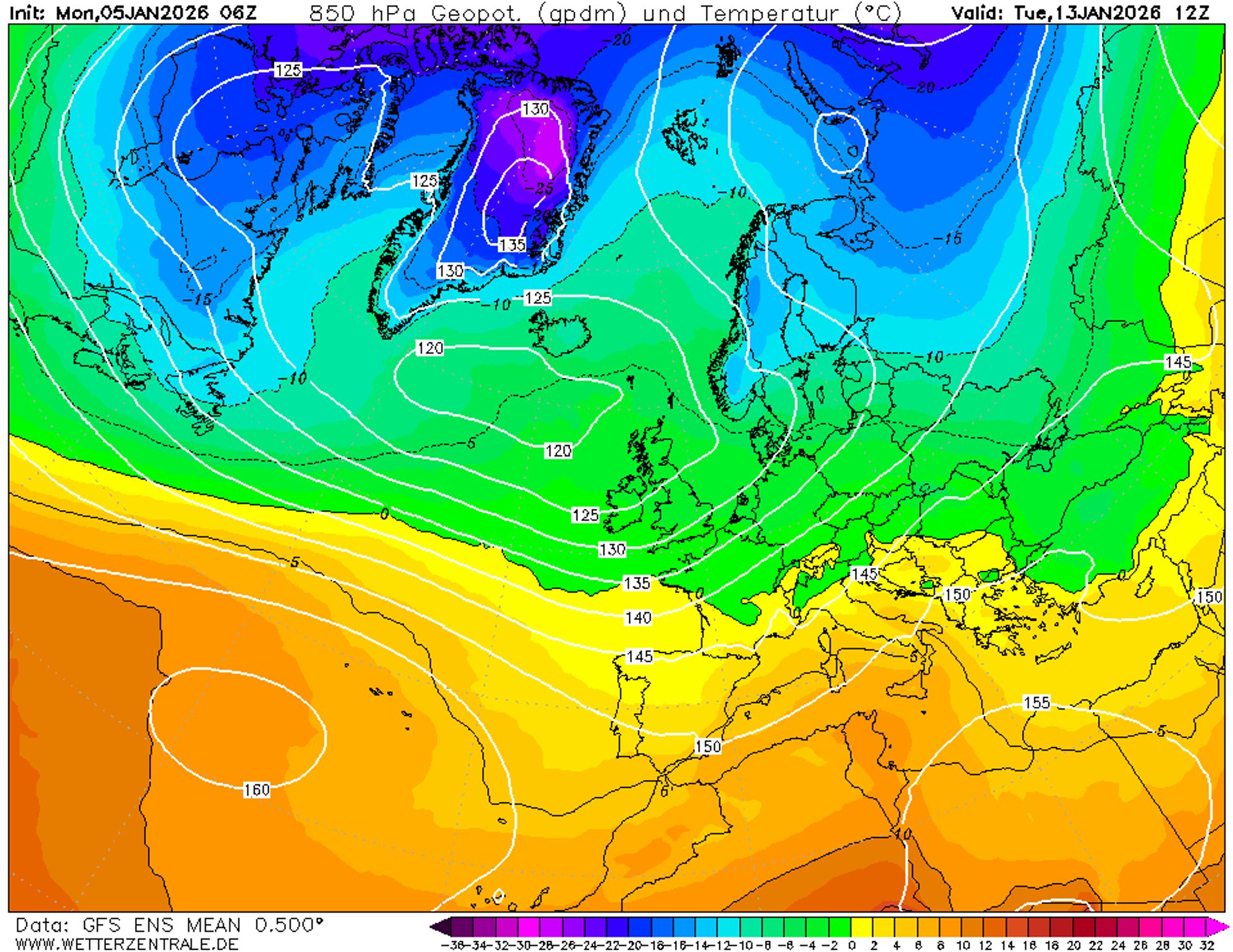
The westerly circulation looks set to dominate for a while. This means continued precipitation chances and temperature swings next week. Ahead of low-pressure systems, the snow line will rise sharply, then drop back into the valleys behind them. Given the flow direction, the Western Alps will likely remain the wettest and, higher up, the snowiest.
Replies
Huge thank you Chris. I’m thinking Vorarlberg for this weekend. The French places with huge snow totals will be too high to enjoy with the wind and visibility predicted on Saturday and Sunday, so am thinking a place with good tree skiing, like Stuben. Does that sound like the right call (for somebody who has to decide soon)? Thank you!!!
Huge thank you Chris. I’m thinking Vorarlberg for this weekend. The French places with huge snow totals will be too high to enjoy with the wind and visibility predicted on Saturday and Sunday, so am thinking a place with good tree skiing, like Stuben. Does that sound like the right call (for somebody who has to decide soon)? Thank you!!!
tarekbayazid - 05 Jan 2026 14:01
My pleasure! Vorarlberg will indeed be more sheltered than France but will also be blustery for a while, most likely between Fri night and Sat night. Sunday is looking calmer.
Is it worth getting the bus to Klosterle and skiing Sonnenkopf in these conditions? I have never bothered, but looks like it might be a good option. We are in St A from Saturday night.
It never snows in Sonnenkopf if you know what I mean 🤫
Say no more, say no more!!