Low-pressure systems will play a major role in the coming period. The barometer is clearly pointing toward a potential dump this weekend, but a rapidly falling pressure alone doesn’t tell the whole story. Preferred regions and snowfall intensity from Friday onward remain quite uncertain. In this forecast, we zoom in on what we do know — and on the factors that explain why uncertainty is still relatively high.
In this update:
- Weather today and tomorrow
- Jet stream and low-pressure systems set the tone
- Multiple precipitation zones from Friday onward

Weather today and tomorrow
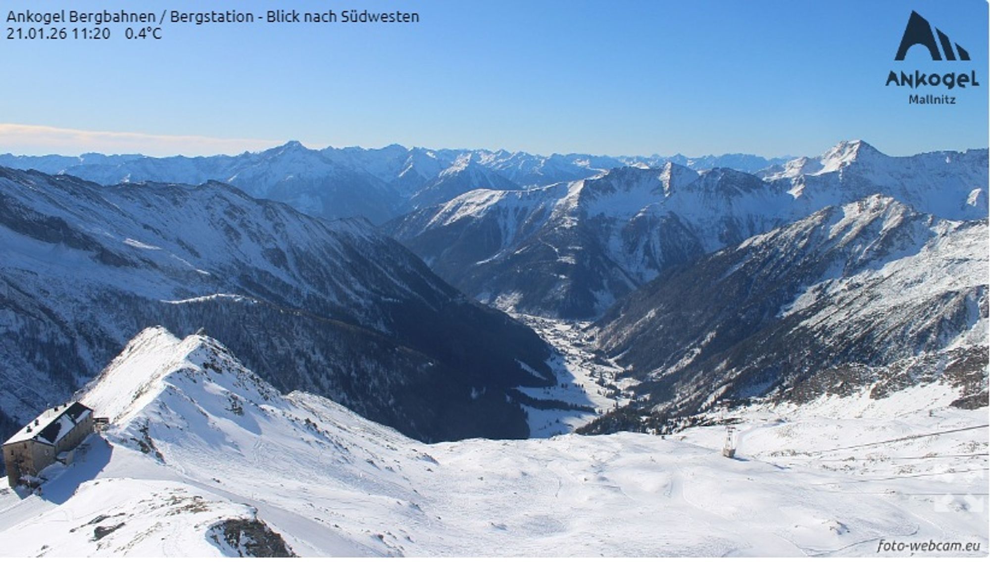
Today, the Alps are bading in sunshine. Winds are generally light, and temperatures are moderate, with values around freezing at 2000 m, or slightly below. Overnight, however, valley temperatures dropped sharply, with moderate frost (< -5°C) and locally even severe frost (< -10°C). After another cold night, little changes tomorrow in the eastern Alps. In the west, cloud cover increases, and in the French Alpes Maritimes and Écrins, some light snowfall above around 1500 m is possible.
Jet stream and low pressure set the tone
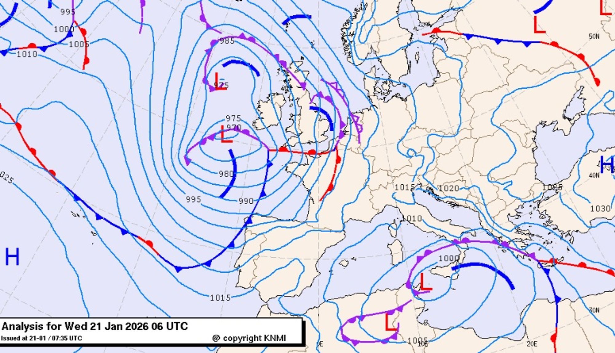
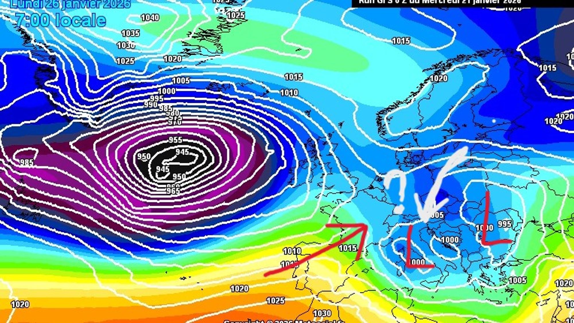
Weather charts show a rather unusual setup in the coming days. While high pressure dominates Scandinavia, a series of low-pressure systems advances from the west toward the European continent. Their influence gradually expands toward the Alps, increasing the chances of snowfall.
The jetstream
The exact track of these low-pressure systems and their associated precipitation zones is largely controlled by the jet stream. As Henri already pointed out yesterday, the jet takes a southerly track in the coming days. Both this far-southern position and its increasingly meandering pattern introduce considerable uncertainty for the forecast from Friday onward.
If a strong, fast jet were aimed directly at the Alps (as during PA#3), the location and intensity of a dump would be relatively straightforward to predict. This time, however, the jet maximum remains well south of the Alps at least until Tuesday, with even a cut-off feature developing around Sunday. As a result, the push and associated orographic lift against the Alps will be weaker, and the cut-off makes the exact placement of precipitation zones much harder to pin down several days in advance — similar to what we saw during PA#4.
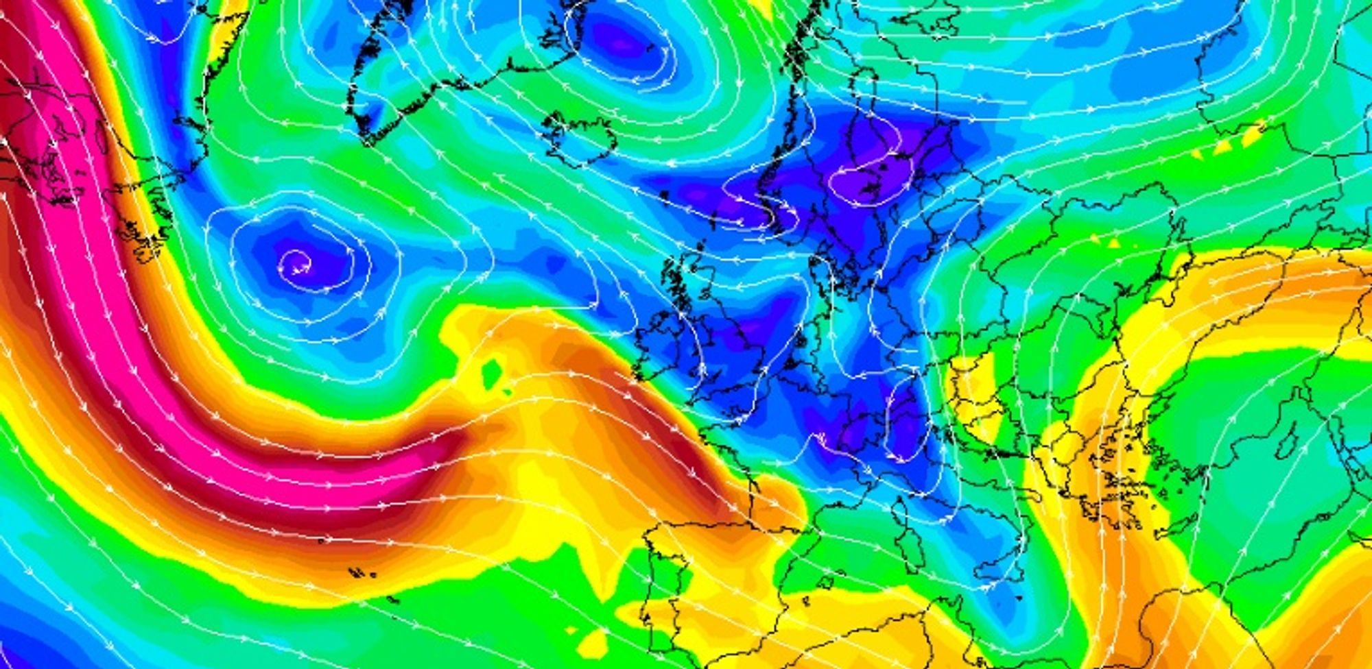
By Sunday, charts at around 3 km altitude show a (near?) cut-off low south of Genoa. What’s clear from the model output is that differences between models remain substantial, leading to very different scenarios in terms of flow direction, stau effects, and ultimately snowfall distribution.
Track of the low-pressure systems and spacing between them
A stubborn low near Sicily is finally retreating, but it is quickly replaced by a new sequence of low-pressure centers. These expand their influence over the Mediterranean and the Alps, strongly shaping the weather from Friday onward.
As the western core gradually fills, a new low develops over Italy, expanding both eastward and northward. Its exact track remains uncertain, but it will directly affect expected snowfall in the eastern Alps. In any case, this system remains influential through the weekend, before another Atlantic low potentially takes over.
The speed at which this system advances also matters — especially for the question of whether there is still room for some north-facing stau in Austria between successive lows.
Multiple precipitation zones from Friday onward
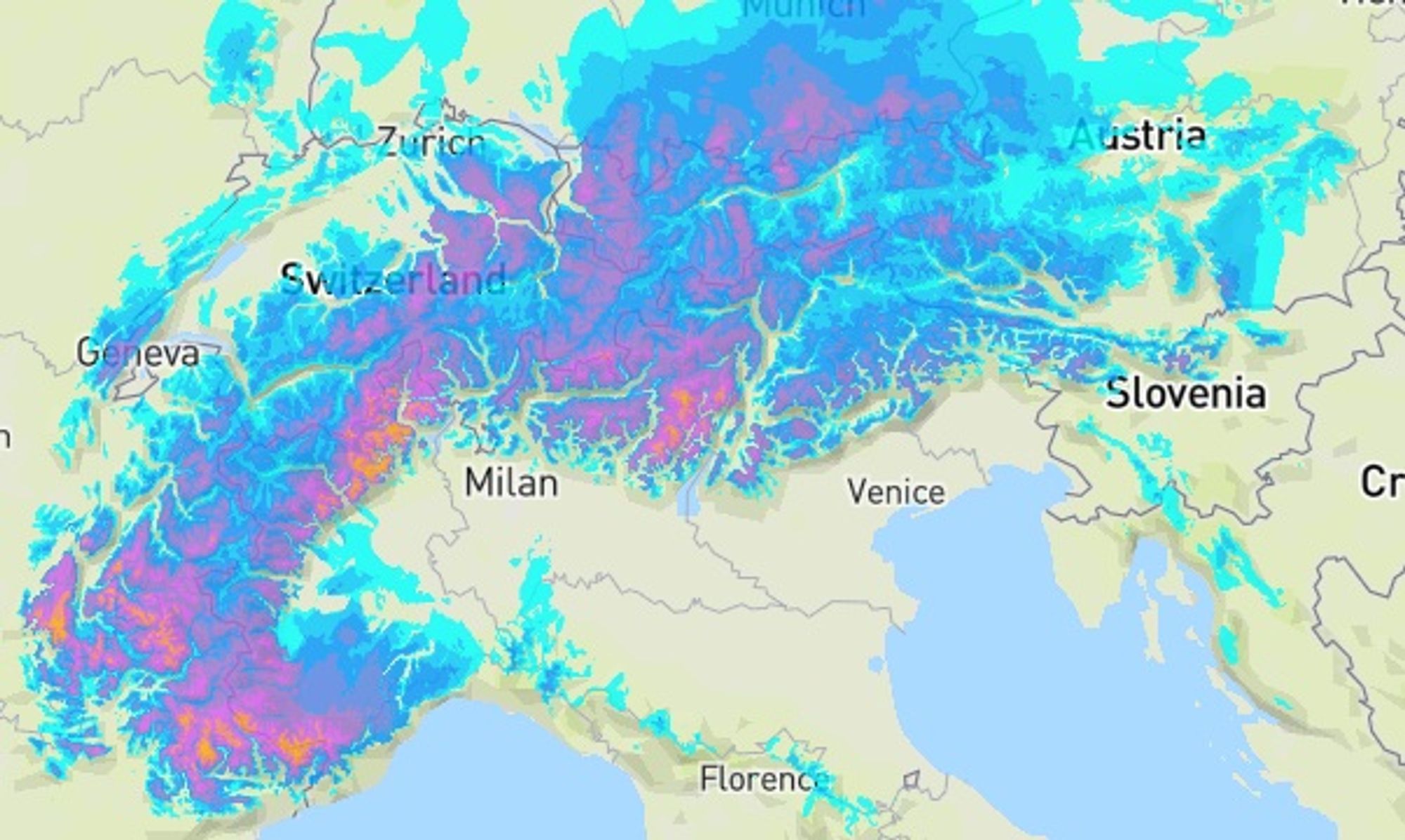
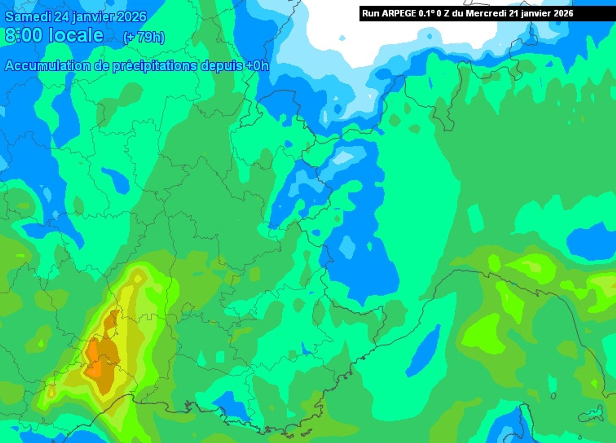
After a first western glancing on Thursday, a more active precipitation zone develops on Friday. With a southerly to southwesterly flow, the Alpes Maritimes, Écrins, southern Piemonte (Cuneo), Ticino, and Lombardy are likely to receive around 10–20 cm of fresh snow above 1000 m by Saturday morning — initially a few hundred meters higher on the French side. Precipitation may push into South Tyrol, but further east, snowfall is expected to be limited.
On Saturday and Sunday, a second precipitation phase follows, again favoring the southwestern and southern Alps. This phase comes with even greater uncertainty, due to the earlier-mentioned cut-off upper low near the Alps. At present, 10–30 cm during this second phase seems likely, this time also including the Dolomites. Depending on where exactly the cut-off sets up, local totals could end up significantly higher — or lower. Snow lines remain relatively low during this phase as well.
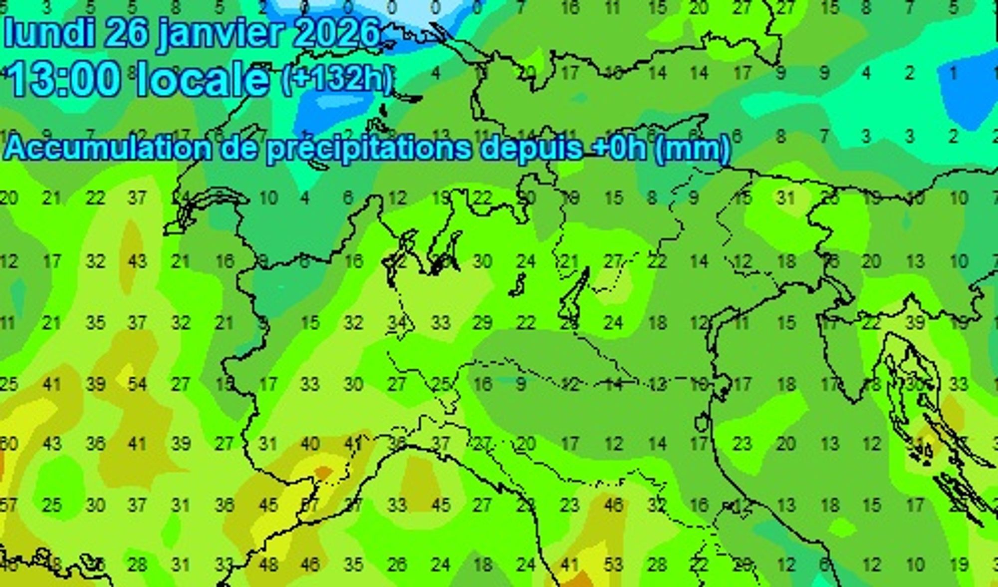
Depending on the eventual track of the developing low, other parts of the Alps could also pick up some fresh snow on Sunday, but we’ll need the next few days to refine those details.
The bottom line is for many Alpine regions, snowfall is on the way in the Friday–Monday window. A PowderAlert for areas that benefit twice from fresh snow (for example the Écrins) is certainly not off the table — but given the current level of uncertainty, we’re intentionally holding off for now.

- 1cm
- 5cm
- 10cm
- 15cm
- 20cm
- 30cm
- 40cm
- 50cm
- 75cm
- 100+
- 1mm
- 5mm
- 10mm
- 20mm
- 30mm
- 60mm
- 120+
The cumulative maps give a broad overview, but don’t be surprised if the forecast jumps around significantly over the next 48 hours.
Finally, a note from the SLF avablog: last week’s heightened avalanche activity was clearly visible there, accompanied by a striking photo that perfectly underscores the importance of good decision-making in the mountains.
Stay tuned for more!
Replies
Thanks for the regular and detailed forecasts! If the Pyrennees are looking good in the coming period would be great if they featured, thanks.
Thanks for the regular and detailed forecasts! If the Pyrennees are looking good in the coming period would be great if they featured, thanks.
8611 - 22 Jan 2026 10:10
We will. Weather will be very changeable the next 5-10 days with fohn and precipitation expected frequently as active frontal systems will pass and winds vary between southerly and WNW’ly.