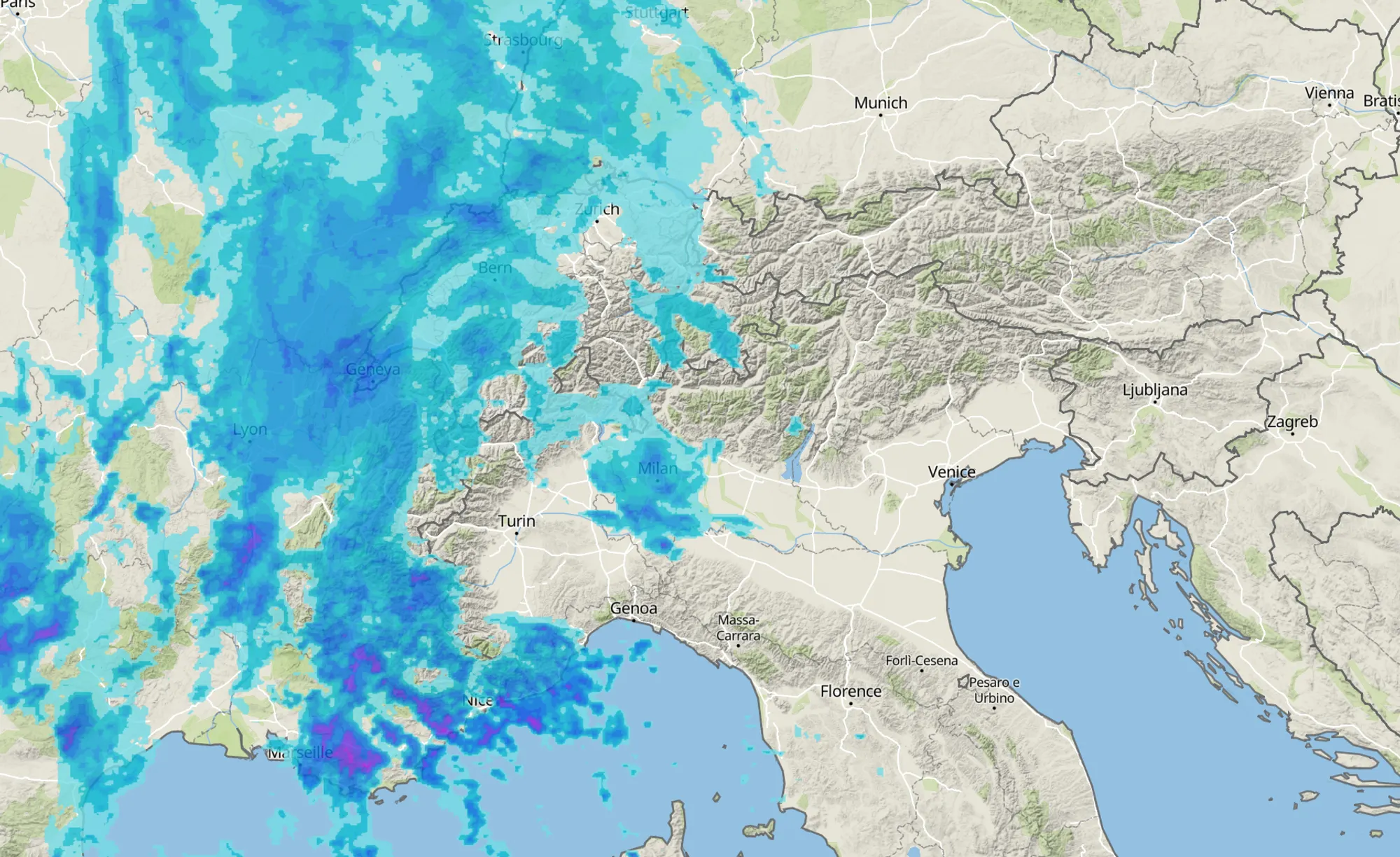
The Alps are clearly shifting up a gear again in the coming days, and we are in PA#5. An active precipitation front is moving in from the west toward the French Alps. The first precipitation will arrive with a relatively high snowline, especially in the French Northern Alps (around 1500-1800 meters, locally even a bit higher along the western Alpine edge), but this will only be brief. During the night into Wednesday, colder air pushes in and the snowline drops rapidly to 500-1000 meters. On the French southern side, it will certainly snow quite low in many inner-alpine areas. As Chris rightly pointed out yesterday, due to this warm sector the highest snowfall totals are expected from around 1700 meters in the Western Alps and about 1300 meters in the Southern Alps.

The latest model runs show strong agreement with the amounts Chris mentioned. Especially the French Southern Alps are set up well for the night into Wednesday: in the region around the Écrins and further south, widespread snowfall of 30 to 40 cm is expected (high-resolution models even show regionally 50-80 cm at higher elevations) by Wednesday morning. So tomorrow morning you’ll already be standing in deep powder there. Sounds like a big party, but be aware that avalanche danger will be level 4 across the French Southern Alps and above the treeline in large parts of southern Piedmont. Read more here en here.
The French Northern Alps will receive a bit less, but even there an additional 10 to 30 cm is expected, and more in regions such as Isère. Many regions on the Italian southern side will also get their share. In addition to 30-50 cm in southern Piedmont (Alpi Marittime) through Wednesday, the Dolomites and Lombardy will see an intensification of snowfall during the night into Wednesday, with amounts of 20-50 cm (lower end in the north, higher end in the south) and a snowline that rises from 500 meters during the day to 800-1200 meters. Keep in mind that the largest amounts here will mainly fall during Wednesday daytime.
Northern Alps: a bit of patience
On the northern side, the föhn flow will persist on Wednesday, keeping it mostly dry there. This changes during the night into Thursday, when colder air flows in from the north. Precipitation will then partially cross the main Alpine ridge, but don’t expect large amounts. Count on 5 to 15 cm, with locally a bit more in high-elevation areas close to the main ridge, such as the Ötztal and Stubai Alps. On Thursday, light snowfall will continue in the Eastern Alps, while the Western Alps will benefit from clearing skies.
Friday: a bit more for the NW Alps
On Friday, a new impulse follows. A secondary disturbance from the Atlantic Ocean will mainly target the French Northern Alps and Valais. The snowline will remain around 1000 meters, and another 10 to 20 cm could fall. The weekend looks somewhat unsettled in these regions and the rest of the Northwestern Alps, while the rest of the Alps will remain largely dry. Looking ahead to next week, new depressions again seem to offer opportunities for the Western and Southern Alps. The Northern Alps will likely remain more often on the föhn side, with drier and milder conditions.
Replies
any updates for the Pyrenees? we go heliskiing in Baquera Beret on Thursday to Saturday and hope for good conditions…