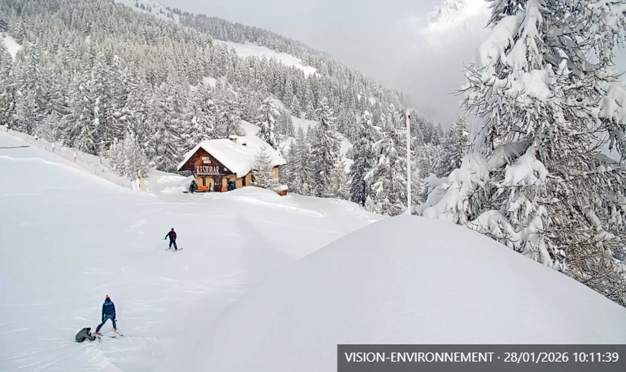
Today the precipitation system relating to PA#5 moves from the Southwestern toward the Southern Alps. While parts of the French Alps woke up with 30–50 cm of fresh snow, snowfall in the Dolomites is only just getting started this morning.
Today’s quick overview:
- Snowfall French Alps
- Snowfall Piemonte & Aosta
- Snowfall Southern Alps
- North of the main alpine ridge
- Pyrenees update
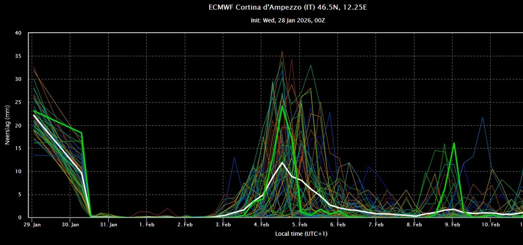
- Dump on the horizon for the Southern Alps next week
If you don’t have a wePowder Pro subscription yet, consider to buy it now with a 30% discount with the code INSTA30 You get access to detailed weather forecasts, the digital freeride guide and Safety Academy modules. Click here for more subscription info

Snowfall French Alps
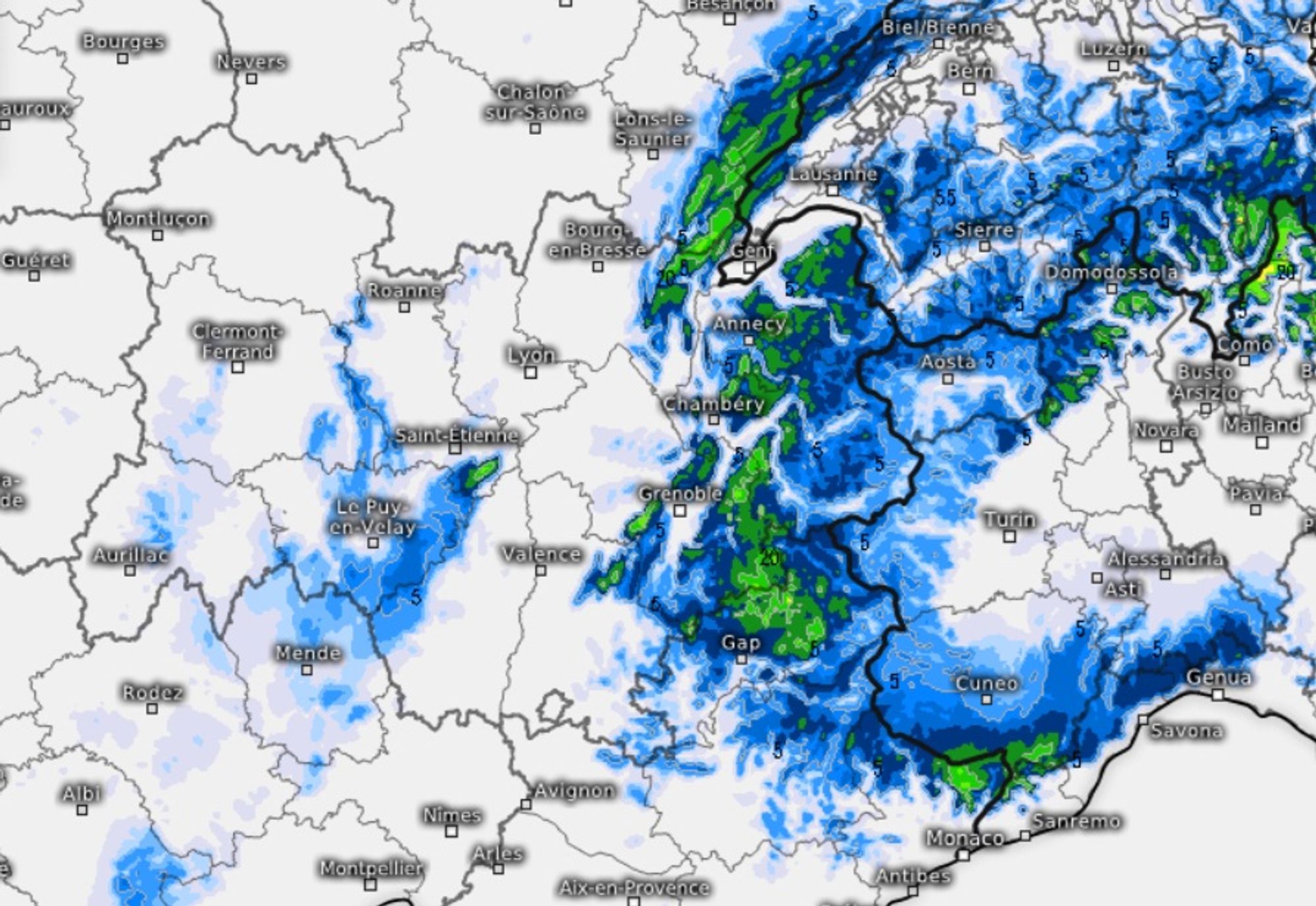
The past 24 hours brought a big change in the French Alps, but with huge regional differences. Southern areas like the Écrins and Alpes Maritimes scored big, while more western and northern regions lagged behind. Strong southerly flow caused large differences in both temperature and precipitation. In the Alpes Maritimes and Écrins, snowfall intensified from yesterday afternoon onward, resulting in 30–60 cm of fresh snow on a large scale. The snowline was relatively low: inner-alpine areas like Puy St. Vincent already saw snow at 1300 m yesterday afternoon with temperatures around 0°C. Further north, temperatures rose significantly and precipitation was slow to arrive. In the Chamonix area, hardly any snow fell until this morning.
Overnight, temperatures dropped everywhere and today (especially this morning) another 5–20 cm will fall above roughly 1000 m.
Heads up: Avalanche danger is high in all areas with significant snowfall. Choose conservative terrain and don’t push it!
Check out the avalanche bulletin here
Snowfall Piemonte and Aosta
On the Italian side, conditions are similar to the southern French Alps. Warm air had less influence here and snowfall started from yesterday afternoon onward.
Above 1000–1300 m, 10–20 cm of fresh snow fell across many areas (Sestriere, Pragelato, Prali, Alagna, Macugnana, Courmayeur), with larger totals close to the French border and in the southern regions:
- Ormea 46cm
- Limone 43cm
- Bardonecchia: 30 cm in town
- Cesana Torinese 25cm
The snowline dropped close to the lowlands overnight. It stays cold today, but only little additional snow is expected.
Snowfall Southern Alps
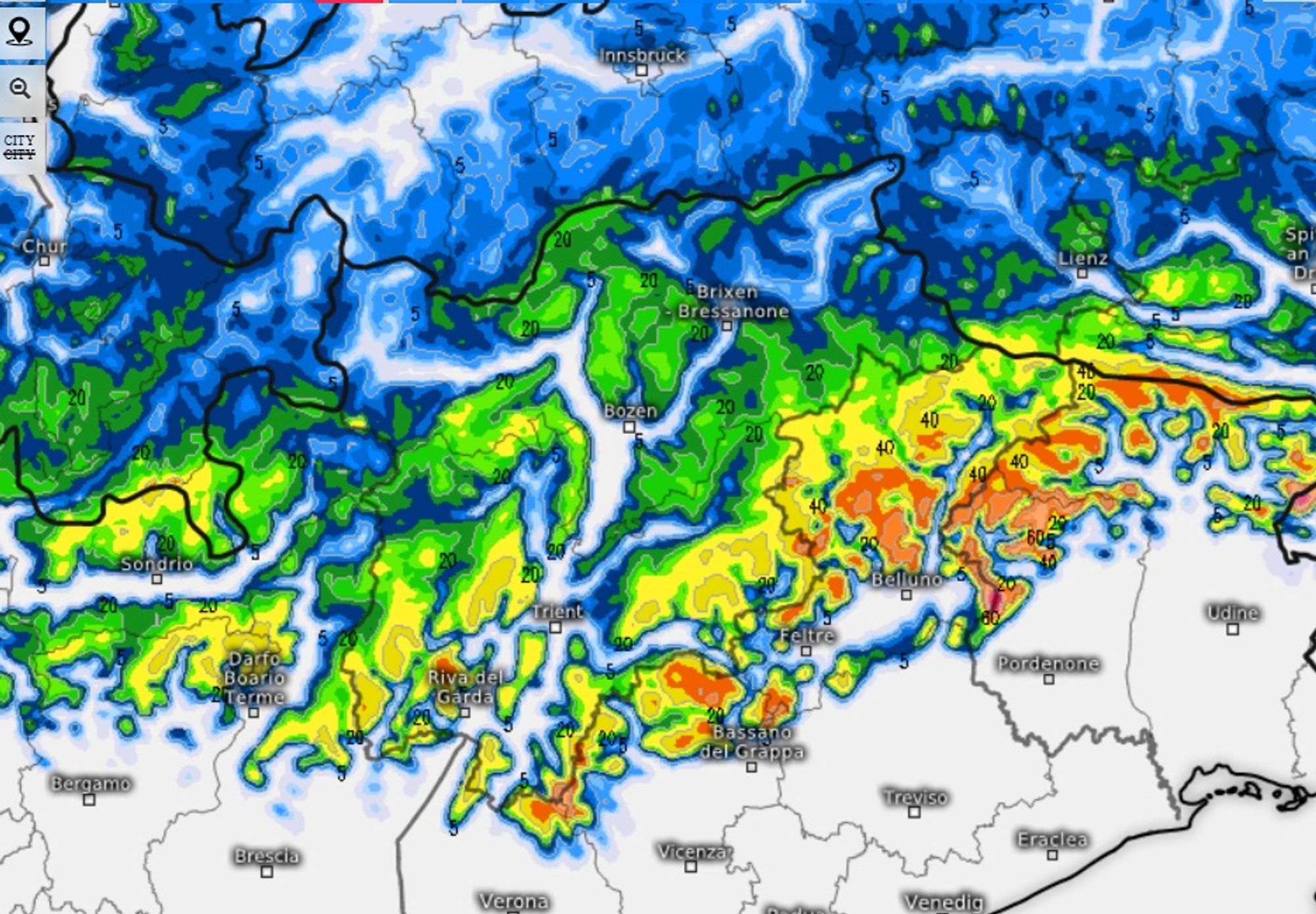
In Ticino and Southern Trentino, some snow fell overnight, but the real action starts today. From Ticino to the Julian Alps, widespread 20–50 cm is expected through tomorrow. Amounts will be slightly lower in South Tyrol and Carinthia, while the far southern areas may locally receive even more. Snowline: initially well below 1000 m, later rising to around or slightly above that level.
If you are on your way in this area; check out the avalanche bulletins here
North of the main alpine ridge
This evening and tonight, a cold front moves through and winds at altitude shift more westerly. This allows precipitation to spread into Austria, including inner-alpine and northern regions. Expect 5–10 cm, with inner-alpine areas locally up to 20 cm.
Pyrenees update
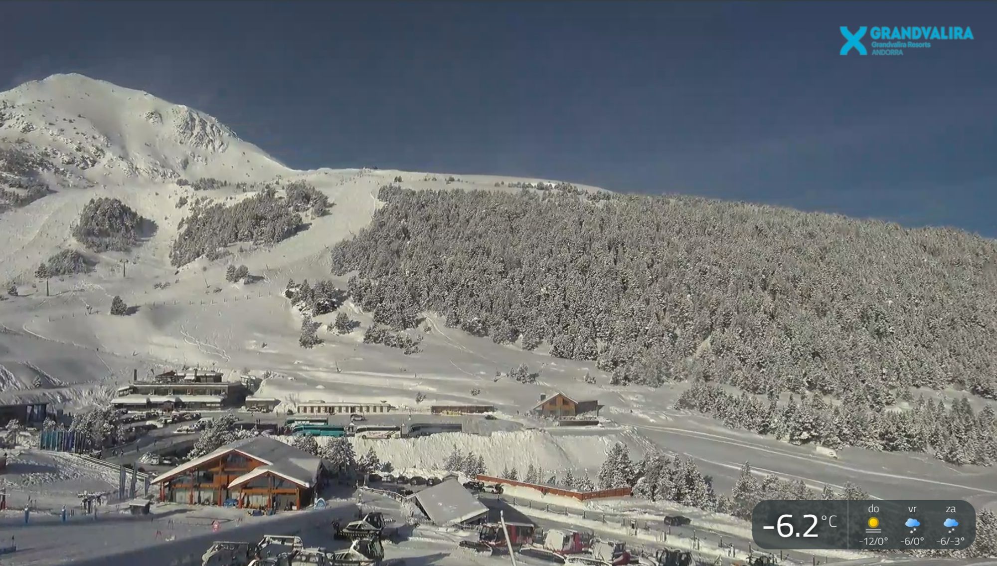
Conditions in the Pyrenees are good to excellent these days. After clearings today some more episodes with snow will be crossing the next few days.
Some impressive footage was shared on the Dutch forum
Definitely a region worth considering right now with cool temperatures sticking around until the weekend.
Dump on the horizon for the Southern Alps next week
On Friday and through the weekend, conditions along the western and northwestern Alps will be unsettled. Temperatures remain moderate, with a few degrees of frost at 2000 m. Next week, the Southern Alps may be in line for another dump, while other regions turn warmer with increasing föhn influence.