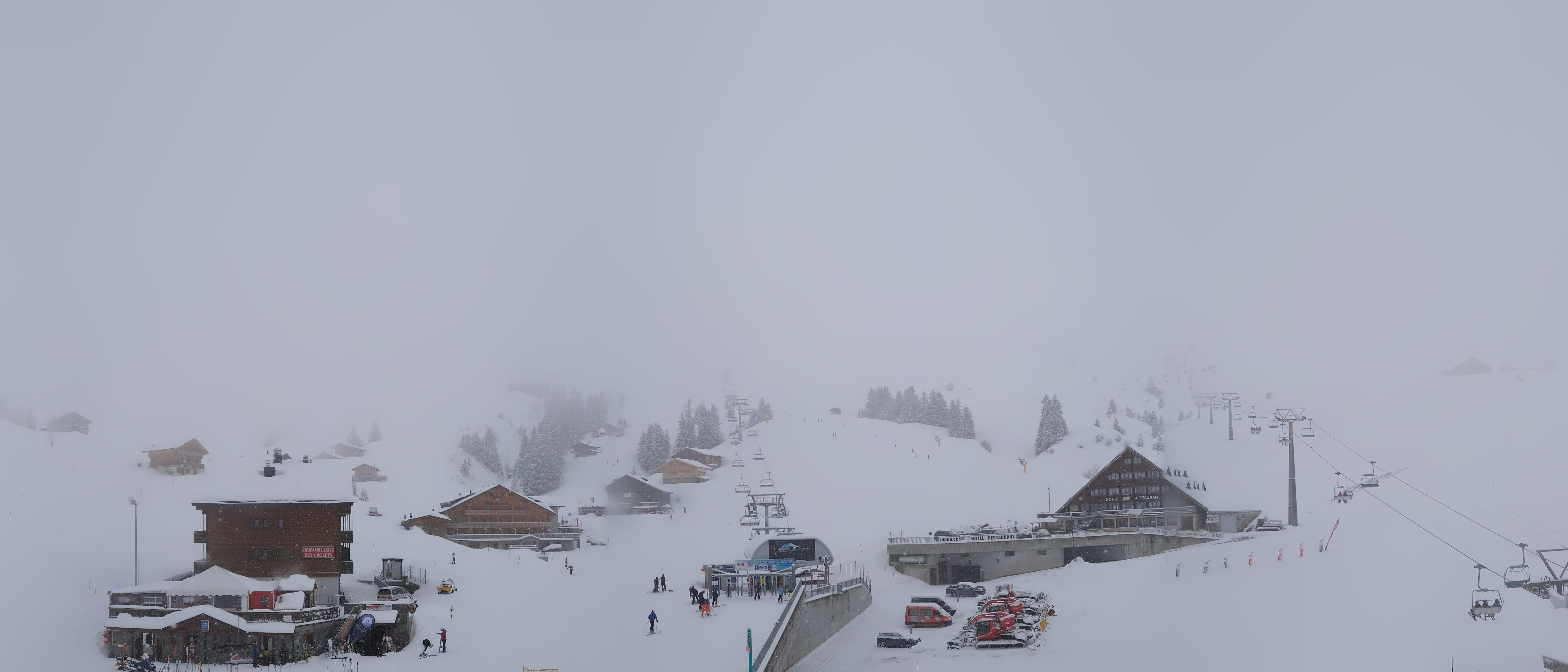
In many places in the north-western Alps 20 centimetres of snow has fallen and also the north side of Austria is enjoying its share, but let’s focus on another region in the Alps. A local snow bomb will bring more than half a meter of snow, locally possibly up to one meter around the tripoint of Austria, Slovenia and Italy in the Julian Alps.
In this weather report:
- Snowbomb in the Julian Alps
- Where to go?
- Possible PA for Northwest?
Snow bomb in the South-Eastern Alps
^The forecasts on wePowder are powdered by our friends at Ortovox
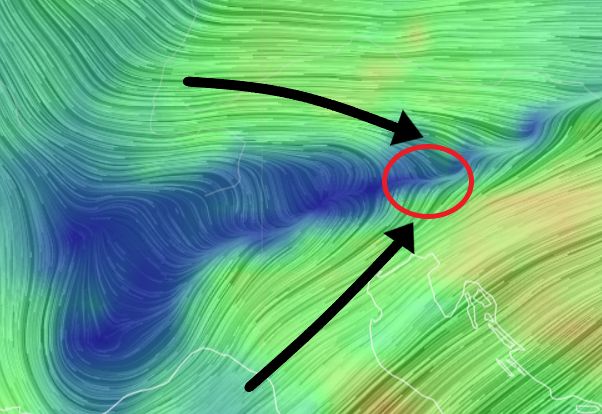
It’s a typical situation for this part of the Alps. A small low pressure core has formed south of the Alps. Due to convergence, the moist Mediterranean air is forced to rise from the southwest, which can lead to a lot of snowfall in the southeastern Alps. Considerably colder air flows from the northwest under this south-westerly flow. The heavy precipitation will be limited to a small area around the Julian Alps, centred on the Kanin massif with the Sella Nevea - Kanin ski area. Also in Nassfeld on the border of Carinthia and Friuli everything falls into place and we will see some serious amounts of snow. If you go a few kilometres to the north, for example on the Gerlitzen near Villach, the precipitation amounts already decrease strongly and it remains at about 20 to 30 centimetres.
")

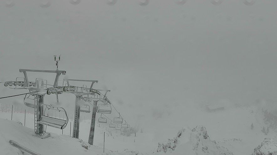
From now on (Wednesday afternoon), the intensity of the precipitation will increase considerably and colder air will flow in. At the moment, the snowline is still locally around 1,500 metres or even higher and there is still fairly heavy snow, but in the course of the afternoon and evening, it will snow down to most valleys. In the course of the afternoon and evening, however, it will snow up to most valleys, with 20 to 30 centimetres of snow.
Where to go?
Is it worth it? The base in areas like Nassfeld is already quite good and with this snowfall in the coming hours it will be very deep. Tomorrow you can enjoy half a meter of powder and the sun seems to break through again during the afternoon. Until the weekend it will remain cloudy, sunny and also fairly cold. The areas higher up, such as Sella Nevea - Kanin, may stay closed for a while due to almost a metre of fresh snow and a high avalanche risk.
PA also for the north-western Alps?
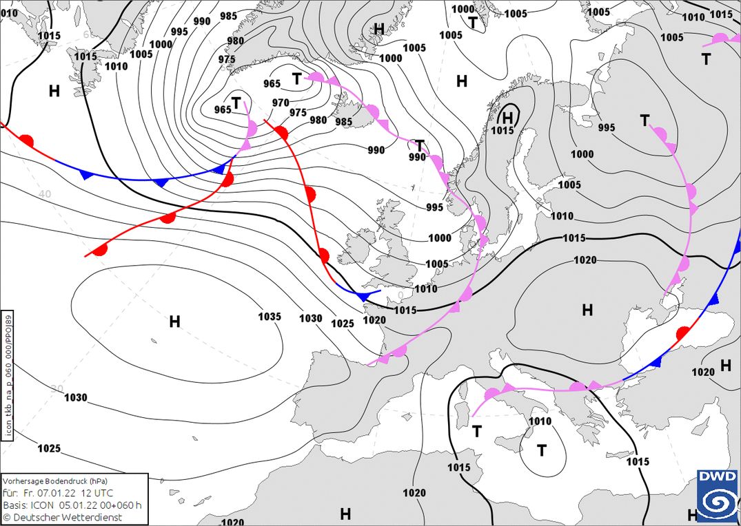
The developments for the weekend are also very interesting to follow. Tomorrow it will clear up from the west and especially the north side of Austria will have to deal with some snow showers. In the course of Friday, another front will follow from the northwest, but this one will not bring much more than a few centimetres. Right behind it, however, is another front with another 10 centimetres of snow possible.
Sunday might bring the real thing, but the models don’t agree with each other yet so I have to be a bit cautious about this snowfall. The expected nordweststau on Sunday looks promising in the European model at the moment, but the American model is still putting the brakes on with a maximum of 20 centimetres in the stau areas. The snow line might be a bit high at the start of this snowfall (around 1500 meters) due to the temporary föhn in the night from Saturday to Sunday before the front penetrates, but as the front passes, the snow line will quickly drop again.
Replies
So essentially this PA#2 is for Nassfeld and nothing more serious until Sunday at the very best…?!
Getting carefully hyped for next weekend! Any idea what the avalanche risk would be Sunday-monday in the best case dump scenario? Is the base layer any good in NW?
Getting carefully hyped for next weekend! Any idea what the avalanche risk would be Sunday-monday in the best case dump scenario? Is the base layer any good in NW?