The Pyrenees are on the eve of a big dump, but also in the Alps, the coming days will be marked by a lot of snowfall. A low pressure core over the Alps and then a succession of fronts from the northwest will bring a lot of snow.
")
")
Snow dump in the Pyrenees
^The forecasts on wePowder are powdered by our friends at Ortovox
As I already wrote in the weather report the day before yesterday, the Pyrenees will be faced with a heavy snow dump from tonight onwards. Until Monday the western areas can receive one meter of snow. Because of the inflow of air of arctic origin, the snow line will temporarily drop below 500 meters tomorrow. On Monday, the cold outbreak will gradually move eastwards, causing the Pyrenees to experience a rising snowline and eventually clear skies, but this will put the Northern Alps in the firing line.
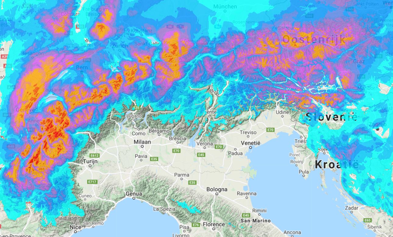
Snowy weekend in the Alps
First we take a step back, because also for the Alps the developments on the weather charts for this weekend are very interesting. Today, the northern side is already experiencing some light snowfall, which could bring about 5 centimetres higher up. Cooler air has already entered the Alps, which makes it possible for snow to fall in the valleys. However, the ground is not cooled down enough everywhere and the snowfall is too light to actually create a snow cover down into the valleys. The extreme eastern Alps will get about 10 centimetres of snow today, in Carinthia and the Julian Alps even more. Tomorrow and Sunday, under the influence of a strong south-westerly flow, this region will get even more snow, locally to over half a metre. The rest of the southern Alps are in the lee.

The Northwest Alps will also receive much-needed snow over the weekend for a great start to the season. In the Stau regions, 20 to 40 centimetres of snow could fall, locally up to half a metre. With the low pressure core directly over the Alps, the hotspots are still hard to determine. In the course of Saturday afternoon, the precipitation will also move further east, making 20 to 30 centimetres possible on a large scale. In combination with the aforementioned snowfall coupled with the southwestern flow, I expect the most snow around the Tauern (up to half a metre) and the areas south of it.
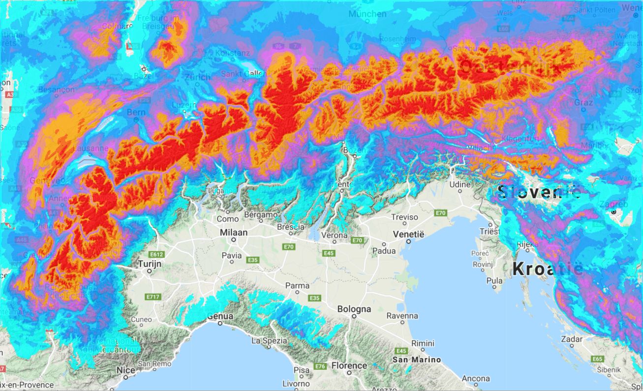
Succession of fronts
Also early next week, the Alps will have to deal with a lot of precipitation. High pressure from the west could bring some clearances in the Western Alps on Tuesday, but during Wednesday a warm front could bring a lot of snow again (with a slightly higher snowline). From Thursday onwards, a north-westerly flow will again provide cold and snowy conditions. Especially the northwestern Alps are likely to get a lot of snow again.
Don’t focus too much on the exact amounts in the map above. Calculating the exact snow amounts for the end of next week is still an impossible job, but the map shows the potential of the weather situation next week. Also in the GFS ensemble for the Northwest Alps we see enough precipitation signals, which makes it clear that we can still expect something.
")
 (wetterzentrale.de)")
Background weather articles
Want to know more about the weather? Read our following background articles:
More background articles will follow shortly.
Replies
is there a new app? loved the old one
Today was awesome in Obertauern - Skitouring in Austria 🎿🚀⛷⛄️❄️👻🎉
We need Powder Alerts and where to head section !!!
We need Powder Alerts and where to head section !!!
Bacak op 29 Nov 2021 11:08
Absolutely agreed! ❄️❄️❄️