That snow is coming next week is by now clear. PA#3 seems increasingly certain, but for now with a few caveats that I describe below.
First of all, some snow tomorrow
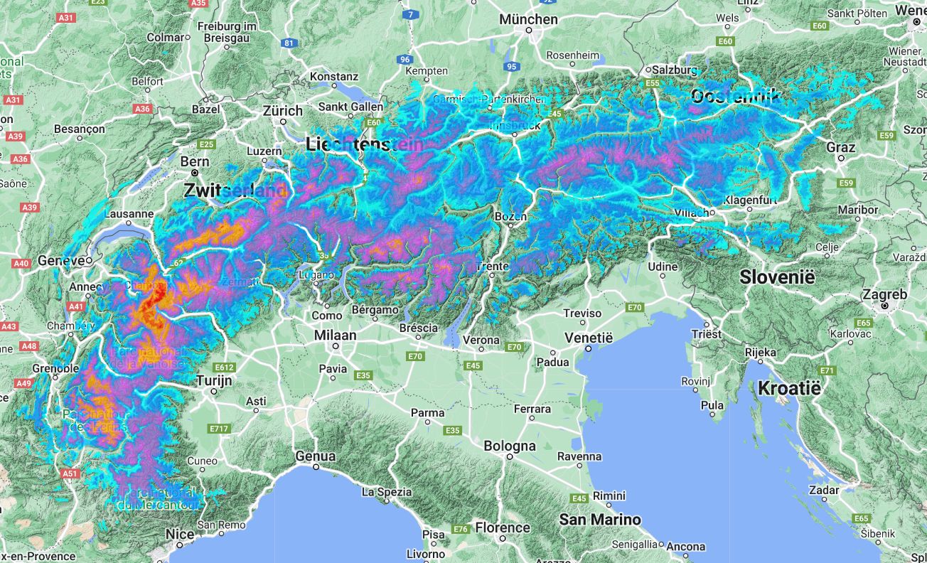
Although the eyes are mainly on next week’s snowfall, let’s take a look at this week first, as tomorrow will also see some snow. With a westerly to northwesterly flow, some precipitation is pushing into the Northern Alps. The snowline here does not really want to drop yet and remains at around 1500 to 1800 metres, in the French Northern Alps also a bit higher. During the night, winds picked up considerably, especially on the northern side in Austria. This is also where it will continue snowing the longest. For most areas on the north side, it will remain around 5 to 10 centimetres. The high-resolution models for some northern stau regions (Allgäu, Arlberg, Dachstein, Hochkönig) locally even show more than 20 centimetres, but at the same time also some more rain below the snowline mentioned above. Friday clears up again everywhere and remains dry. Saturday is also part of this calm interlude.

")
PA#3 next week?
After a far too warm period, we finally seem to be getting serious snowfall again next week, but it is all not in the bag yet. The weather models do not yet give a clear picture and from run to run we also see quite a few differences. An overview of what is known at the moment:
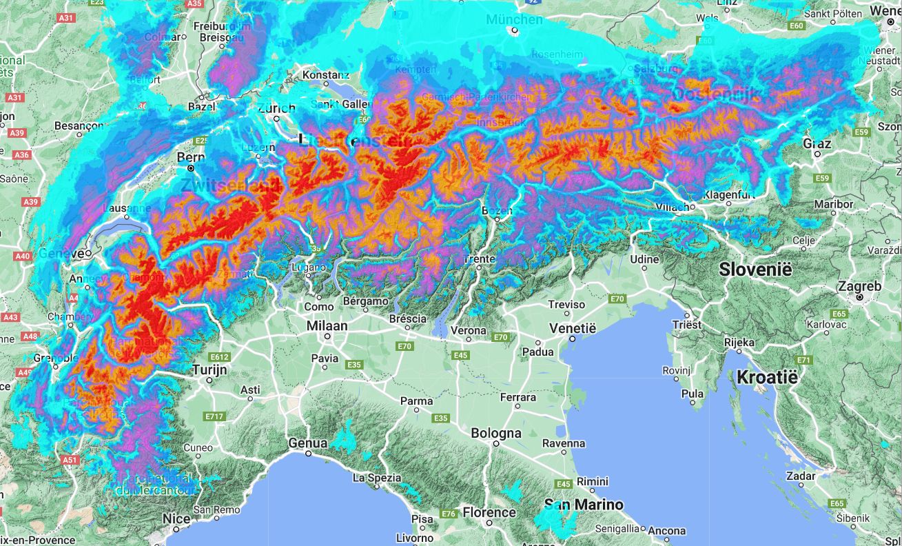
- First the southern Alps, then the north-western Alps:
On Sunday, most of the snow seems first for the Italian southern Alps. In the Northern Alps, we first see temporary southern föhn. Soon, the centre of gravity of the snowfall moves to the north-west Alps due to the western to north-western flow. Initially on Sunday, the snowline here is likely to be around 1,500 metres, but during Monday the cold seems to gain ground, allowing the snowline to drop to around 1,000 metres and possibly even below.
- Fluctuating temperatures:
The temperature yoyo will be able to start causing varying snowlines. Wintry conditions with snow all the way into the valleys will be difficult for many regions. So, for now, it looks like cold could trickle in from the northwest on Monday, but there is still a lot of uncertainty about the timing along with the precipitation. By the middle of next week, it will become temporarily warmer again. This could be accompanied by precipitation with a higher snowline, but we will have to wait for details.
- Snow amounts uncertain:
Particularly for the Northern Alps, the amounts could still decrease significantly with some small shifts. We already see this in the past model runs as well. Both the US and European models calculate significantly lower amounts on the north, but also on the northwest side. In the European model, the amounts are almost halved until next Wednesday! Therefore, to conclude, I would like to stress one more time: we are talking about the (medium-)long term (+120h and later), so I cannot yet pinpoint the hotspots of snowfall with great certainty. Because of this trend, as much as I would like to, I am not issuing a PA for now. Hopefully Friday I will!
Read also:
Replies
Fingers crossed in Chamonix!!! Thanks for the update!!! ;)
Fingers crossed. In this modern world,
South winds = heat wave, off the charts
South Westerly = heat wave to very hot
Westerly = Above average to significantly above average
Easterly = Average
Northerly = Below Average
So lets pray for Northern or easterly winds \
ecmwf looks very “Westerly”, even south westerly at times… not so good news. Hoping for some change, Meanwhile the only choices in FR and CH would be Val Thorens, Zermat, Saas Fee, The top parts of Verbier, and similar. Anything above 2300 should be ok for piste skiing.