It is hard to imagine with the current spring conditions, but it really is time for PA#3! At the time of writing, it also feels just like spring here in Innsbruck. It’s well over 10 degrees, the sun is shining brightly and the snowless mountains suggest it’s the end of March, but for most parts of the Alps, things are really changing. From Sunday, the Alps finally dive into a snowy phase everyone has been eagerly awaiting.
In this weather report:
- First snow on Sunday
- South Alps first, then north-west Alps
- Monday a temporary north-weststau
- Significantly milder from Tuesday evening
- Where to go?
- Additional update over the weekend to follow
")
")
First snow on Sunday
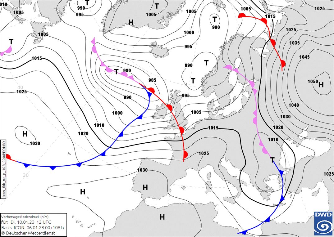
The GFS and ECMWF are surprisingly in line today in terms of precipitation distribution and amount. I should add that shifts are still possible, especially for snowfall in the second half of next week. This weekend comes too soon, as the first snowfall will only follow during Sunday. The driver of the snowfall is a strong low-pressure complex over the Atlantic. As we have seen more often in recent times, the core deflects northwards via Scotland, but this time we see the development of a deeper trough, allowing the troubled Alps to finally look forward to some significant snowfall again.
Sunday morning, the cold front of this low-pressure system approaches from the west, but pretty soon the centre of gravity shifts to the southern Alps. This is due to a separate low-pressure core developing over the Mediterranean. In the French Alps it could snow from around 1,600 metres altitude, in the southern areas several hundred metres higher. The amounts will still be limited on Sunday morning, with around 5 to 15 centimetres (the least in the French Northern Alps), but more will soon follow. The cold front on the north side will not move further east, leaving large parts of Switzerland and Austria dry at first and dealing with southföhn. Only during the night from Sunday to Monday will the föhn be cleared here and it could snow in the northern Alps as well. The wind does pick up considerably with the arrival of this precipitation.
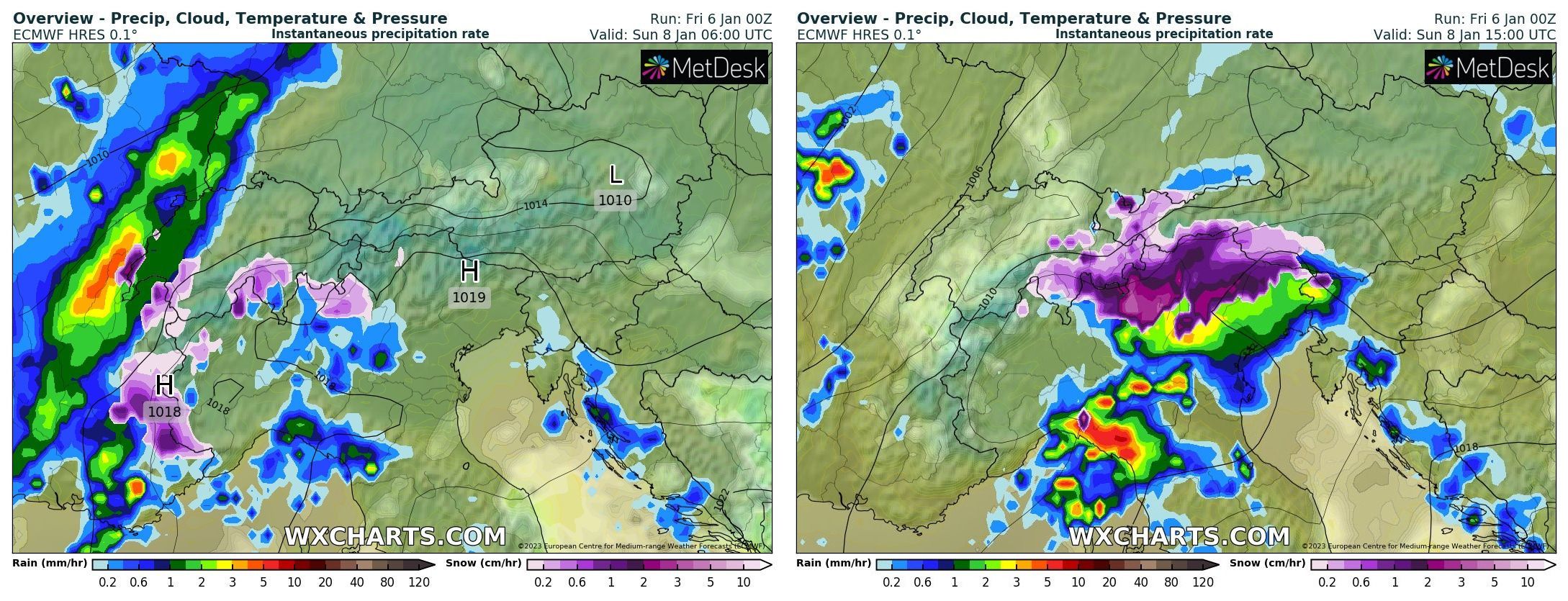
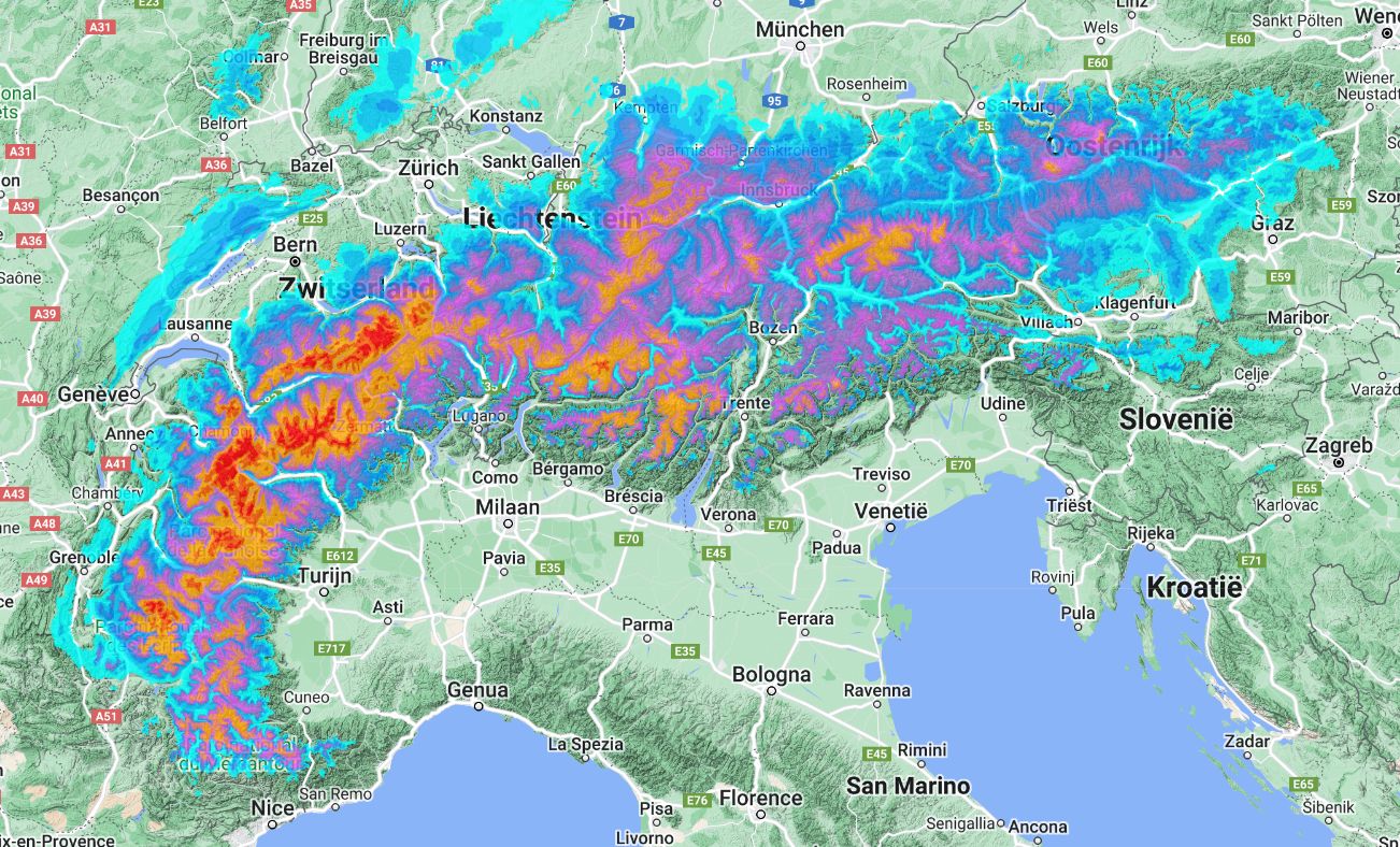
Cold front approaches the Western Alps, but the heaviest snowfall quickly shifts to the Southern Alps (wxcharts.com)
Back to the southern Alps for a moment, as here the intensity actually increases during the day on Sunday. Especially Lombardy, the southern Dolomites and further east in the Julian Alps could see a lot of snow. The snowline here remains around 1,500 metres. In most southern areas at the alpine edge during the night to Monday also temporarily a bit higher. Until Monday afternoon, around 20 to 30 centimetres will fall in these regions. Typical for the Julian Alps, snow amounts here are significantly higher. Most models calculate around a metre of snow higher up here!
Snow for the North(west)ern Alps too
At the second attempt, the northern Alps do manage to get snow. The föhn clears and during Sunday night the precipitation spreads more and more. The snowline drops to around 1,200 metres altitude. Along with the initial snow, I expect around 20 centimetres in the French Alps until Monday morning. In the rest of the Northern Alps, it will initially stay at around 5 to 10 centimetres.
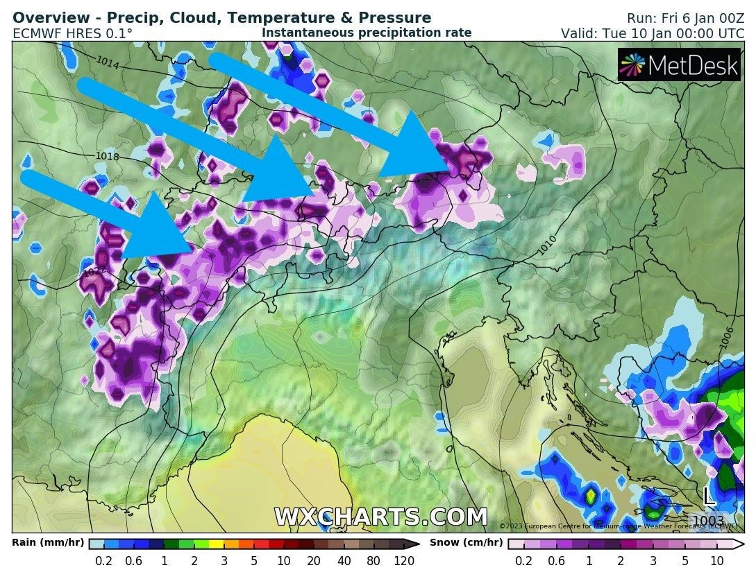
Monday a temporary northweststau
Monday during the day, the remnants of the precipitation area move further east and it may clear up temporarily, especially in the southern Alps. The north-west Alps notice less of this, as snow showers soon follow with the north-westerly flow. It remains cold, so we will see the snowline drop further, to (well) below 1,000 metres. With these (strong) snow showers, we could locally see some surprises in snow amounts in the stau areas.
The most is currently calculated for the French Northern Alps up to central Switzerland, with 20 to 40 centimetres of snow. Furthermore, the typical northweststau areas like (Vor)Arlberg and Dachstein also benefit well, but in the remaining areas in Austria the amounts remain somewhat more limited. On Tuesday, the intensity of the snowfall decreases again and the remnants move further eastwards. In Austria, it will continue snowing a bit longer. From the west, some warmer air will slowly but surely flow in again. On Tuesday evening, this warm front will bring back some snow (and likely some rain as well unfortunately) on the northern side.
Significantly warmer from Tuesday night onwards
So the northern (western) Alps will not be in the cold for long, as considerably warmer air comes with the warm front to the Alps. For now, most of the precipitation seems to move north of the Alps, but areas in the Northern Alps should still expect some temporary rain up to 1500 - 1700 metres at the end of this precipitation. In the process, winds pick up considerably. After that, the temperature yoyo will continue as well. It remains changeable in the North(western) Alps with quite some snow, but we should therefore take into account a varying snowline.
Where to go?
As mentioned, this weekend is actually just a bit too early for powder. Sunday will see some snow higher up in the Western Alps, but accummulation by late afternoon is still limited. Monday already has significantly more options with around 20 centimetres fresh in and around the French Northern Alps, but Tuesday looks to be the best day with serious amounts in the French Northern Alps and the rest of the north-western Alps. Small sidenote: note that there is not a solid base everywhere. We see in the north-west Alps, for example, big differences between below and above 2000 metres. In the Northern Alps, snow cover is quite thin in many places even to higher altitudes.
For the southern Alps, the Julian Alps will clearly be the winner in terms of snow accumulation, with Sella Nevea - Kanin being a good option, for example. At the moment almost everything is open there and a fine base. The only open question is when they will open after the snowfall. Tuesday with the sun out could be a dream day in this corner. But also nearby areas like Nassfeld with a good base or Lombardy is with about 20 to 30 centimetres seem like great options at the moment.
Extra update over the weekend
Due to the exciting weather situation next week, there will be an extra update over the weekend.
Read also:
Replies
At last!! :)
Looks like the Southern Alps (Italy) is secretly having a great season! Here in Campiglio we’ve had around 50-80cm base since early December and it’s held out during the recent warm phase. If the Forecast delivers for the southern Dolomites, we are in for a great start to the mid season, can’t wait to ride pow again!!!
Looks like the Southern Alps (Italy) is secretly having a great season! Here in Campiglio we’ve had around 50-80cm base since early December and it’s held out during the recent warm phase. If the Forecast delivers for the southern Dolomites, we are in for a great start to the mid season, can’t wait to ride pow again!!!
Austria is A winner for powdered surface
Great derailed report Henri thanks. Great to see the snow back.
finally … snooooow. lets hope the base builds nicely.
time lapse pow webcam in Verbier
https://www.teleport.io/view?feedId=zrrxhkayanlbdg8zudsm&view=full
Models still showing interesting probabilities of winter after 17 of Jan. I guess we have to wait 1 week more to see.