It is dumping in Piedmont! The retour d’Est has delivered again. As expected, the strongest snowfall has moved south during the night and morning. Around 40 - 80 centimetres of snow has already fallen in that region, further north in Prali 40cm, Sestriere also around 30 to 40cm, but more is coming!
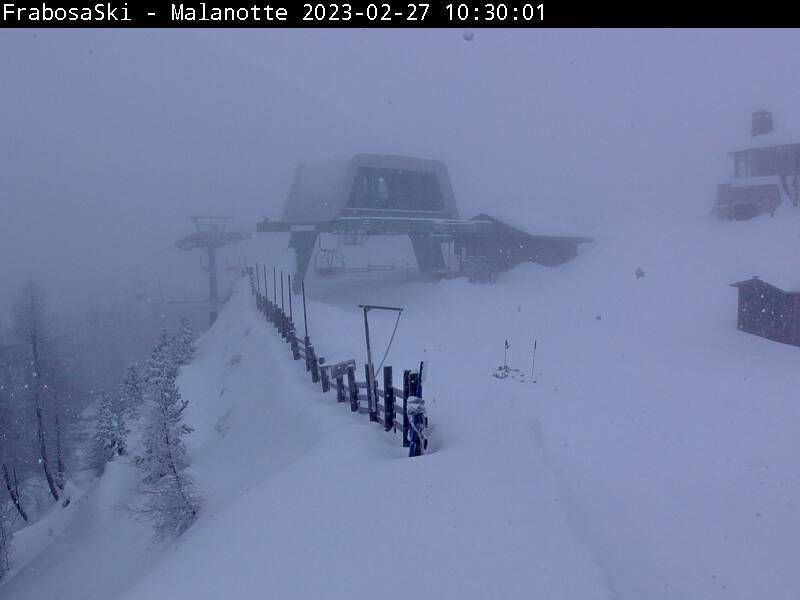
A round of webcams:


In the afternoon the snowfall weakens, but it can continue to snow lightly, in the south also still a bit stronger. Piedmont should still expect some snowfall during the day tomorrow too, but the really large amounts falling have passed.
")

Second phase of snowfall in Piedmont on its way
For the rest of the Alps, the sun returns in full force over the next few days, but as the low-pressure area continues to spin over the Mediterranean for a few more days, it will likely snow a bit longer, especially in Piedmont. On Wednesday, the snowfall seems to intensify again. According to the European model and the German ICON, some 30-50 centimetres seems to be back with ease, possibly with peaks of up to 70-80 centimetres. Temperatures do rise a bit, though, which means the snowline could steadily rise to around 1,000 metres on Thursday. During the night to Thursday, the rest of the southern Alps may also see some snow, but here it won’t be much more than a couple of centimetres.
The remaining regions in the Alps will thus keep it dry. Here it will be sunny for the next few days. Temperatures slowly rise again to around normal for the time of year. From Friday, Austria could possibly get some snow again, but it does not seem to be more than a refresher of a few centimetres.
Read also:
Replies
Any idea on what occurs next week yet. Euro vs gfs is showing different outcomes
After next weekend, most models are showing less high pressure blocking above the Atlantic Ocean, which would lead to more westerlies and changeable weather, with a succession of warm- and cold fronts. It’s a good trend for the higher regions in the western Alps, but in these situations the snowline might be quite high from time to time. Of course, this is only a trend and not a guarantee. It’s too far away for any other details like the timing of fronts, snow amounts and snowline.
Could you please fix your misguiding snowfall amounts to correlate with what actually has fallen?
Forecast is of course a forecast, but you report for ex. on Sestrieres resort page that there has fallen only 9-15cm(depending of the peak) and on this page you say it’s 30-40cm.
People miss pow days because of that and isn’t the point of this whole service to help people get there where the action is?
Tomorrow I should be in Prali.
For Mondole Ski I think it is necessary to wait a few more days. The chairlifts and connections are not fully open yet
We have a week off from the 18th March - where would you recommend we go for the best snow - we haven’t booked anything yet and can go anywhere in Europe.
Some impressions from Limone from today. The godola was closed today.
https://cdn.wepowder.com/site/forum/15/779bf44cb89cddc9b660a8465b56ea3c_pxl_20230227_150736295.jpg https://cdn.wepowder.com/site/forum/15/b4da5a844714a815f78543f6a8e27226_pxl_20230227_130334137.jpg https://cdn.wepowder.com/site/forum/15/d0e88f0abadeb90003ba143e7d9718a7_pxl_20230227_130218817.jpg https://cdn.wepowder.com/site/forum/15/c533693995451ba69bbef8dca0ed5af1_pxl_20230227_130015002.jpg?width=800
I think Italy - is probably going to be the best bet?
Hey guys! thanks for providing the info. Any information regarding warming up later the week in Piemonte? Charts now showing rapid temperature increase from thursday on?
Friday gets warm there.
Unfortunately
http://www.nimbus.it
old style web, mostly in Italian :-)
1 + metres of powder here in Mallorca… 🤷♂️ Pity my ski gear is all stored at Geneva… kinda weird seeing the Tramuntana’s totally white! Looks like a proper alpine mountain range just now!! haha… and bloody cold too!! Maybe we should build a cable car here on Puig Major… 🤷♂️🤷♂️🤷♂️🤷♂️
Is Anthropogenic Global Warming. Although the air mixes pretty well, so I’m not sure why it’s so patchy. But it is AGW.
… Oh wait, it’s COLD there! LOL