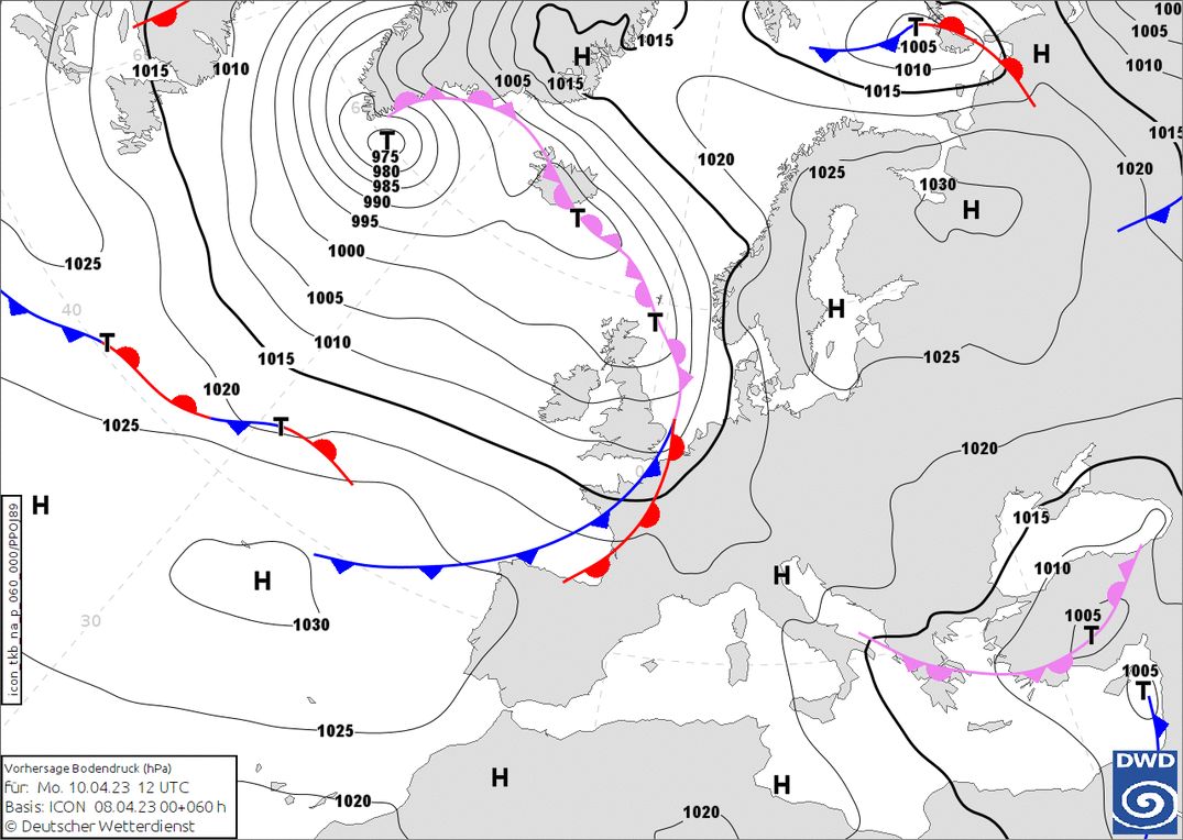
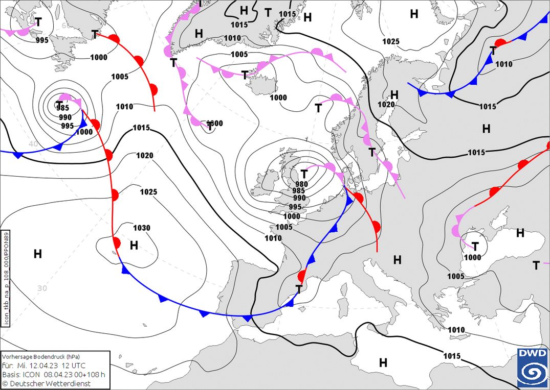
During this Easter weekend, we will see some fresh snow in Austria, but I do not expect large amounts. After the weekend, the wind turns more to the west, which lead to a more changeable weather pattern across the whole Alps. Initially, this is not yet accompanied by large amounts of snow, but from Wednesday a cold front could start bringing significantly more snow across much of the Alps.
Snow in Austria
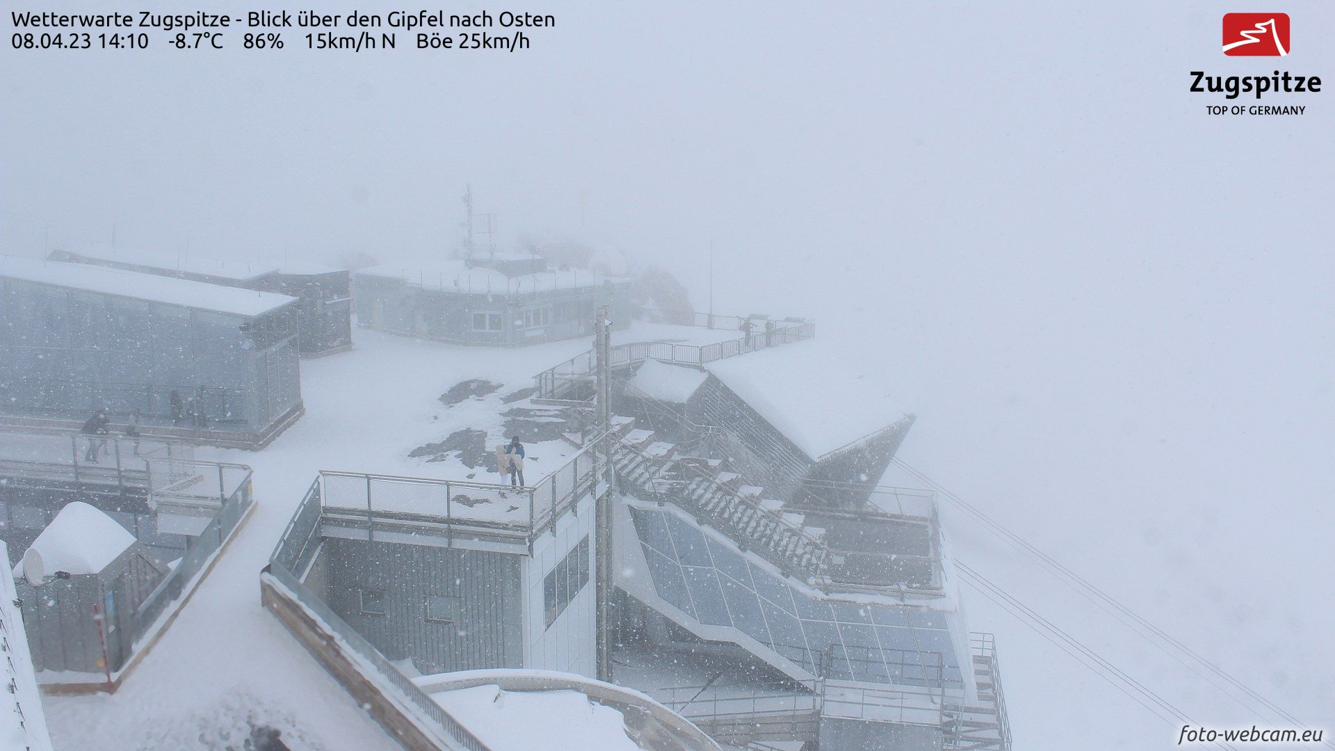
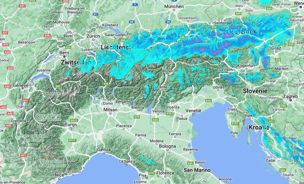
After some fresh snow in the northwest Alps, some snow will follow today from a more unusual angle: the northeast. In doing so, the snowfall is mainly limited to Austria and the far eastern part of Switzerland. On the northern edge, some 10 centimetres will fall in the stau areas, while in the remaining regions it will remain at a few centimetres. The snowline will drop from 1,000 metres to around 600 - 800 metres during the evening.
Between two air masses
From the west, mild air tries to reach the Alps, but in the eastern Alps it will remain cold even tomorrow. In eastern Austria, it could snow for even longer. Over the two days in particular, around 20 centimetres can fall in Salzburgerland and western Styria. With the north-easterly flow, it will be cold and the snowline will remain quite low for April, around 800 metres. In the Western Alps, at the same time, it is considerably milder, with the freezing level reaching well above 2000 metres.
Monday quite warm
On Monday, mild air will also reach the rest of the Alps from the west, allowing temperatures to rise again everywhere. On the north and west side of the Alps, we will see up to around 20 degrees in the valleys and a freezing level around 2,500 metres. During the day, increasing clouds will follow from the west, which are the first signal of an upcoming weather change.
During the night from Monday to Tuesday and Tuesday morning, a precipitation area reaches the north-west Alps. Snow initially only falls above 2,000 metres, but due to the entry of cooler air, the snowline soon drops towards 1,500 metres. The precipitation is likely to just skim the Alps, so amounts will remain limited and fall mainly in the northern areas between eastern Switzerland and Upper Austria. With the precipitation, there will also be strong winds especially in these areas along the northern alpine rim.
Possibly much more snow
After a temporary warmer phase with föhn on the north side on Wednesday, developments will become more exciting from the evening onwards. A firm cold front from the north-west could start bringing quite a bit of snow, with the snowline dropping significantly again. At the moment, most models indicate snow not only for the north-west Alps, but also on the southern side. Monday/Tuesday morning in a new weather report all the details, at the moment it is still too early for exact amounts!
Read also:
Replies
Happy Easter @@Henri, seems winter anomaly is in progress
Had good time in Austria. 5-15cm on top of firm snow. On glaciers 3000m in protected areas up to 30-50cm